Wikimedi'Òc
Modes d'emploi

Cet album fait partie des albums
Cet album photos contient les sous-albums suivants :


Indian Monument Ft Mitchell.jpg - Altairisfar

MenawaPlaqueTallapoosa.JPG - File Upload Bot (Magnus Manske)
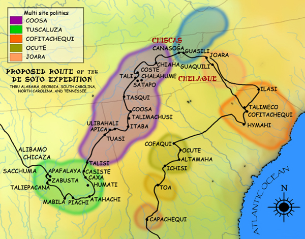
DeSoto Map Leg 2 HRoe 2008.jpg - Ras67
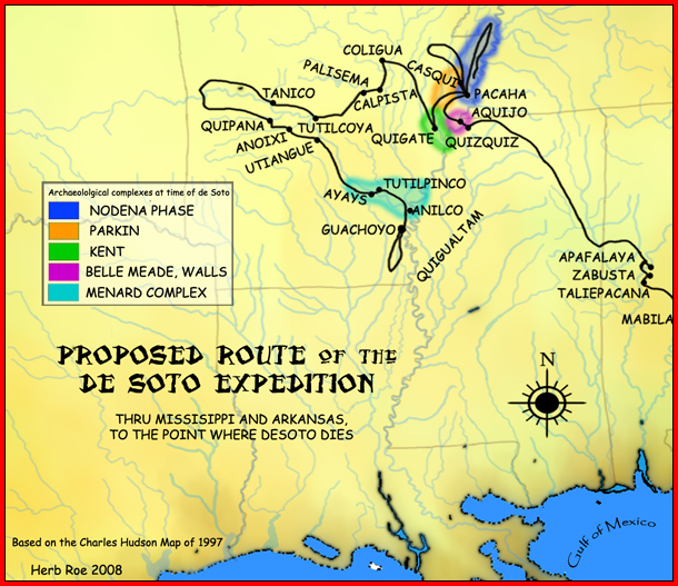
DeSoto Map Leg 3 HRoe 2008.jpg - Heironymous Rowe
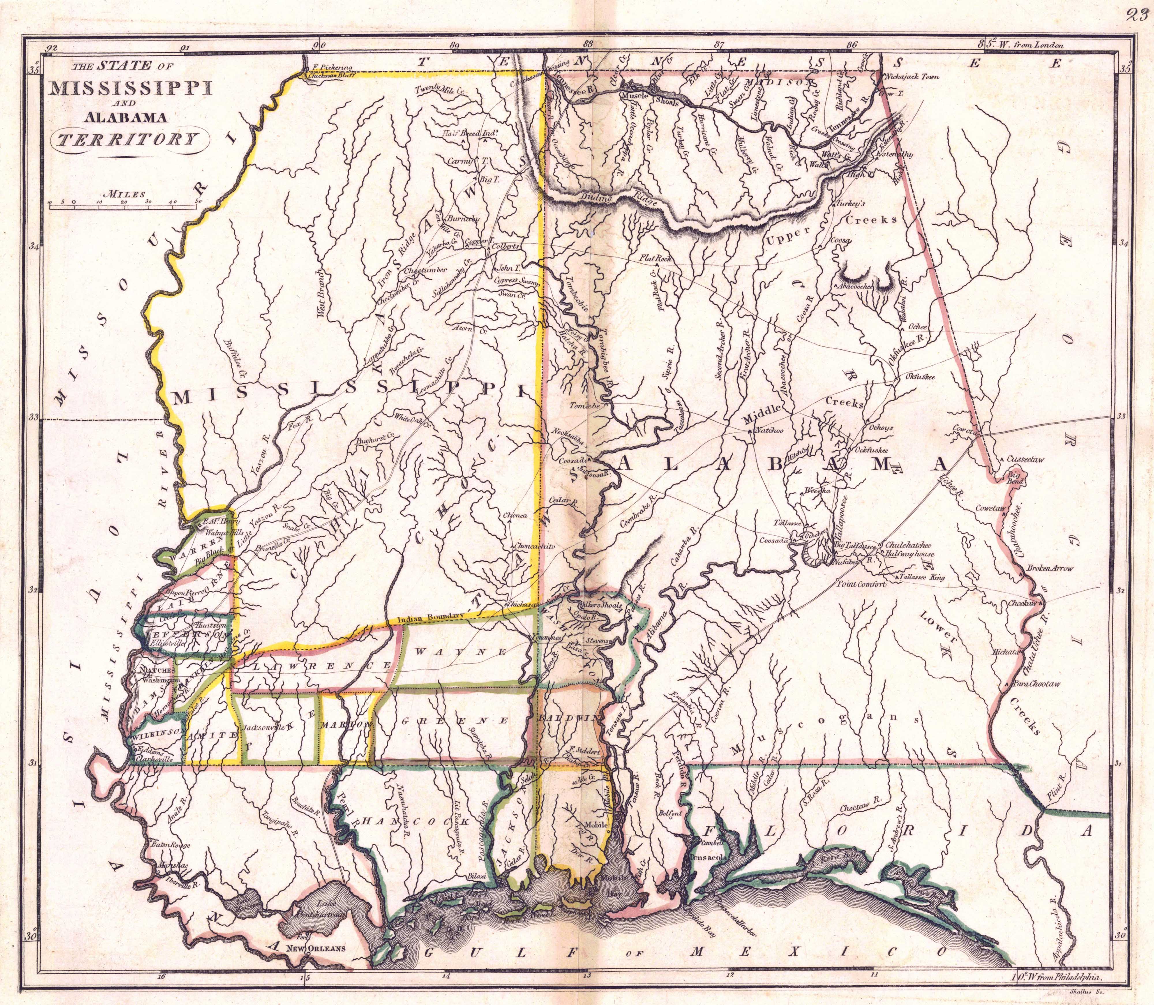
1817 Map of Mississippi and Alabama.jpeg - Spyder Monkey
1815m4.jpg - Avaghnn

Glennville Historic District.JPG - SaveRivers

Fort Walton and Leon-Jefferson cultures map HRoe 2012.jpg - Heironymous Rowe

Alabama tribal land map 1830.png - Yassie

Indian trading post at Fort Mitchell.jpg - Dofftoubab
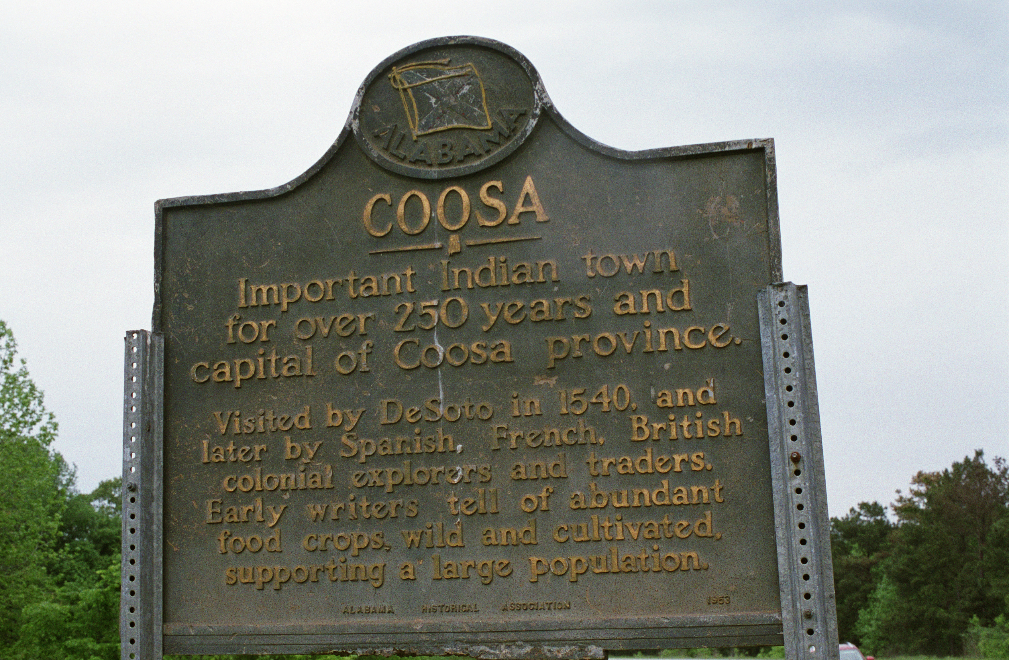
Coosa Historical Marker outside of Childersburg, AL.jpg - Jmk7

Collections of the Georgia Historical Society (1916) (14598015370).jpg - Fæ

Battle of Horseshoe Bend.jpg - Pi3.124

Stop -3 P9230249 Tohopeka Village.JPG - Chris Light
Scenes from Alabama on bronze doors by Nathan Glick, Alabama Department of Archives and History, Montgomery, Alabama LCCN2010637688.tif - Fæ
Historic sign, Claiborne, Alabama LCCN2010639895.tif - Fæ
Indian baths at Old St. Stephens Park, St. Stephens, Alabama LCCN2010640236.tif - Fæ
Indian baths at Old St. Stephens Park, St. Stephens, Alabama LCCN2010640237.tif - Fæ
This is an amazing stone wall constructed single-handedly by a man named Tom Hendrix in Florence, Alabama LCCN2010640665.tif - Fæ
This is an amazing stone wall constructed single-handedly by a man named Tom Hendrix in Florence, Alabama LCCN2010640673.tif - Fæ
This is an amazing stone wall constructed single-handedly by a man named Tom Hendrix in Florence, Alabama LCCN2010640695.tif - Fæ

"Florida et Regiones Vicinae" (9124298123).jpg - Fæ
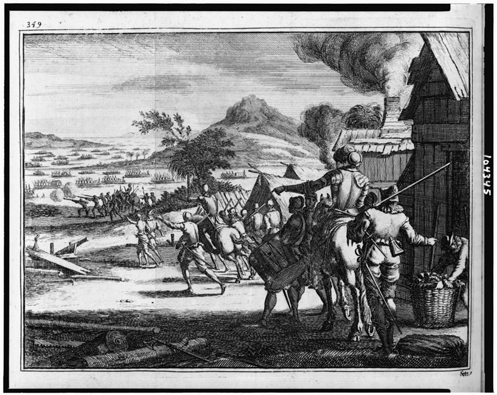
Entrée de Espagnols dans la Province de Chicaça LCCN91480216.jpg - Fæ

A plan of part of the rivers Tombecbe, Alabama, Tensa, Perdido, & Scambia in the province of West Florida; with a sketch of the boundary between the nation of upper Creek Indians and that part of the LOC 73691550.jpg - Fæ

Map of Barbour County State of Alabama. Exhibiting the locations of Creek Reservations Under the Treaty of March 14 1832 - NARA - 102278788.jpg - US National Archives bot

Map of Chambers County State of Alabama. Exhibiting the locations of Creek Reservations Under the Treaty of March 14 1832 - NARA - 102278790.jpg - US National Archives bot

Map of Russell County State of Alabama, Exhibiting the locations of Creek Reservations Under the Treaty of March 14th 1832 - NARA - 102278786.jpg - US National Archives bot
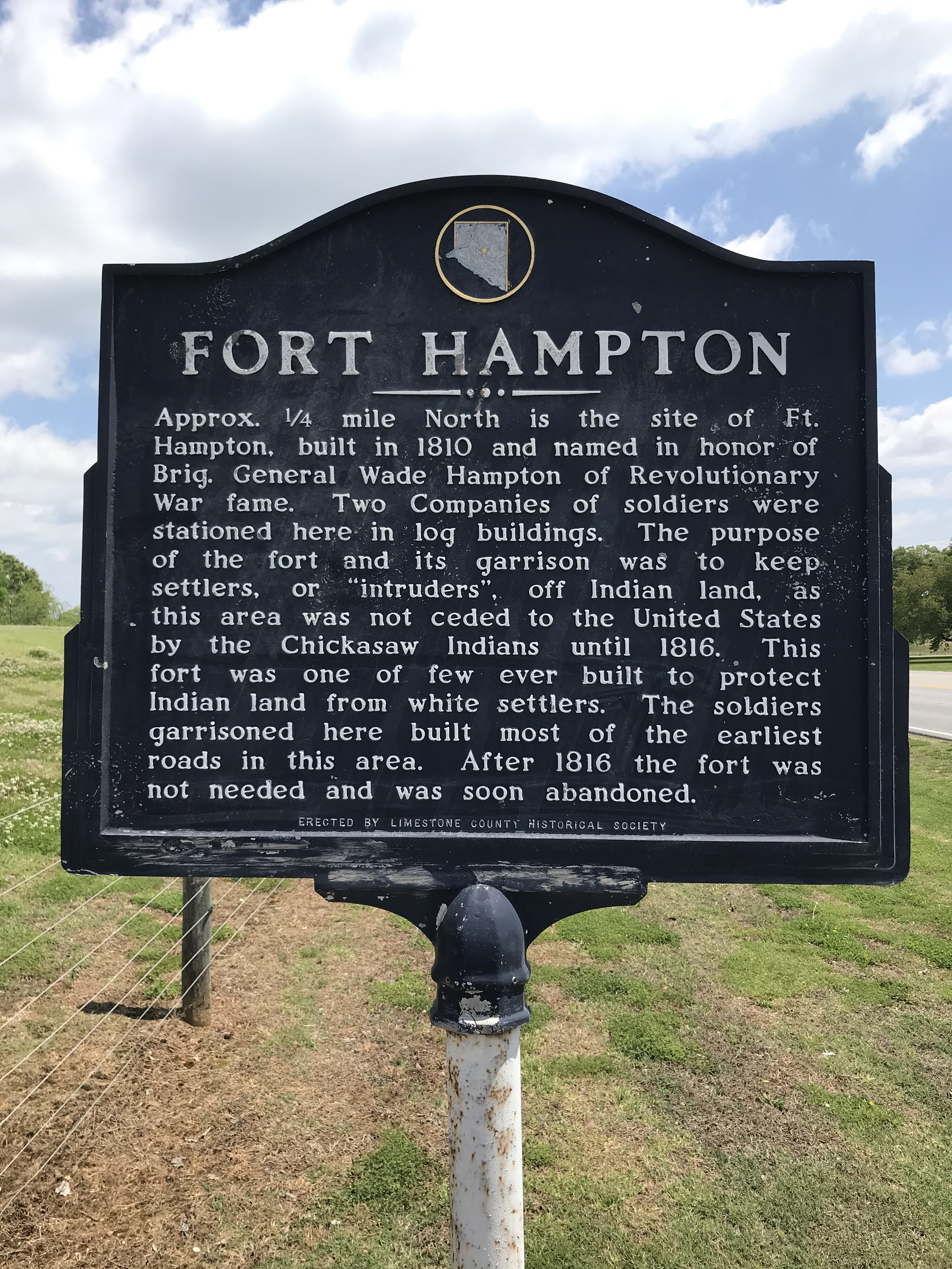
Fort Hampton Historical Marker.jpg - Dofftoubab

Fort Hull map.jpg - Dofftoubab

Sketch of Little Tallassie, or the Hickory Ground (traced).png - DanCherek

TENNESSEE map - Indian land cessions in the United States.jpg - Jengod

TENNESSEE and ALABAMA portions - Indian land cessions in the United States.jpg - Jengod

Cessions Southeastern Tribes- Andrew Jackson.jpg - Wtfiv

Fort Armstrong and Strother.jpg - Dofftoubab

Map from Indian land cessions in the United States by Charles C. Royce 33.jpg - Jengod

Paramountcy of Coosa.jpg - Dodolulupepe

Clay County Historical Society Museum (Ashland, Alabama) 2.jpg - Photo Archives
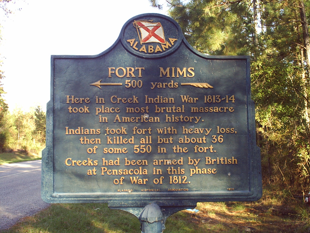
Ft. Mims sign.JPG - Dthem 2000

Tallapoosa County - Horseshoe Bend National Military Park - 20220711145800.jpg - Riis2602

Steatite bird pipe, unfinished, found at Carpenter's Bend of Tallasseehatchee Creek.jpg - Jengod