Wikimedi'Òc
Modes d'emploi

Cet album fait partie des albums


Phantom bear on Purgatoire River, 15 miles below Las Animas, Colo, from Robert N. Dennis collection of stereoscopic views.jpg - DcoetzeeBot

Veta Pass, Colorado. Elevation 9,339 feet above the level of the sea, from Robert N. Dennis collection of stereoscopic views.jpg - DcoetzeeBot

Pueblo, Colorado, U.S.A, by Kilburn, B. W. (Benjamin West), 1827-1909.jpg - DcoetzeeBot

Fairy Grotto, Toltec tunnel, Colorado, by Rau, William Herman, 1855-1920.jpg - DcoetzeeBot

Dump Mt. from milk ranch, by Chamberlain, W. G. (William Gunnison).jpg - DcoetzeeBot

The Fort Garland extension of the Denver and Rio Grande Railroad crosses the summit of Veta Pass at an elevation of 9339 feet. (...), by Chamberlain, W. G. (William Gunnison).jpg - DcoetzeeBot

Shearing sheep, by Chase, D. B. (Dana B.).jpg - DcoetzeeBot

The City of Trinidad, Colorado, from Robert N. Dennis collection of stereoscopic views.jpg - DcoetzeeBot

Veta Pass, train above the clouds, by Robert M. Davis.jpg - DcoetzeeBot

The "Mule shoe.", by Gurnsey, B. H. (Byron H.), 1833-1880.jpg - DcoetzeeBot

Dump Mountain, looking at north-east corner, by Gurnsey, B. H. (Byron H.), 1833-1880.jpg - DcoetzeeBot
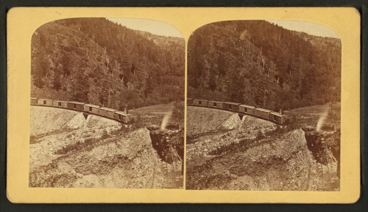
"The Mule shoe.", by Gurnsey, B. H. (Byron H.), 1833-1880.jpg - DcoetzeeBot

Sangre de Cristo station, summit of the range. Veta Mountain in the distance, by Gurnsey, B. H. (Byron H.), 1833-1880.jpg - DcoetzeeBot

Sangre de Cristo station, summit of the range. Veta Mountain in the distance, by Gurnsey, B. H. (Byron H.), 1833-1880 2.jpg - DcoetzeeBot

Natural photograph of a bear on the rocks of the Purgatoire River, by Gurnsey, B. H. (Byron H.), 1833-1880.jpg - DcoetzeeBot

The largest cottonwood tree in Colorado, Fifth Street, South Pueblo, by Gurnsey, B. H. (Byron H.), 1833-1880.jpg - DcoetzeeBot

The railway on the end of Dump Mountain, by Gurnsey, B. H. (Byron H.), 1833-1880.jpg - DcoetzeeBot

The railway on the end of Dump Mountain, by Gurnsey, B. H. (Byron H.), 1833-1880 2.jpg - DcoetzeeBot

The railway on the end of Dump Mountain, by Gurnsey, B. H. (Byron H.), 1833-1880 3.jpg - DcoetzeeBot

The railway on the end of Dump Mountain, by Gurnsey, B. H. (Byron H.), 1833-1880 4.jpg - DcoetzeeBot

West side of Dump Mountain, looking east, by Gurnsey, B. H. (Byron H.), 1833-1880.jpg - DcoetzeeBot

West side of Dump Mountain, looking east, by Gurnsey, B. H. (Byron H.), 1833-1880 2.jpg - DcoetzeeBot

North side of Dump Mountain, looking down the grade, by Gurnsey, B. H. (Byron H.), 1833-1880.jpg - DcoetzeeBot

North side of Dump Mountain, looking down the grade, by Gurnsey, B. H. (Byron H.), 1833-1880 2.jpg - DcoetzeeBot

West End, Toltec tunnel, from Robert N. Dennis collection of stereoscopic views.jpg - DcoetzeeBot
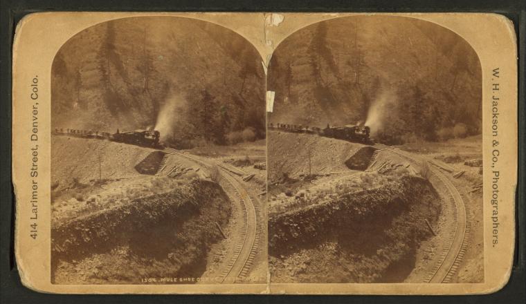
Mule Shoe curve, Veta Pass, by W. H. Jackson & Co..jpg - DcoetzeeBot

Toltec gorge, by W. H. Jackson & Co..jpg - DcoetzeeBot

Toltec tunnel from across the gorge, by W. H. Jackson & Co..jpg - DcoetzeeBot

Dump Mountain from Mule Shoe, by W. H. Jackson & Co..jpg - DcoetzeeBot

Mule Shoe curve, Veta Pass, Colorado, from Robert N. Dennis collection of stereoscopic views.jpg - DcoetzeeBot

Trinidad, Colo., with Fisher's Peak in background, from Robert N. Dennis collection of stereoscopic views.jpg - DcoetzeeBot

Railroad above the clouds, by Weitfle, Charles, 1836-1921.jpg - DcoetzeeBot

Railroad above the clouds, by Weitfle, Charles, 1836-1921 2.jpg - DcoetzeeBot

Railroad above the clouds, by Weitfle, Charles, 1836-1921 3.jpg - DcoetzeeBot

Railroad above the clouds, by Weitfle, Charles, 1836-1921 4.jpg - DcoetzeeBot

Stonewall Valley, Greenhorn range, from Robert N. Dennis collection of stereoscopic views.jpg - DcoetzeeBot

Veta Pass. D. & R. G. R. R. (Denver & Rio Grande Railroad) elevation 9339 ft, from Robert N. Dennis collection of stereoscopic views.jpg - DcoetzeeBot