Wikimedi'Òc
Modes d'emploi

Cet album fait partie des albums


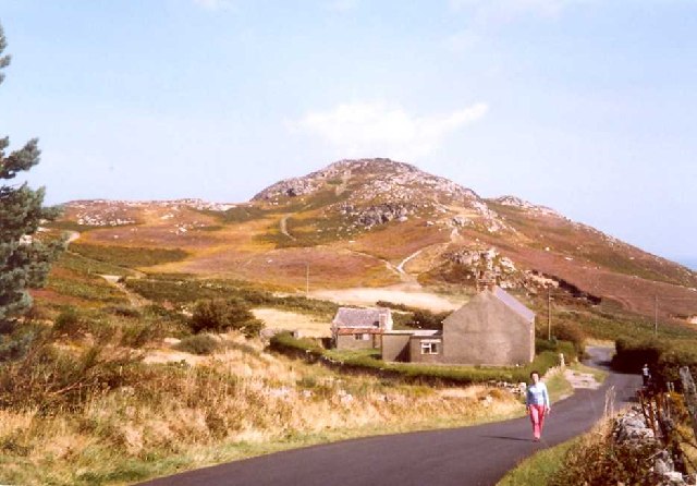
Bodafon.jpg - Bjh21

Mynydd Bodafon, Anglesey - geograph.org.uk - 7855.jpg - GeographBot

Pen y Castell, Mynydd Bodafon, Anglesey - geograph.org.uk - 7849.jpg - GeographBot

Yr Arwydd, Anglesey - geograph.org.uk - 7859.jpg - GeographBot

Bog near Bryn Mwcog - geograph.org.uk - 101667.jpg - GeographBot

Mynydd Bodafon from Maenaddwyn - geograph.org.uk - 421752.jpg - GeographBot

Rock outcrop on Mynydd Bodafon - geograph.org.uk - 421088.jpg - GeographBot

The eastern flank of the Bodafon intrusive rock outcrop - geograph.org.uk - 420713.jpg - GeographBot

The south-eastern slopes of Mynydd Bodafon - geograph.org.uk - 421198.jpg - GeographBot

View across the Lligwy valley in the direction of Mynydd Bodafon - geograph.org.uk - 421436.jpg - GeographBot

Junction of the road from the Rynys Caravan Park and the A 5025 - geograph.org.uk - 931143.jpg - GeographBot

Mynydd Bodafon - geograph.org.uk - 1031324.jpg - GeographBot

The sun setting over Mynydd Bodafon - geograph.org.uk - 1112353.jpg - GeographBot

The Capel Sardis bend on the A5025 at Llaneuddog - geograph.org.uk - 1184167.jpg - GeographBot

Large open fields extending south of the Llaneuddog road - geograph.org.uk - 1200015.jpg - GeographBot

View southeastwards across grazing land towards Mynydd Bodafon mountain - geograph.org.uk - 1200010.jpg - GeographBot

A field gate - geograph.org.uk - 1229964.jpg - GeographBot

Farmland between Bodneithior and Melin Esgob - geograph.org.uk - 1229813.jpg - GeographBot

View SE across farmland at Bodneithior with Mynydd Bodafon in the background - geograph.org.uk - 1229790.jpg - GeographBot

View across grazing land towards the valley of Afon Goch and Mynydd Bodafon - geograph.org.uk - 1229946.jpg - GeographBot

View across pasture land to Wern Cottage and Mynydd Bodafon - geograph.org.uk - 1226827.jpg - GeographBot

The lower slopes of Mynydd Bodafon from the Maenaddwyn road - geograph.org.uk - 1230503.jpg - GeographBot

The start of the footpath to Mynydd Bodafon - geograph.org.uk - 1230564.jpg - GeographBot

Farmland near Ponciau with Mynydd Bodafon forming the background - geograph.org.uk - 1361408.jpg - GeographBot

Mynydd Bodafon from near Maenaddwyn - geograph.org.uk - 1361372.jpg - GeographBot
View across farmland towards Graigfryn Fawr Farm - geograph.org.uk - 1361453.jpg - GeographBot

A view across Cors Erddreniog, Anglesey, Wales.jpg - Warrenkovach

Pupils of Thomas Ellis School, Holyhead on a geological survey at Mynydd Bodafon, Anglesey (1521654).jpg - Jason.nlw

Pupils of Thomas Ellis School, Holyhead on a geological survey at Mynydd Bodafon, Anglesey (1521655).jpg - Jason.nlw

Pupils of Thomas Ellis School, Holyhead on a geological survey at Mynydd Bodafon, Anglesey (1521656).jpg - Jason.nlw

Pupils of Thomas Ellis School, Holyhead on a geological survey at Mynydd Bodafon, Anglesey (1521657).jpg - Jason.nlw

Pupils of Thomas Ellis School, Holyhead on a geological survey at Mynydd Bodafon, Anglesey (1521658).jpg - Jason.nlw

Pupils of Thomas Ellis School, Holyhead on a geological survey at Mynydd Bodafon, Anglesey (1521659).jpg - Jason.nlw

Pupils of Thomas Ellis School, Holyhead on a geological survey at Mynydd Bodafon, Anglesey (1521660).jpg - Jason.nlw

Pupils of Thomas Ellis School, Holyhead on a geological survey at Mynydd Bodafon, Anglesey (1521661).jpg - Jason.nlw