Wikimedi'Òc
Modes d'emploi

Cet album fait partie des albums
Cet album photos contient les sous-albums suivants :


Bridal Veil Creek, Bridal Veil Falls - DPLA - c7877d4790d1c88a6ad5015b383be150.jpg - DPLA bot

USA Multnomah, Oregon age pyramid.svg - DieBucheBot

Ainsworth SP Oregon 2007.03.17.png - Meno25

Columbia River Gorge, Oregon.jpg - Mike Peel

Eaglecreek-28July2006.jpg - Reddi~commonswiki

HCRH milepost 35.jpg - NE2
Multnomah County Sheriff inmate transport truck.jpg - File Upload Bot (Magnus Manske)

Greshambuttexmas.JPG - Emilia12345
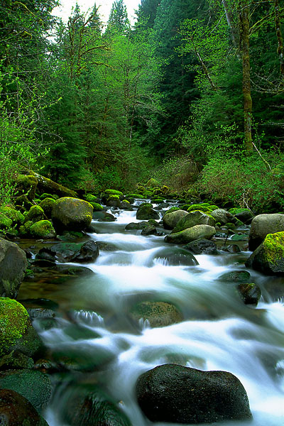
Fir Creek on the Bull Run.jpg - Finetooth

Bridge to nowhere.jpg - Electron
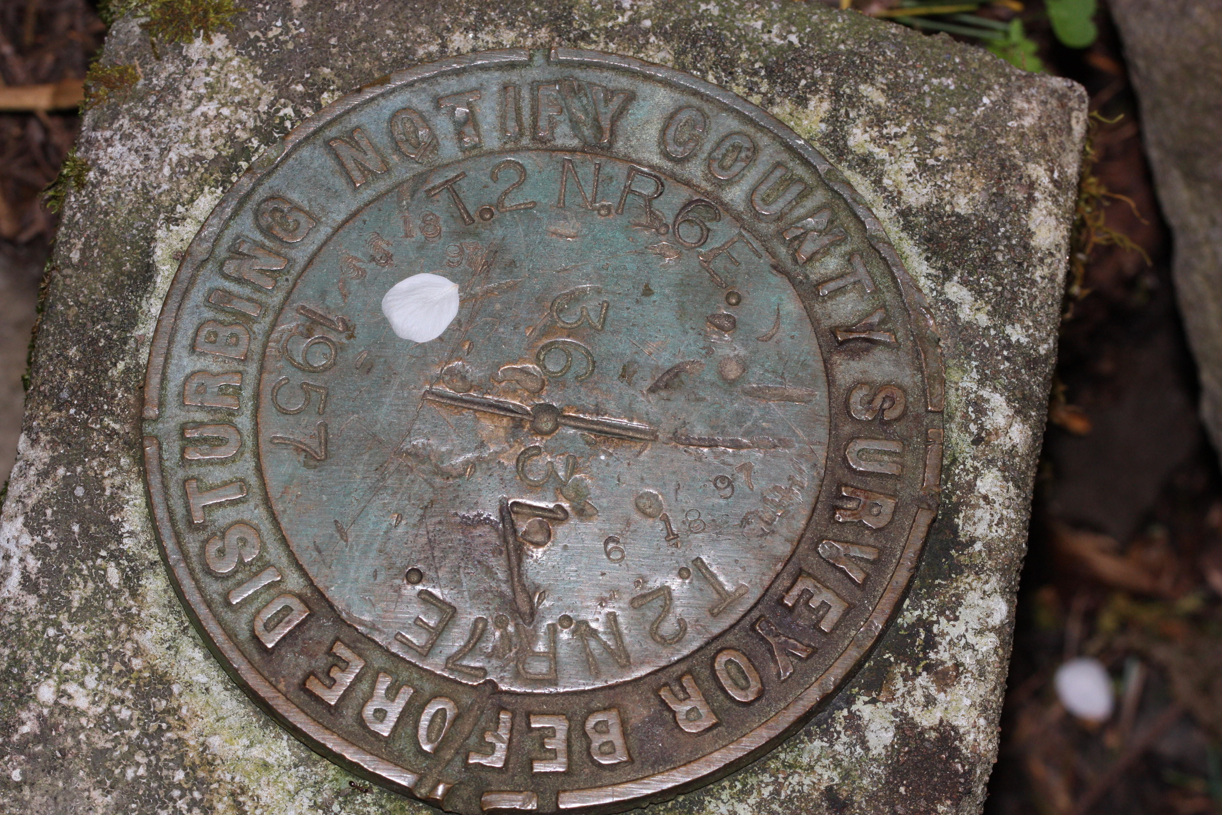
Multnomah County survey marker 2701.JPG - Wsiegmund

Columbia River Gorge (1).jpg - File Upload Bot (Magnus Manske)

Portland Railroad Bridge, West Shore magazine, 1887.jpg - Orygun

Communications towers on Dixie Mountatin - Oregon.JPG - Aboutmovies

Search for Kyron Horman on March 26 2011 - Oregon.JPG - Aboutmovies

Sauvie Island and the Columbia River from Skyline - Oregon.JPG - Aboutmovies

2011-12-03 Mycena epipterygia (Scop.) Gray 187425.jpg - Thkgk

Arata Creek flows onto I-84 east of Portland (6733255599).jpg - File Upload Bot (Magnus Manske)

Coopey Falls.jpg - Visitor7

Ernest C Loll Marker.jpg - Visitor7

Columbia River Highway (8515604587).jpg - File Upload Bot (Magnus Manske)

Morning mist in Columbia Gorge (4332507297).jpg - File Upload Bot (Magnus Manske)

Multnomah Falls Area (5769489354) (2).jpg - Russavia
Eagle Creek Overlook Shelter, Columbia Gorge,Oregon-Washington Border, Bonneville, Multnomah County, OR HABS ORE,26-BOND.V,1- (sheet 1 of 9).tif - Fæ
Eagle Creek Overlook Shelter, Columbia Gorge,Oregon-Washington Border, Bonneville, Multnomah County, OR HABS ORE,26-BOND.V,1- (sheet 3 of 9).tif - Fæ
Eagle Creek Overlook Shelter, Columbia Gorge,Oregon-Washington Border, Bonneville, Multnomah County, OR HABS ORE,26-BOND.V,1- (sheet 7 of 9).tif - Fæ
Eagle Creek Overlook Shelter, Columbia Gorge,Oregon-Washington Border, Bonneville, Multnomah County, OR HABS ORE,26-BOND.V,1- (sheet 4 of 9).tif - Fæ
Eagle Creek Overlook Shelter, Columbia Gorge,Oregon-Washington Border, Bonneville, Multnomah County, OR HABS ORE,26-BOND.V,1- (sheet 9 of 9).tif - Fæ
General perspective view of McCord Creek Bridge, view looking east on Interstate 84 - McCord Creek Bridge, Spanning McCord Creek at Milepost 38.62 on Old Columbia River Highway (Highway HAER OR-135-2.tif - Fæ
General perspective view of McCord Creek Bridge, view looking southeast - McCord Creek Bridge, Spanning McCord Creek at Milepost 38.62 on Old Columbia River Highway (Highway No. 30), HAER OR-135-3.tif - Fæ
Detail view of railing - McCord Creek Bridge, Spanning McCord Creek at Milepost 38.62 on Old Columbia River Highway (Highway No. 30), Warrendale, Multnomah County, OR HAER OR-135-5.tif - Fæ
General perspective view of McCord Creek Bridge, view looking southeast - McCord Creek Bridge, Spanning McCord Creek at Milepost 38.62 on Old Columbia River Highway (Highway No. 30), HAER OR-135-4.tif - Fæ
Topographic view of McCord Creek Bridge and the Columbia River Gorge - McCord Creek Bridge, Spanning McCord Creek at Milepost 38.62 on Old Columbia River Highway (Highway No. 30), HAER OR-135-1.tif - Fæ

Launch of yacht BayOcean.png - Mtsmallwood

2013-11-17 Mucronella Fr 388036.jpg - Thkgk

Modular Power Meter (18936623638).jpg - Tony Webster

Rose City Antifascists Portland Oregon Sign Post (18246019692).jpg - Tony Webster

Montgomery Park, Portland (17718396438).jpg - Tony Webster

Romanesco Broccoli (10897329605).jpg - Wilfredor

Back To The Grind (5463247517).jpg - Wilfredor

Ponytail Falls (5435282402).jpg - Wilfredor

Early Spring at the Station (4881369168).jpg - Wilfredor

“Inside myself is a place where I live all alone and that is where I renew my springs that never dry up.” - Pearl S. Buck (4676425999).jpg - Wilfredor

Ballerina (4416216042).jpg - Wilfredor
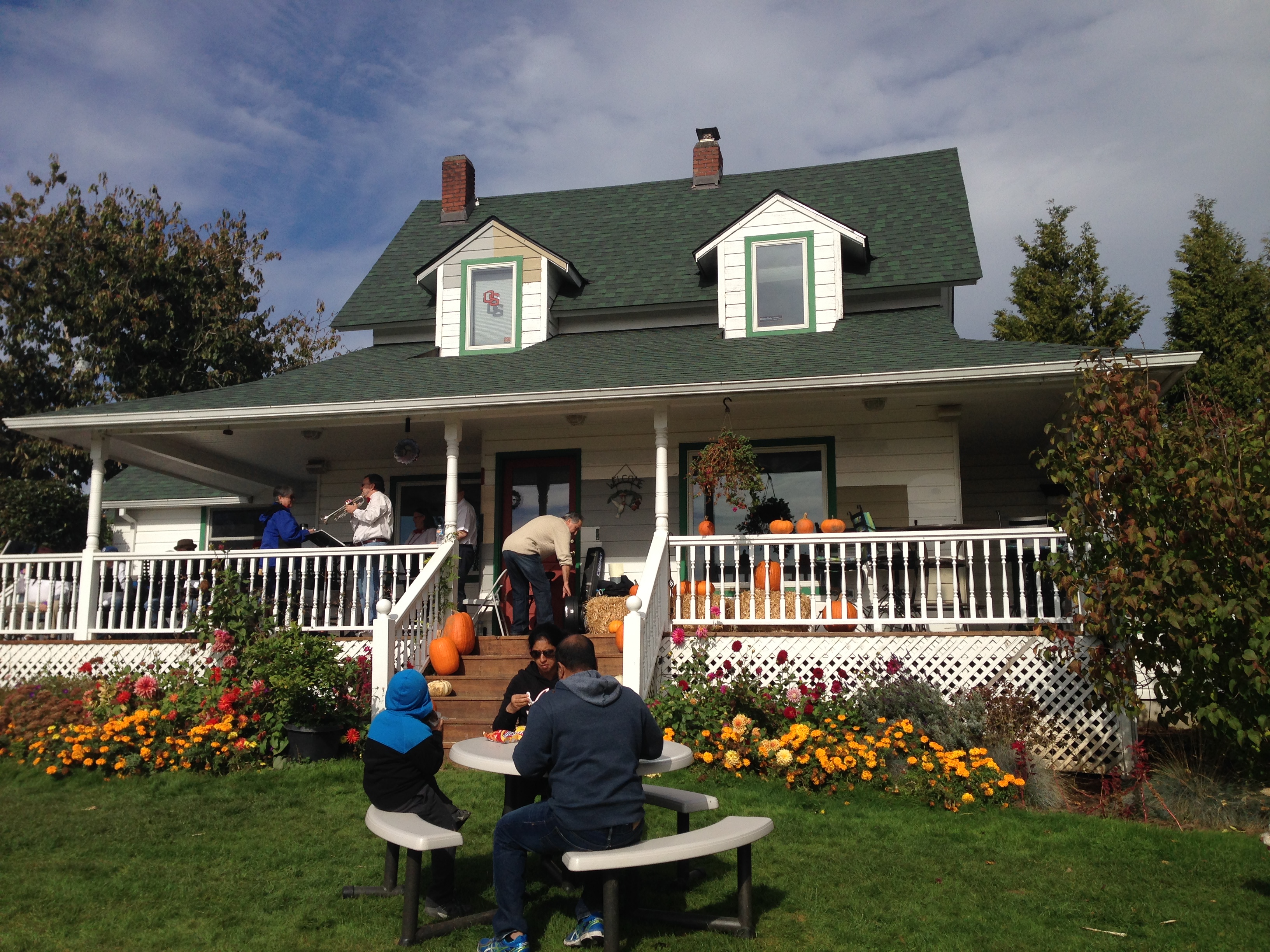
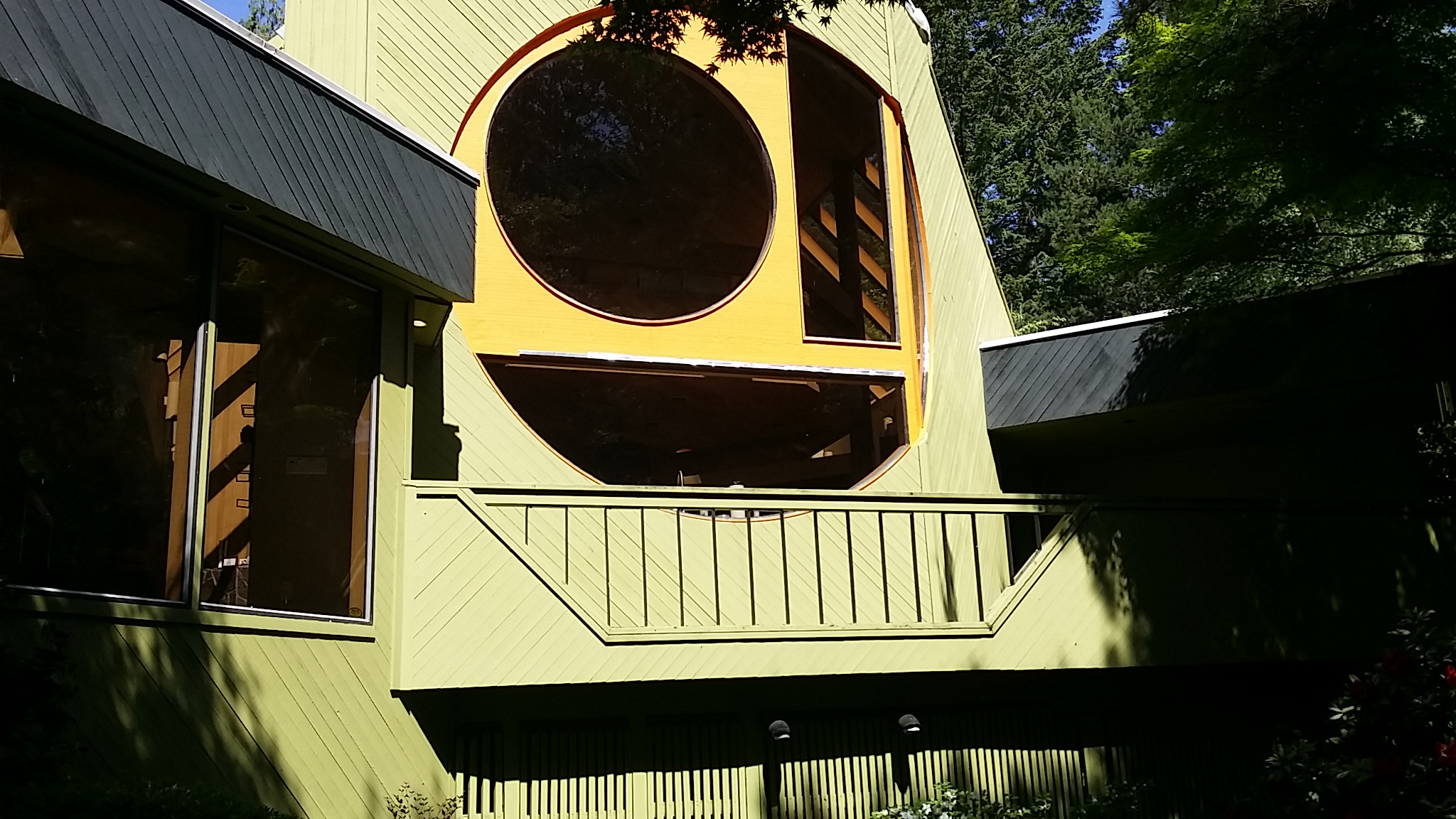
Plumper pumpkin house.jpg - Kingofthedead

Plumper Pumpkin Patch.jpg - Kingofthedead
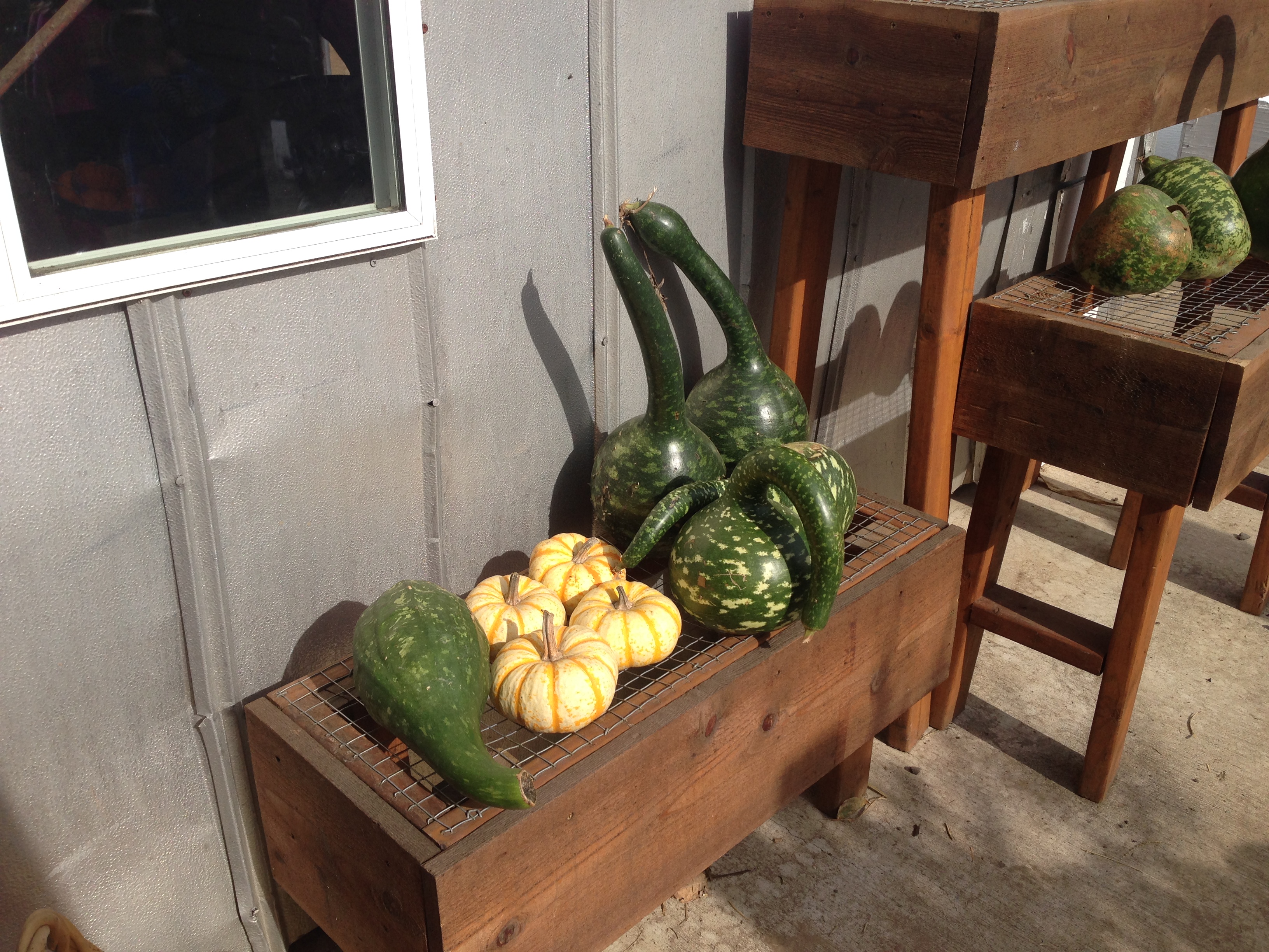
Table gourds.jpg - Kingofthedead

Multnomah OR July 14 2004.jpg - Kingofthedead
Portland Painting Contractors-Cascade Painting and Restoration - panoramio.jpg - Panoramio upload bot

Skyline School Reserved Parking - panoramio.jpg - Panoramio upload bot

Cooks in dining room (4587520000).jpg - Fæ

Timber between Larch Mountain and Mount Hood (4587520152).jpg - Fæ

Undercutting a larch tree (4586894979).jpg - Fæ

Two men with downed larch tree (4586895079).jpg - Fæ

Man holding a large saw (4586895051).jpg - Fæ

Log dump into Mill Pond (4586895111).jpg - Fæ

Loading logs with "Donkey" (4586895143).jpg - Fæ

Two men sawing a larch tree (4587520178).jpg - Fæ

Yarding and loading "donkey" (4586895169).jpg - Fæ

Logs on train cars (4586895213).jpg - Fæ

Steam train engine (4586895243).jpg - Fæ

Train of logs arrived at the mill (4586895353).jpg - Fæ

Refuse burner from the mill (4586895449).jpg - Fæ

Carriage inside mill (4586895495).jpg - Fæ

Trimmer in mill (4586895529).jpg - Fæ

General view in Palmer (4586895553).jpg - Fæ

Log pond and jack (4586895583).jpg - Fæ

Men in saw filing room at mill (4587524608).jpg - Fæ

Mill hands (crew of men). Group portrait. 1910. (4587524638).jpg - Fæ

Mill hands (crew of men). Group portrait. 1910. (4586899375).jpg - Fæ

Woods crew in dining room (4587524702).jpg - Fæ

Woods crew (men). Group portrait. 1910. (4586899393).jpg - Fæ
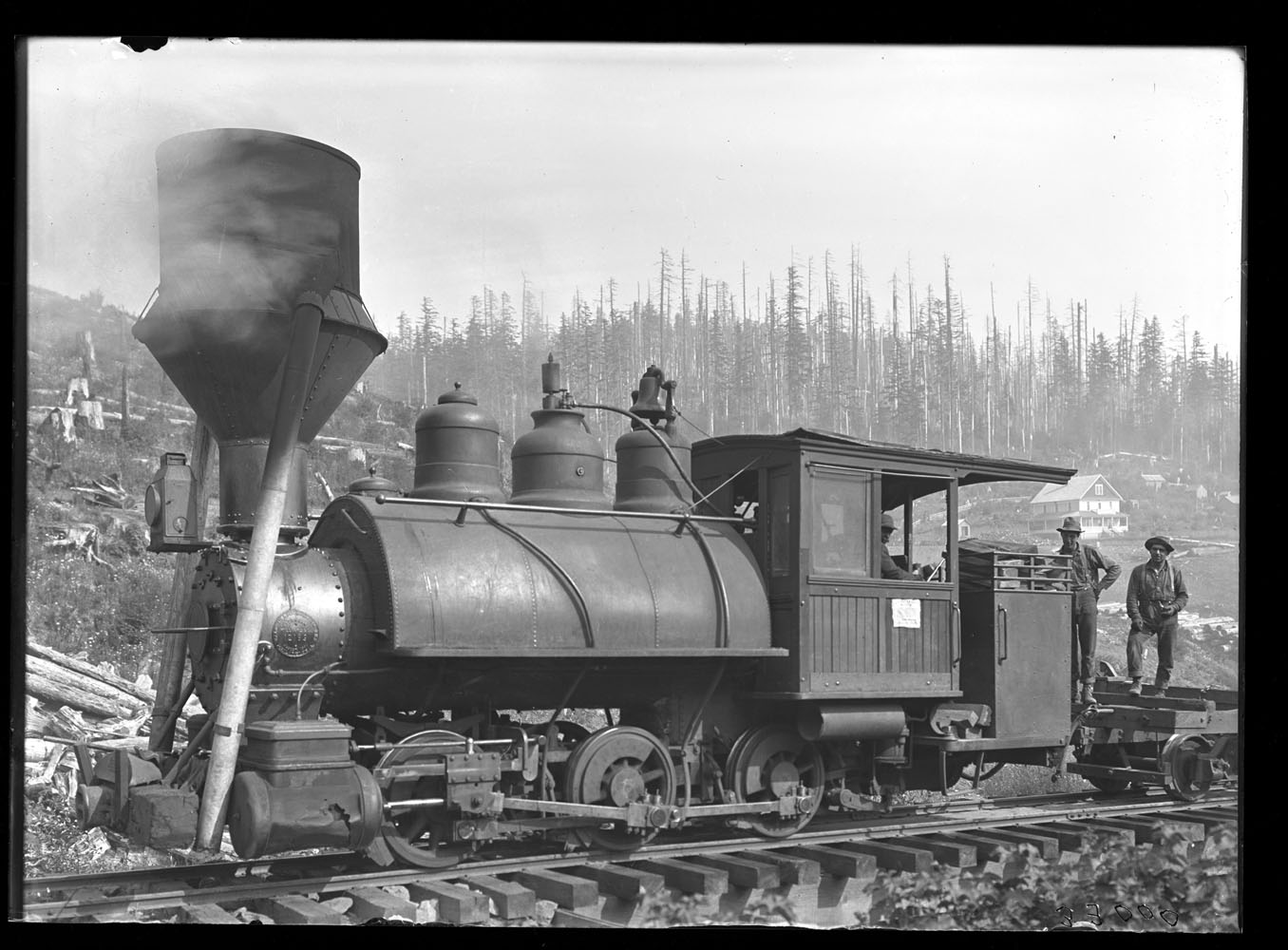
Steam train engine and men (4587524736).jpg - Fæ

"Peggy" engine in woods (4586899479).jpg - Fæ

Man with his arm resting on a large table saw blade (4587524718).jpg - Fæ

Three men with saws (4586899659).jpg - Fæ

Man standing against a Douglas Spruce tree (4587524916).jpg - Fæ

Tunnel - panoramio (19).jpg - Panoramio upload bot

Hawthorne bridge - panoramio.jpg - Panoramio upload bot
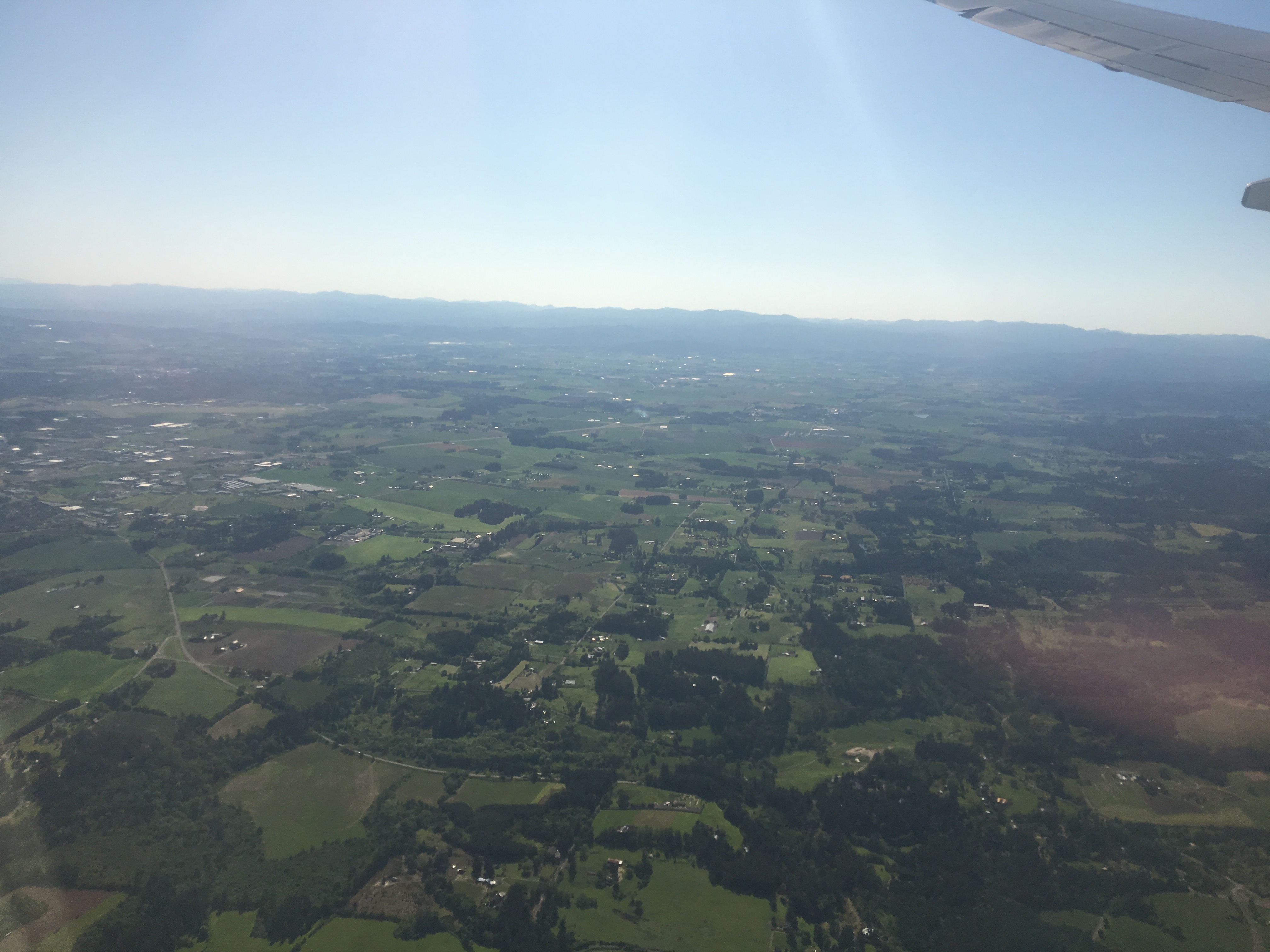
Aerial view of Northern Multnomah County.jpg - Kingofthedead

Hike near Bonneville.jpg - Kingofthedead

Multnomah County, OR, USA - panoramio (7).jpg - Panoramio upload bot

Multnomah County, OR, USA - panoramio (8).jpg - Panoramio upload bot

Bridgeoporus nobilissimus 750401.jpg - Leoboudv

Bridgeoporus nobilissimus 750402.jpg - Leoboudv

Marigold Works Vegan Sandwiches (34785238156).jpg - Tony Webster

New Tomorrow (121495215).jpeg - Rodrigo.Argenton

Sandy River (Oxbow Park, Multnomah County, Oregon, USA) 1 (19841324060).jpg - Ser Amantio di Nicolao

Sandy River (Oxbow Park, Multnomah County, Oregon, USA) 2 (20029302285).jpg - Ser Amantio di Nicolao

Sandy River (Oxbow Park, Multnomah County, Oregon, USA) 3 (19408314293).jpg - Ser Amantio di Nicolao

1940 Census Population Schedules - Oregon - Multnomah County - ED 37-204 - DPLA - df1c9300e9d8c074efeda52607c0dab6 (page 1).jpg - DPLA bot

1940 Census Population Schedules - Oregon - Multnomah County - ED 37-204 - DPLA - df1c9300e9d8c074efeda52607c0dab6 (page 2).jpg - DPLA bot

1940 Census Population Schedules - Oregon - Multnomah County - ED 37-204 - DPLA - df1c9300e9d8c074efeda52607c0dab6 (page 3).jpg - DPLA bot

1940 Census Population Schedules - Oregon - Multnomah County - ED 37-204 - DPLA - df1c9300e9d8c074efeda52607c0dab6 (page 4).jpg - DPLA bot

1940 Census Population Schedules - Oregon - Multnomah County - ED 37-204 - DPLA - df1c9300e9d8c074efeda52607c0dab6 (page 5).jpg - DPLA bot

1940 Census Population Schedules - Oregon - Multnomah County - ED 37-204 - DPLA - df1c9300e9d8c074efeda52607c0dab6 (page 6).jpg - DPLA bot

1940 Census Population Schedules - Oregon - Multnomah County - ED 37-204 - DPLA - df1c9300e9d8c074efeda52607c0dab6 (page 7).jpg - DPLA bot

1940 Census Population Schedules - Oregon - Multnomah County - ED 37-204 - DPLA - df1c9300e9d8c074efeda52607c0dab6 (page 8).jpg - DPLA bot

1940 Census Population Schedules - Oregon - Multnomah County - ED 37-204 - DPLA - df1c9300e9d8c074efeda52607c0dab6 (page 9).jpg - DPLA bot

1940 Census Population Schedules - Oregon - Multnomah County - ED 37-204 - DPLA - df1c9300e9d8c074efeda52607c0dab6 (page 10).jpg - DPLA bot

1940 Census Population Schedules - Oregon - Multnomah County - ED 37-204 - DPLA - df1c9300e9d8c074efeda52607c0dab6 (page 11).jpg - DPLA bot

1940 Census Population Schedules - Oregon - Multnomah County - ED 37-204 - DPLA - df1c9300e9d8c074efeda52607c0dab6 (page 12).jpg - DPLA bot

View of the Hills-2.jpg - Lucario298

View of the Hills.jpg - Lucario298

View of the Mountain and Lake.jpg - Lucario298

Fishing on the Lake.jpg - Lucario298

The Trees.jpg - Lucario298

The Sun and the Lake.jpg - Lucario298

Trees and lake near Multnomah Falls.jpg - Lucario298

Bar Chart of Citizenship in Multnomah County, (2015).svg - Dave-landry-datawheel

Bar Chart of Non-English Speakers in Multnomah County (2015).svg - Dave-landry-datawheel

Bar Chart of Race & Ethnicity in Multnomah County, or (2015).svg - Dave-landry-datawheel

Tree Map of Employment by Industries in Multnomah County, or (2015).svg - Dave-landry-datawheel

Tree Map of Employment by Occupations in Multnomah County, or (2015).svg - Dave-landry-datawheel