Wikimedi'Òc
Modes d'emploi

Cet album fait partie des albums
Cet album photos contient les sous-albums suivants :


Map of the Reserve of Fort Kearny.png - Indianertosset

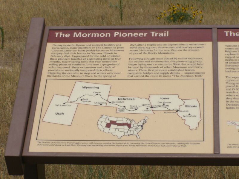
Western Trails in Nebraska.svg - Swid

Mormon trail monument.jpg - Napa
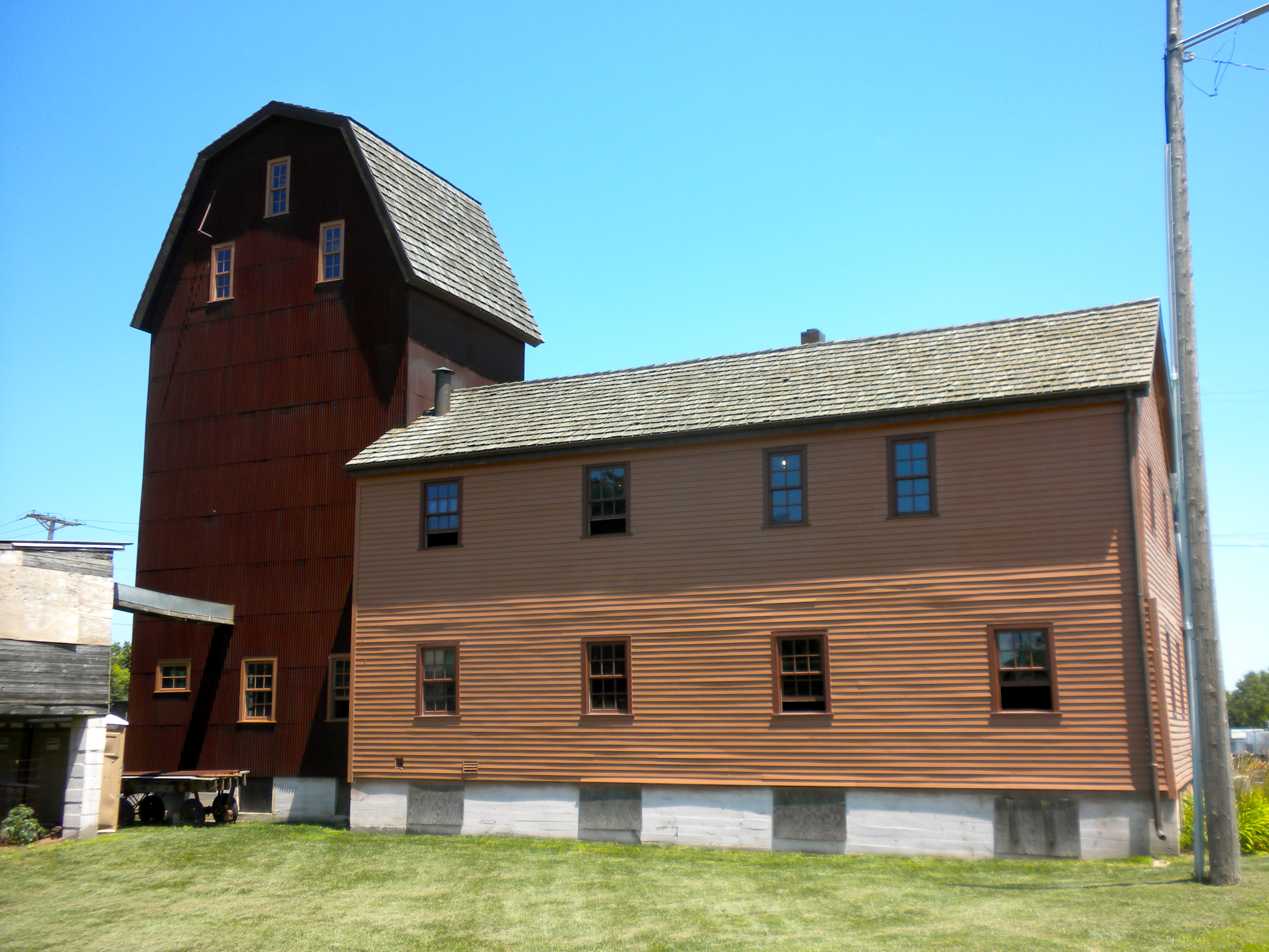
Florence Mill NE.JPG - Smallbones
Wayside on Mormon Trail Nebraska.JPG - File Upload Bot (Magnus Manske)
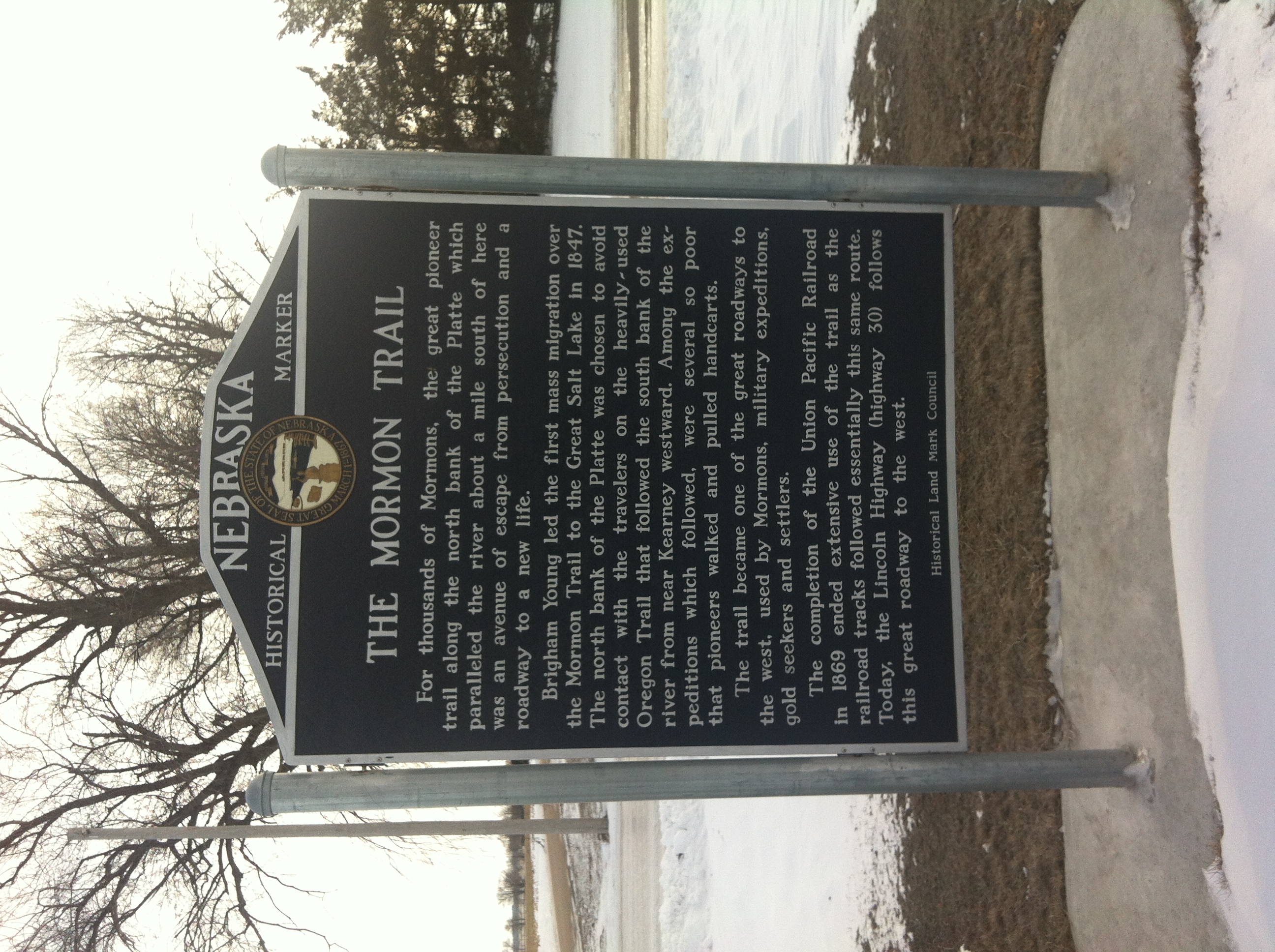
Mormon Trail Marker in Central City, NE.JPG - I am One of Many

Road to Zion P6060664.jpg - Chris Light

Broadwater- The Rapture of Spring P7170191.jpg - Chris Light

Frontier Mail Carriers 2016-07-12 1347.jpg - Chris Light

Narcissa Whitman marker P7170187.jpg - Chris Light

D-17a. Windlass Hill on the California, Mormon Pioneer, and Oregon National Historic (2005) (6f3166a6-4006-4cb6-b99b-6db85688f21e).jpg - BMacZeroBot

D-28. North Platte Valley Museum (11th and J Streets, Gering) on the California, Mormon Pioneer, Oregon, and Pony Express National Historic Trail (2005) (290f835c-61db-4b00-806a-62227d2b5b4d).jpg - BMacZeroBot

D-7. Roadometer Starting Point (North Platte Regional Airport, east of North Platte) on the Mormon Pioneer National Historic Trail (2005) (6d92b335-4856-4145-bc8b-6e34d49bf32a).jpg - BMacZeroBot

D-17. Ash Hollow Complex (about 2 miles southeast of Lewellen) on the California, Mormon Pioneer, and Oregon National Historic Trails (2005) (e0fb357a-1f58-4c32-b7f0-f7c98c7b696d).jpg - BMacZeroBot

B-7. Liberty Pole Camp (Fremont Lakes State Recreation Area) on the Mormon Pioneer National Historic Trail (2005) (c7d526f5-062d-4e8b-a90b-6981a0ea49d9).jpg - BMacZeroBot

D-20. Frog's Head Bluff (Indian Lookout Point) Interpretive Wayside (2 miles west of Lisco) on the California and Mormon Pioneer National Historic Trails (2005) (28117997-2165-4903-aec8-68ca020d5d10).jpg - BMacZeroBot

B-9. Pawnee Mission and Village Wayside (6 miles west of Genoa) on the Mormon Pioneer National Historic Trail (2005) (9f5a0245-cec5-42da-b9ab-c7ee1c34f228).JPG - BMacZeroBot

D-21. Ancient Bluff Ruins and Narcissa Whitman Interpretive Waysides (6 miles west of Lisco, 8 miles east of Broadwater) on the California, Mormon Pioneer, and Oregon Trails (2005) (6abc21fb-f3d5-4f63-8791-751d28de9251).jpg - BMacZeroBot

D-8. The Sand Hill Ruts (4 miles north of Sutherland) on the California and Mormon Pioneer National Historic Trails (2005) (816df4bc-537d-4bbd-8378-4dc965c8d591).jpg - BMacZeroBot

B-11. MurdockMormon Trail Ruts (1.5 miles south of Alda) on the Mormon Pioneer National Historic Trail (2005) (afcb49cb-6ad6-445a-8eb5-95bd3c484a66).JPG - BMacZeroBot

D-18. Blue Water BattlefieldHarney MassacreBattle of Ash Hollow Historic Wayside (1.8 miles west of Lewellen) on the California, Mormon Pioneer, and Oregon National Historic Trails (2005) (9b909bdf-e8e0-403e-b799-80ae065344ab).jpg - BMacZeroBot

D-34. Horse Creek Treaty Grounds and Battle Site (2 miles southwest of Morrill) on the California, Mormon Pioneer, Oregon, and Pony Express National Historic Trails (2005) (3c3f8956-9c36-47a5-af4f-60962e26adc0).jpg - BMacZeroBot

D-17c. Pioneer Grave at Ash Hollow Cemetery on the California, Mormon Pioneer, and Oregon National Historic Trails (2005) (640e77de-a469-475b-8131-a13decf6b6ca).jpg - BMacZeroBot

B-8. Genoa Ruts (1.5 miles southeast of Genoa) on the Mormon Pioneer National Historic Trail (2005) (6d5632af-2ed0-4254-98de-e044b4861d1e).JPG - BMacZeroBot

D-4. Dawson County Historical Museum (805 N. Taft Street, Lexington) on the California, Mormon Pioneer, Oregon, Pony Express National Historic Trails (2005) (a1adeaf8-71f4-444f-9201-3d4bbeec2822).jpg - BMacZeroBot