Wikimedi'Òc
Modes d'emploi

Cet album fait partie des albums
Cet album photos contient les sous-albums suivants :


Valley In Scotland.jpg - MatthewJS

Dunachton.jpg - Catfish Jim and the soapdish

Black Law - geograph.org.uk - 10154.jpg - GeographBot

Beinn Lair - geograph.org.uk - 25844.jpg - GeographBot

Rannoch Moor - geograph.org.uk - 22225.jpg - GeographBot

Deer fence - geograph.org.uk - 34559.jpg - GeographBot

Glenmarksie - geograph.org.uk - 36175.jpg - GeographBot

Moorland above Torran, Ford, Argyll - geograph.org.uk - 74941.jpg - GeographBot

Tweed's Well - the source of the River Tweed - geograph.org.uk - 33419.jpg - GeographBot

Windy Slack - geograph.org.uk - 60415.jpg - GeographBot

Looking north from top of String road, Arran - geograph.org.uk - 97785.jpg - GeographBot

Creagh an Fhinch and Meall a Bhuiridh - geograph.org.uk - 112093.jpg - GeographBot

Moorland near Shearleat - geograph.org.uk - 123973.jpg - GeographBot

River Add in upper reaches - geograph.org.uk - 123958.jpg - GeographBot

Larsen trap. - geograph.org.uk - 135558.jpg - GeographBot

Island of Kerrera - geograph.org.uk - 140015.jpg - GeographBot

Dry ground, Beinn Ghlas. - geograph.org.uk - 151054.jpg - GeographBot

Edge of the moorland - geograph.org.uk - 112501.jpg - GeographBot

Moorland, west of Beinn Ghlas. - geograph.org.uk - 151052.jpg - GeographBot

Southwest to Northeast, Beinn Ghlas. - geograph.org.uk - 151083.jpg - GeographBot

Moorland on the Dunlossit Estate - geograph.org.uk - 112502.jpg - GeographBot

The deer fence - geograph.org.uk - 112462.jpg - GeographBot

Unimproved land with a view to the Paps of Jura - geograph.org.uk - 112499.jpg - GeographBot

Tundra-like Summit plateau of Sgurr na Ruaidhe - geograph.org.uk - 170786.jpg - GeographBot

Nick of the Balloch - geograph.org.uk - 185641.jpg - GeographBot

Moorland above Glen Strathfarrar - geograph.org.uk - 214128.jpg - GeographBot

Moorland in the heart of Islay - geograph.org.uk - 216034.jpg - GeographBot

Moorland in the heart of Islay - geograph.org.uk - 216038.jpg - GeographBot

N.I.M.B.Y s - geograph.org.uk - 211596.jpg - GeographBot

Whiteadder Water - geograph.org.uk - 244939.jpg - GeographBot

Deer Fence - geograph.org.uk - 253770.jpg - GeographBot

Looking northeastwards to a copse on the slopes of Carn na Glaisaisneach. - geograph.org.uk - 250209.jpg - GeographBot

Moorland erratics - geograph.org.uk - 252960.jpg - GeographBot

The moor by Drumguish along the A939. - geograph.org.uk - 250195.jpg - GeographBot

The mountain track in the mid distance leads to the grouse butts of Maol am Tailleir. - geograph.org.uk - 253699.jpg - GeographBot

Cyclists ascending the Nick of the Balloch - geograph.org.uk - 263388.jpg - GeographBot

Near Cnoc Fraing - geograph.org.uk - 264205.jpg - GeographBot

Nick of the Balloch (south side) - geograph.org.uk - 263384.jpg - GeographBot

On Ashie Moor - geograph.org.uk - 265232.jpg - GeographBot

Upper Glen Feshie - geograph.org.uk - 265950.jpg - GeographBot

Moorland at Carn Monadh nan da Allt - geograph.org.uk - 274844.jpg - GeographBot

Moorland at Badninish - geograph.org.uk - 296370.jpg - GeographBot

Creag Mhigeachaidh - geograph.org.uk - 318583.jpg - GeographBot

Moorland, Allt nam Bò - geograph.org.uk - 318542.jpg - GeographBot

North ridge, Creag Mhigeachaidh - geograph.org.uk - 318654.jpg - GeographBot

Coire Bogha Choinnich - geograph.org.uk - 320009.jpg - GeographBot

Forest on the south side of the Nick of the Balloch - geograph.org.uk - 334133.jpg - GeographBot

The deer fence - geograph.org.uk - 333709.jpg - GeographBot

Kilennan River - geograph.org.uk - 351817.jpg - GeographBot

Moorland Track - geograph.org.uk - 351815.jpg - GeographBot

Peat Track in Fleisirin (Flesherin) - geograph.org.uk - 364235.jpg - GeographBot

Doughty Farm Road - geograph.org.uk - 378943.jpg - GeographBot

Doughty Hill - geograph.org.uk - 378937.jpg - GeographBot

Dry-Stone Dyke - geograph.org.uk - 378960.jpg - GeographBot

Edge of The Pilot - geograph.org.uk - 378855.jpg - GeographBot

Forest and Moor - geograph.org.uk - 378845.jpg - GeographBot

Glenalla View - geograph.org.uk - 378927.jpg - GeographBot

Into The Forest - geograph.org.uk - 378868.jpg - GeographBot

Into the Forest - geograph.org.uk - 378930.jpg - GeographBot

Moorland View - geograph.org.uk - 378917.jpg - GeographBot

On the Hill - geograph.org.uk - 378877.jpg - GeographBot

Towards Dalquhairn Burn - geograph.org.uk - 378887.jpg - GeographBot

We're Watching You - geograph.org.uk - 378941.jpg - GeographBot

Mam Suim - geograph.org.uk - 391787.jpg - GeographBot

Dibidil Track - geograph.org.uk - 411146.jpg - GeographBot

Moorland and Peat Hags - geograph.org.uk - 417599.jpg - GeographBot

Moorland near Sanna - geograph.org.uk - 411132.jpg - GeographBot

Summit of Knock Hill - geograph.org.uk - 418734.jpg - GeographBot

Old shooting butt, Crooked Bank - geograph.org.uk - 441452.jpg - GeographBot

A verdant moorland scene with all the trimmings. - geograph.org.uk - 455908.jpg - GeographBot

An easterly view in the continuous rainfall from Craig Tiribeg. - geograph.org.uk - 455129.jpg - GeographBot

Grit on a peat plate for the grouse^^ - geograph.org.uk - 454891.jpg - GeographBot

Lane junction by Tiribeg Wood. - geograph.org.uk - 455092.jpg - GeographBot

Lichen - a paws-on experience^ - geograph.org.uk - 455105.jpg - GeographBot

Looking Towards Kilkerran House - geograph.org.uk - 472289.jpg - GeographBot

Lochindorb, the crest of the hill on the extended track above Corrycharcle - geograph.org.uk - 480733.jpg - GeographBot

Dava Moor - geograph.org.uk - 524605.jpg - GeographBot

Boulder on Creag Bheithe Mhor - geograph.org.uk - 530022.jpg - GeographBot

Creag Bheithe Bheag - geograph.org.uk - 530027.jpg - GeographBot

A westerly view from the dismantled railway. - geograph.org.uk - 544175.jpg - GeographBot

Moorland below Braeriach - geograph.org.uk - 544929.jpg - GeographBot

Across the moor to the southeast of Easter Limekilns. - geograph.org.uk - 566488.jpg - GeographBot

Easterly from the road end by Easter Limekilns. - geograph.org.uk - 566491.jpg - GeographBot

To the nor'east across the moor near Creag a Ghiuthais - geograph.org.uk - 566628.jpg - GeographBot

The grouse shooters' convoy by Lochindorb - geograph.org.uk - 574309.jpg - GeographBot

Allt Bheadhair - geograph.org.uk - 613293.jpg - GeographBot

Carn Bheadhair - geograph.org.uk - 613294.jpg - GeographBot

Rough land on Cruach nam Broighleag - geograph.org.uk - 617387.jpg - GeographBot

Deer fences, Achnasheen Plantation - geograph.org.uk - 624604.jpg - GeographBot

Crossing Culmark Hill - geograph.org.uk - 633646.jpg - GeographBot

Deer fence - geograph.org.uk - 649871.jpg - GeographBot

Gambolling in the heather south of Carn Maol - geograph.org.uk - 663430.jpg - GeographBot

Gully and ford in the glen of Caochan a Ghaid - geograph.org.uk - 663435.jpg - GeographBot

The moorland track south of Carn Maol summit - geograph.org.uk - 663276.jpg - GeographBot

Moorland near Achlean - geograph.org.uk - 693884.jpg - GeographBot

Creag Bheithe Mhor - geograph.org.uk - 708887.jpg - GeographBot

The southern slopes of Auchmantle Fell - geograph.org.uk - 702546.jpg - GeographBot

Allt na Buaile Duibh - geograph.org.uk - 740244.jpg - GeographBot

West flank of Stemster Hill - geograph.org.uk - 775141.jpg - GeographBot

Deer fence and forest edge - geograph.org.uk - 798688.jpg - GeographBot

Kircram - deer fence - geograph.org.uk - 846640.jpg - GeographBot

Gate in deer fence - geograph.org.uk - 945854.jpg - GeographBot

Agro Track Crossing Grouse Moor Towards Clava Forest - geograph.org.uk - 1020030.jpg - GeographBot

Gate in deer fence - geograph.org.uk - 1085649.jpg - GeographBot

Deer fence separating forest from moorland - geograph.org.uk - 1128667.jpg - GeographBot

Deer fence... - geograph.org.uk - 1184932.jpg - GeographBot

Deer fence - geograph.org.uk - 1198852.jpg - GeographBot

Deer fence, Meall Breac - geograph.org.uk - 1258559.jpg - GeographBot

Old deer fence - geograph.org.uk - 1271136.jpg - GeographBot

Plateau, on the Bruar - Feshie watershed - geograph.org.uk - 1301634.jpg - GeographBot

Deer fence at Rowardennan Forest - geograph.org.uk - 1333041.jpg - GeographBot

Deer fence and waterfall - geograph.org.uk - 1364992.jpg - GeographBot

Deer fence, Meall Dheirgidh - geograph.org.uk - 1372959.jpg - GeographBot

Grouse moor south of Badnonan - geograph.org.uk - 1433177.jpg - GeographBot

853m top, Monadh Ghaig - geograph.org.uk - 1442548.jpg - GeographBot

Deer fence above Strathaird - geograph.org.uk - 1451782.jpg - GeographBot

Deer fence with kissing gate - geograph.org.uk - 1539223.jpg - GeographBot

Deer fence and coniferous forest - geograph.org.uk - 1540126.jpg - GeographBot

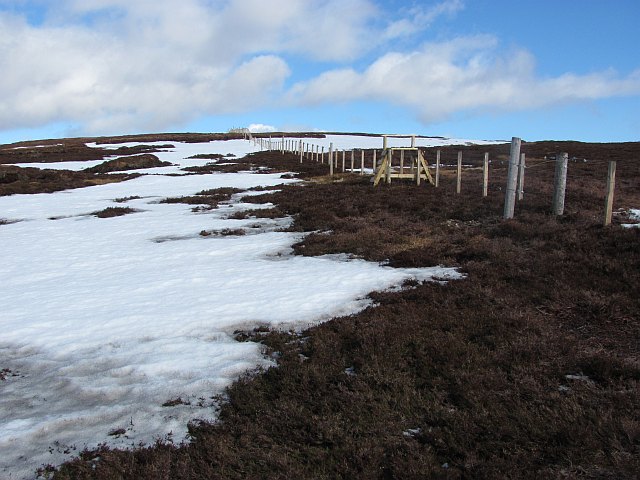
New deer fence - geograph.org.uk - 1568715.jpg - GeographBot

Deer fence, Lundie - geograph.org.uk - 1722760.jpg - GeographBot
At last a crossing place - geograph.org.uk - 1775850.jpg - GeographBot