Wikimedi'Òc
Modes d'emploi

Cet album fait partie des albums
Cet album photos contient les sous-albums suivants :


Jbel al mahser près du village de Twissite - Province de Jerada.jpg - Farajiibrahim

Cathedral Imsfrane Morocco.jpg - Moroccan Navigator

"Das größte zusammenhängende Oasengebiet Marokkos". 10.jpg - Holger Uwe Schmitt

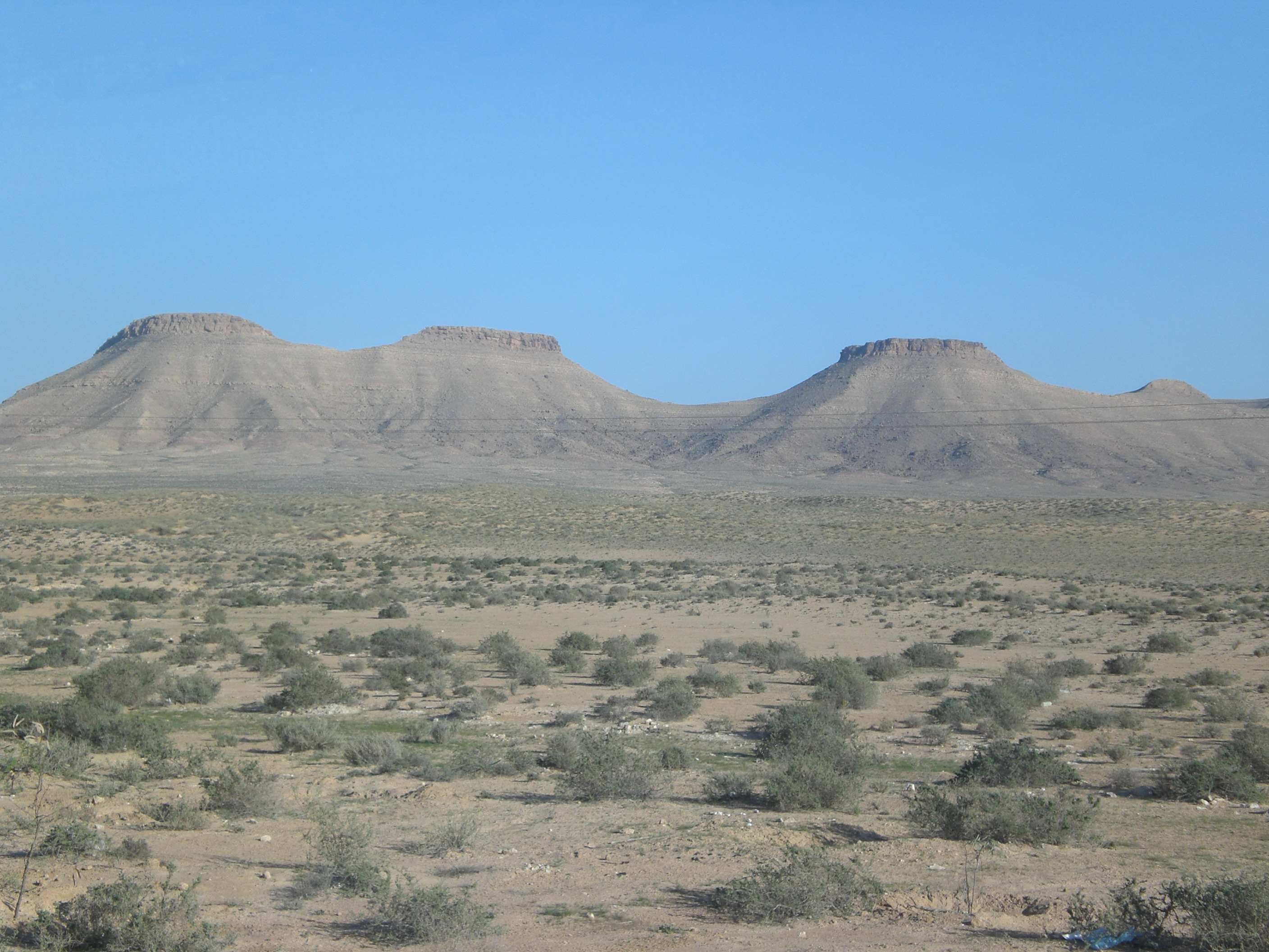
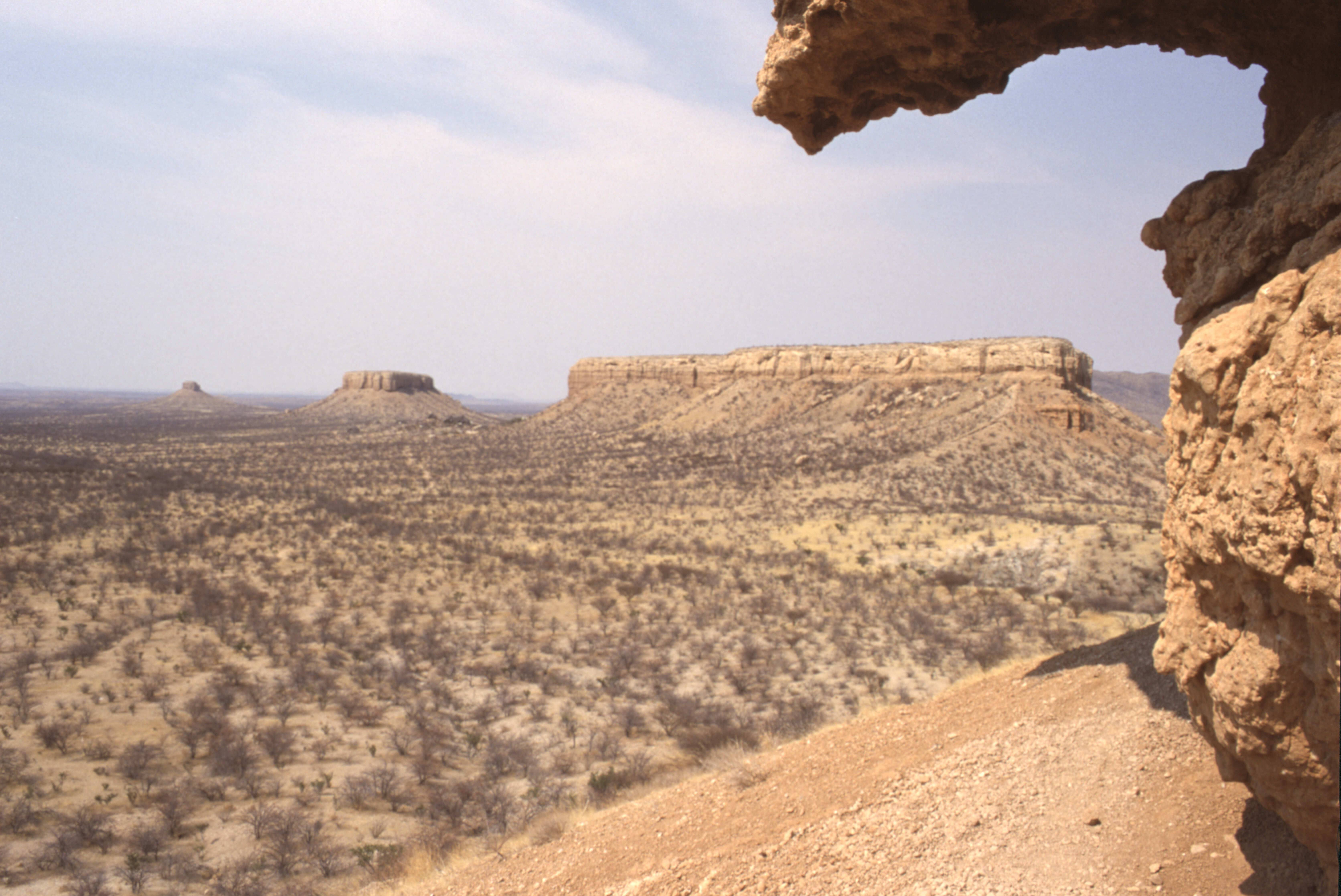
Dejbel saghro.jpg - EL-Boukhou

Saghro.jpeg - File Upload Bot (Magnus Manske)

Le billard.JPG - Yelles

La cathédrale, Azilal.jpg - Nawfal Kharbach

Morocco - panoramio (32).jpg - Panoramio upload bot

Errachidia Province, Morocco - panoramio (2).jpg - Panoramio upload bot

BUTTE (PSF).jpg - Igno2

Butte PSF.png - Kylu

Cerro testigo en Toledo.JPG - Miguel303xm~commonswiki

Caisteal Liath, Suilven.jpg - McLurker

Cristo y Cerro.JPG - CParísC

Bardeako muinoak.jpg - Assar
Dj Tebaga Kh.jpg - م ض

Cerro Negro Nequén Argentina.JPG - Carride

Monte Santu e Monte S. Antonio (Pelau), Siligo, Sardinia.jpg - Fpittui

Jemez.JPG - Honinbou
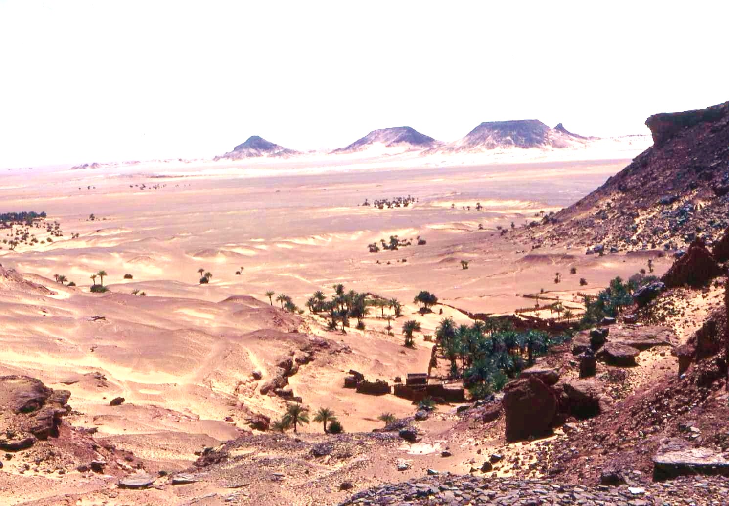
Alentours de Timimoun. 2.jpg - Michel-georges bernard

Sangar western sahara.jpg - Meteorite Recon~commonswiki
Hoya de Guadix 3.JPG - Xemenendura

IslandInTheSky.JPG - Citypeek

Cerro Baul.jpg - Simon chara

Montagne du Faltre.jpg - Jmp48

Paysage (Plateaux).JPG - Bsm15~commonswiki

Mesa in Douglas County, CO IMG 5946.JPG - Billy Hathorn

PSM V81 D234 Toyalane near luni pueblo new mexico.png - Ineuw

PSM V81 D236 Enchanted mesa in western new mexico.png - Ineuw

PSM V81 D237 Tooth of time new acoma pueblo new mexico.png - Ineuw

PSM V81 D238 Outliers of the great acoma mesa.png - Ineuw

PSM V81 D239 An isolated mesa near acoma pueblo.png - Ineuw

PSM V81 D240 Cretacic sandstone and breccia near los cerrillos new mexico.png - Ineuw

PSM V81 D241 Face of the high acoma mesa.png - Ineuw

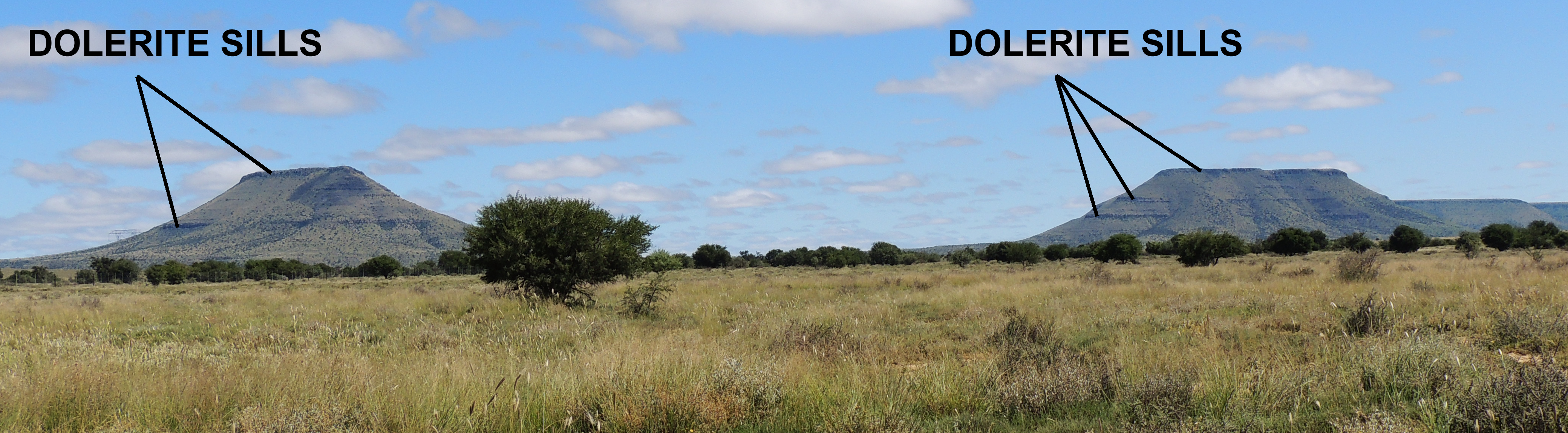
RSA Karoo.jpg - MGA73bot2

A distant shot of the west mesa in new mexico.jpg - Fæ
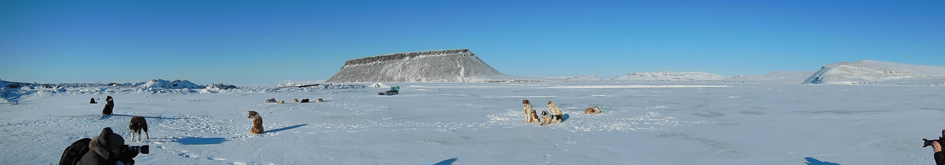
Sled dogs on sea ice in North Star Bay near Thule Air Base, Greenland.jpg - Stas1995
Karoo Koppies.png - Oggmus

Вид на остров Бэлл.jpg - Nixette

Texas 1950s drought.jpg - Iamozy
The view of Acoma, N.M (NYPL b11707655-G90F462 011F).tiff - Fæ

Title- Hance's Trail. (9672554071).jpg - Fæ

Culebra Peak and Range. (14769622832).jpg - Fæ

San Luis, Colo. (14767587034).jpg - Fæ

- panoramio (2677).jpg - Panoramio upload bot
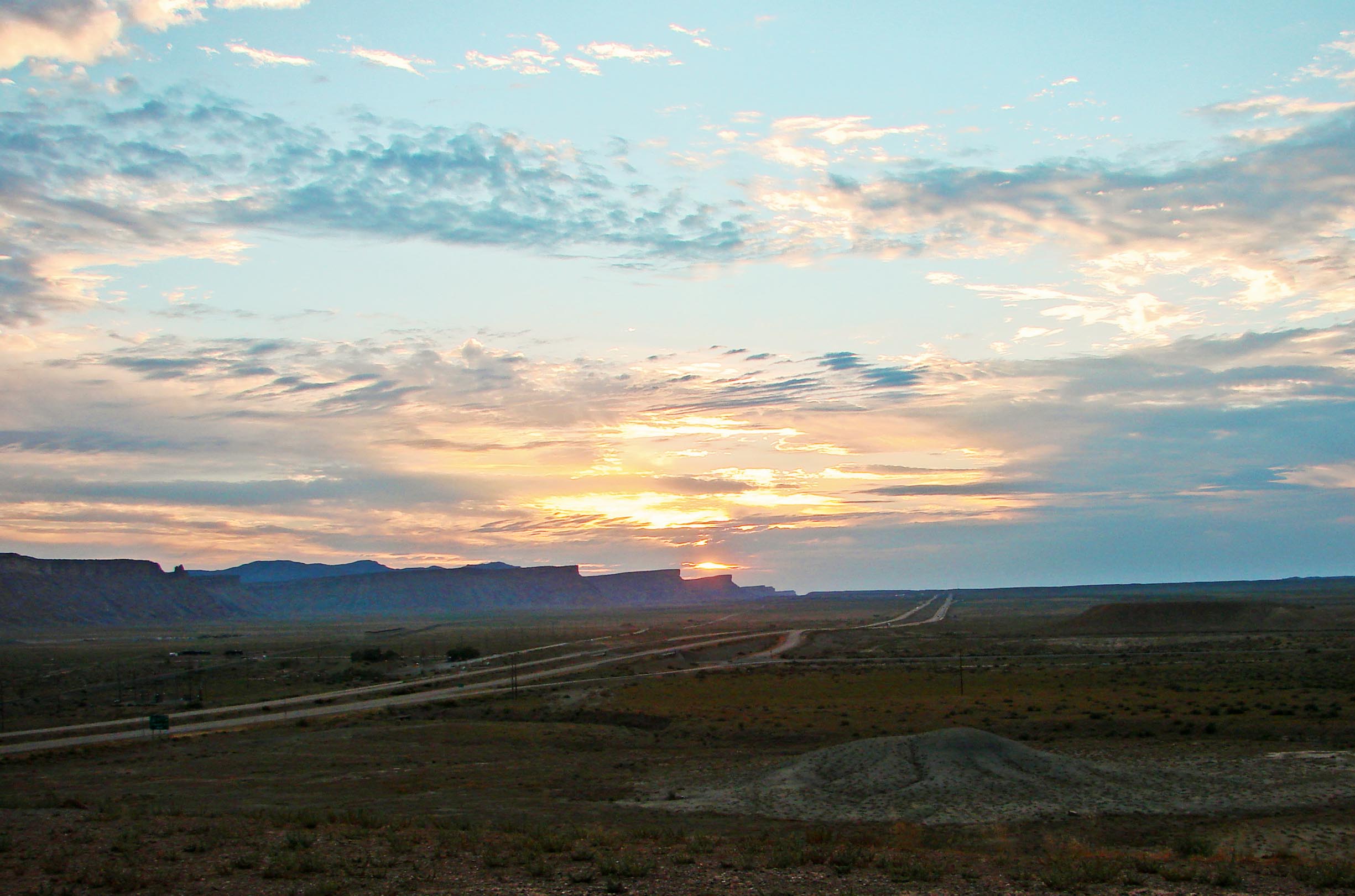
Sunrise, Central UT 7-13 (17169712108).jpg - Fæ

Sunrise, Utah Mesas 7-13 (14411222560).jpg - Fæ

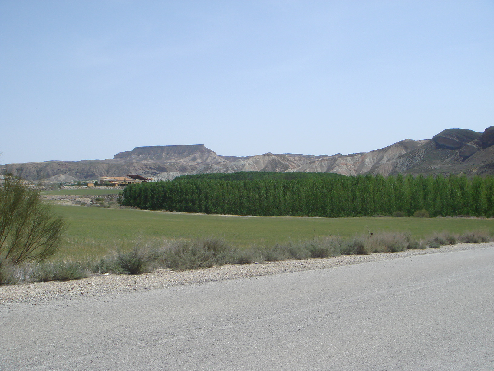
Le Maroc - panoramio (9).jpg - Panoramio upload bot
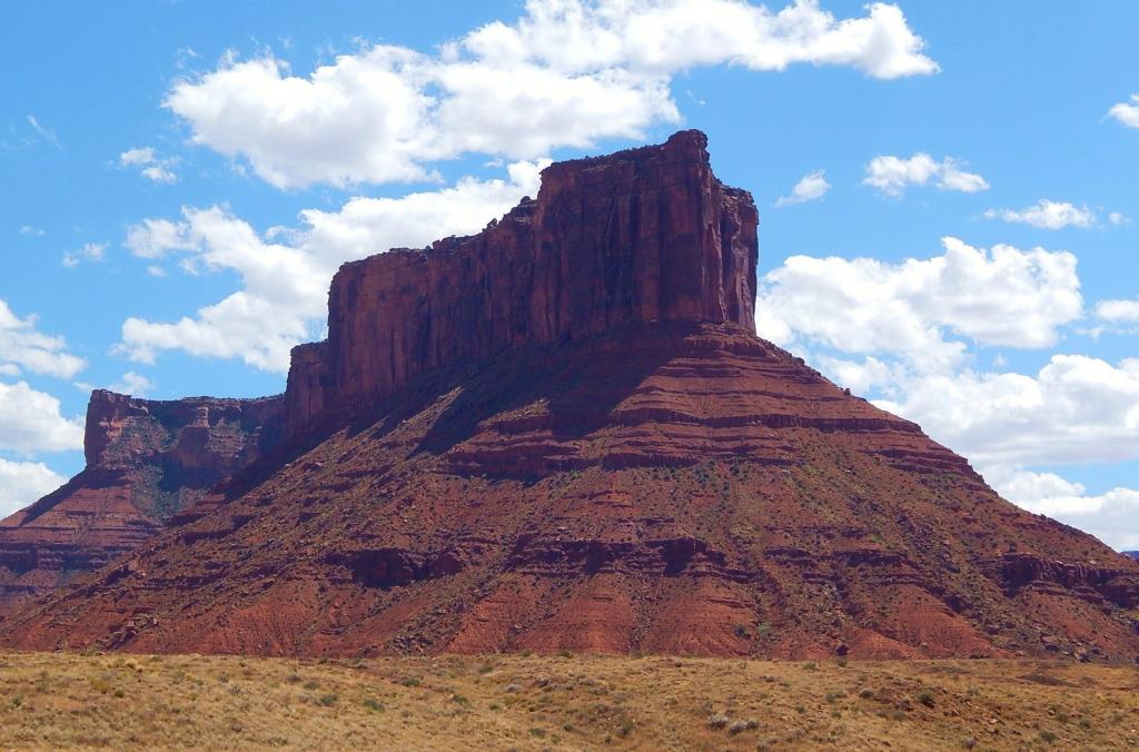
Parriott Mesa.jpg - Ron Clausen
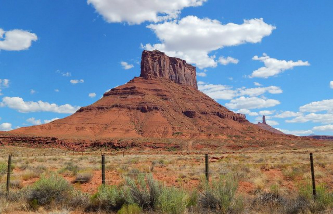
Convent Mesa, aka The Convent.jpg - Ron Clausen

Dunst Namibia Oct 2002 slide346 - kurz vor dem Vingerklip.jpg - Diascanprojekt Dunst

Dunst Namibia Oct 2002 slide351 - grandioser Weitblick.jpg - Diascanprojekt Dunst

Dunst Namibia Oct 2002 slide352 - wie eine Festung.jpg - Diascanprojekt Dunst
Dunst Namibia Oct 2002 slide353 - Ausblick.jpg - Braveheart

Gamsberg mountain, Namibia (2014).jpg - Olga Ernst

View from Ugab Terrace Lodge to the SSW.jpg - Olga Ernst

Middle Ugab Valley, Namibia (2014).jpg - Olga Ernst

Okenyenya mountain and mesas in front, Namibia (2014).jpg - Olga Ernst

Mesa in NE Syrtis.png - Justinbl

Mesa (or 'Jump Up') Diamantina Developmental Road Boulia Shire Queensland P1040104u.jpg - John Robert McPherson

Mesa (PSF).png - Encik Tekateki

Views of Glen Canyon National Recreation Area, Arizona and Utah (179dee2b-6dcd-4855-b197-612b77d15ebd).jpg - BMacZeroBot

Views of Glen Canyon National Recreation Area, Arizona and Utah (73576d5a-e049-410b-8f2d-d60620d5263a).jpg - BMacZeroBot

Views of Glen Canyon National Recreation Area, Arizona and Utah (a356cb8b-68cf-4bfa-ae78-8b8e09a9c70a).jpg - BMacZeroBot

Views of Glen Canyon National Recreation Area, Arizona and Utah (c613f5b5-5976-48af-a155-a281571e1718).jpg - BMacZeroBot

Cockburn Range.jpg - JulieMay54

Prewitt Landscape.jpg - Kimichip

Railway crossing with red cliffs in background.jpg - Kimichip

Cogolludo 1980.jpg - LBM1948

Paysage (Plateaux) (cropped).JPG - Zoozaz1

A set of mesas in the distance in the Santa Fe National Forest at Buckman Road near Santa Fe, NM (09009deb-3fa3-49ec-9cd9-15fd97a9d7d4).JPG - BMacZeroBot

Diablo Canyon is in the disatance from Buckman Road near Santa Fe, NM (155d31c2-8d5e-445c-af9c-d8e485c2a826).JPG - BMacZeroBot

Diablo Canyon Recreation Area Site Rules Sign at Diablo Canyon near Santa Fe, NM (16ef927b-3a5b-4e67-8f24-e3714cf1b6a0).JPG - BMacZeroBot

The high desert landscape at the Santa Fe National Forest near Santa Fe, NM (2f15cba8-8484-4fc0-abbb-13e40361225e).JPG - BMacZeroBot

A jagged ridge leads to Diablo Canyon in Santa Fe County, NM (334a6d77-9eb9-4259-ac33-9a94e8649141).JPG - BMacZeroBot

An expansive view of the high desert landscape at the Santa Fe National Forest near Santa Fe, NM (3731ddd0-f6f4-4252-994f-bb29b9b2a1b8).JPG - BMacZeroBot

A panoramic view off of Bosquecito Road outside of Socorro, NM (3947d927-1298-422a-9f0f-113f522ce0fd).JPG - BMacZeroBot

The view looking South towards Arroyo de la Parida on Bosquecito Road outside of Socorro, NM (3af2bac9-8283-452d-9fb1-7af040c17328).JPG - BMacZeroBot

A view from the canyon looking South into Arroyo de la Parida on Bosquecito Road outside of Socorro, NM (4c1d3047-37ac-43c9-890e-70aaca61e919).JPG - BMacZeroBot

Buckman Road with Diablo Canyon in the background near Santa Fe, NM (5b588c76-daf6-482e-9945-1382a436468f).JPG - BMacZeroBot

Picturesque views of the Santa Fe National Forest as seen from Buckman Road near Santa Fe, NM (72129a00-5f94-402b-ac88-7e1762ae82a8).JPG - BMacZeroBot

Construction is almost complete at the visitors parking lot at Diablo Canyon in Santa Fe County, NM (74feed80-b2f6-494d-854c-06ec438e9982).JPG - BMacZeroBot

New gravel is being laid in the visitors parking lot at Diablo Canyon in Santa Fe County, NM (820eb06b-9ac1-4104-babc-4a44581a783d).JPG - BMacZeroBot

Contractors build a visitors parking lot at Diablo Canyon in Santa Fe County, NM (8cfb402c-da1f-4282-88f4-70266a3e093a).JPG - BMacZeroBot

A large dry river bed at Diablo Canyon and Buckman Road near Santa Fe, NM (8d79178b-cc06-4b9e-98a6-ebe525f4805e).JPG - BMacZeroBot

Evidence of run off water coming from a ridge line near Diablo Canyon in the Santa Fe National Forest near Santa Fe, NM (941bf357-1457-4714-a3f5-957a92c9a938).JPG - BMacZeroBot

A view of a snow covered mesa near Diablo Canyon in Santa Fe County, NM (95d54dc8-0d98-4adc-8dea-f097646cf16b).JPG - BMacZeroBot

A panoramic view of the Arroyo de la Parida off of Bosquecito Road outside of Socorro, NM (9d3f38df-c561-4d78-b161-89be45c0d74c).JPG - BMacZeroBot

A long panoramic view of the Arroyo de la Parida looking South on Bosquecito Road outside of Socorro, NM (e16ca1be-1608-4e36-854f-4762f6580c84).JPG - BMacZeroBot

A panoramic view of the Arroyo de la Parida looking South on Bosquecito Road outside of Socorro, NM (f7271b7b-eb06-4ed0-a2e7-86eb7f4ee03f).JPG - BMacZeroBot

Sun shines on the face of Diablo Canyon near Santa Fe, NM (feb91e18-df18-4143-9342-7d66c70dfc6a).JPG - BMacZeroBot

Adrar 1997 08.jpg - LBM1948

Mesa with possible tracks of boulders.jpg - Jimmarsmars

Layered hills around Mars 21.jpg - Jimmarsmars

57059 2045mesa.jpg - Jimmarsmars

Blick vom Rocher de Capluc den Tarn abwärts.jpg - GerritR

Столова гора з лісовим масивом. Крим. Україна.JPG - Shiro D. Neko