Wikimedi'Òc
Modes d'emploi

Cet album fait partie des albums
Cet album photos contient les sous-albums suivants :


Inca-expansion.png - JohnnyMrNinja

Aleni1623.jpg - MawaruNeko

Coronado expedition.jpg - XcepticZP
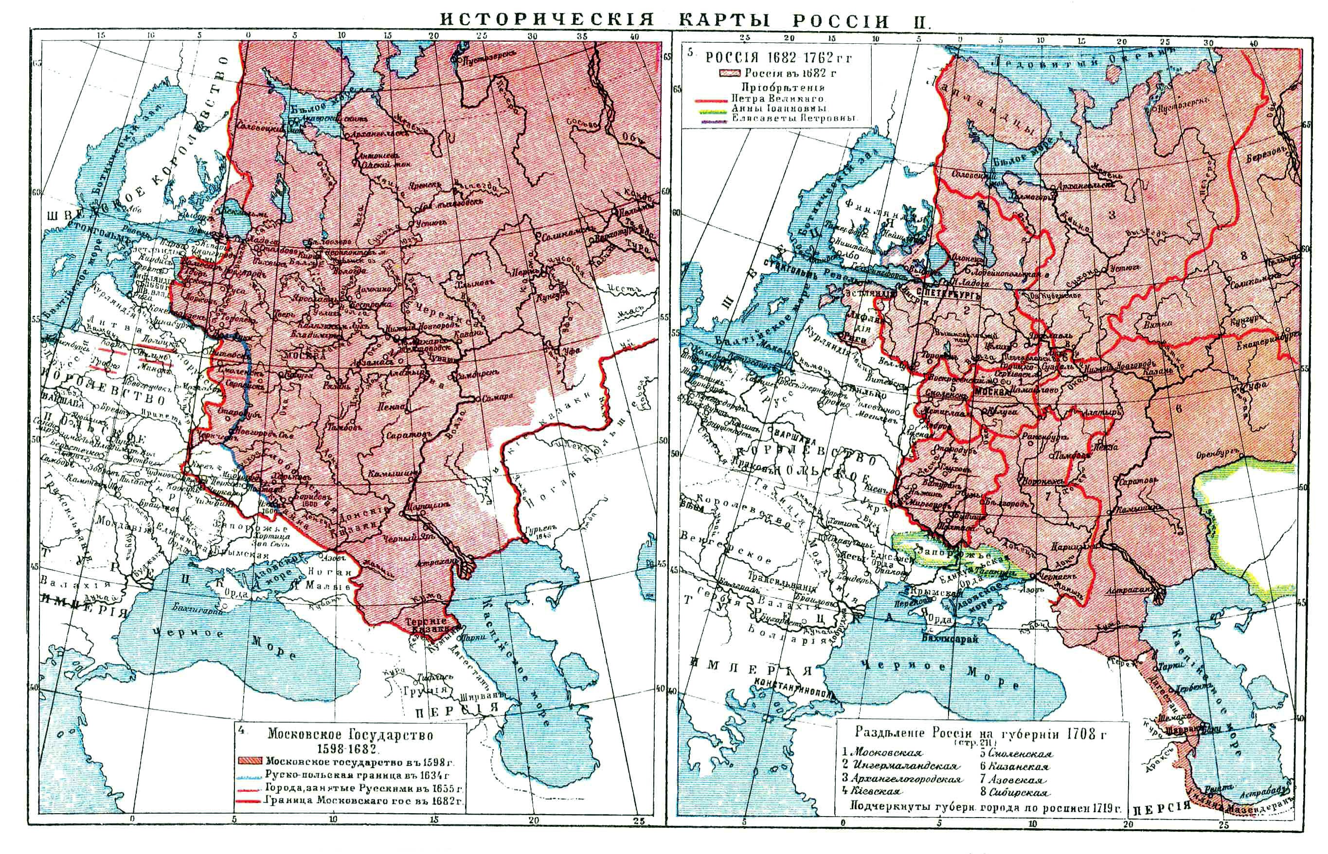
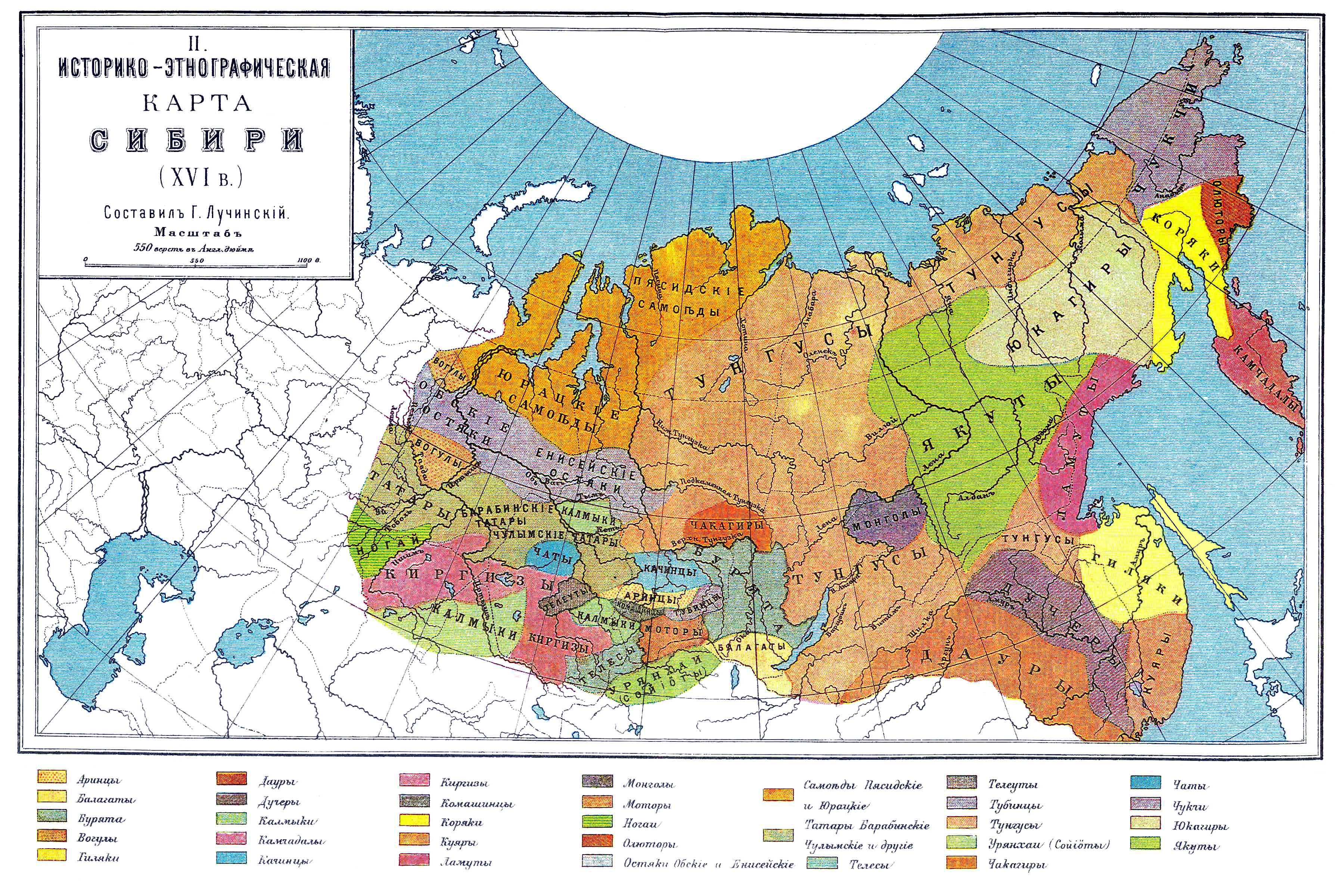
History of Russia, XVI-XVII c.jpg - .:Ajvol:.

Balboa Voyage 1513.PNG - RokerHRO

Capitulacion1529.png - 8Fer9

Map of 16th-century Japan Ukrainian.png - Ras67
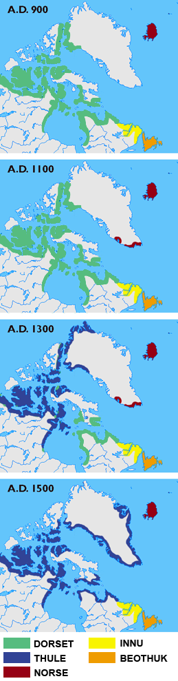
Arctic cultures 900-1500.png - Kmusser

Sype - La herdike enterprinse faict par le Signeur Draeck.jpeg - Frank Schulenburg

Hondius Vera Totius Expeditionis Nauticae Francis Drake colored.jpg - Lencer

Hondius Vera Totius Expeditionis Nauticae Francis Drake high.jpg - Lencer
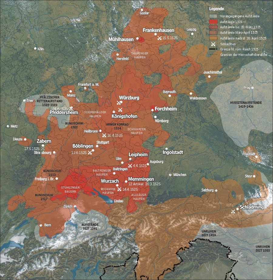
Karte bauernkrieg3.jpg - Cwbm (commons)

Camino Español.PNG - Miguelazo84
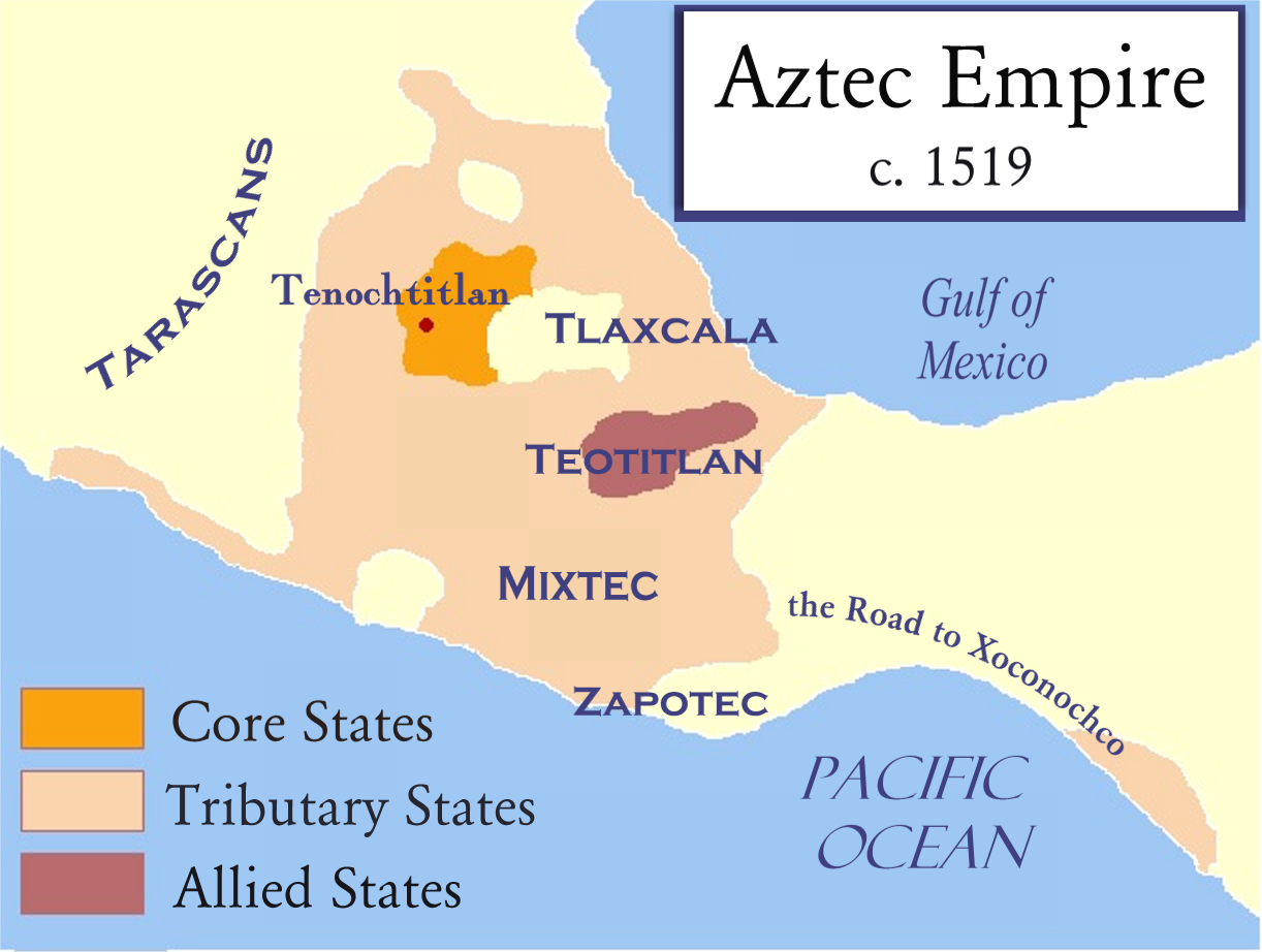
Aztec Empire c 1519.png - Madman2001

Spanish Empire around 1580.png - Galileo01

North america ethnic 1500.JPG - Olahus

Bahamani-sultanate-map.svg - Renato de Carvalho Ferreira
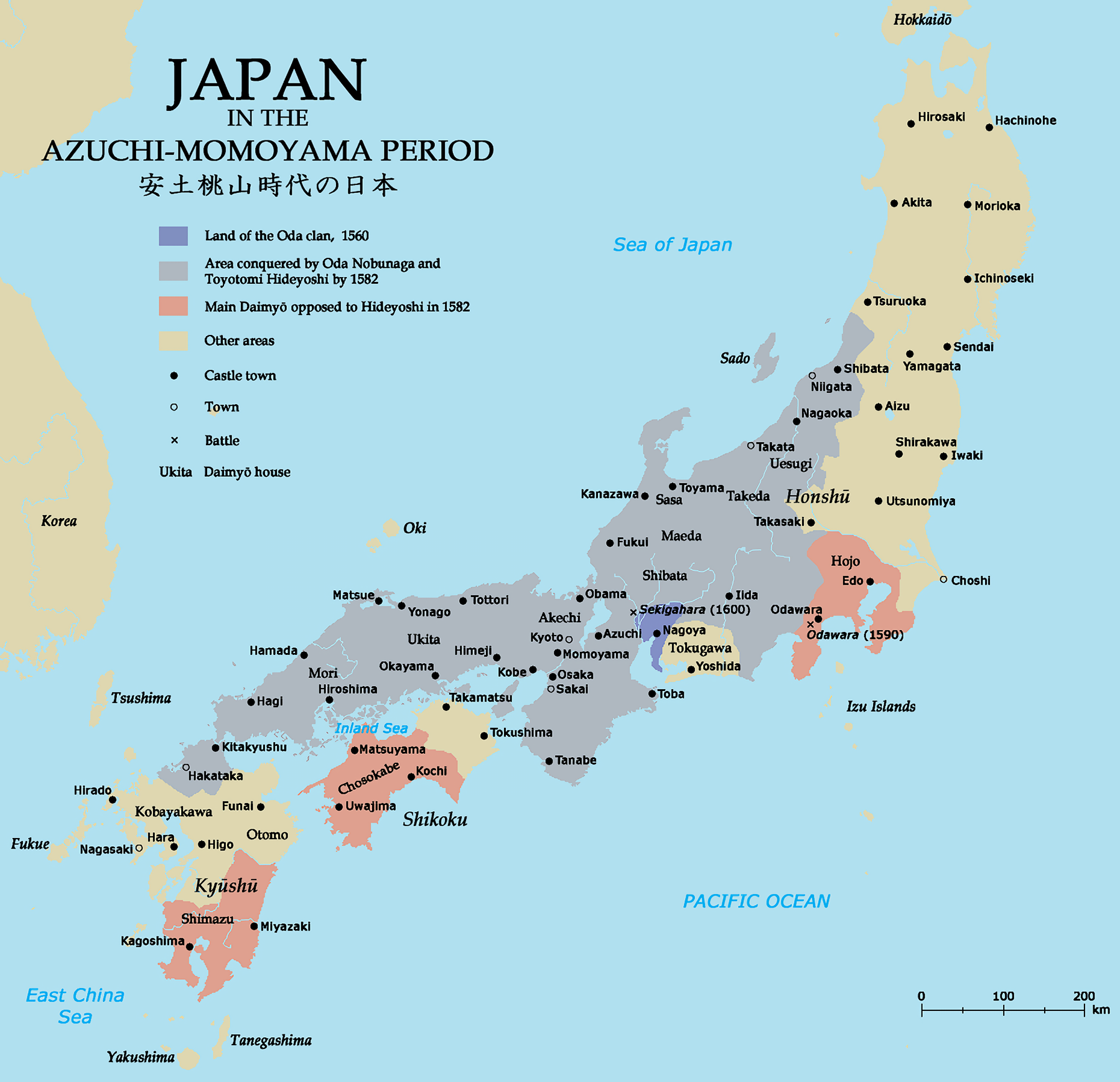
Azuchimomoyama-japan.png - Artanisen

Map of France under Francis I (1515-1547)-fr.svg - Historicair

Aztec empire 1519-fr.svg - Historicair
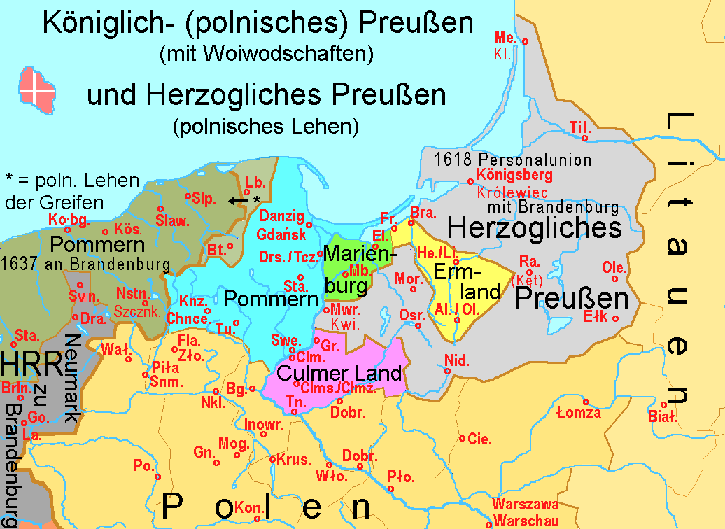
K0nigl+herzoglPreussen.png - Ulamm

1150Azie.jpg - File Upload Bot (Magnus Manske)

Utrecht-atrecht.jpg - BotMultichill

Ruta Belalcazar 200.png - C arango

Grandesdécouvertes.png - Vivelefrat

Localización del movimiento comunero.svg - OestePurpura
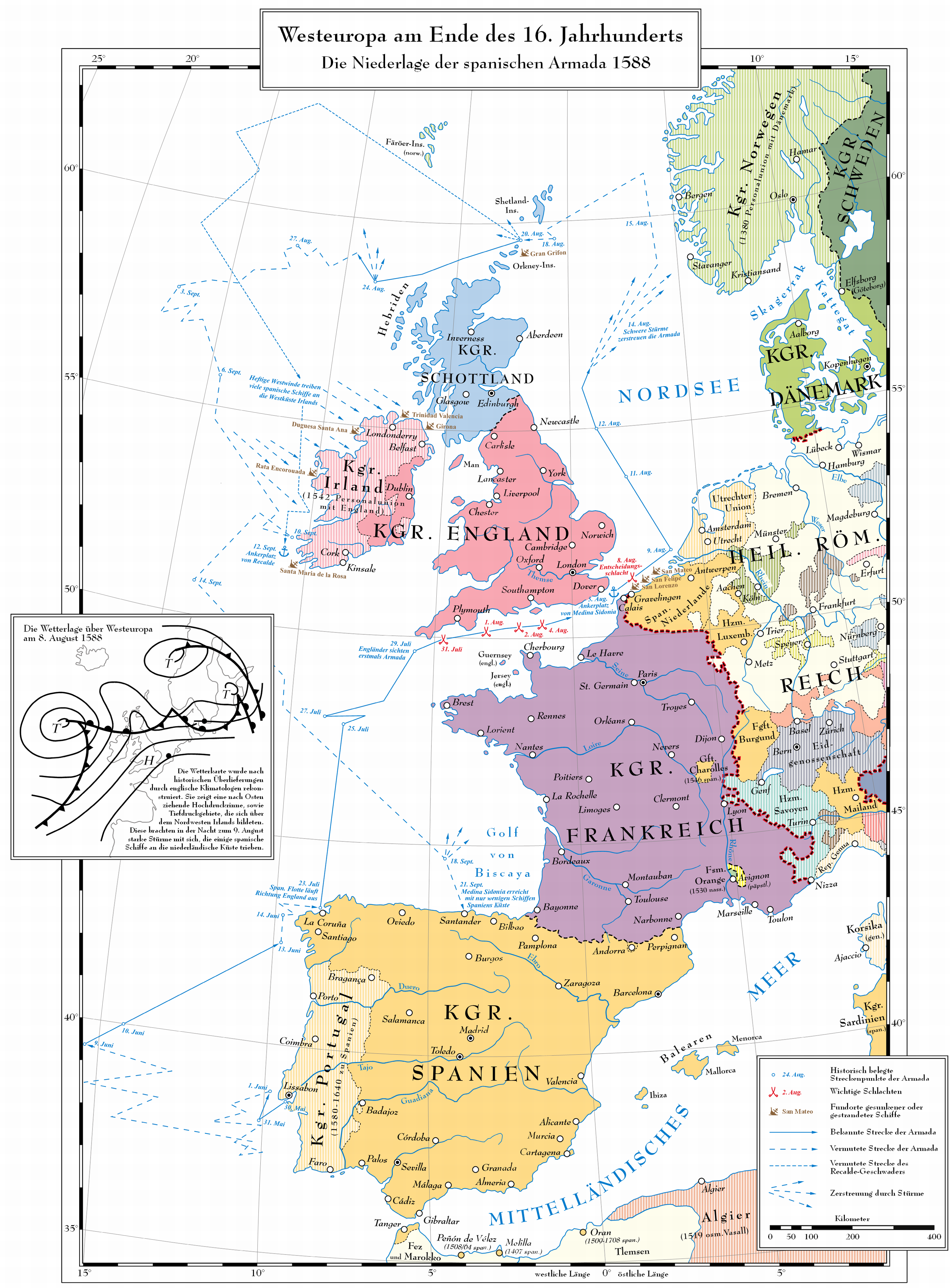
Untergang der Armada.png - Codeispoetry

Rebelión de Las Alpujarras.png - Tyk
Blankmap-ao-270W-asia65.png - Bluemr145~commonswiki

SEÑORIOS ANDA DESOR.png - Jompy

Condado de Niebla.png - Jompy
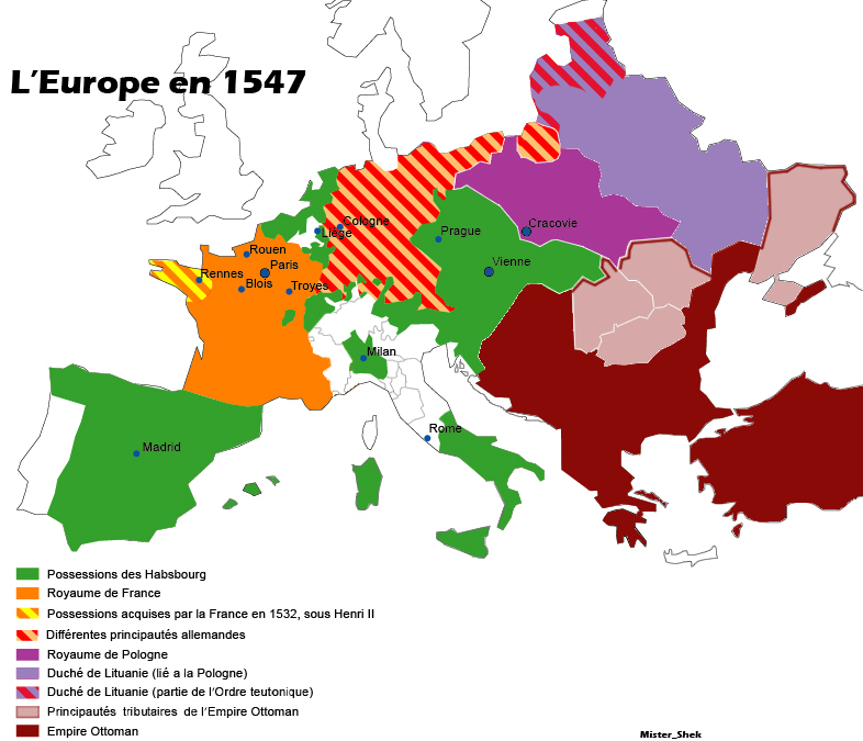
Europe en 1547 par Mister Shek.jpg - Mélomène

Duché Naxos Giovanni IV Crispo.png - Cedric B.

Cortes1591.svg - Jompy
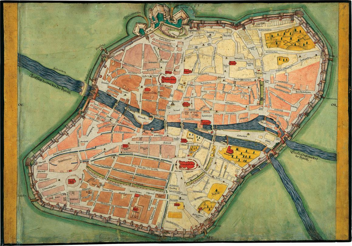
Pfinzing Nürnberg Grundriss.jpg - AndreasPraefcke

Aztec empire 1519-el.svg - Badseed

Philip II's realms in 1598.png - Nagihuin

ValdiviaCuzcoAtacama.png - Mmansilla~commonswiki

ValdiviaTucapel.png - Mmansilla~commonswiki

ValdiviaVuelveAlPeru.png - Mmansilla~commonswiki
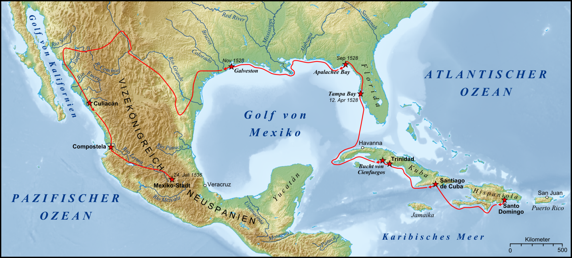
Expedition Cabeza de Vaca Karte.png - Lencer
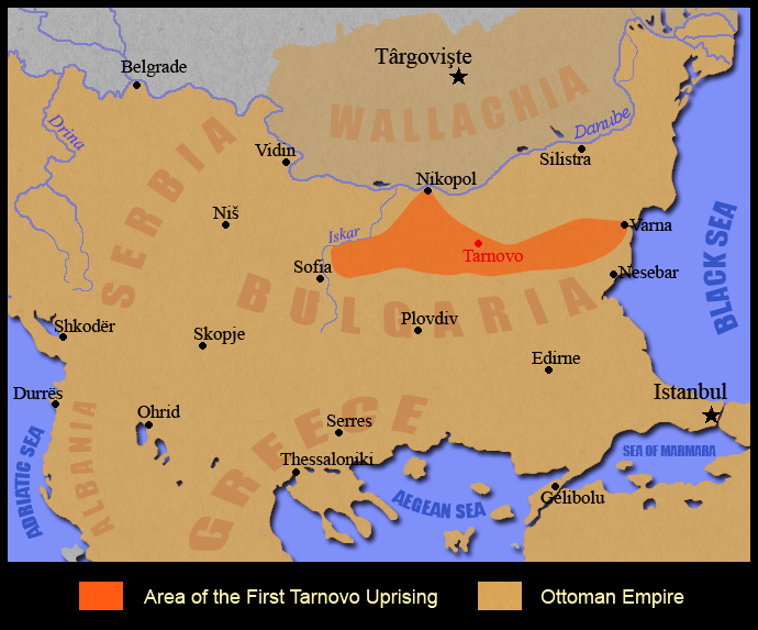
First Tarnovo Uprising.png - Kandi
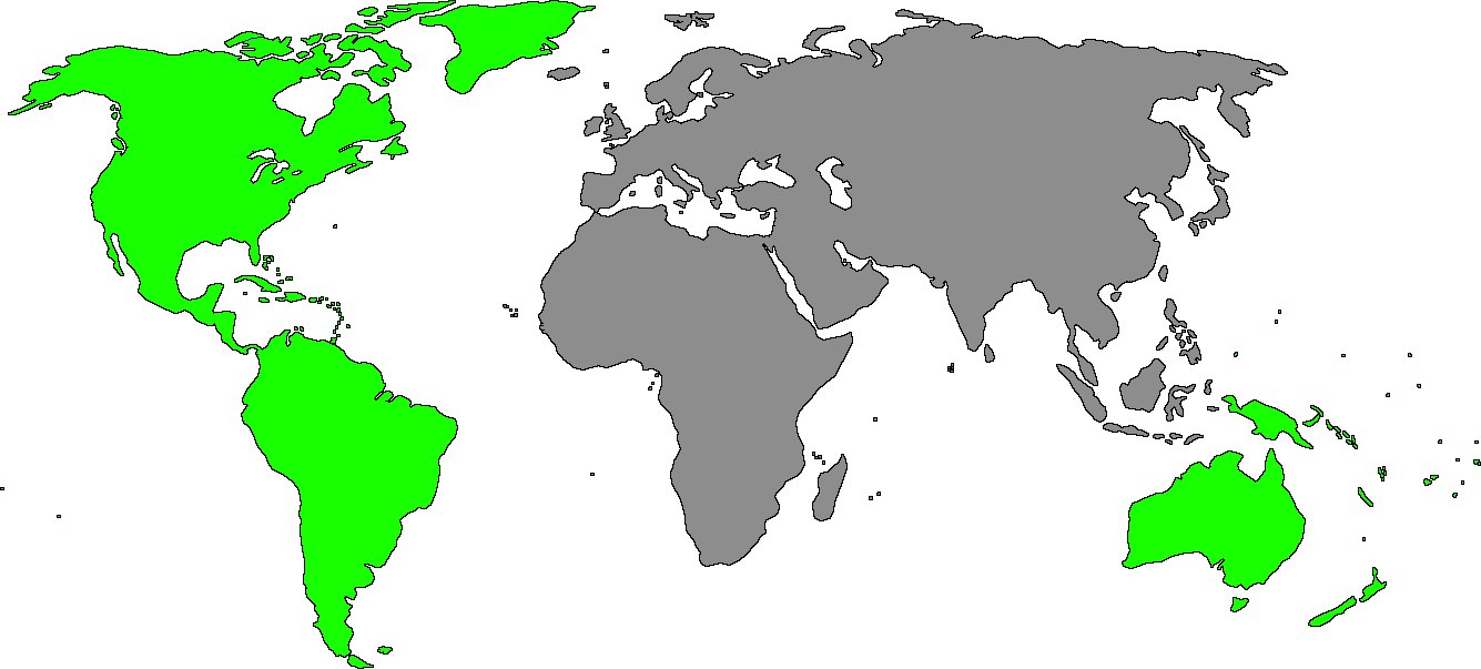
OldNewWorld v2.png - Abrahamic Faiths

Portuguese discoveries and explorationsV2en.png - Uxbona
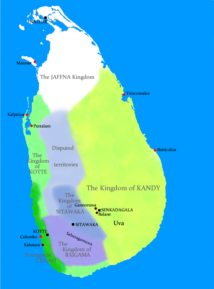
Sri Lanka geopolitics, 1520s.png - Docsubster
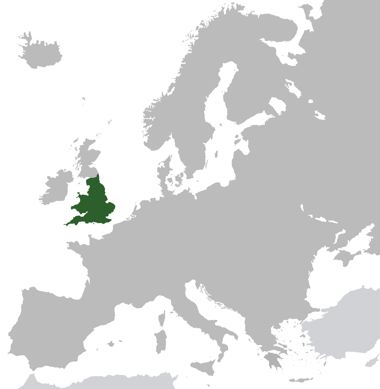
Kingdom of England.png - AnonMoos

Giurisdizioni bresciane in epoca veneta (Luca Giarelli).png - Lord Hidelan
PolskaWazów.gif - File Upload Bot (Magnus Manske)
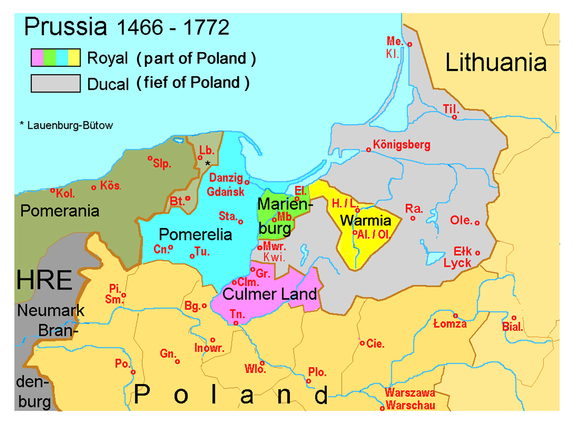
K0nigl+herzoglPreussen-2009-25-12.png - Jacurek~commonswiki

Hungarian-Ottoman border at the beginning of the 16th century.svg - Kmiki87

Duché Giacomo IV.png - O Kolymbitès

Saxony after the Treaty of Naumburg - NL.png - Sir Iain

Locator Bishopric of Meissen - NL.png - Sir Iain

Locator Bishopric of Merseburg - NL.png - Sir Iain
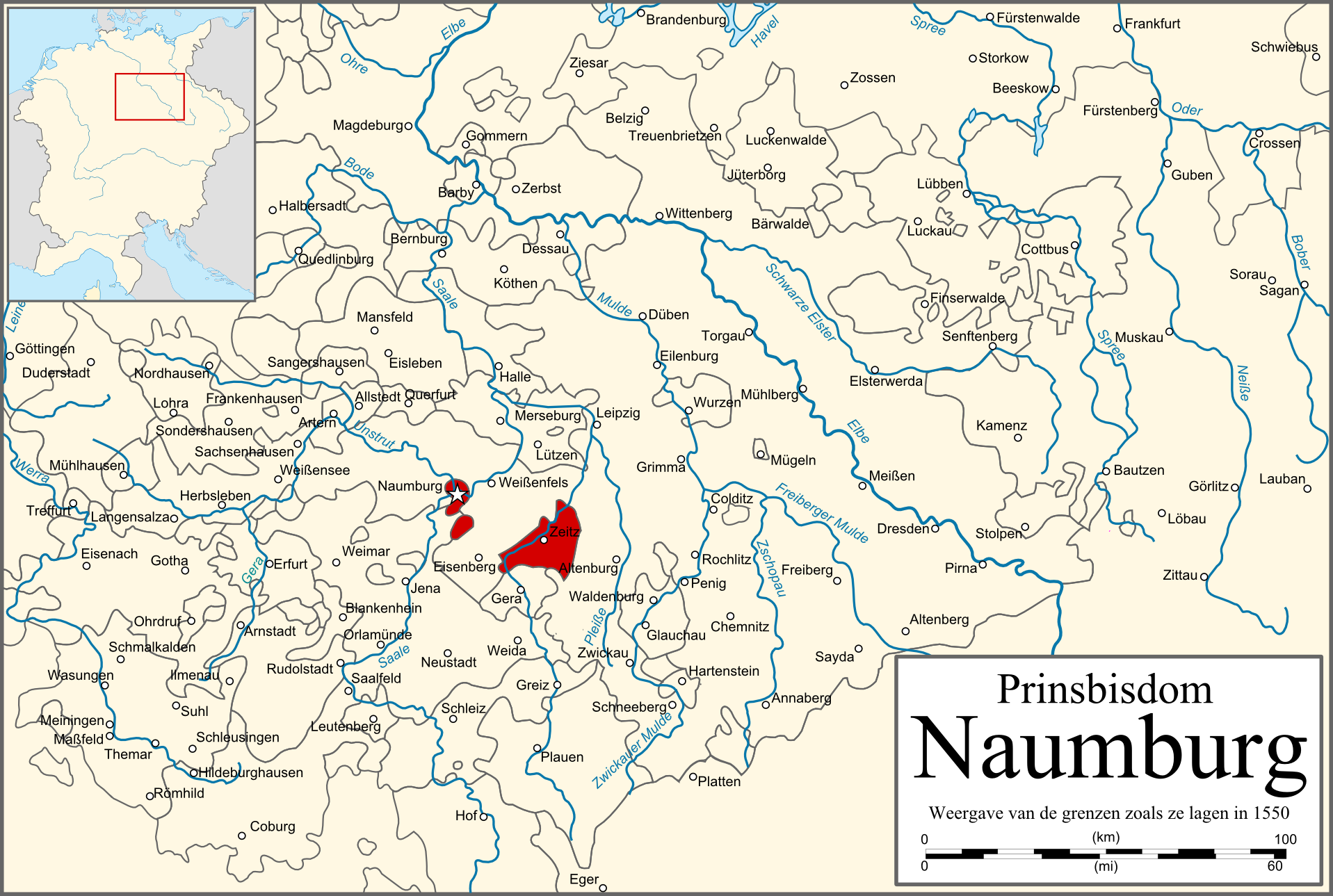
Locator Bishopric of Naumburg - NL.png - Sir Iain

Mapa Helwiga (Wschodnia część Górnego Śląska).JPG - File Upload Bot (Magnus Manske)

Saxony after the Capitulation of Wittenberg (1547) - NL.png - Sir Iain

Piris Reis expedition map-fr.svg - Pethrus

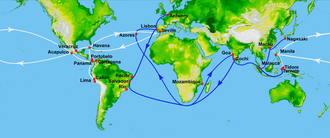
16th century Portuguese Spanish trade routes.png - Hohum

Map of the Imperial Circles (1560)-en.svg - Sir Iain

Map of the Imperial Circles (1560)-nl.svg - Sir Iain
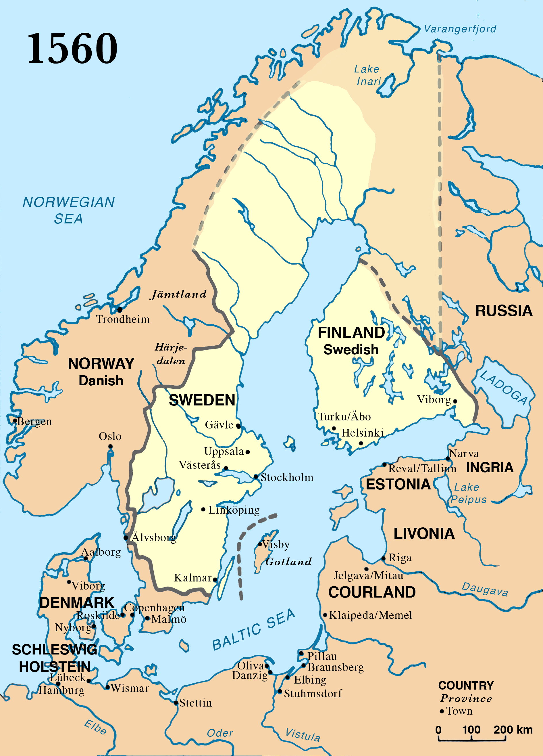
Sweden 1560.png - P. S. Burton
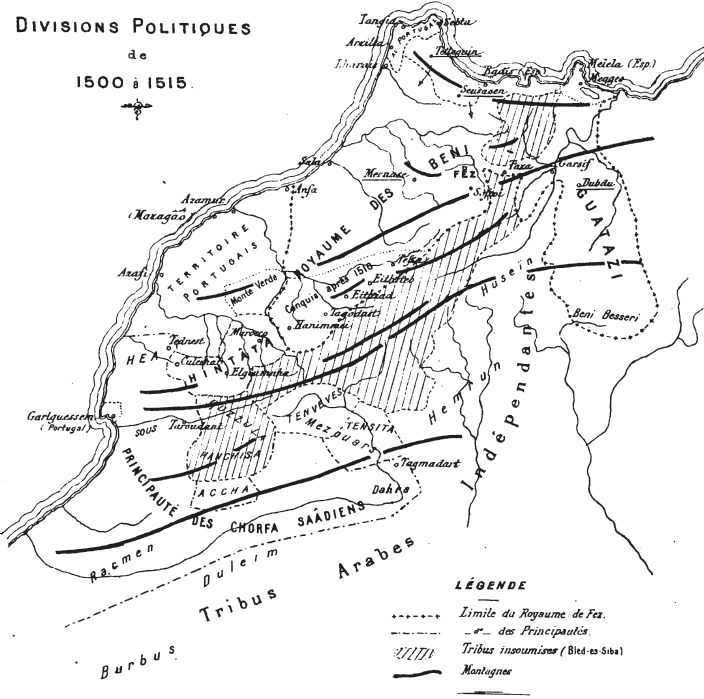
Marruecos1500-1515.PNG - Bokpasa

Map of the Kazakh Khanate in the first quarter of the 16th century.png - Gestuman

1844 Spruneri Map of Asia in the 15th and 16th Centuries (Ming China) - Geographicus - AsiaXVXVI-spruneri-1855.jpg - BotMultichill

Viagem do Japao.png - Uxbona

Utrecht-Atrecht keerte 1579.gif - Nederlandse Leeuw

Map of the Imperial Circles (1560)-la.svg - Homo lupus

Map of the Imperial Circles (1560)-de.svg - Furfur

Chichimecas.png - Grin20

Chichimeca Nations.png - Grin20

Chichimecas - esp.png - Grin20
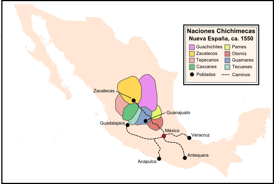
Chichimeca nations - esp.png - Grin20

Wappen,Herkunft und Ahnentafel.jpg - Walter Fr. Schleser

Rota nova.jpg - Americaunicamp2012

Battle of Mulleriyawa-1562 Troop Disposition.png - Nishadhi

Saxony after the Capitulation of Wittenberg (1547) - DE.png - Ras67

OldNewWorld.png - OgreBot

TerrGeldKle 16Jhdt.jpg - Rolopedia

Expediciones Españolas.jpg - Franco310397

Aztec empire 1519-mk.svg - MacedonianBoy

Estado do Brazil 1549.jpg - Zorahia

Mesoamérica y Centroamerica prehispanica siglo XVI.svg - Juan Miguel

OldenburgerDeiche um1645+Lockfleth um1515.jpg - Ulamm
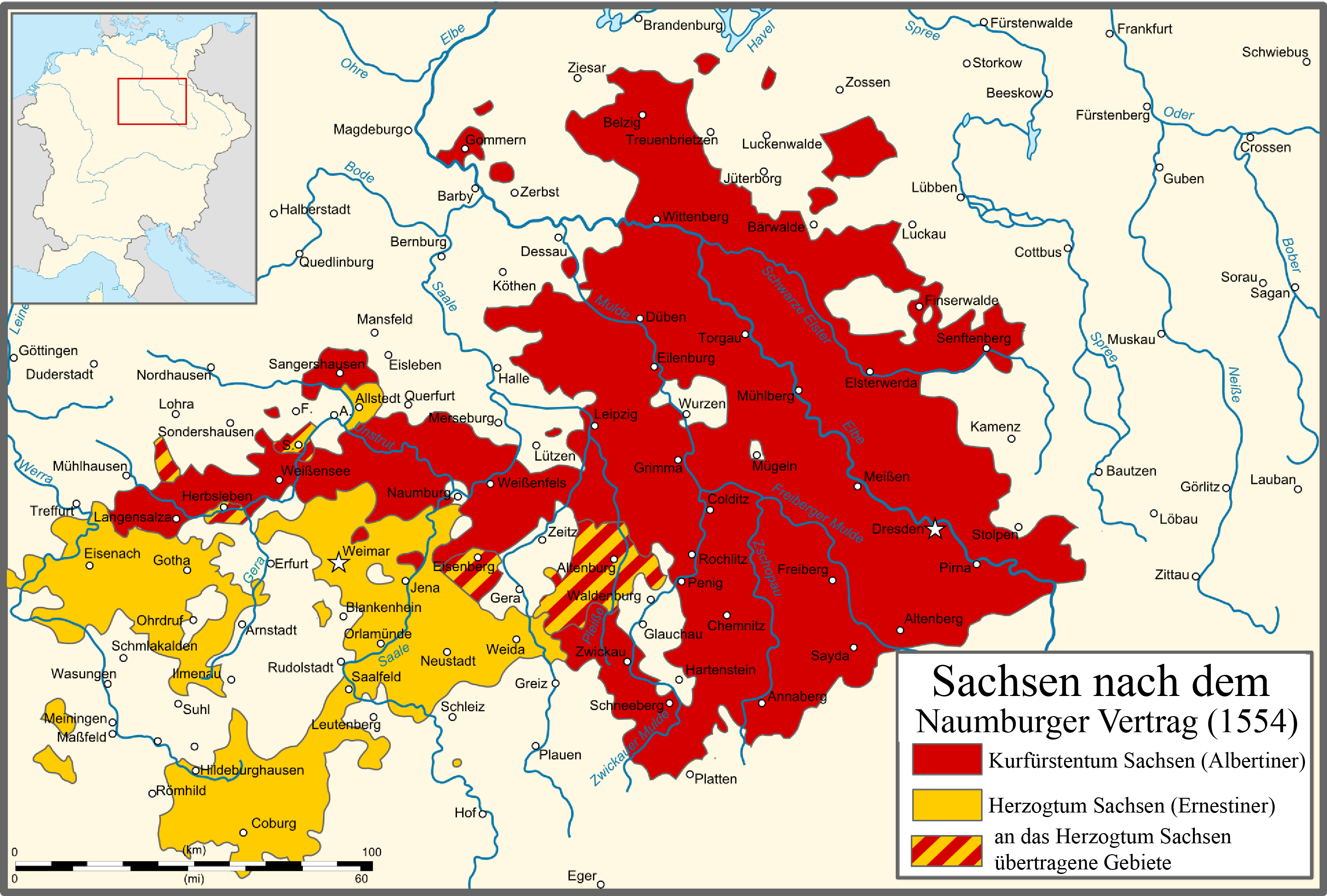
Saxony after the Treaty of Naumburg - DE.png - Furfur

Caucasus 1530 map de alt.svg - Don-kun

Caucasus 1530 map de.png - Don-kun

Map of the Imperial Circles (1560)-es.svg - Rowanwindwhistler

Hungarian-Ottoman border at the beginning of the 16th century-es.svg - Rowanwindwhistler

Livonian war map (1558-1560) uk.svg - ReAl

Nanban trade map.jpg - Quark Logo
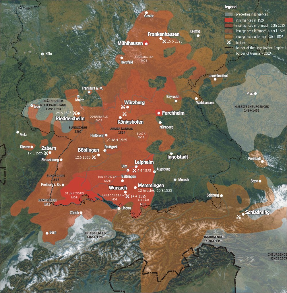
Karte bauernkrieg3 en.jpg - MGA73
Map of the Serb Uprising of 1596–97.jpg - Zoupan

Aztec empire 1519-nl.svg - Wikibelgiaan
Map of Nivkh terria.jpg - Papasanders

ImperioOtomanoSimplificado.svg - Rowanwindwhistler

Osmanlı haritası Kanuni 1566.jpg - Oktaytanhu

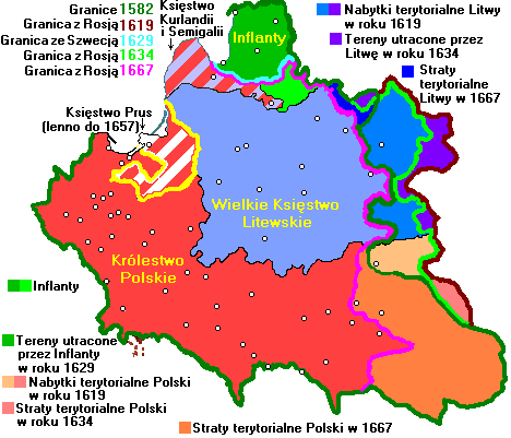
Map of Poland and Lithuania (1618-1667)-es.svg - Rowanwindwhistler

Livonian war map (1570-1577)-es.svg - Rowanwindwhistler

Az Azték Birodalom 1519-ben.png - Regasterios

Aztec empire 1519-es.svg - Rowanwindwhistler

Karte des Hochstifts Brandenburg.svg - Haster

Toungoo campaigns (1534–1547) km.png - Nisetpdajsankha

RepúblicaDeLasDosNaciones1569-es.svg - Rowanwindwhistler

16th century Spanish expansion in the Caribbean.png - Simon Burchell

ImperioOtomanoSimplificado-pt.svg - Renato de Carvalho Ferreira

Jovan Nenad State BG.png - StanProg

551 of '(F. C. Schlosser's Weltgeschichte für das deutsche Volk. Unter Mitwirkung des Verfassers bearbeitet von ... G. L. Kriegk. (Vollständiges Namen- und Sach-Register ... angefertigt von G. L. Kriegk.))' (11155553203).jpg - Artix Kreiger 2

Expedition Cabeza de Vaca Karte (cropped).png - ديفيد عادل وهبة خليل 2

Aztec empire 1519-pt.svg - Renato de Carvalho Ferreira

Vexilographic maps of Pontic littoral by end of 13th-17th century.svg - Niklitov

Iroquoiens St Laurent.png - Myrhonon

CaminoEspañol.svg - Manlleus

CaminoEspañol-NL.svg - Hans Erren
GRAN CHICHIMECA.jpg - Udghistoriadora

Eastern Adriatic 1558.svg - Tezwoo

Azuchimomoyama Japan br.png - Alan J. Roxx

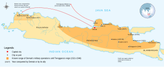
Demak Sultanate conquests and expeditions (id).svg - AnsyahF

Demak Sultanate conquests and expeditions.svg - AnsyahF

Implantation des Bournonville en Boulonnais (v.1350-v.1500).svg - Thom.lanaud

廣輿圖敘廣輿總圖.jpg - Happyseeu

ImperioOtomanoSimplificado-ar.svg - باسم

Rebelión de Las Alpujarras.svg - Rowanwindwhistler

Timucua-And-Surrounding-Groups.png - KiwiNova

Karte Vordere Reichskreise.svg - NordNordWest

16th century Spanish trade routes.png - Koppchen

Mesoamérica y Centroamerica prehispanica siglo XVI.jpg - Glowinthedarkness

The Administrative Divisions of Safavid Iran in the the South Caucasus.svg - HistoryofIran

Map of the Imperial Circles (1560)-ca.svg - Manlleus

Map of the Kazakh Khanate 1521.png - Gestuman

Map of the Kazakh Khanate in 1500-1521 physical.png - Gestuman

Theophanes' Journeys Between Hermopolis and Antioch.jpg - Awmcstaff

Розмах руху комунерос.svg - Igor Yalovecky