Wikimedi'Òc
Modes d'emploi

Cet album fait partie des albums
Cet album photos contient les sous-albums suivants :


Mappaemundi vertical.gif - Leinad-Z~commonswiki

Monde-anciens.JPG - ComputerHotline
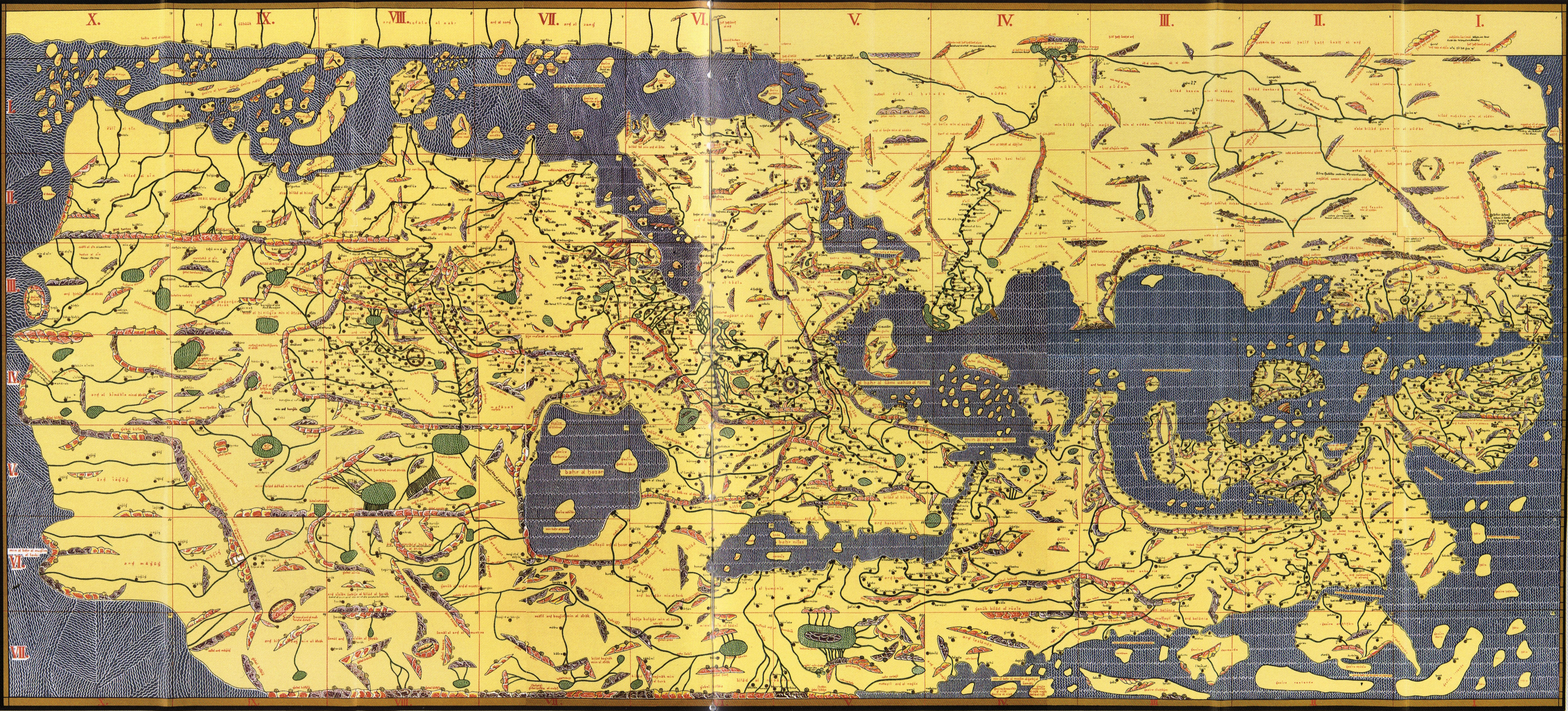
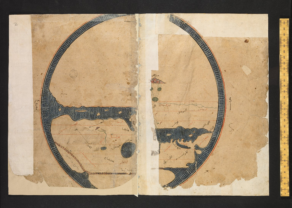
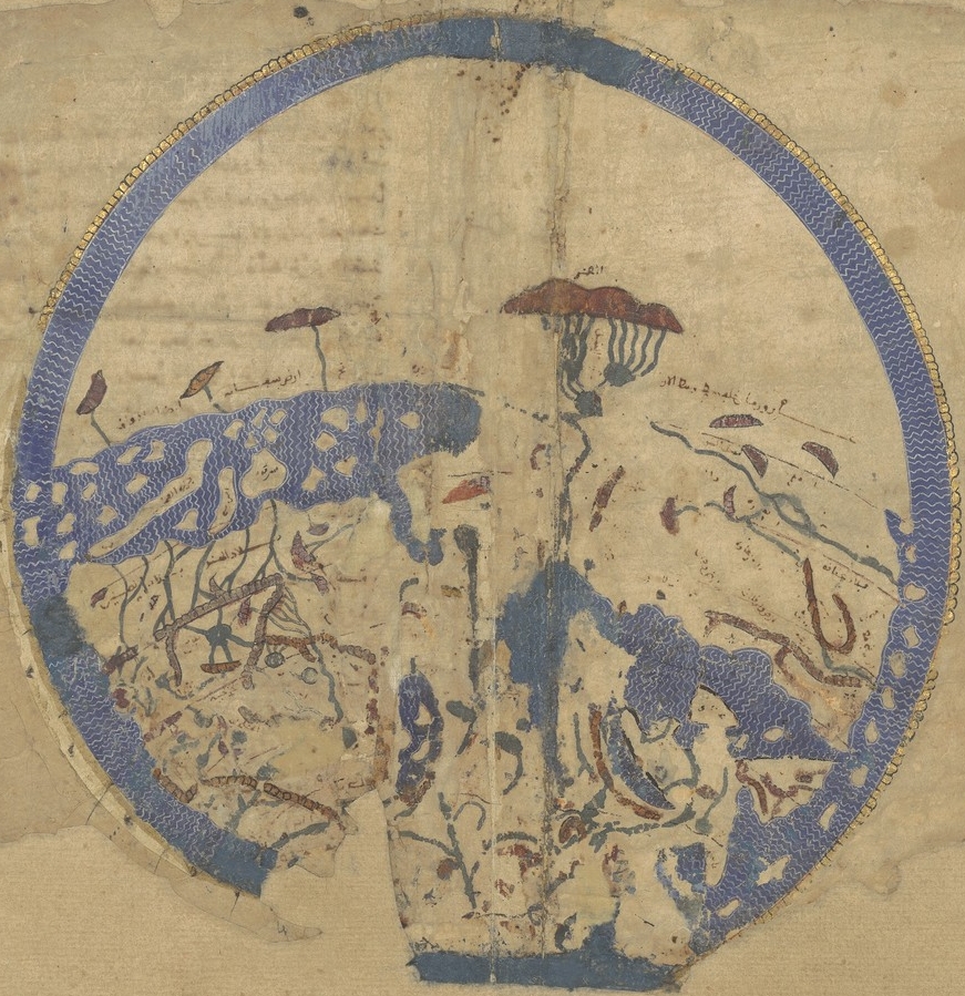
TabulaRogeriana.jpg - Denniss

Karte Isidor.jpg - Mike Krüger
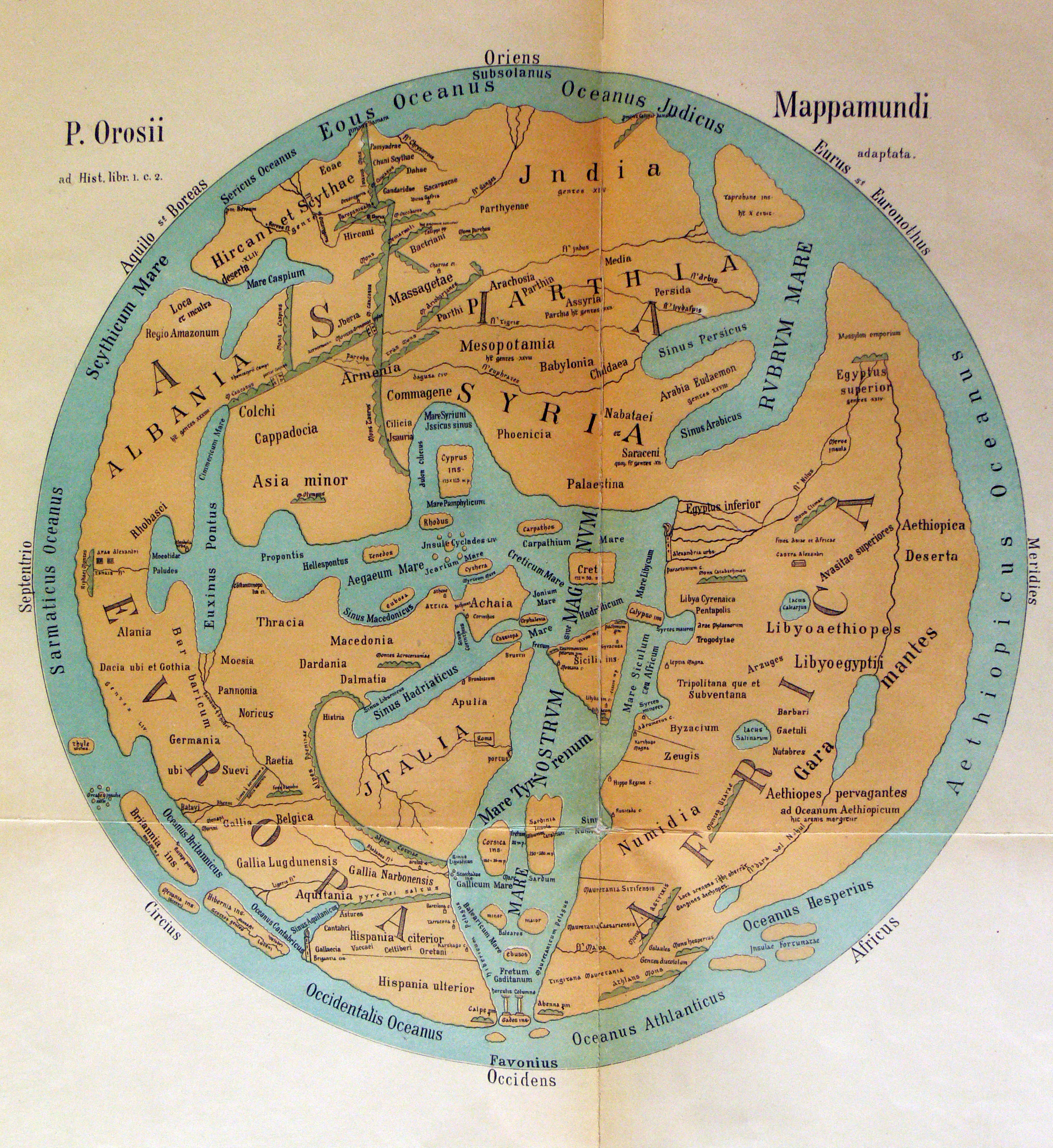
Karte Orosius.jpg - Fingalo

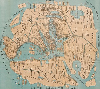
Karte Pomponius Mela.jpg - Sette-quattro

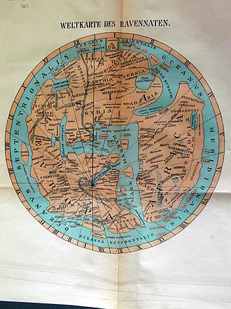
Karte Ravennat.jpg - Fingalo

Liber floridus Weltkarte.jpg - Furfur
C+B-Geography-Map1-StrabosMap.PNG - Mikeroetto

European knowledge 1400.jpg - Robbot
Map of the world.jpg - Mike Peel
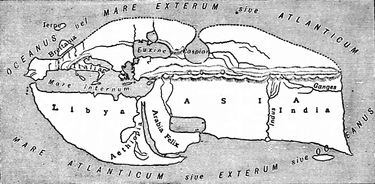
Butler Obris Veteribus Notus.jpg - Geagea
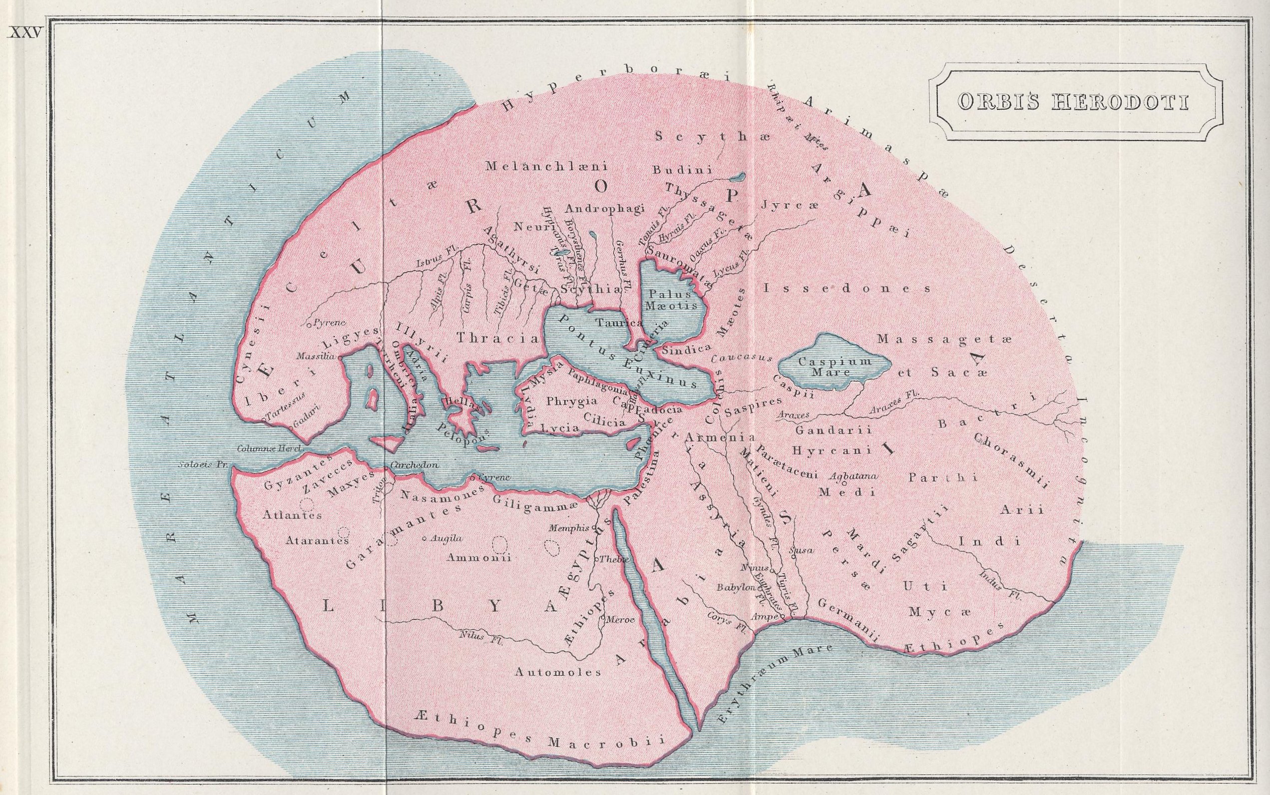
Butler Orbis Herodoti.jpg - Geagea

Playfair, Principal. Map of the World According to Strabo. 1814 A.jpg - Geagea

Playfair, Principal. Map of the World According to Strabo. 1814 B.jpg - Geagea

Playfair, Principal. Map of the World According to Strabo. 1814.jpg - Geagea

1837 Malte-Brun Map of the World According to the Ancients - Geographicus - WorldAncient-mb-1837.jpg - BotMultichill

1837 Malte-Brun Map of Europe in the Middle Ages - Geographicus - MiddleAges-mb-1837.jpg - BotMultichill

Fr Sélestat Bibliothèque Humaniste In Somnium Scipionis.jpg - Pethrus

D401- Monde connu d’Eratosthènes.-L2-Ch9.png - Vieux têtard

Mela codanus sinus.jpg - File Upload Bot (Magnus Manske)
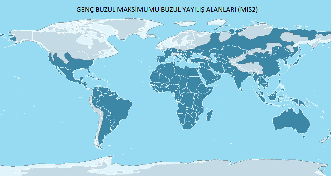
Son Buzul Maksimumu.png - Cemoguz buke
Islamic map of the world Wellcome L0035009.jpg - Fæ

Karte Pomponius Mela rotated.jpg - Sette-quattro
EB 1911 Map Fig 6.png - LlywelynII

World map from Portolan atlas of al-Sifaqsi.jpg - MartinPoulter
Book of Roger MS. Greaves 42 1b.jpg - MartinPoulter

Bodleian Libraries, Mappa Mundi by Petrus Vesconte.jpg - One2

Bodleian Libraries, Mandorla Mappa Mundi.jpg - MartinPoulter

Bodleian Libraries, Mappemonde.jpg - MartinPoulter

Bodleian Libraries, Map of the World.jpg - MartinPoulter

Bodleian Libraries, Mappemonde de Merino Sanuto.jpg - MartinPoulter

Nr. 1. Sechs Karten zur Geschichte der antiken Erdkunde.png - Lucius Castus

17 of 'Geographie Générale ... Avec index, etc' (11100032736).jpg - Artix Kreiger 2

24 of 'A history of the United States and its people, for the use of Schools' (11105826244).jpg - Enyavar

143 of 'Das neue Buch der Reisen und Entdeckungen. O Spamer's illustrirte Bibliothek der Länder & Völkerkunde, etc. (Unter redaktion von F. von Hellwald und R. Oberländer.) vol. 1' (11058648883).jpg - Artix Kreiger 2

Tabula Rogeriana 1929 copy by Konrad Miller.jpg - Skimel
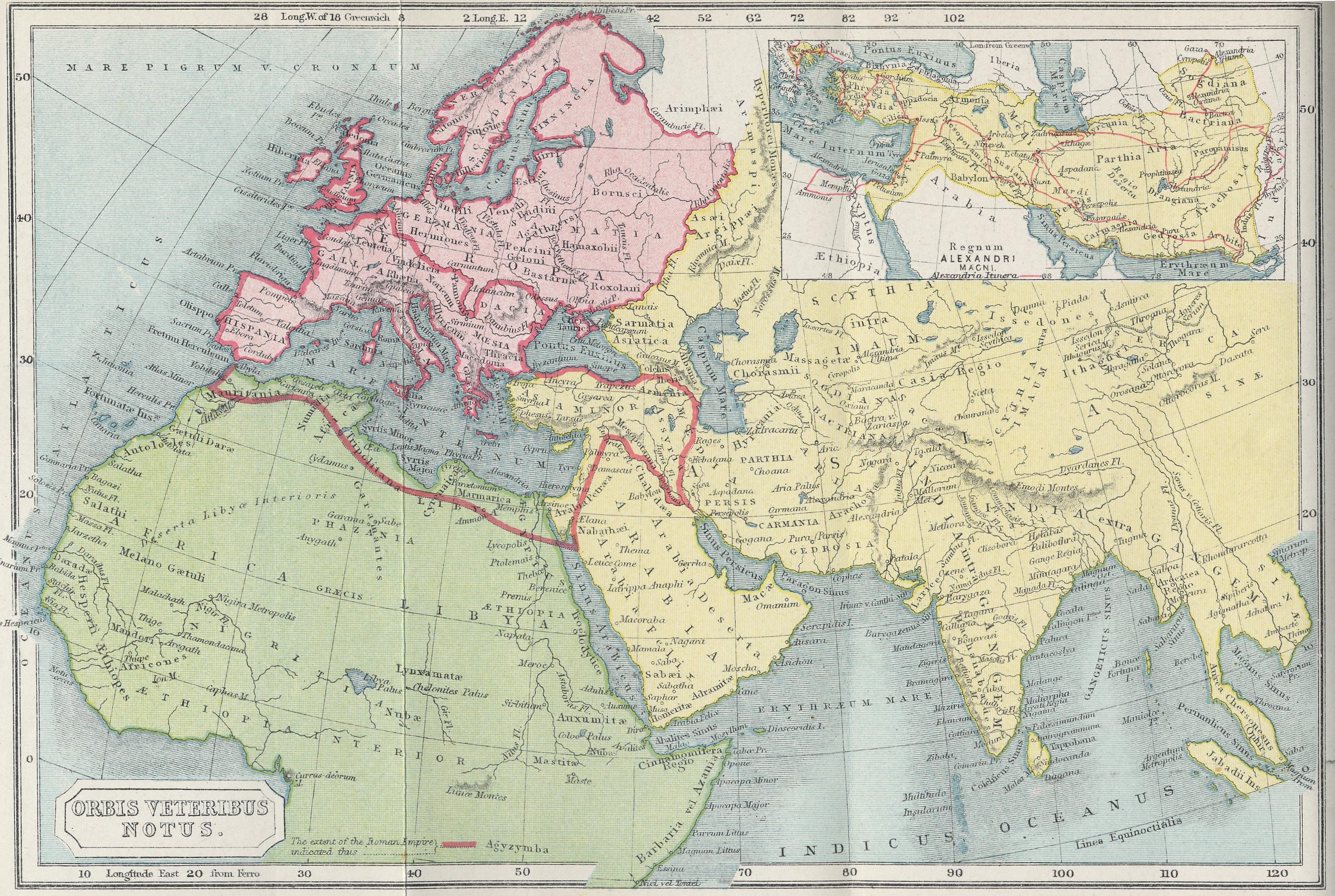
An atlas of ancient geography - comprehended in sixteen maps, selected from the most approved works - to elucidate the writings of the ancient authors, both sacred and profane. LOC 96675605-9.tif - Fæ

An atlas of ancient geography - comprehended in sixteen maps, selected from the most approved works - to elucidate the writings of the ancient authors, both sacred and profane. LOC 96675605-9.jpg - Fæ

The world as known to Christian Europe in 1492, compiled with special reference to Behaim's Globe.jpg - Happyseeu

Book of Roger MS. Greaves 42 1b cropped.jpg - Andrew Dalby
Idrisi MS BNF Ar 2221 f 3v-4r.JPEG - Andrew Dalby
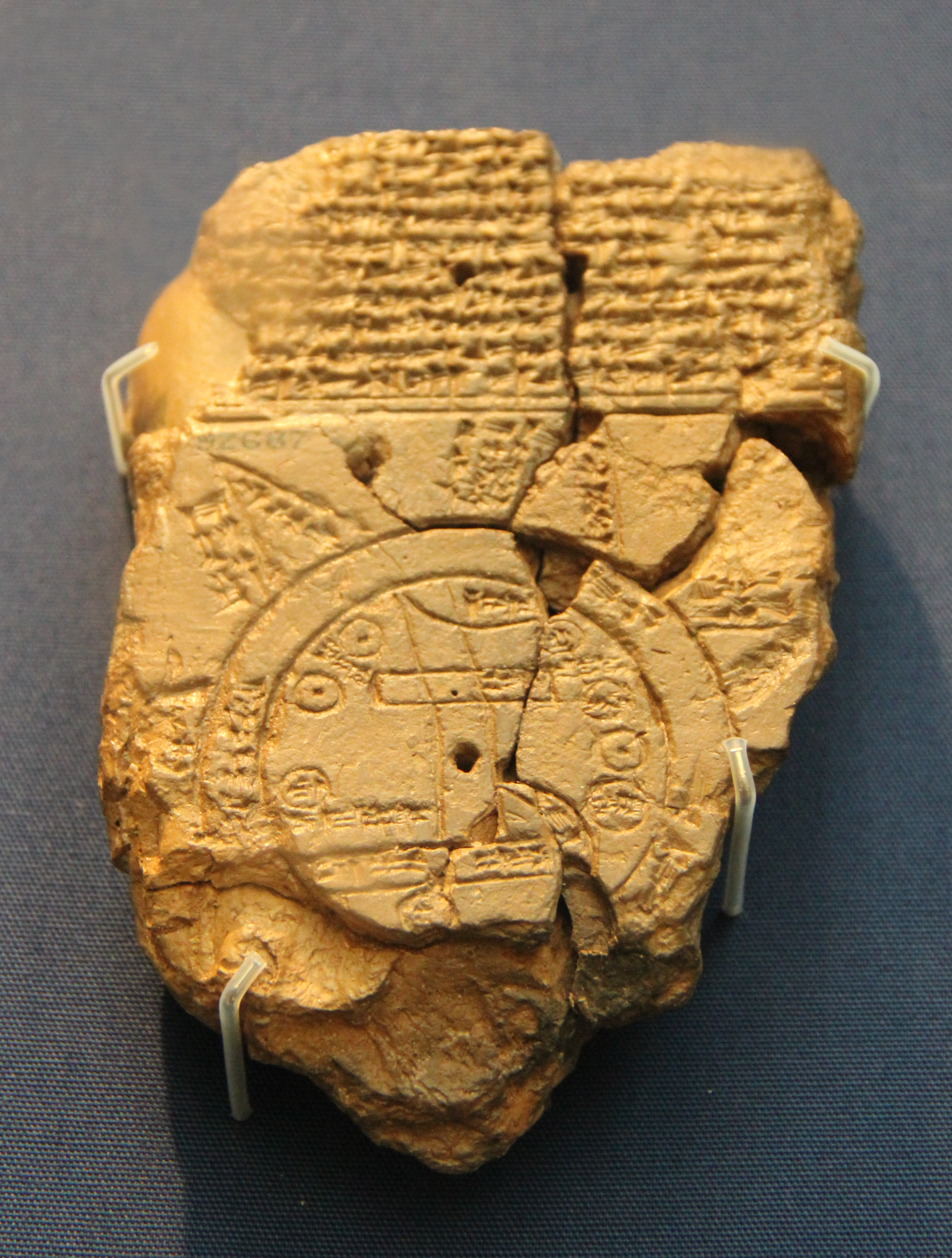
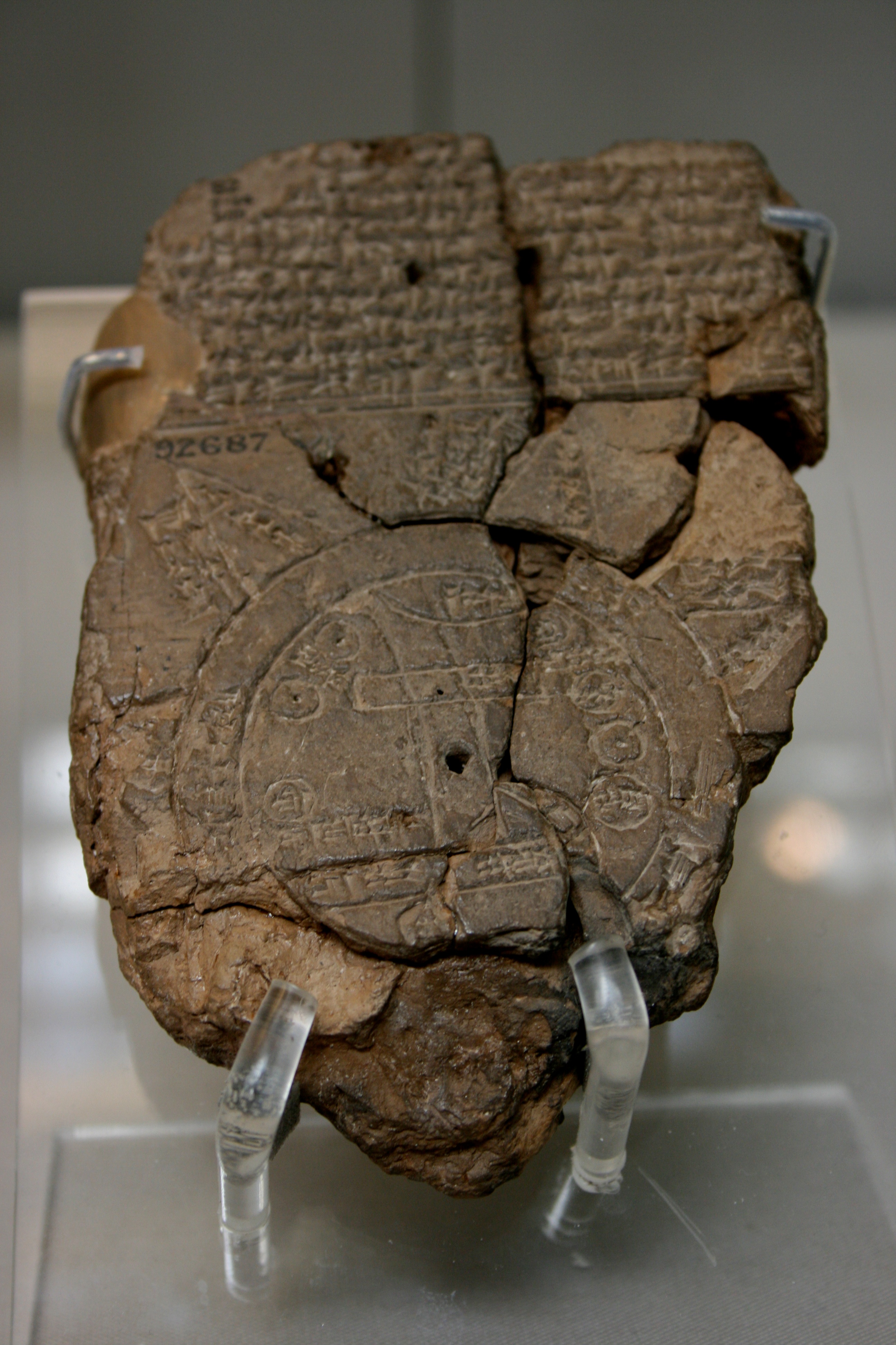
Babylonian Map of the World, 700-500 BC.jpg - पाटलिपुत्र

Das Weltkärtchen von Strassburg, 9. Jahrhundert.jpg - Balkanique

Hekataios.jpg - Key Xusrew

Karte Pomponius Mela (cropped).jpg - Onceinawhile

Mapping of the world, 1922.jpg - Universalis

Carte du monde connu des anciens accompagnée des systèmes géographiques d'Homèro... et de Ptolémée - dressée par MM. Charle et L. Badré ; sous la direction de M. Letronne ; sous la direction de M. Letronne... - btv1b53093808n.jpg - Gzen92Bot

Antiquissima orbis delineatio - btv1b53179325z (1 of 2).jpg - Gzen92Bot
Bodleian Libraries, Mappemonde(KenBurns).webm - Theklan

Victoria and Albert Museum, Londýn, Anglie 07.jpg - Fry72

Small Idrisi.jpg - Daemon2010