Wikimedi'Òc
Modes d'emploi

Cet album fait partie des albums
Cet album photos contient les sous-albums suivants :


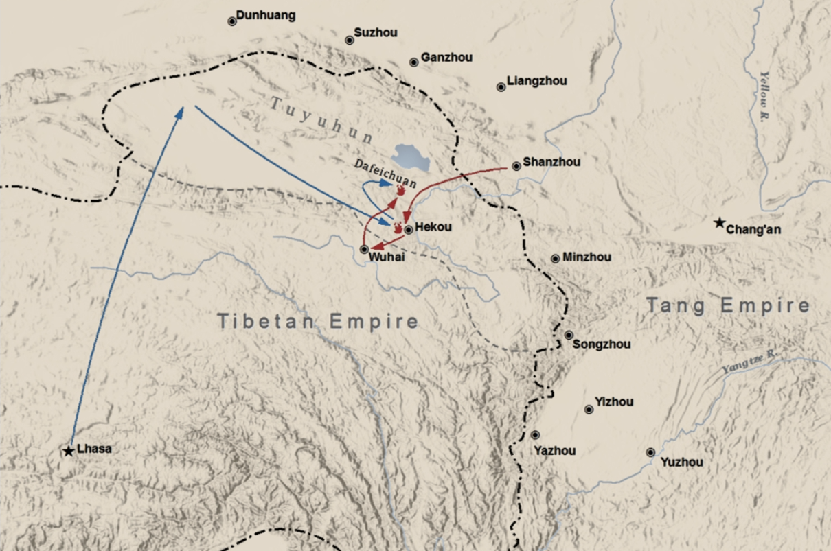
The Battle of Dafeichuan.png - 完颜吴乞买

The Ming Dynasty at its peak.png - Fazoffic

Ming dynasty under Yongle Emperor.png - Fazoffic

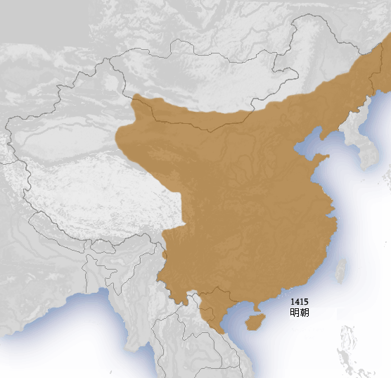
Map of Ming Chinese empire 1415 (cropped 2).jpg - Remsense

Han foreign relations CE 2.jpg - Saperaud~commonswiki

Hedin-First expedition.jpg - Battra~commonswiki
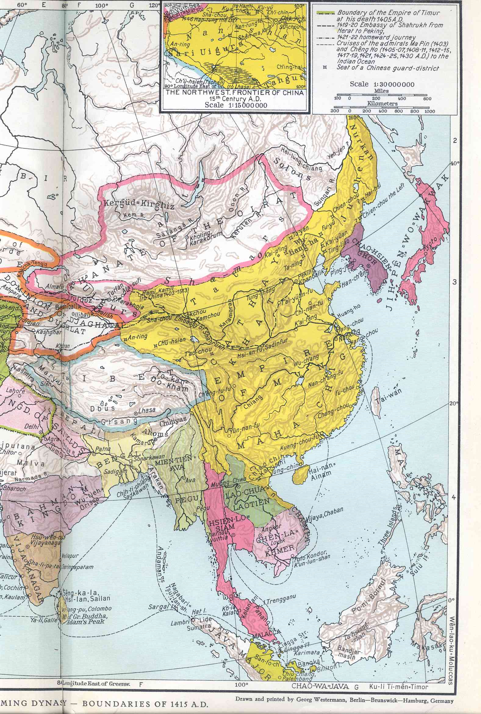
Map of Ming Chinese empire 1415.jpg - 我乃野云鹤
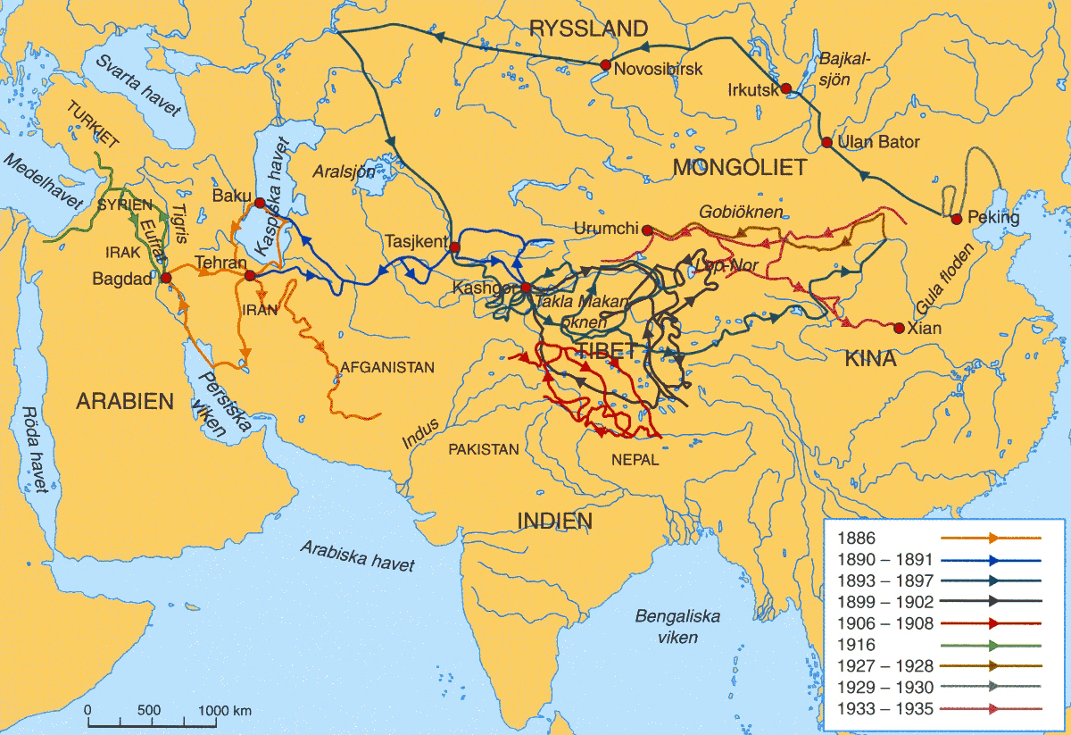
Exploring expeditions of Sven Hedin 1886-1935.jpg - Michael Gäbler

Tang China 669AD.jpg - Bidgee

Han Civilisation.png - Shizhao

Han provinces.jpg - Itsmine
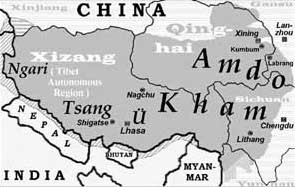
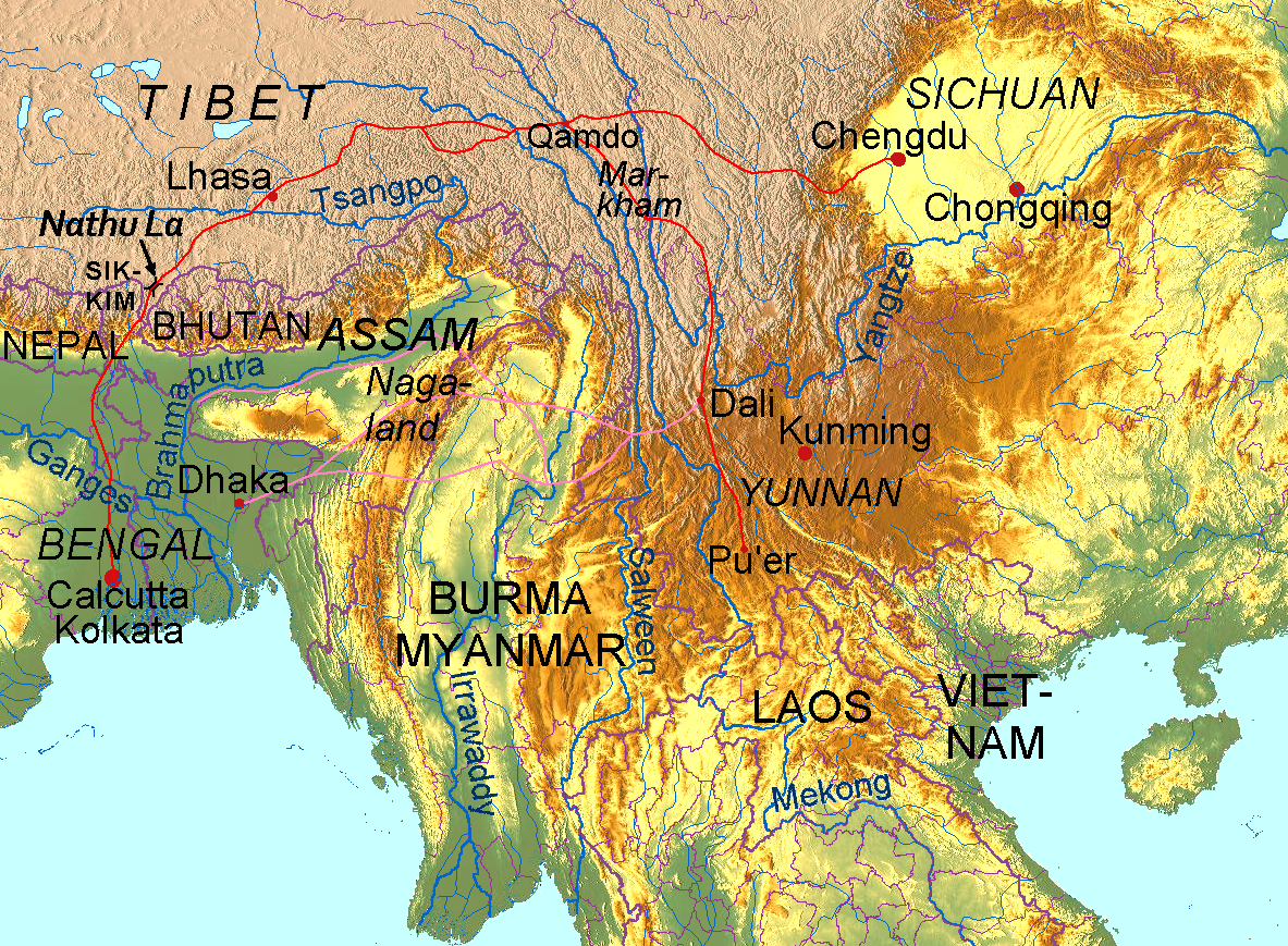
Map of Tibet Ü-Tsang Amdo and Kham.jpg - Beao

China Ming 1580.jpg - Itsmine

Xizang Dong1.png - 枫难寻~commonswiki

Kohima.jpg - Hohum

China India eastern border 88.jpg - Yuje
Radhanites2.png - Lx 121

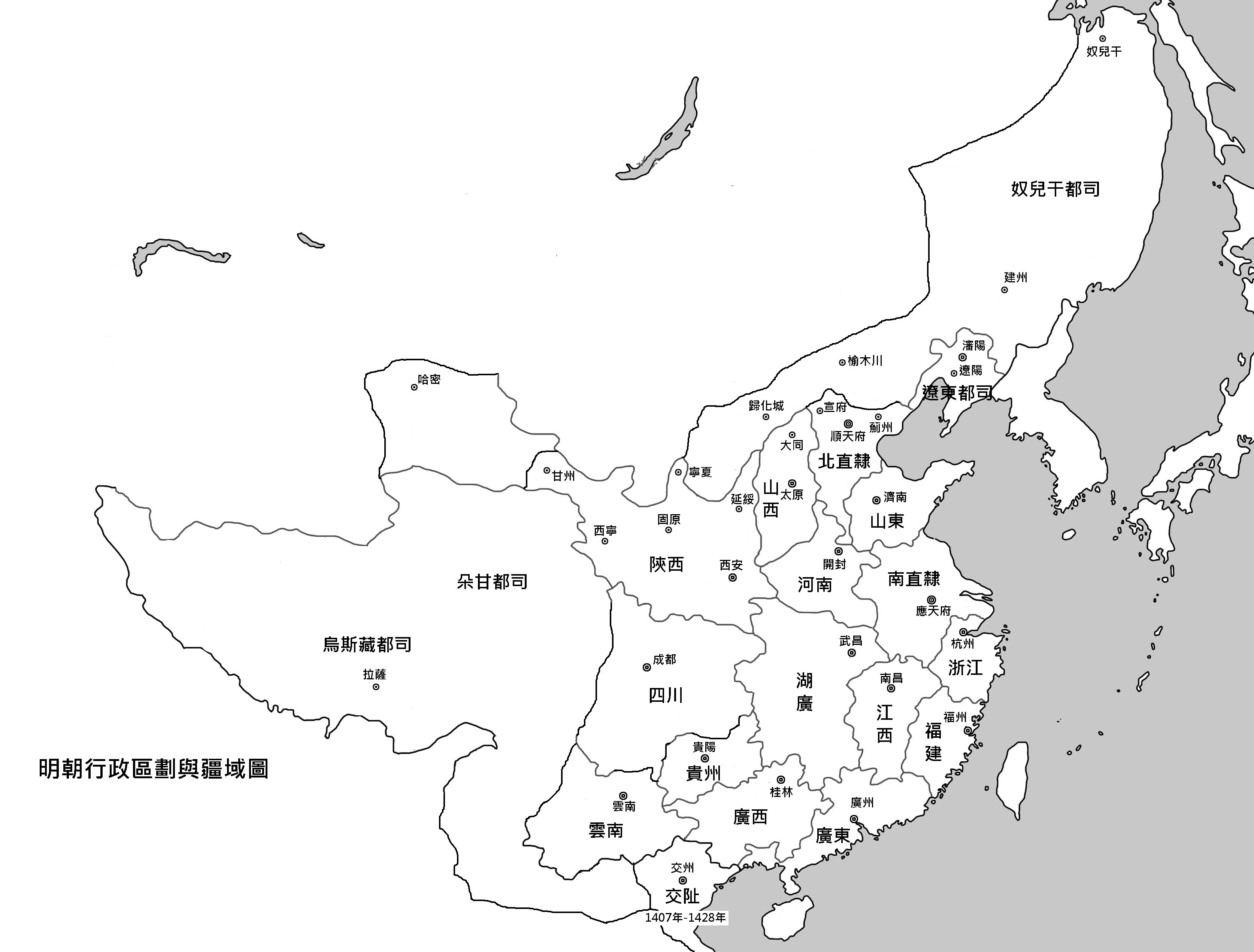
Ming Dynasty 1415.png - Ian Kiu
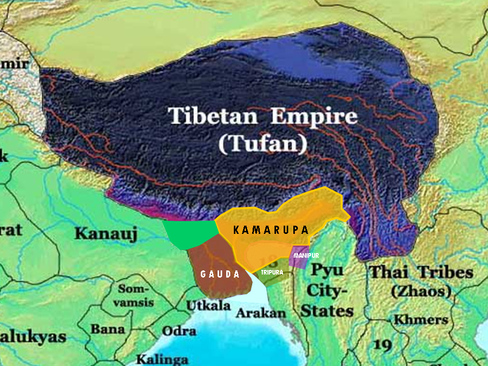
Kamarupa 7th-8th Century AD.jpg - Porikolpok Oxom~commonswiki

Kamarupa 7th-8th Century Cities.jpg - Porikolpok Oxom~commonswiki

British expedition to Tibet map.jpg - DonaldDuck
Ming China and Asia.jpg - Jjarivera~commonswiki

Plán Lhasy.jpg - Geographus

Burma II - VI 1944.svg - Dove
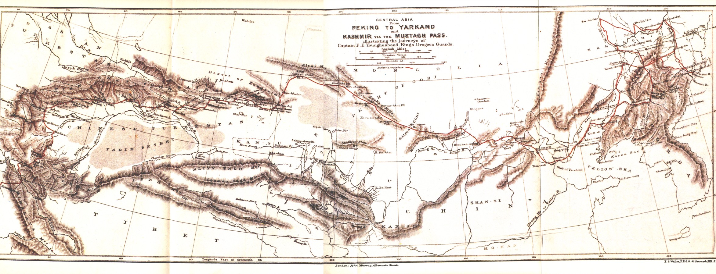
Younghusband PekingToYarkand Map.jpg - Keithonearth

TibetAD800.png - Gabagool

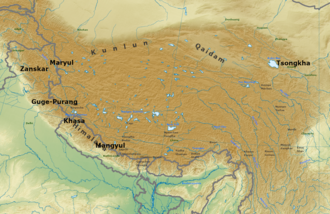
Historic Tibet Map-cs.svg - Podzemnik

Historic Tibet Map v češtině.png - STS Chvojkovice-Brod

Tibet ming.png - Bidgee
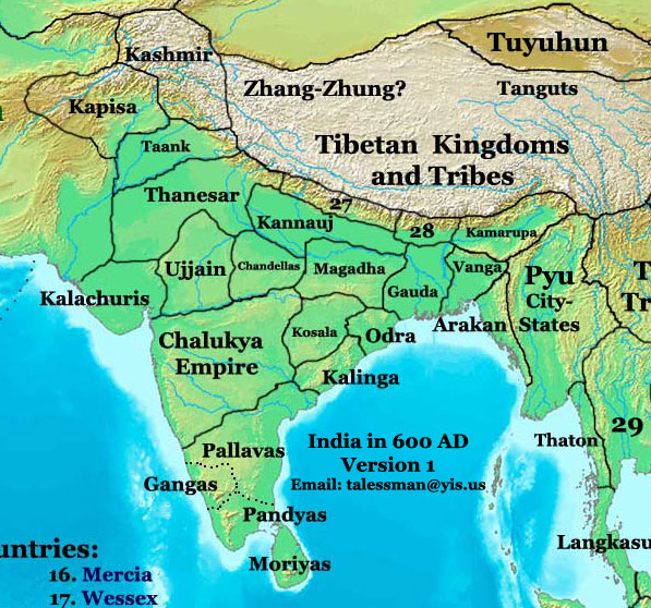
India 600ad v1.jpg - File Upload Bot (Magnus Manske)

India 600ad v2.jpg - File Upload Bot (Magnus Manske)

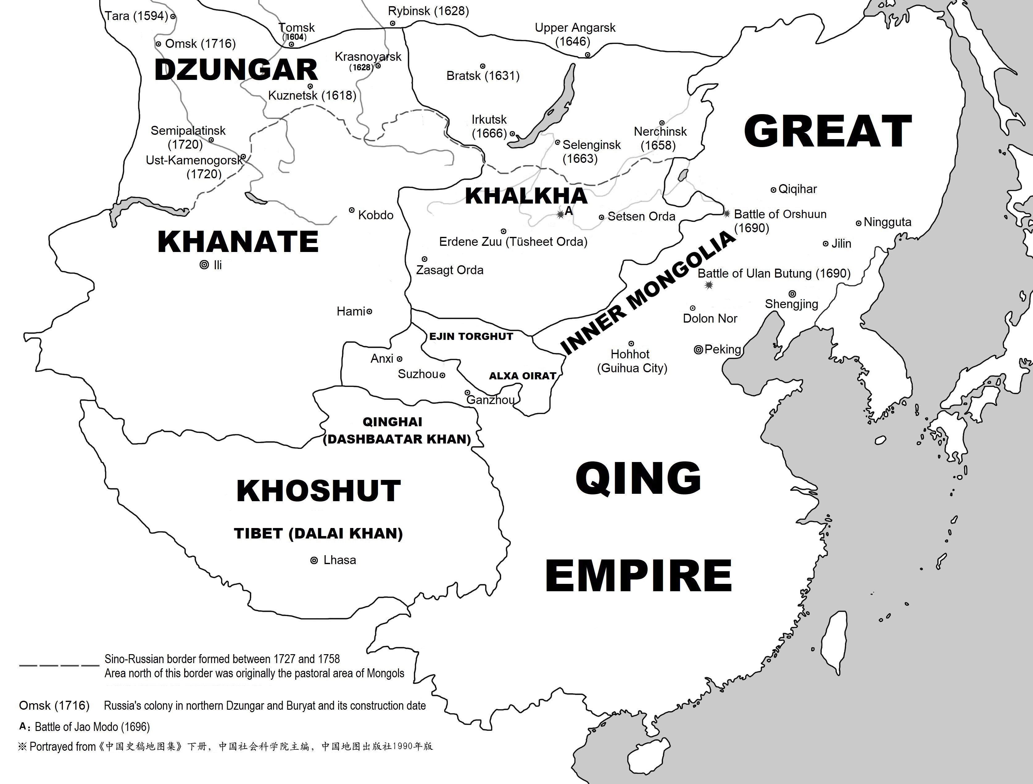
Map-Qing Dynasty 1689.jpg - Kallgan

Asia 600ad 2.jpg - トムル
China Ming Dynasty.jpg - File Upload Bot (Magnus Manske)
Ming Dynasty 1415 chinese.png - File Upload Bot (Magnus Manske)
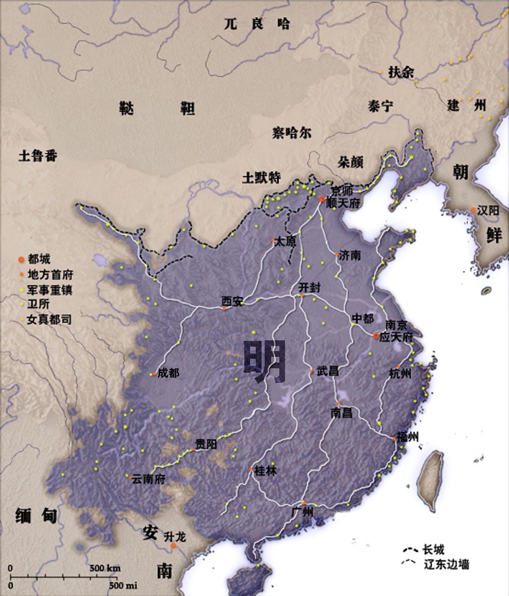
Ming Dynasty Administrative division.jpg - File Upload Bot (Magnus Manske)

ROC - 西藏地方.png - OCIDLE

ジュンガル帝国.png - トムル
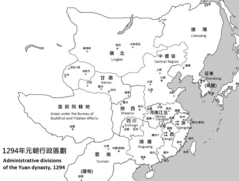
Yuan Dynasty Administrative division 1330.jpg - Cartakes

Map-Qing Dynasty 1820.jpg - Kallgan
Asia 13th Century.pdf - Дмитрий Кошелев

D061- Tibet -liv2-ch11.png - Vieux têtard

Tee-Pferde-Straße.png - Ulamm
Tea-Horse-Road.png - Ulamm

Map of the Four Horns of the Tibetan Empire (7th century)-EN.svg - Sir Iain

Chamagudao.png - Ulamm
Chamagudao (no names).png - Ulamm

BEAL(1869) FAH-HIAN'S ROUTE THROUGH INDIA AND TARTARY.jpg - Metilsteiner

Tea-Horse-Road 2.png - Yerius J
Khoshut Khanate.png - Cartakes

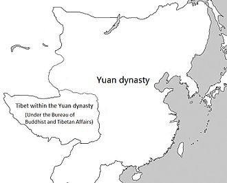
Yuan dynasty and Tibet.jpg - Cartakes

Qing dynasty and Tibet.jpg - Geographyinitiative

Routes of ancient commerce (14803030753).jpg - SteinsplitterBot

Map of the Four Horns of the Tibetan Empire (7th century)-es.svg - Rowanwindwhistler
Wu Hu Uprising.png - Seasonsinthesun

Ming divisions.png - Hohum
Map of the Tea-Horse road.png - Redgeographics
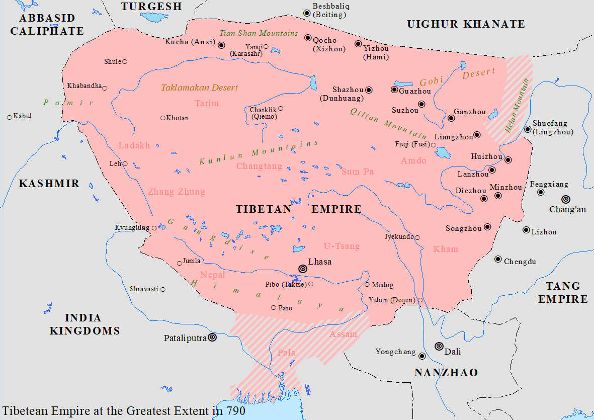
Tibetan Empire.png - Seasonsinthesun
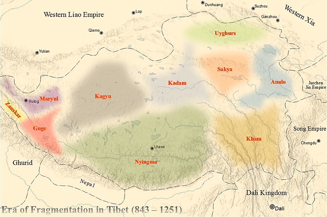
Era of Fragmentation in Tibet.png - Seasonsinthesun

Tang-Tuyuhun War.png - Seasonsinthesun

Sixteen Kingdoms 338 AD.jpg - Seasonsinthesun

Sixteen Kingdoms 326 AD.jpg - Seasonsinthesun

Sixteen Kingdoms 317 AD.jpg - うぃき野郎

Sixteen Kingdoms 376 AD.jpg - Seasonsinthesun

Sixteen Kingdoms 350 AD.jpg - Seasonsinthesun

Sixteen Kingdoms 391 AD.jpg - Seasonsinthesun

Sixteen Kingdoms 398 AD.jpg - Seasonsinthesun

Sixteen Kingdoms 402 AD.jpg - Seasonsinthesun
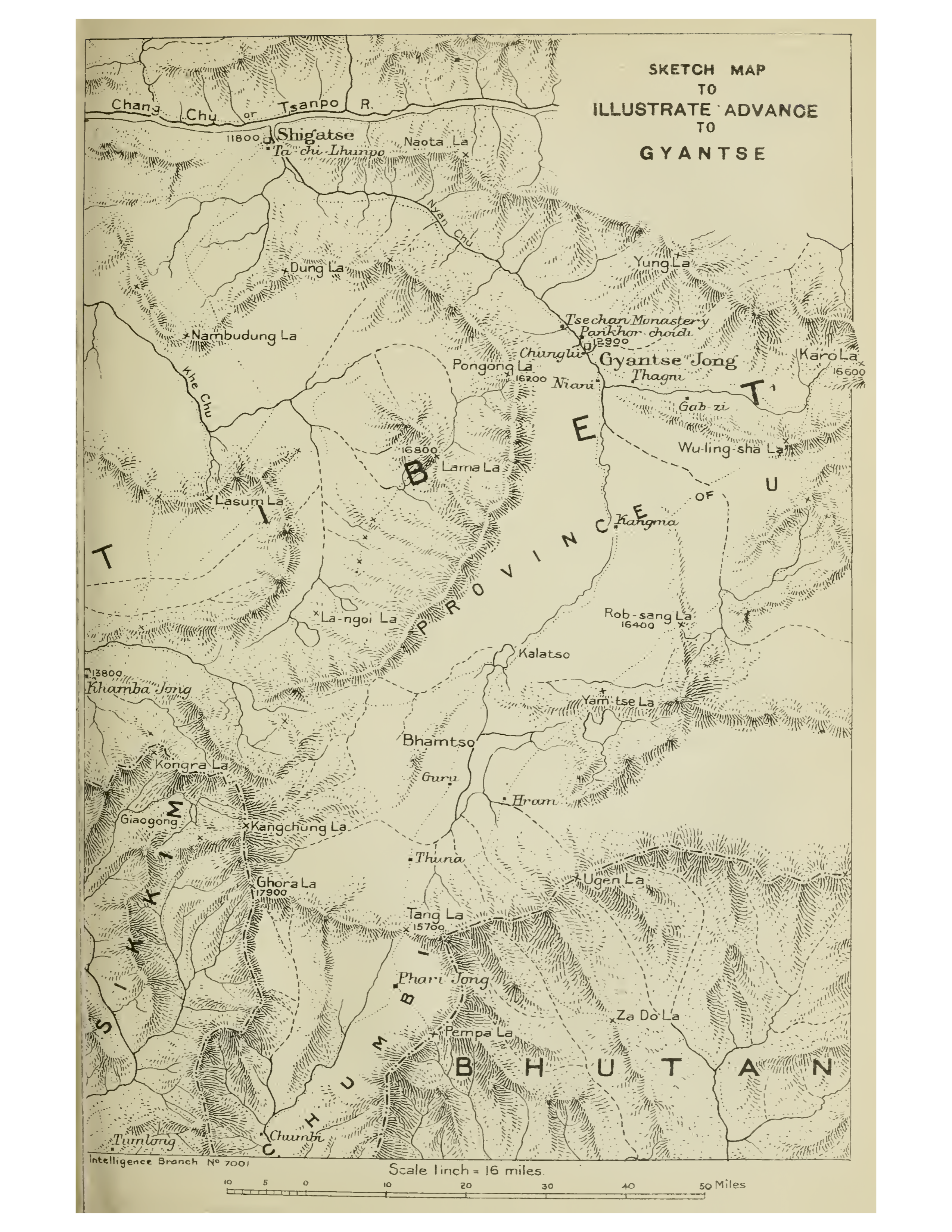
Map of British expedition to Tibet.png - Happyseeu

Xin Dynasty Uprisings.png - Seasonsinthesun
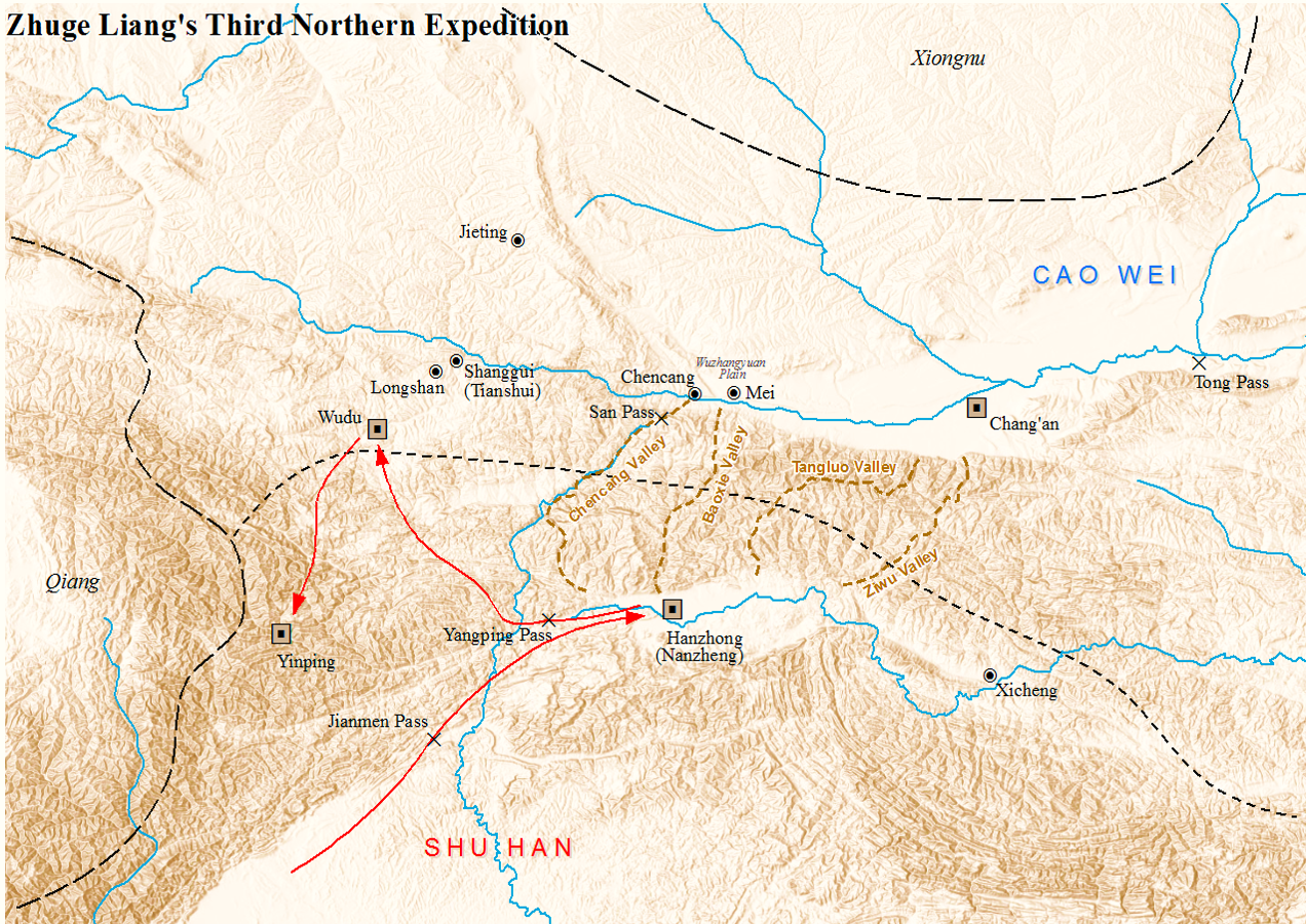
Zhuge Liang 3rd Northern Expedition.png - Seasonsinthesun
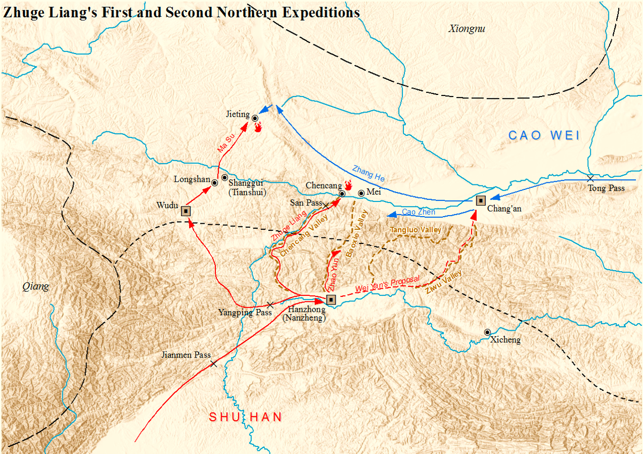
Zhuge Liang 1st and 2nd Northern Expeditions.png - Seasonsinthesun
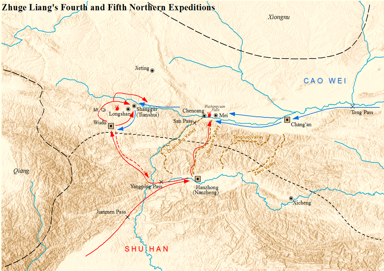
Zhuge Liang 4th and 5th Northern Expeditions.png - Seasonsinthesun

Sketch map of Younghusband expedition to Tibet with date.jpg - Happyseeu

Map of Ming Chinese empire 1415 (cropped).jpg - ديفيد عادل وهبة خليل 2

China 1820 zh-hant.svg - Goodmartin

China 1820 zh-hans.svg - HNlander

China 1820 de.svg - Furfur

Map of Tibet detail from China old map 1936 (cropped).jpg - Tibet Nation

China 1911 de.svg - Furfur

Map of Tibet and the Empire of Kublai Khan, from- Asia 13th Century (cropped).jpg - Tibet Nation

Era of Fragmentation.png - Qiushufang
Map-Qing Dynasty 1689-en.jpg - GnolizX

China 1820 es.svg - Milenioscuro

China 1911 es.svg - Milenioscuro

Kohimamagyar.jpg - Talmann
Phagmodrupa dynasty.png - DamiKarv