Wikimedi'Òc
Modes d'emploi

Cet album fait partie des albums
Cet album photos contient les sous-albums suivants :


Ancient Political Divisions.jpg - Tarif
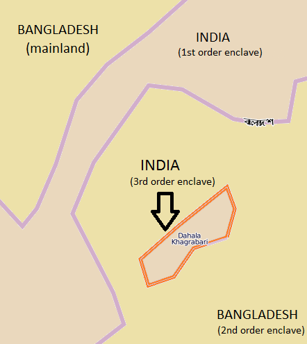
Dahala Khagrabari.png - Simon

Tee-Pferde-Straße.png - Ulamm
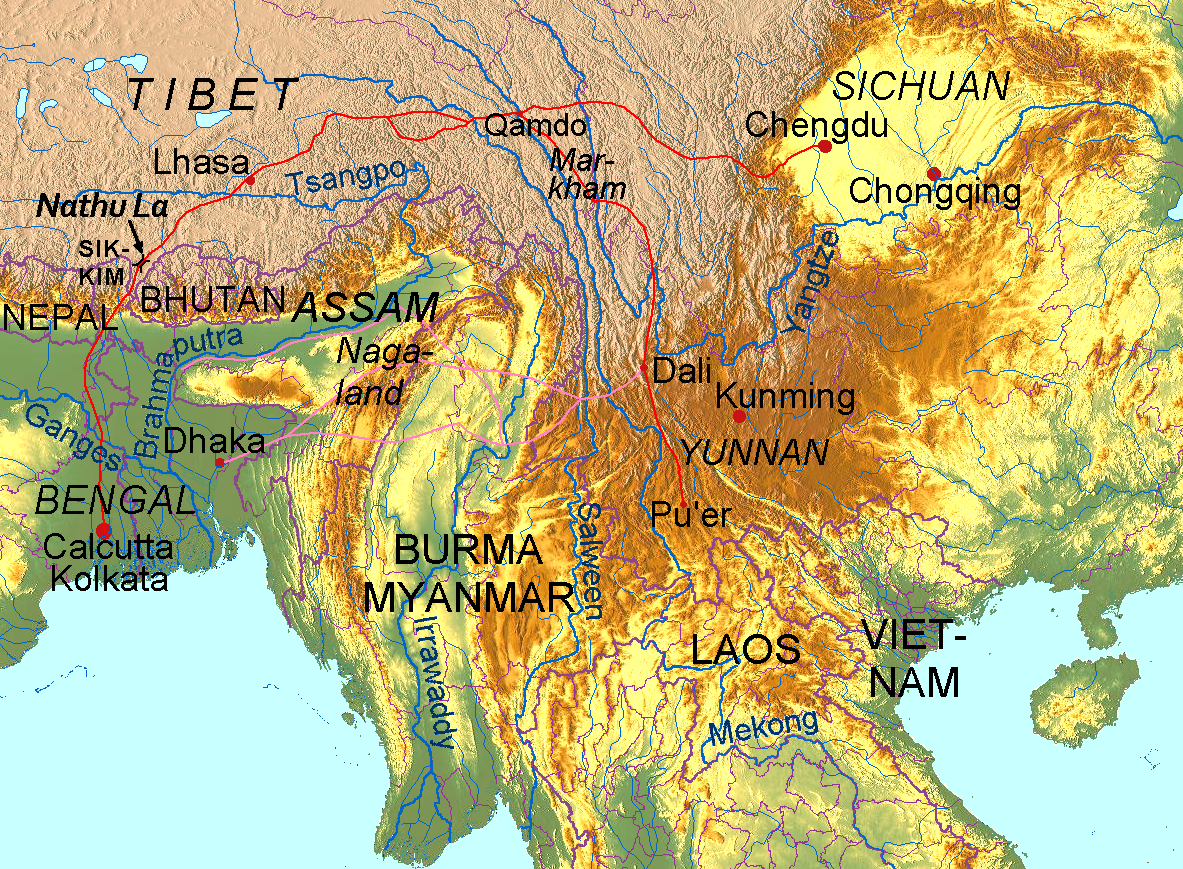
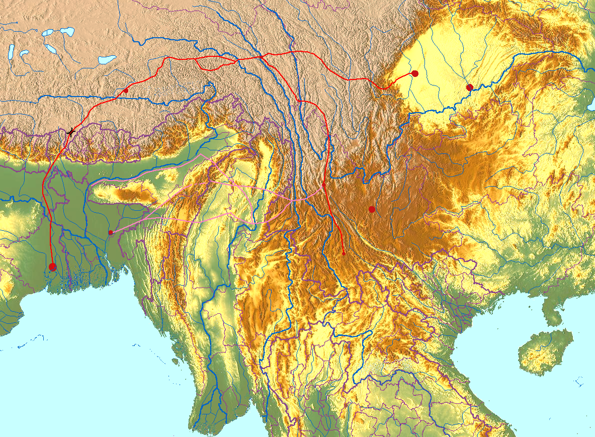
Tea-Horse-Road.png - Ulamm

Chamagudao.png - Ulamm
Chamagudao (no names).png - Ulamm

Tea-Horse-Road 2.png - Yerius J

Dahala Khagrabari de.svg - Furfur

Map of Bengal.gif - Bongan
Mughal Bengal.png - Vaza12

Ilyas Shah's kingdom and expeditions.jpg - Vaza12
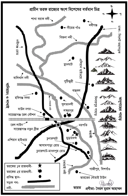
Taraf Map.jpg - Murad120

Kingdom of Bhati.png - F2416
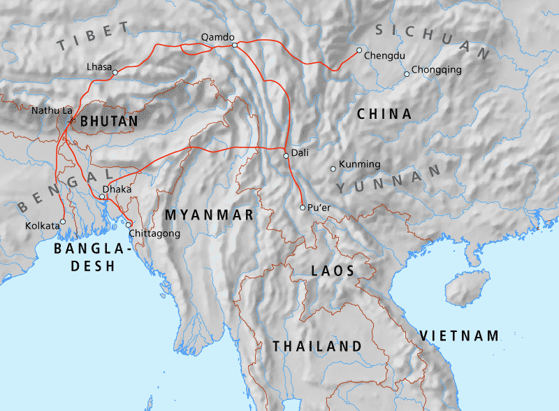
Map of the Tea-Horse road.png - Redgeographics

Battle of Giria march.jpg - Metesjams

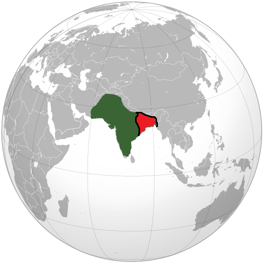
Bengal in 1947 Partition of Bengal.svg - Aziz Tarak.
Gangaridai Kingdom.png - Fidolex
Portuguese-settlements-in-the-bay-of-Bengal.-Author-Marco-Ramerini.jpg - Hugo Refachinho

Map-of-the-Portuguese-settlements-in-North-Bengal.-Author-Marco-Ramerini.jpg - Hugo Refachinho

The Persian and Mauryan Empires.jpg - Rnrctg

Map of Bengal around 1000 CE.png - Takshashila7977

Map of Bengal in 958 CE.png - Takshashila7977

Map of the Battles and Battlefields of the Bengal Subah.png - Greatswrd

AD 1750 MAP OF NAWABS OF BENGAL.jpg - SYED ASAD AHMED FARAZ
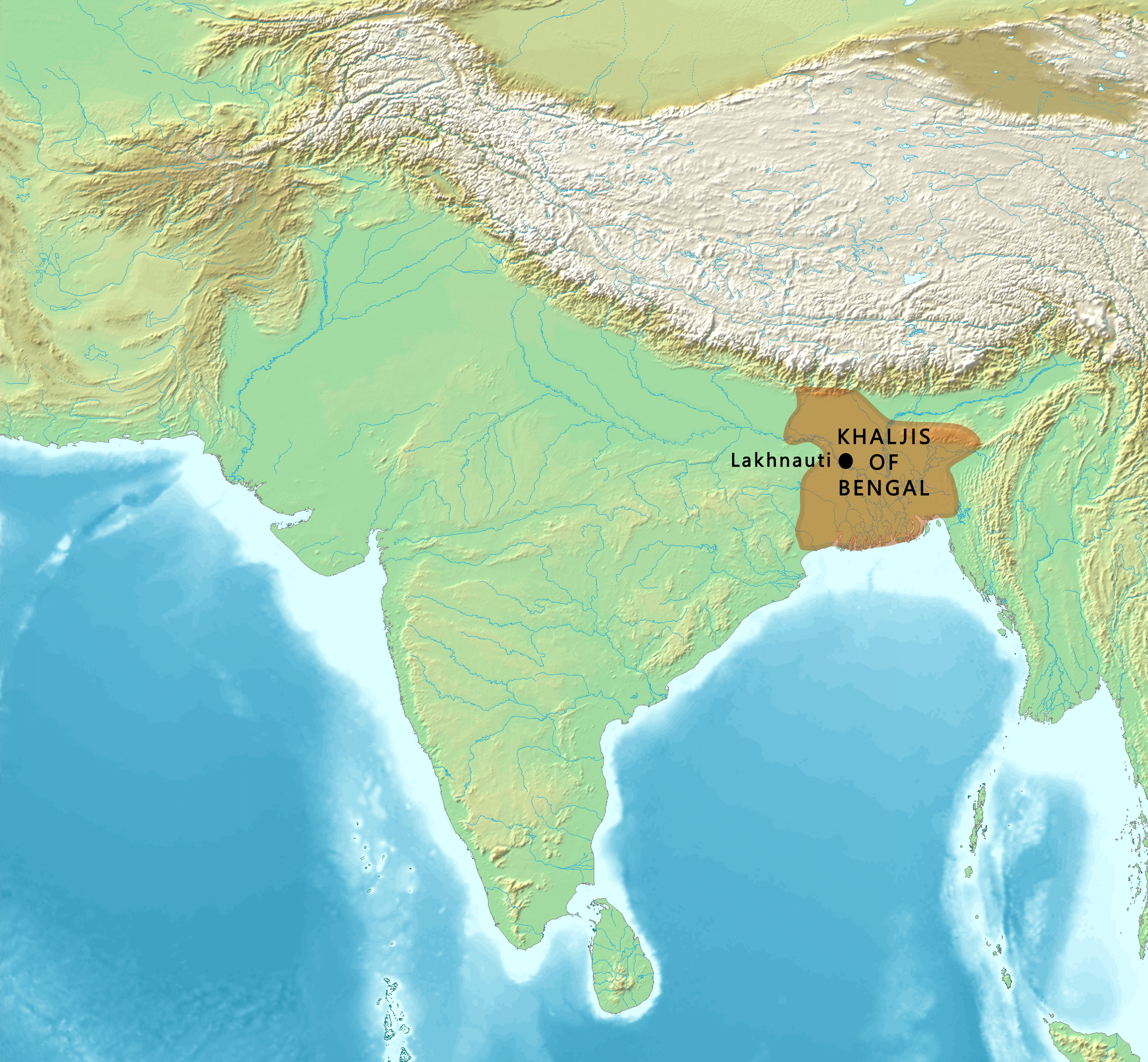
Map of the Khaljis of Bengal.png - पाटलिपुत्र

Taraf Kingdom MAP - Taraf of Bengal Map -Taraf Pargana.jpg - Taraf Pargana

English Version of Taraf Kingdom Map.jpg - Taraf Pargana

Dahala Khagrabari en.svg - Colohisto

Dahala Khagrabari English.svg - Colohisto

Dahala Khagrabari Italian.svg - Colohisto

Map of the Nawabs of Bengal.jpg - Tiipu

Habshi Dynasty of Bengal (map).jpg - Tiipu

Shamsher Gazi Kingdom (Tripura).jpg - Tiipu

Bengal Sultanate before unification.jpg - Tiipu

Nawabs of Bengal - 1729.png - Greatswrd