Wikimedi'Òc
Modes d'emploi

Cet album fait partie des albums
Cet album photos contient les sous-albums suivants :


Huanghemap.png - Fanghong
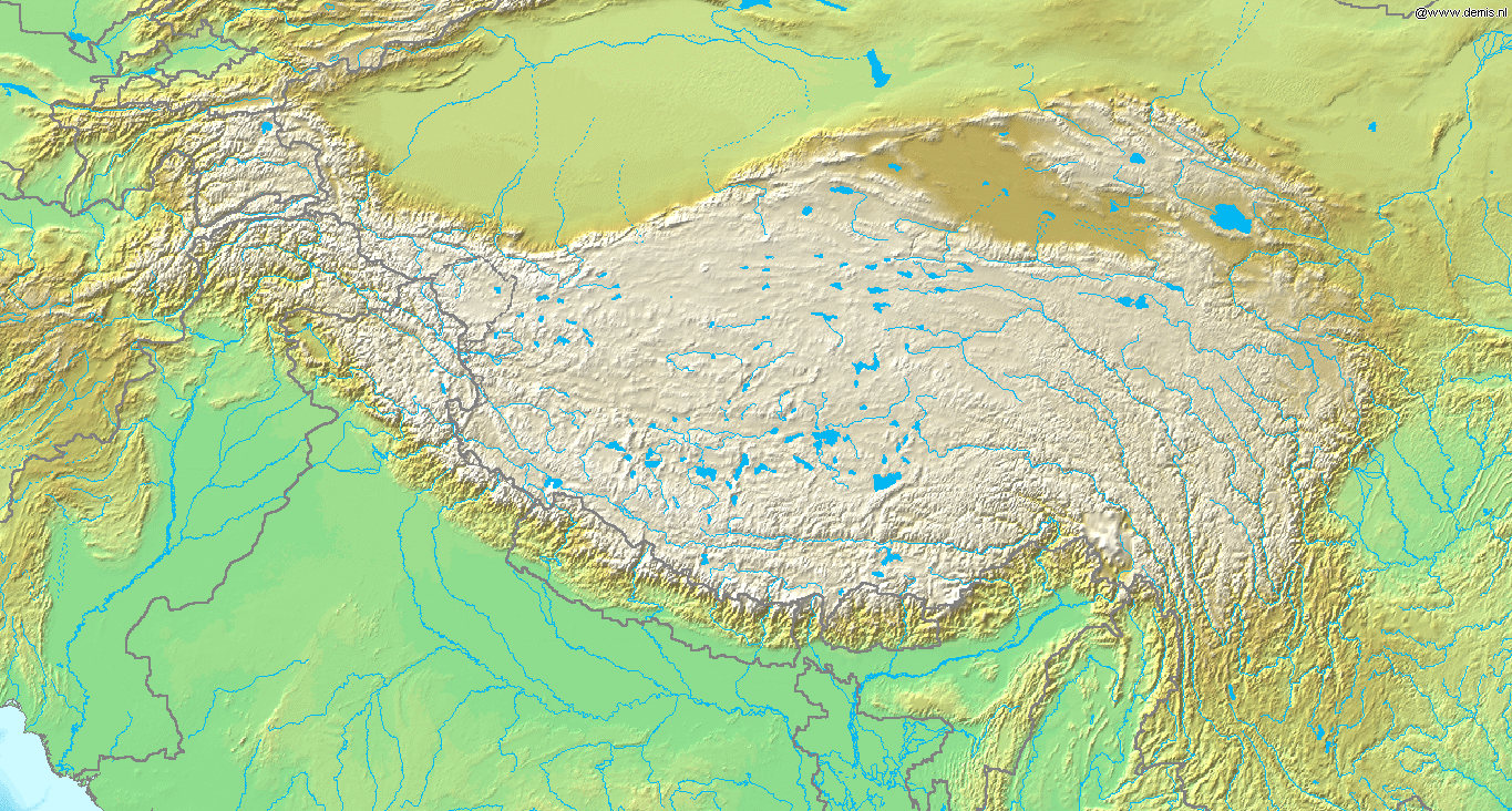
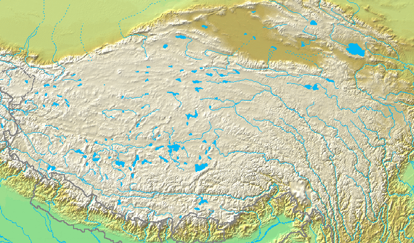
Topografic map of Tibetan Plateau.png - Botev

HuangHeZmenyDolnihoToku.PNG - File Upload Bot (Martin Kozák)

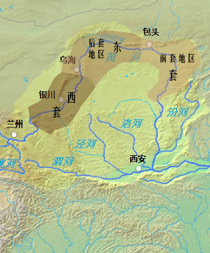
黄河流域主要城市.svg - GreatHan

China Loess Plateau.png - Croquant
China Loess Plateau and Ordos Desert.png - Croquant
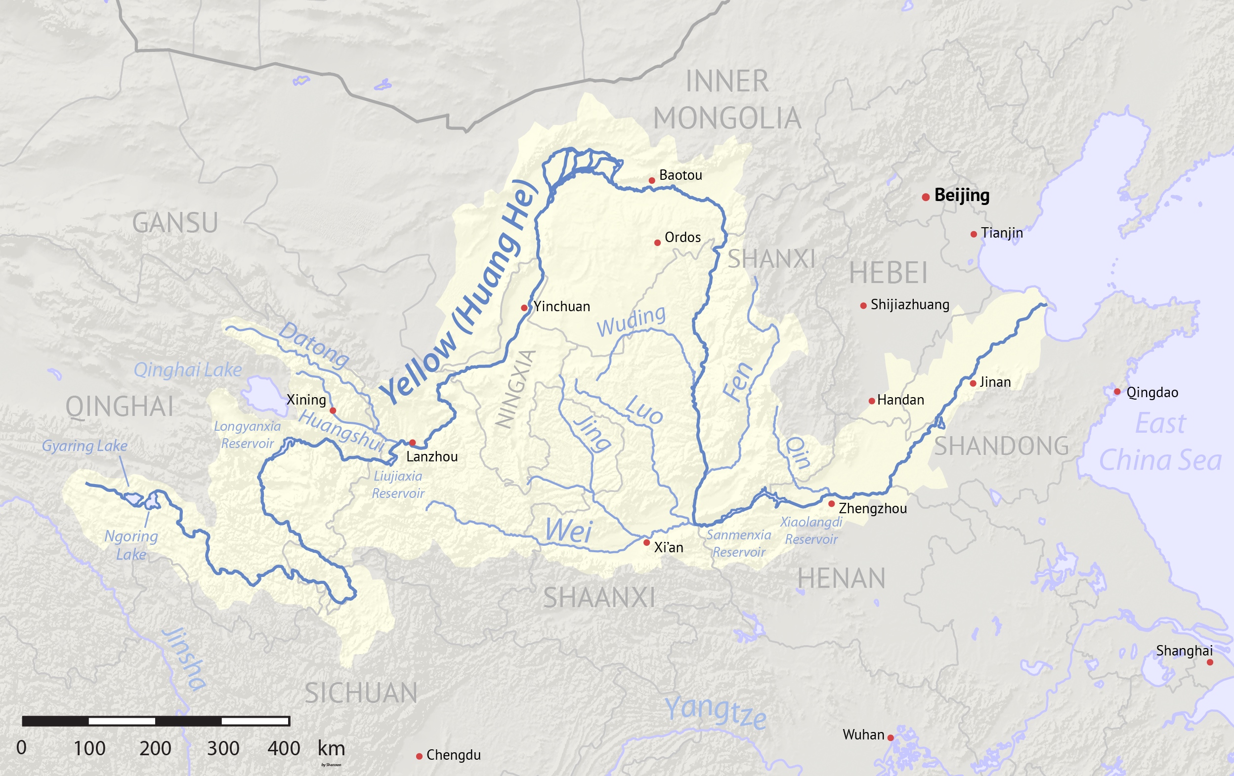
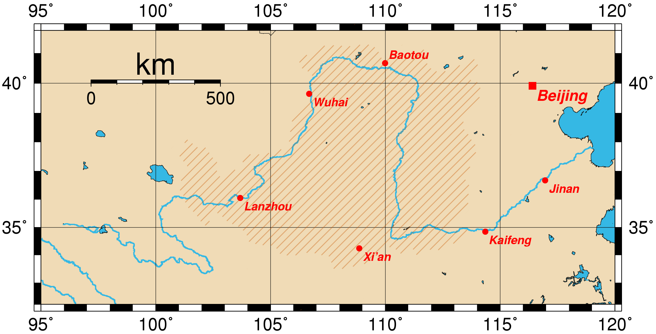
Yellowrivermap.jpg - Shannon1
Huanghemap zh-hans.png - Crwx

Huanghemap zh-hant.png - Crwx

Yellowrivermap-2.jpg - 陇右甘南
Yellowrivermap copy copy.jpg - Zcm11

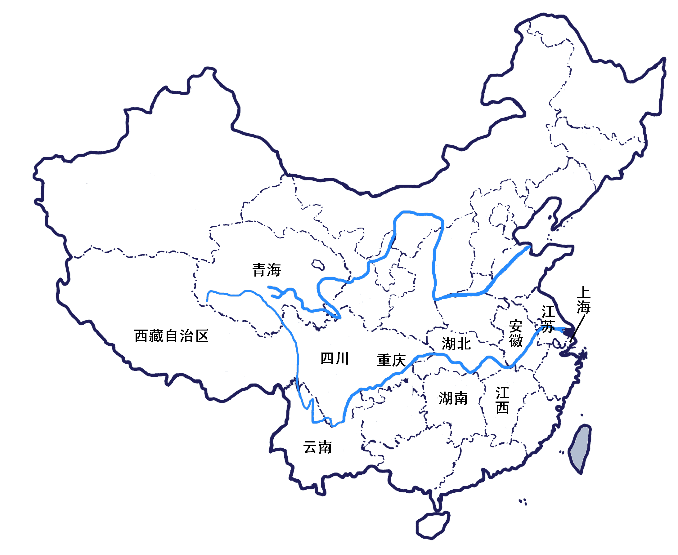
Major cities along the Yellow River.svg - GreatHan

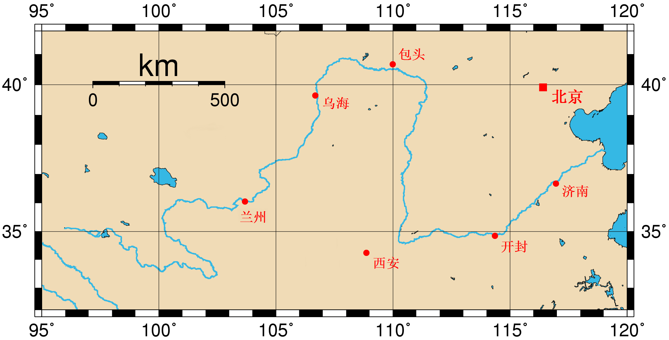
Yellowrivermap-zh-hans.jpg - Patvoiiage

Yellowrivermap-zh-hant.jpg - Patvoiiage
Yangtze River and Yellow River.gif - Zhousiyuan

Atlas Van der Hagen-KW1049B13 039-XANTVNG SINARVM IMPERII PROVICIA QUARTA.jpeg - OlafJanssen

Yellow River watercourse changes.svg - Stevenliuyi

Yellow River watercourse change 1855.svg - Stevenliuyi
312 of 'China in Transformation ... With ... maps and diagrams' (11245748964).jpg - Artix Kreiger 2

546 of 'The International Geography. ... Edited by H. R. Mill' (11167528043).jpg - Artix Kreiger 2

170 of 'The Earth and its Inhabitants. The European section of the Universal Geography by E. Reclus. Edited by E. G. Ravenstein. Illustrated by ... engravings and maps' (11269033596).jpg - LlywelynII

100 of 'The Earth and its Inhabitants. The European section of the Universal Geography by E. Reclus. Edited by E. G. Ravenstein. Illustrated by ... engravings and maps' (11121641875).jpg - LlywelynII

239 of 'The Earth and its Inhabitants. The European section of the Universal Geography by E. Reclus. Edited by E. G. Ravenstein. Illustrated by ... engravings and maps' (11126027584).jpg - Artix Kreiger 2

238 of 'The Earth and its Inhabitants. The European section of the Universal Geography by E. Reclus. Edited by E. G. Ravenstein. Illustrated by ... engravings and maps' (11122936074).jpg - Artix Kreiger 2

Liang Huai yan chang ji si sheng xing yan tu. LOC gm71005050.jpg - Fæ

Henan quan tu LOC 96685909.jpg - Fæ

Da Ming yu di tu LOC 2002626776-1.jpg - Fæ

Tian xia zong yu tu. LOC 2002626780-1.jpg - Fæ

Der Jesuiten-Atlas der Kanghsi-Zeit - China und die Aussenlaender LOC 74650033-16.jpg - Fæ

Yellow river.svg - 丁志仁
Da Qing fen sheng yu tu LOC 2002626726-1.jpg - Fæ

Boundary of Tibet in 1912 map of China with its territories from National Geographic magazine (cropped).jpg - Tibet Nation

Yellow River watercourse changes en.svg - Esiymbro
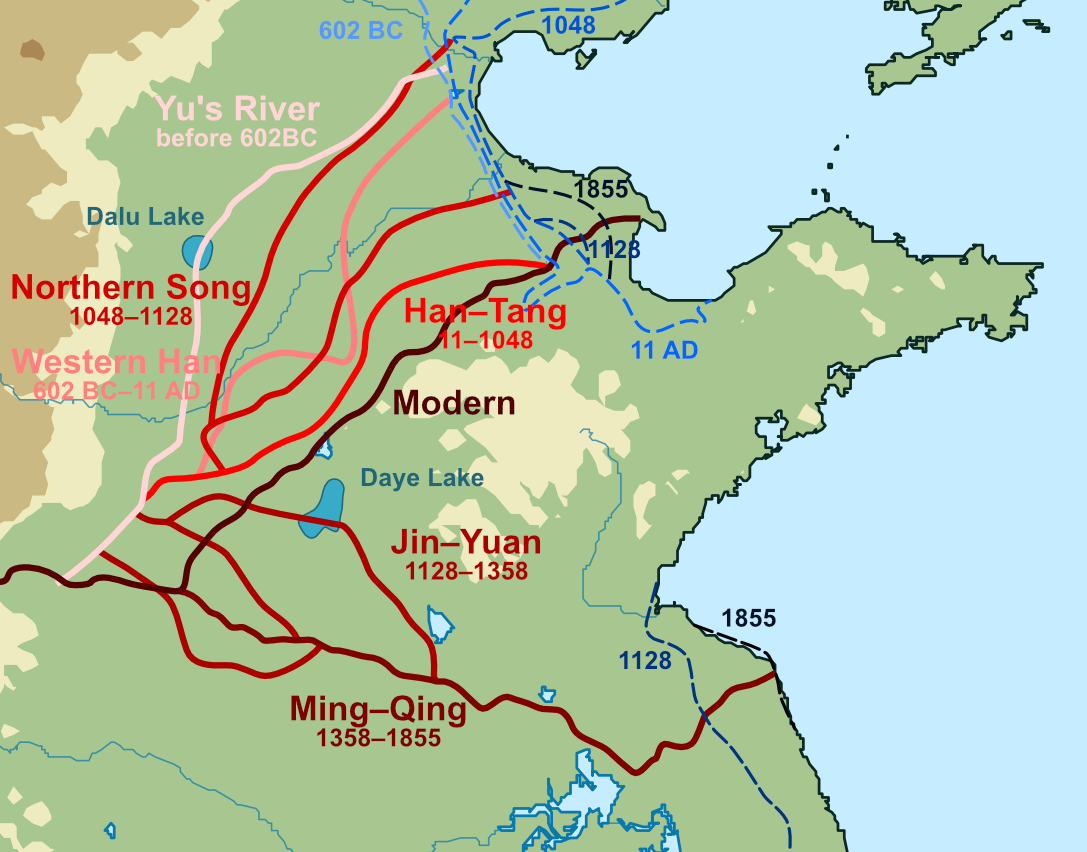
Yellow River watercourse changes en.png - Esiymbro

Guang yu tu - er juan LOC 2008623187-1.jpg - Fæ
Guang yu tu - er juan LOC 2008623187-32.tif - Fæ

Guang yu tu - er juan LOC 2008623187-32.jpg - Fæ

Guang yu tu - er juan LOC 2008623187-33.jpg - Fæ

Guang yu tu - er juan LOC 2008623187-34.jpg - Fæ
Guang yu tu - er juan LOC 2008623187-40.tif - Fæ
Guang yu tu - er juan LOC 2008623187-40.jpg - Fæ
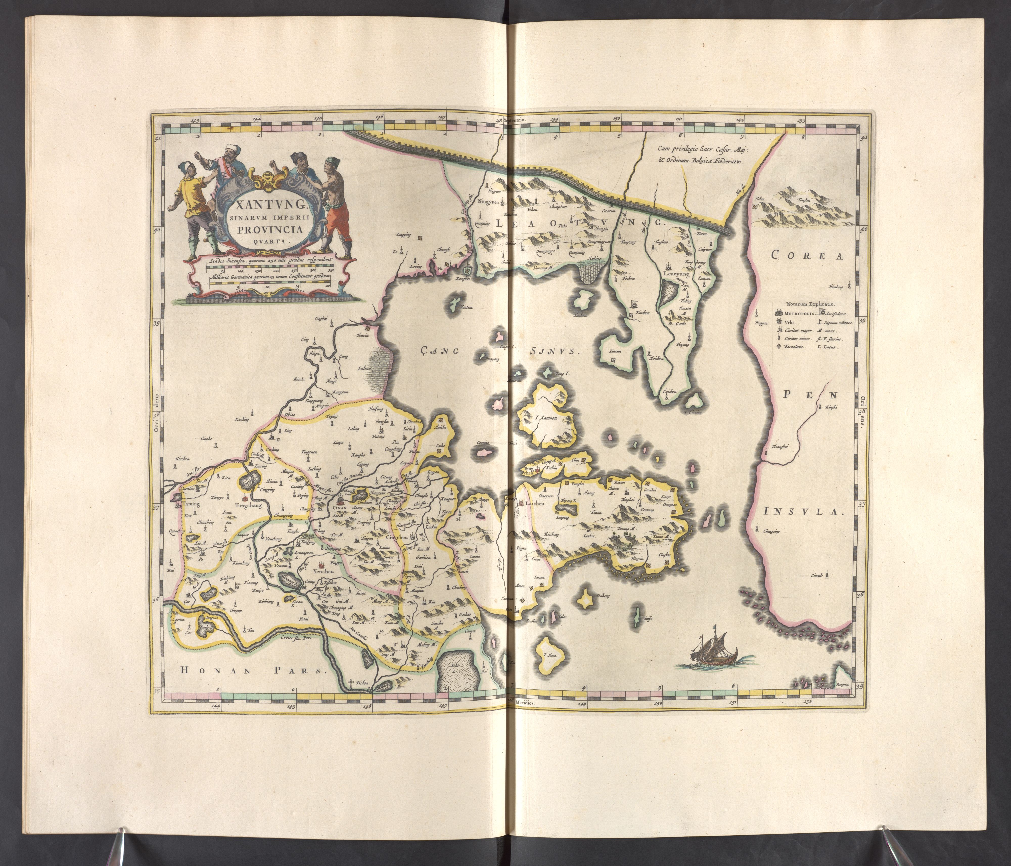
Xantvng - Atlas Maior, vol 11, map 16 - Joan Blaeu, 1667 - BL 114.h(star).11.(16).jpg - JhealdBot
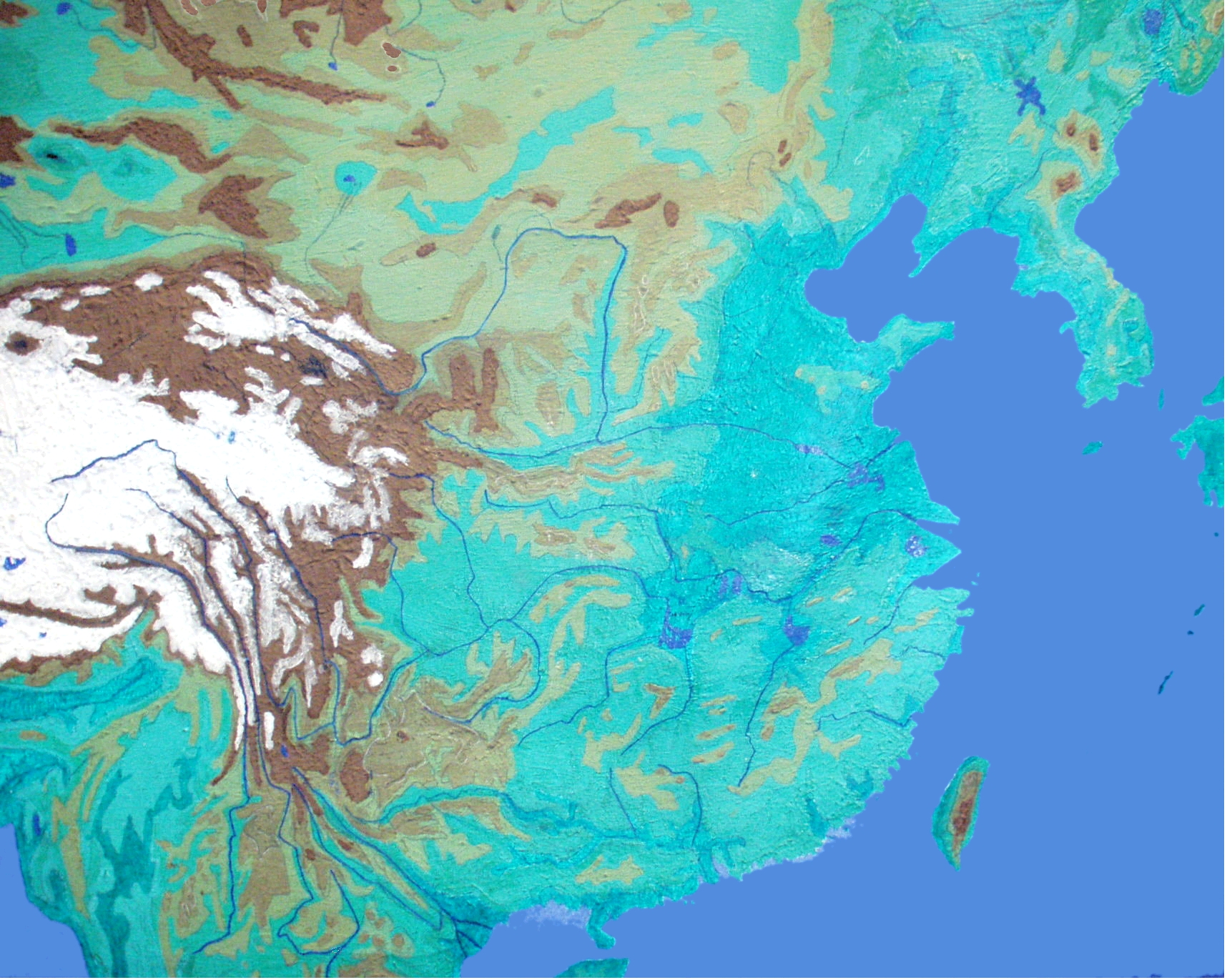
Physical map of Tibet.png - Andrew Dalby

Yellow River course changes.gif - Qiushufang

Map of Tibet- "TIBET CONFIDENTIAL" "Ethnographic Boundary of Tibet" "Approximate Line of Communist Advance" and "Reportedly occupied by Communists" "11518, CIA, 2-50" February 1950 map- 305945 11518 01.jpg - Smasongarrison

Map of Tibet- "TIBET CONFIDENTIAL" "Ethnographic Boundary of Tibet" "Approximate Line of Communist Advance" and "Reportedly occupied by Communists" "11518, CIA, 2-50" February 1950 map- 305945 11518 01 (cropped).jpg - Tibet Nation

Yellowrivermap-fr.png - Pline

Bassin-du-fleuve-jaune.png - Pline

Fluvi Jaune - Topografia dau bacin.png - Nicolas Eynaud

Map of Tibet- "TIBET CONFIDENTIAL" "Ethnographic Boundary of Tibet" "Approximate Line of Communist Advance" and "Reportedly occupied by Communists" "11518, CIA, 2-50" February 1950 map- 305945 11518 01 (cropped) (cropped).jpg - Koavf

1934年民生渠平面图.svg - Baomi

民生渠平面略图1934年.svg - Baomi

土默特右旗河流灌渠图.svg - Baomi

Province de Kiang-nan - vingt quatre cartes particulières formant 3 grandes feuilles - btv1b550051140 (06 of 24).jpg - Gzen92Bot

Mouth of the Yangtze 1754.jpg - LlywelynII

Yellow River (Indiana) watershed.jpg - Mheberger

Huang chao zhi sheng di yu quan tu - btv1b531099218 (16 of 38).jpg - Gzen92Bot
Portrait map of China.jpg - Patrick Edwin Moran

卫辉府位置图1820.svg - 瑞丽江的河水

汝州位置图1820.svg - 瑞丽江的河水

河南省行政区划1820.svg - 瑞丽江的河水

彰德府位置图1820.svg - 瑞丽江的河水

怀庆府位置图1820.svg - 瑞丽江的河水

河南府位置图1820.svg - 瑞丽江的河水

南阳府位置图1820.svg - 瑞丽江的河水

开封府位置图1820.svg - 瑞丽江的河水

大名府位置图1820.svg - 瑞丽江的河水

光州位置图1820.svg - 瑞丽江的河水

归德府位置图1820.svg - 瑞丽江的河水

汝宁府位置图1820.svg - 瑞丽江的河水

许州位置图1820.svg - 瑞丽江的河水

陕州位置图1820.svg - 瑞丽江的河水

Der Jesuiten-Atlas der Kanghsi-Zeit - China und die Aussenlaender LOC 74650033-9.jpg - Fæ

Yu Sheng Huang He quan tu. LOC gm71005027.jpg - Fæ

Physical Geography with the Boundaries of Ancient China.jpg - LlywelynII

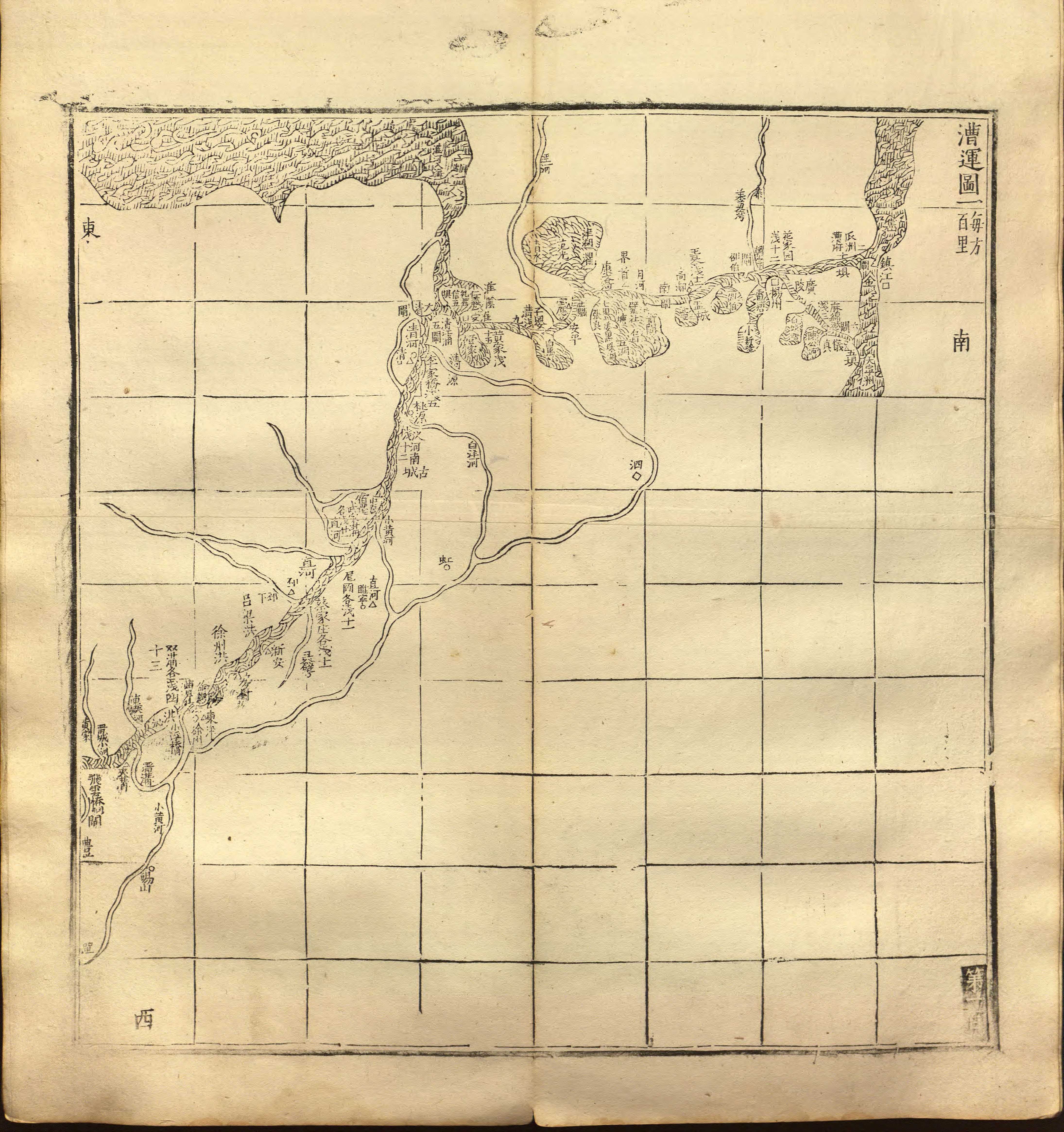
(Tongwaxiang yi xia Huang He chuan yun di gong tu tie shuo) LOC gm71002482.jpg - Fæ