Wikimedi'Òc
Modes d'emploi

Cet album fait partie des albums
Cet album photos contient les sous-albums suivants :


Drake Passage - Lambert Azimuthal projection 0.png - Geo Swan

Drake Passage - Orthographic projection.png - Geo Swan
Drake Passage - Lambert Azimuthal projection.png - Geo Swan

Orthographic projection centred over South Georgia Island.png - Geo Swan

Orthographic projection centred over King George Island.png - Geo Swan

0rthographic projection over Austral Island.png - Geo Swan

Drift of the Endurance.png - Denniss

Great circle.svg - Rainer Bielefeld

Tca map.png - Janitoalevic

Rjorge u map.png - Gi

Robert u map.png - Gi
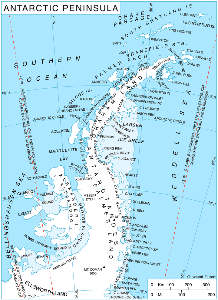
Ant-pen map.png - Mahahahaneapneap

Livingston u.png - Gi

Scotia Sea.png - Foobaz

Drake passage.png - Gi

Drake passage en.png - Gi

LocationSouthernOcean.png - Lasunncty
Antarctica map.jpg - Martas011

AntarktisUndAfrika.png - Andrew pmk~commonswiki

AntarktisUndAustralien.png - Andrew pmk~commonswiki

AntarktisUndSuedamerika.png - Andrew pmk~commonswiki

Ant sea-ice 2004-11-09.png - Hgrobe
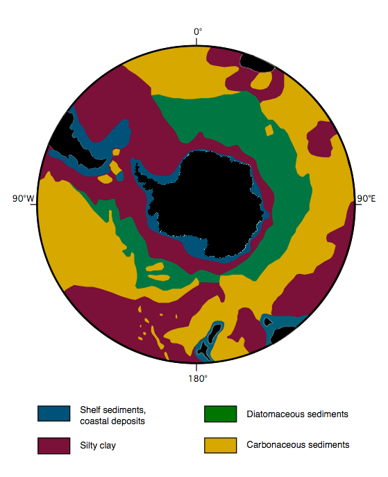
Southern-ocean sediment hg.png - Ciaurlec
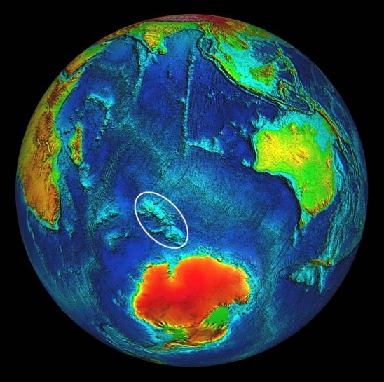
Kerguelen Plateau Location.jpg - Llnoba~commonswiki

Kerguelen Plateau Subdivisions.jpg - Llnoba~commonswiki
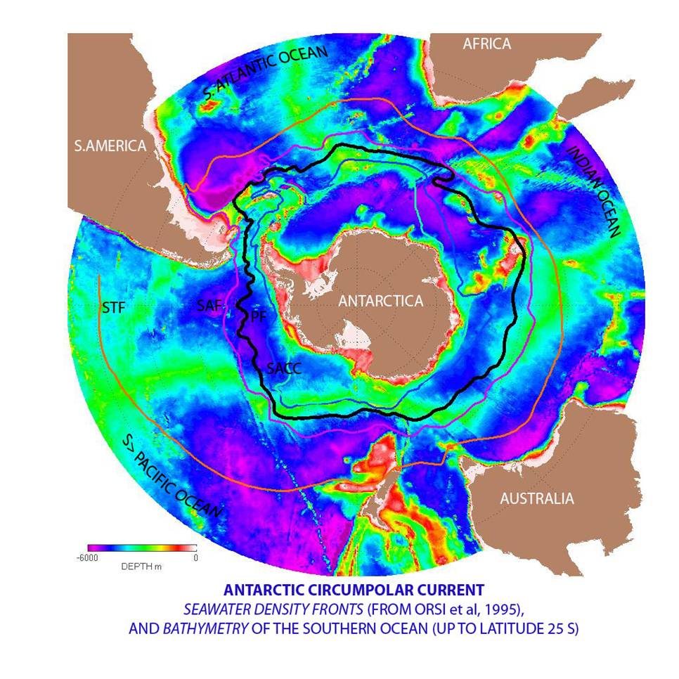
Antarctic Circumpolar Current.jpg - Dexter siu

Verne-sfinga-mapa.jpg - File Upload Bot (Magnus Manske)

Karte antarktis2 geo.png - File Upload Bot (Magnus Manske)

S 199906 conc.png - Hnchan01

Larsen iceshelves.png - Ras67

Arctice and Antarctic seasonal ice cover.jpg - Geo Swan

Southern Hemi Antarctica.png - Leonard G.
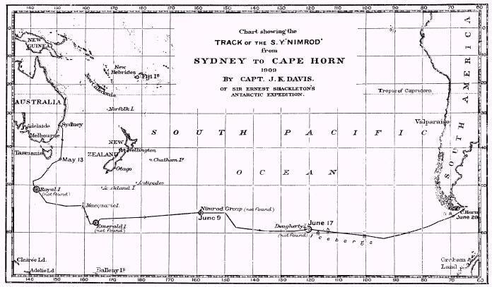
Nimrod.1909 voyage.jpg - Goustien

Argentine Antarctica.svg - Dexxter

Antártida Argentina.png - Janitoalevic

Sediments-southerocean.png - Hgrobe
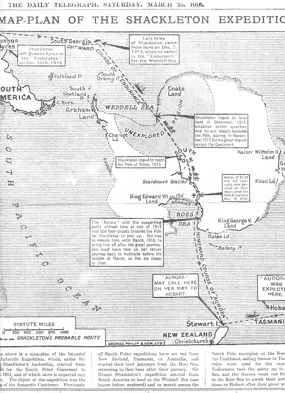
Shackleton Expedition map-plan.jpg - Hohum

Dake-antarctic-map.jpg - Goustien

'The Sphinx of the Ice Fields' by George Roux 16.jpg - Electron

Antarctica, Bouvet Island, discovery map 1739.jpg - Loranchet

Antarctica, Bouvet Island, discovery map 1754.jpg - Loranchet

East Scotia Ridge vents map.png - Snek01

Delimitación natural entre los océanos Pacífico y Atlántico Sur por el arco de las Antillas Australes.png - CHUCAO

Chart of the track of the Dolphin, Tamar, Swallow & Endeavour through the South Seas ; & of the track of M. Bougainville round the World (5385394992).jpg - File Upload Bot (Magnus Manske)
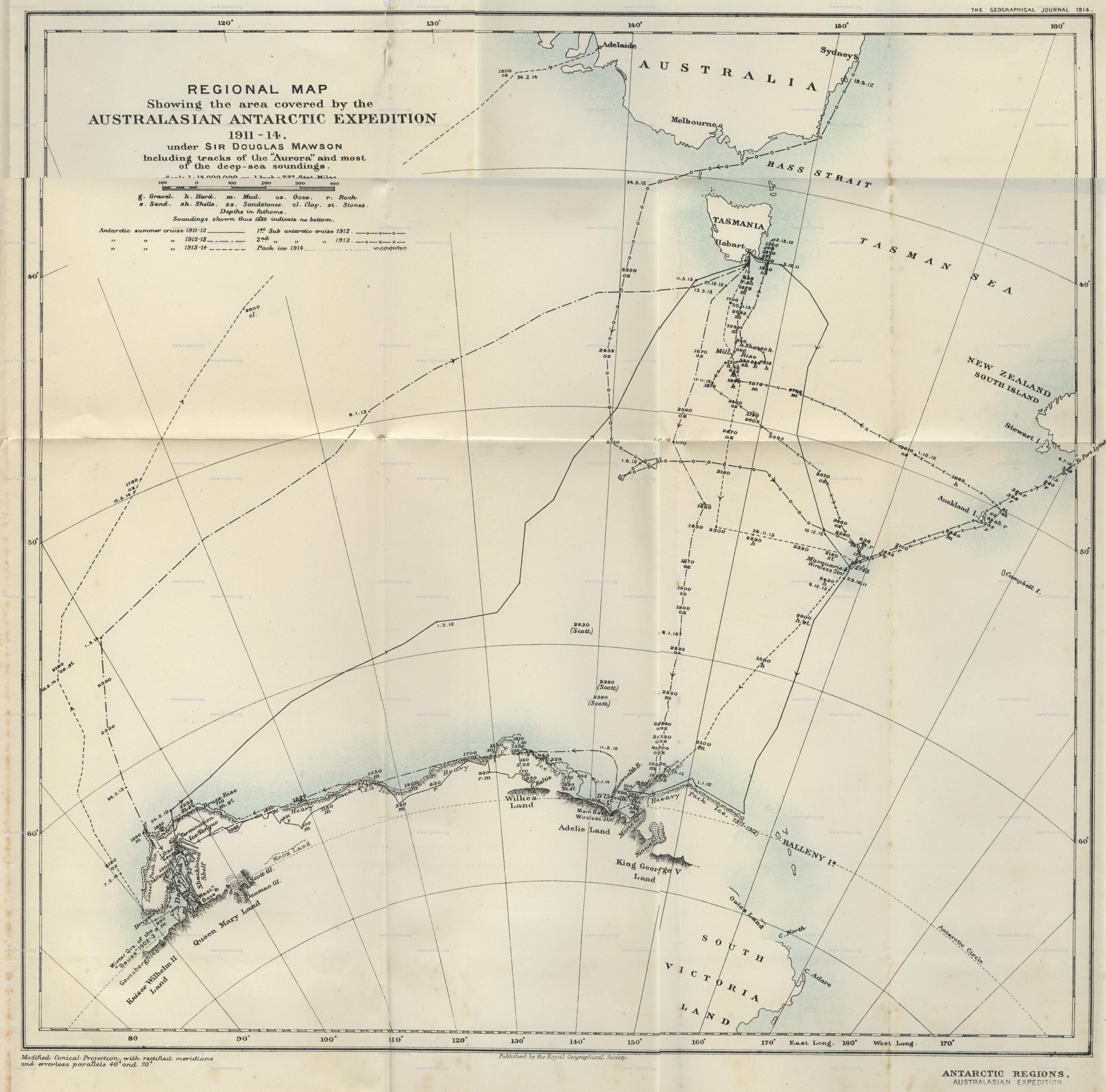
Royal-geographical-society geographical-journal 1914 australian-antarctic-expedition-sir-douglas-mawson 3000 2963 600.jpg - Dmartyn80

SMOS2010.png - LlywelynII

Antarctic-seas-en.jpg - Nickpo

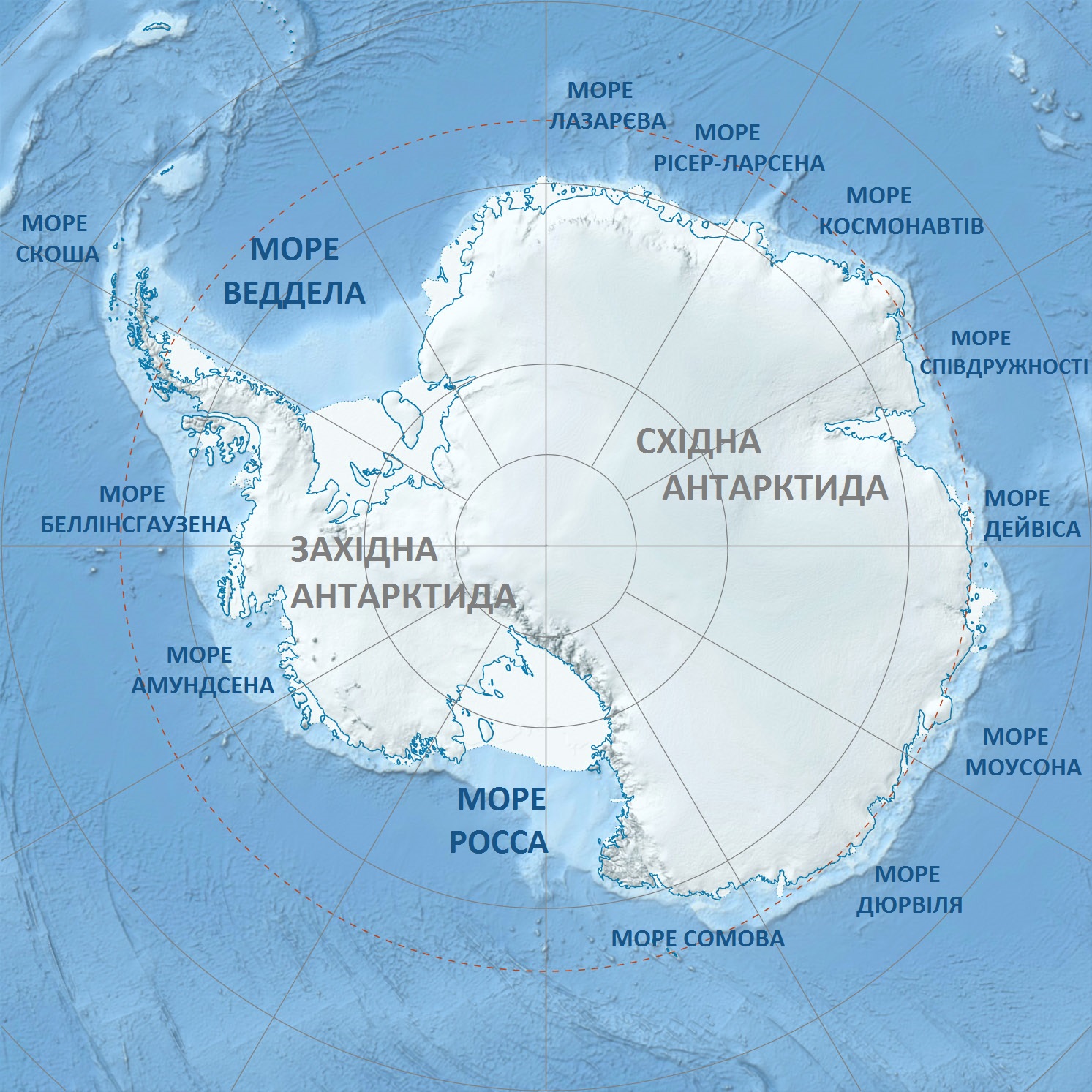
Antarctic-seas-ru.jpg - Nickpo
Antarctica relief location map ua.jpg - Viktor Legend

Antarctic-seas-ka.jpg - Otogi

Scotia Sea NOAA.jpg - Fama Clamosa

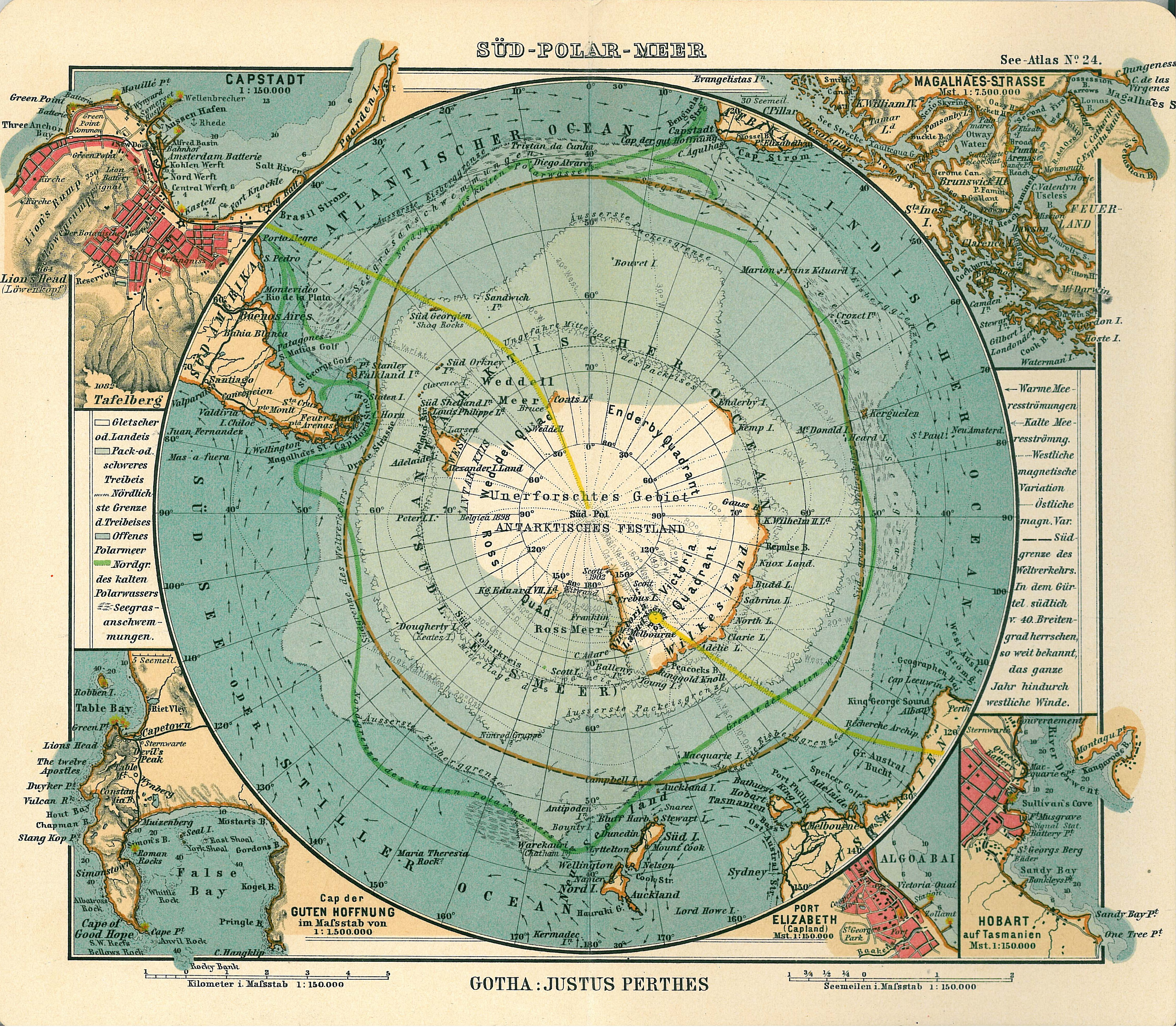
Brockhaus' Konversations-Lexikon (1892) (14597997597).jpg - SteinsplitterBot

Brockhaus' Konversations-Lexikon (1892) (14784158632).jpg - SteinsplitterBot

MaresAntárticos.svg - Rowanwindwhistler

Antarctic-seas-he.svg - קרלוס הגדול
Antarctic-seas-Blank.svg - קרלוס הגדול

Palmer Archipelago map.png - TooncesB

Location map Anvers Island Antarctica.png - TooncesB
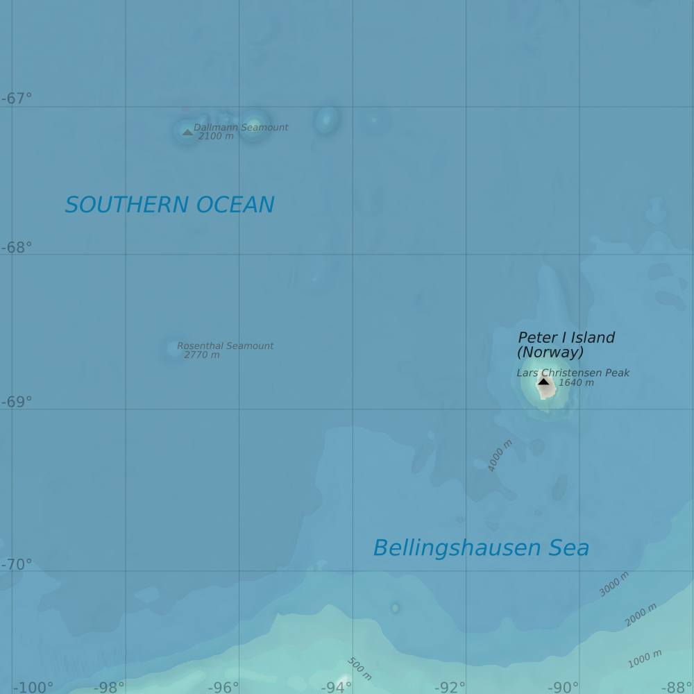
Map -69 -94 Peter I Island.png - Metropolcarte

Nimrod Gruppe 1906.jpg - Lewenstein

18 of 'The Earth and its Inhabitants. The European section of the Universal Geography by E. Reclus. Edited by E. G. Ravenstein. Illustrated by ... engravings and maps' (11122623905).jpg - Artix Kreiger 2

19 of 'The Earth and its Inhabitants. The European section of the Universal Geography by E. Reclus. Edited by E. G. Ravenstein. Illustrated by ... engravings and maps' (11127666063).jpg - Artix Kreiger 2

Weddell-Island-wider-region.png - Apcbg

Antarctic-seas-af.svg - Rooiratel

Antarctic-seas-en.svg - Manlleus

Antarctic-seas-mk.svg - Bjankuloski06

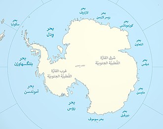
Antarctic-seas-ar.jpg - باسم

Australia's official interpretation of the names and limits of oceans and seas around Australia.png - SCHolar44

Bahari zinazopakana na Antaktiki.png - Kipala

1906 Antarctica map (cropped).jpg - Tibet Nation

Ecological-zones-of-the-Southern-Ocean.png - Sohmen

Southern Ocean in the world (blue) (W3) (CWF).svg - Aplaice

Admiralty Chart No 5096B South Attlantic and Southern Oceans Gnomonic, Published 1938.jpg - Kognos
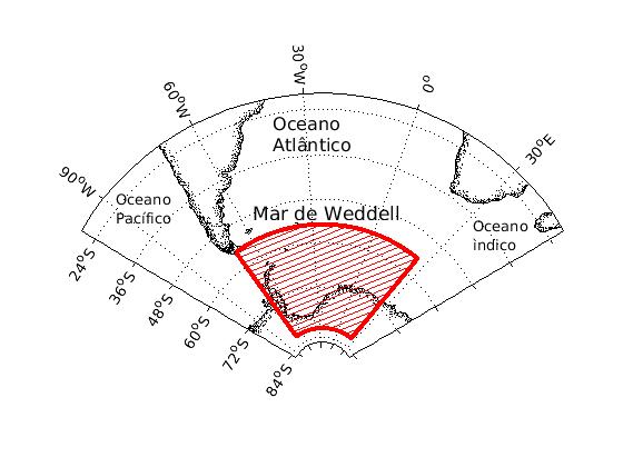
LimitesMarWeddell.jpg - MarieMassarico

Coccolithophores and diatoms in the Southern Ocean.png - Epipelagic

Coccolithophores and diatoms in the Southern Ocean 2.png - Epipelagic

Antarctic-seas-sl.svg - GeographieMan

PAT - Antarctic region.gif - Babelia

Antarctica location map hr.svg - The Yennefer

Antarctica High Plateau (ann14031a).jpg - OptimusPrimeBot

Shackleton Fracture Zone.jpg - Janitoalevic

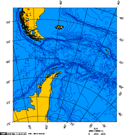
Delimitación natural entre los océanos Pacífico y Atlántico Sur por la zona de fractura Shackleton.svg - Janitoalevic

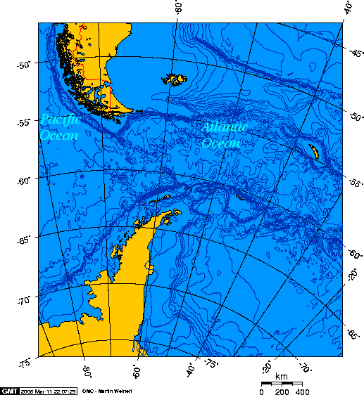
Natural delimitation between the Pacific and South Atlantic oceans by the Shackleton fracture zone.svg - Janitoalevic

Admiralty Chart No 132 Gnomonic Chart of Indian and Southern Oceans, Published 1914.jpg - Kognos

Admiralty Chart No 1094 Kangaroo Island, Published 1964.jpg - Kognos

Admiralty Chart No 5098 Gnomonic Chart of the South Pacific and Southern Oceans, Published 1914.jpg - Kognos

Nordenskiöld 1897 Figure 100 LOC Image 215.jpg - Kognos

Antaktiki milima.png - Kipala