Wikimedi'Òc
Modes d'emploi

Cet album fait partie des albums
Cet album photos contient les sous-albums suivants :


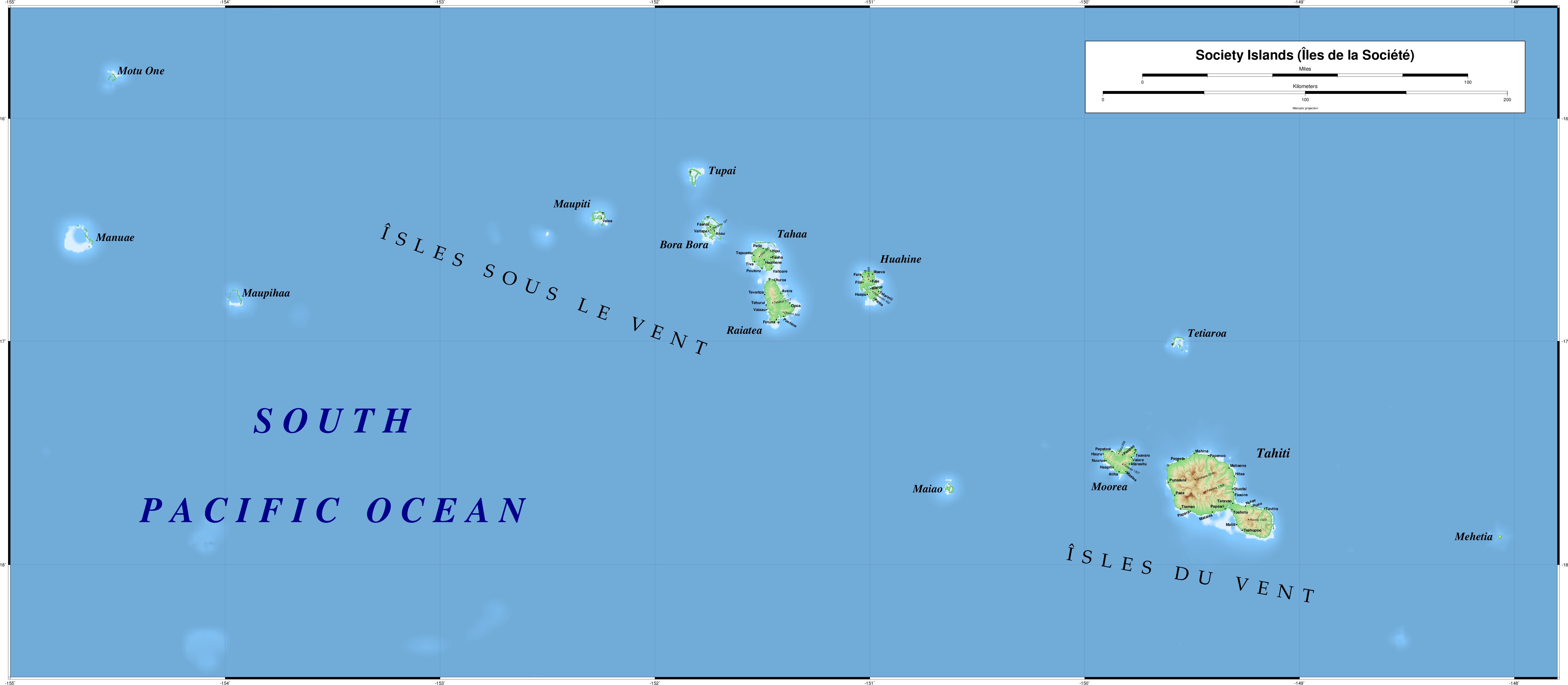
Karta FP Societe isl.PNG - Hobe

Societe isl Mehetia.PNG - Telim tor
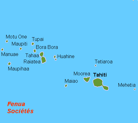
LocationSocietyIslands.PNG - Telim tor

Map-society-islands-hogg-1784.jpg - Ratzer

1769 Cook Map of the Society Islands - Geographicus - SoecityIsland-cook-1769.jpg - BotMultichill

1769 Cook Map of Tahiti, the Society Islands, and the Vicinity - Geographicus - OtahitiDecouverts-cook-1769.jpg - BotMultichill

1780 Cook - Hogg Map of Tahiti ( Society Islands ) - Geographicus - Tahiti-hogg-1780.jpg - BotMultichillT
Societyislands.jpg - Keithpickering~commonswiki

Edward T. Perkins, Georgian and Society Islands, 1854.jpg - Jbarta

PERKINS(1854) p246 MAP OF TAHITI ISLANDS.jpg - Metilsteiner

Carte des Isles de la Societé 1790.jpg - Ratzer

Carte des isles de la Societé découvertes par le Lieutenant J. Cook, 1769 (19572710145).jpg - Tm

Windward Islands of Society Islands.jpg - Gretarsson

Image taken from page 173 of 'Voyage d'une famille autour du monde ... Traduit de l'anglais par J. Butler ... (Abridged.) Deuxième édition' (16588900261).jpg - Artix Kreiger 2

181 of '(An Account of a Voyage round the World, in the years MDCCLXVIII, MDCCLXIX, MDCCLXX, and MDCCLXXI.)' (11220361106).jpg - Artix Kreiger 2

Tuulepealsed saared.png - Epp

Meyer‘s Zeitungsatlas 091 – Mittelamerika.jpg - Derbrauni

Admiralty Chart Catalogue 1967 Page 091 Index P1.jpg - Kognos

Iles de la Société - btv1b53009094t.jpg - Gzen92Bot

All the Islands accountofvoyages 02hawk 0316.jpg - Kognos

Admiralty Chart No 1107 Plans in the Iles de la Societe, Published 1972.jpg - Kognos

Bora-Bora cropped from Admiralty Chart No 1107 Plans in the Iles de la Societe, Published 1972.jpg - Kognos