Wikimedi'Òc
Modes d'emploi

Cet album fait partie des albums


Governo Reorganizado da República da China.png - Hen Sil-Mat

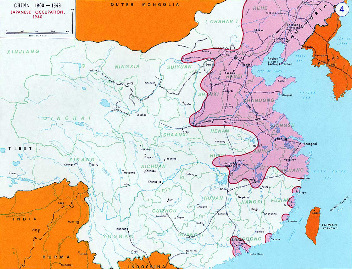
Campanhas Japonesas no Nordeste da China (1931 - 1936).png - Hen Sil-Mat
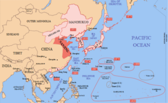
Japanese Occupation - Map.jpg - Mys 721tx

Sihangmap.png - Mahahahaneapneap

Sihangmap trad.png - Vanished user 456745753784

Sihangmap simp.png - Vanished user 456745753784

Battle of South Shanxi map.jpg - Vanished user 456745753784
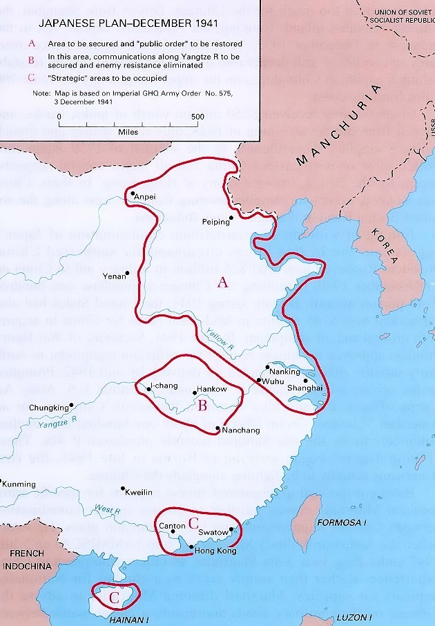
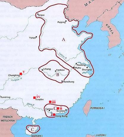
Japanese plan for china - December 1941.jpg - W.wolny
India China transportation - 1942-1943.jpg - W.wolny

Japanese Ichigo Plan - April 1944.jpg - W.wolny

The Salween campaign - 11 May-30 June 1944.jpg - W.wolny

End of the Salween campaign - 3 Nov 1944-27 Jan 1945.jpg - W.wolny

The Chihchiang campaign - 8 April-7 June 1945.jpg - W.wolny

China situation Oct1944.jpg - Vanished user 456745753784

77shibian.png - Ras67

Ichigo plan.jpg - Cllaydi

Battle of Nanking 1937.jpg - みや東亞

Japanese China Garrison Army 1937 Jul.jpg - みや東亞

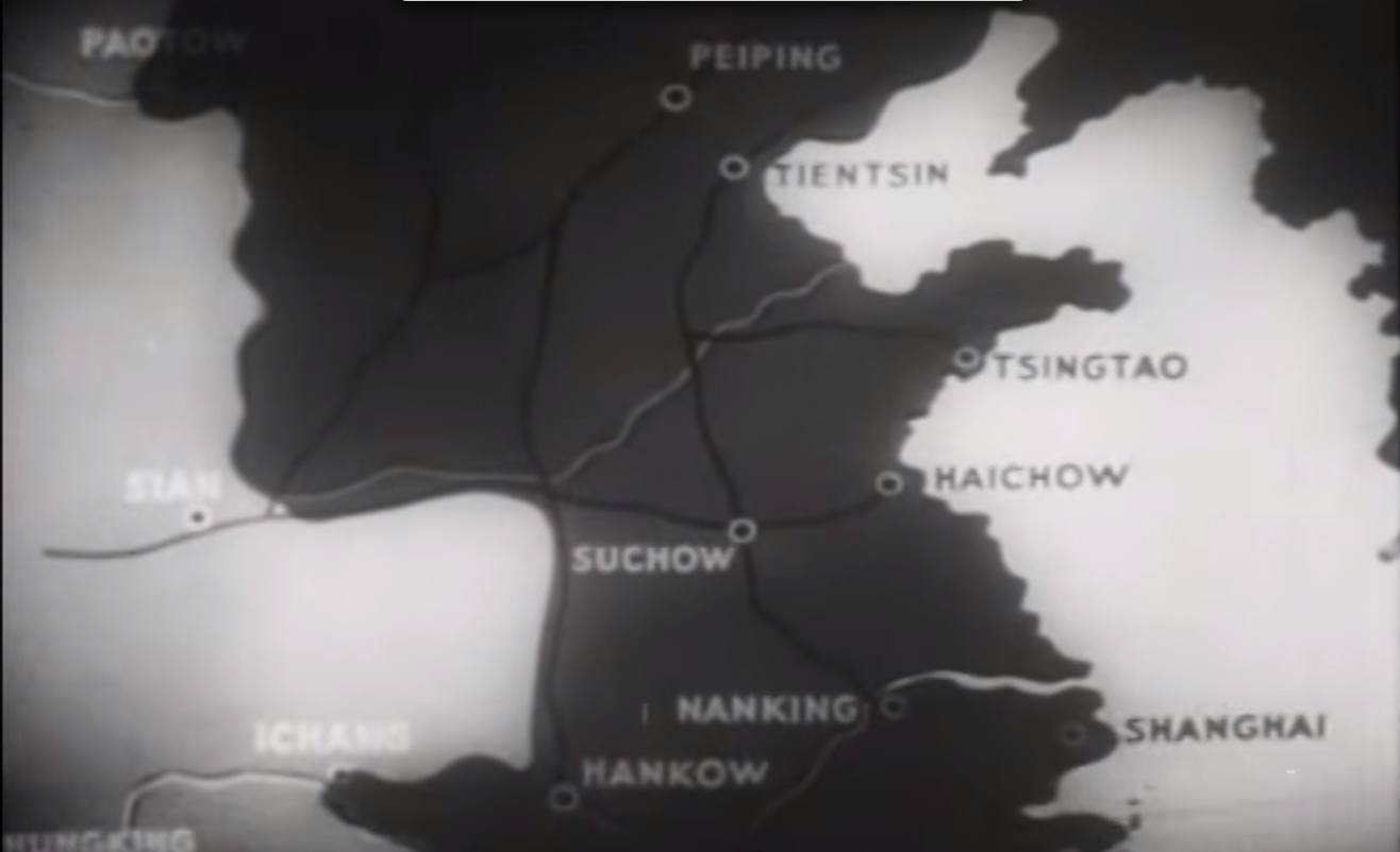
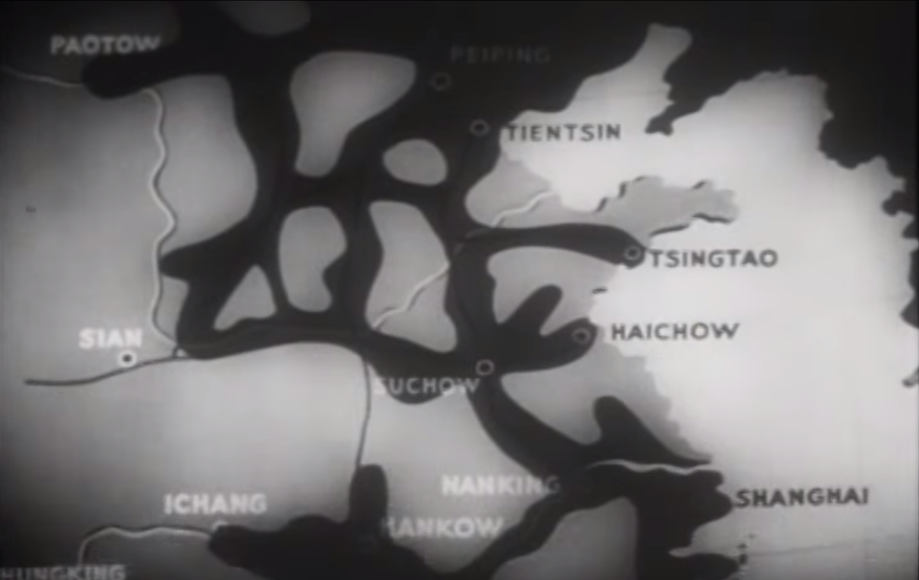
Battle of Xuzhou 1938.jpg - みや東亞

Situation map of Hukawng Valley.jpg - Arilang1234

Training at Ramgarh.jpg - Arilang1234

Map of India Burma Theatre.jpg - Arilang1234

Marco Polo Bridge Incident 1.jpg - みや東亞

盧溝橋付近.jpg - みや東亞

Nanjing republic 1940-1945.png - Kaioh Sun

Nanking incident death toll claimed by China.jpg - みや東亞

OcupaciónJaponesaDeChina1940.svg - Rowanwindwhistler

RutasDeAbastecimientoDelGobiernoDeChongqing.svg - Rowanwindwhistler

Sihangmap.svg - Derfel73
Lindsay Ride's Escape Route from HK to Chungking.jpg - Clithering

NRA Military Regions in August 1937.JPG - Anchuhu

Sihangmap trad.svg - Ericmetro

Situation at the End of World War Two.PNG - FutureTrillionaire

Japanese Occupation of China 1940.svg - Odie5533

Japanese Occupation of China 1940 de.svg - Ditch Witch

Second Sino-Japanese War WW2.png - Phead128~commonswiki

Segonda Guèrra Mondiala - Teatre chinés.png - Nicolas Eynaud

Map of East Hebei Autonomous Council.svg - Ericmetro

Map of Reformed, Provisional Gov of ROC and Mengjiang (1937-1940) - en.svg - Ericmetro

Map of Reformed, Provisional Gov of ROC and Mengjiang - zh-hant.svg - Ericmetro

China Proper 1944.png - LlywelynII
Japanese claimed zones.png - LlywelynII
Japanese zones of control.png - LlywelynII

Major Japanese drives in 1937.jpg - Prüm

Map of Reformed, Provisional Gov of ROC and Mengjiang (1937-1940) - es.svg - Rowanwindwhistler

Mengjiang, North Shanxi, South Chahar Map - Circa 1937-1939.png - Khu'hamgaba Kitap

North Shanxi Autonomous Government Map, 1937.png - Khu'hamgaba Kitap

South Chahar Autonomous Government Map c. 1937.png - Khu'hamgaba Kitap

Japanese Occupation of China 1940 (Chongqing).png - Krib

Administrative map of the United Mongol Autonomous Government.png - 荒巻モロゾフ
1937 Japanese pictorial map of East Asia during the Second Sino-Japanese War - verso.tif - Balkanique
1937 Japanese pictorial map of East Asia during the Second Sino-Japanese War.tif - Balkanique

Theaters of Chinese National Revolutionary Army.png - Seasonsinthesun
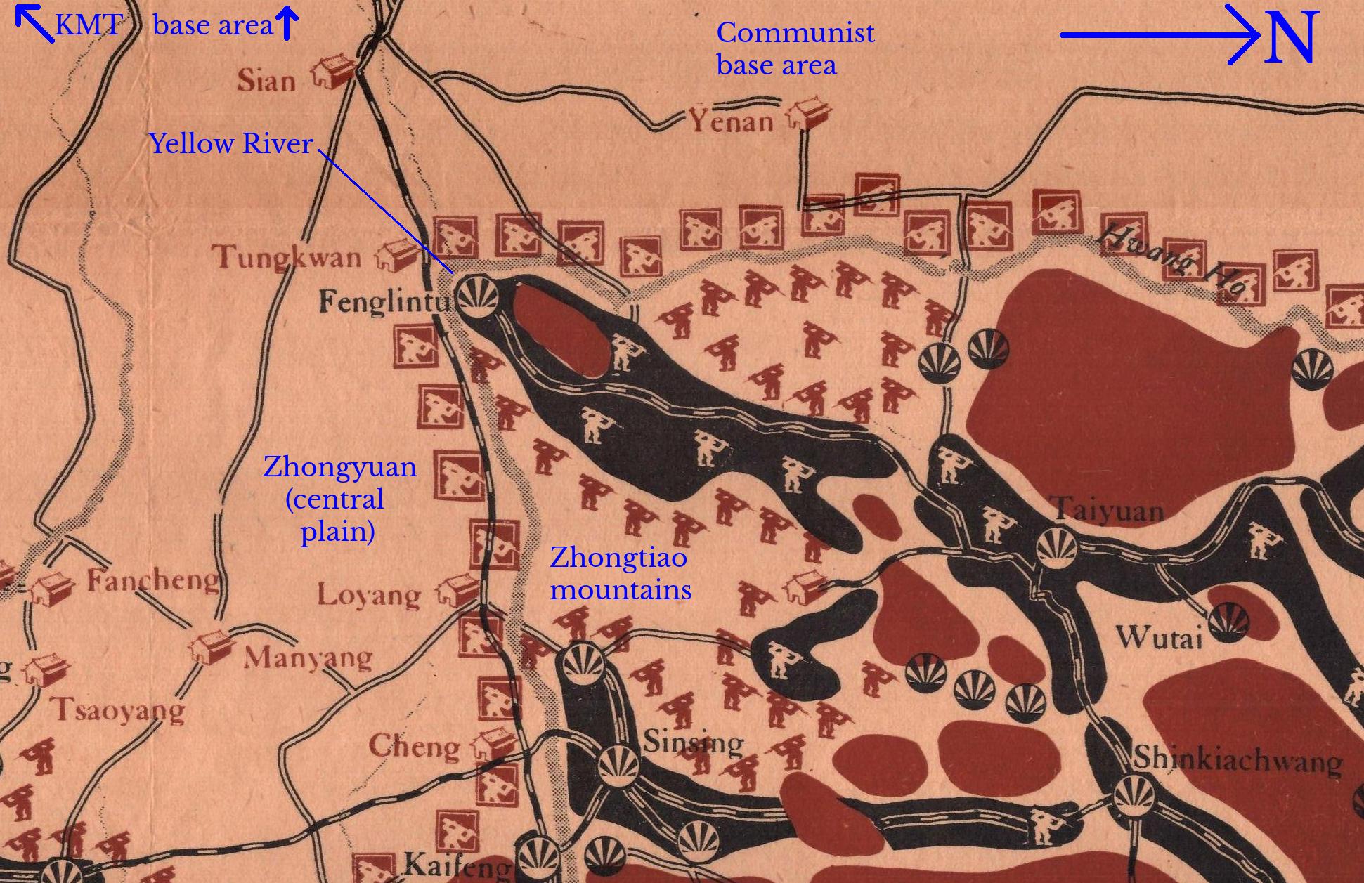
Battle of South Shanxi Context.jpg - M.R.Forrester