Wikimedi'Òc
Modes d'emploi

Cet album fait partie des albums


Gambier9.png - Ratzer
Karta FP Gambier isl.PNG - Hobe

Temoe Map.jpg - Telim tor

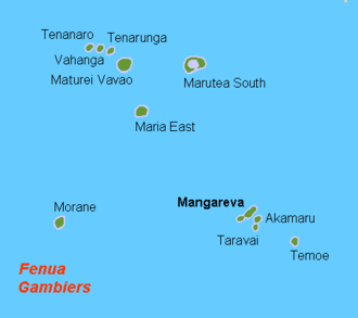
Gambier Inseln png.png - File Upload Bot (Magnus Manske)
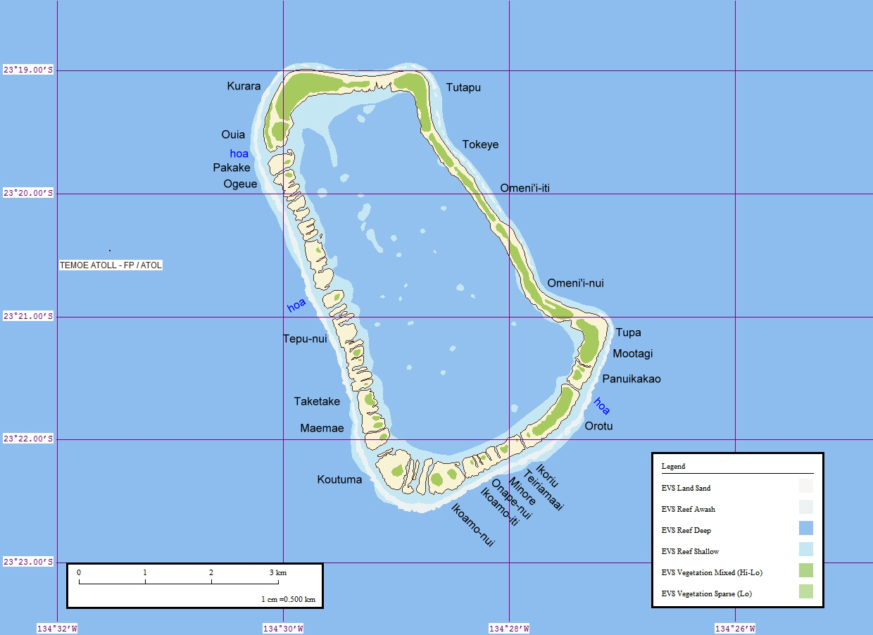
Temoe Map Names.png - Ratzer

Mangareva 1974 nautical chart.jpg - Ratzer

Map of the Gambier Islands and of Prospect Island (Temoe Atoll) by Capt. James Duff.jpg - Ratzer

Gambier Islands 1838 map.jpg - Ratzer
Gambier Islands 1826 map by Beechey.jpg - Ratzer

Map of the Gambier Islands and of Prospect Island (Temoe Atoll) by Capt James Duff (retouched).jpg - Hic et nunc

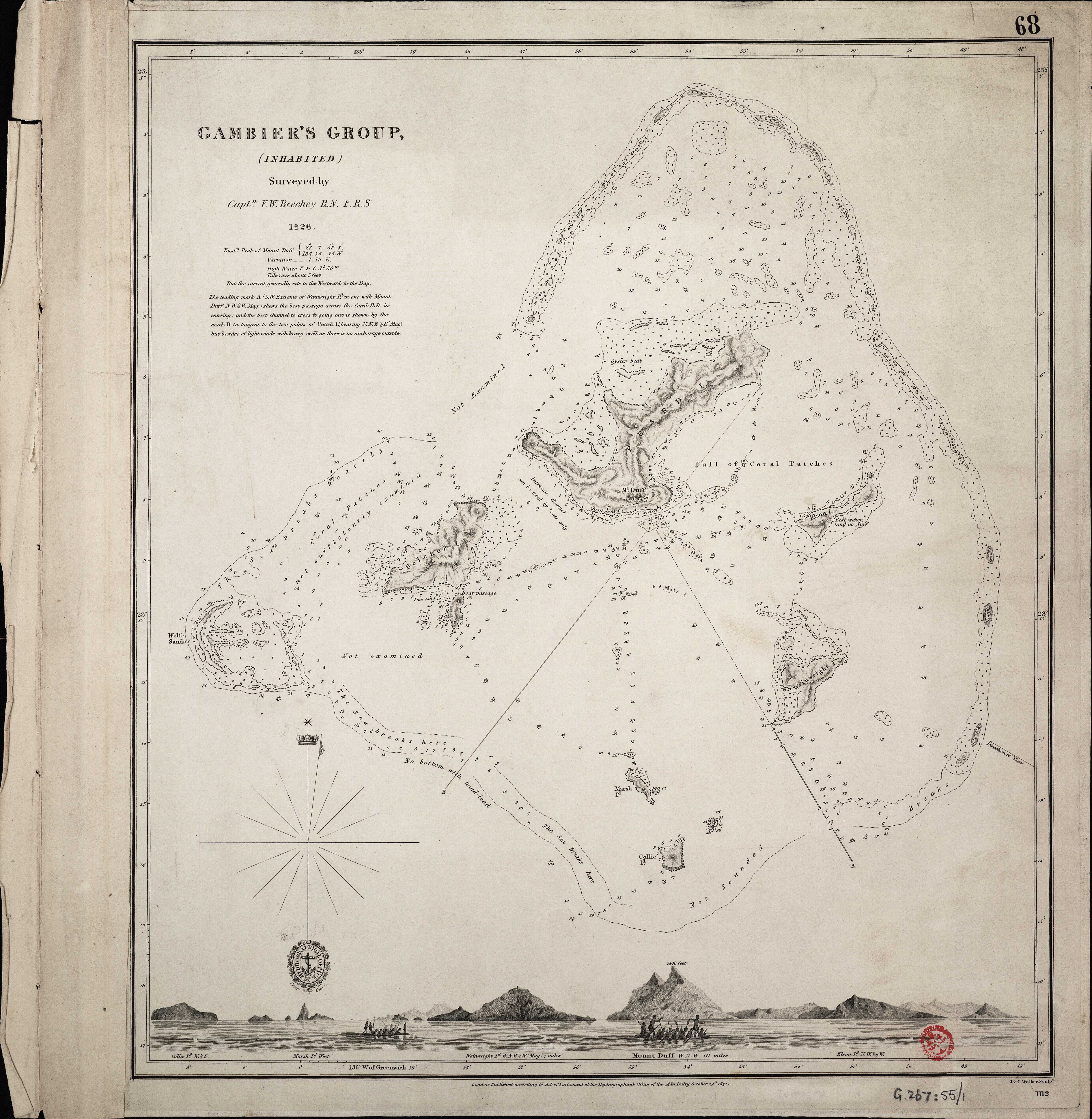
Admiralty Chart No 1112 Gambier Group, Surveyed by Beechey 1826, Published 1831.jpg - Ratzer
Admiralty Chart No 1112 Gambier's Group, (inhabited) surveyed by Captn. F.W.Beechey R.N. F.R.S. 1826. RMG F0296, Published 1831.tiff - Fæ

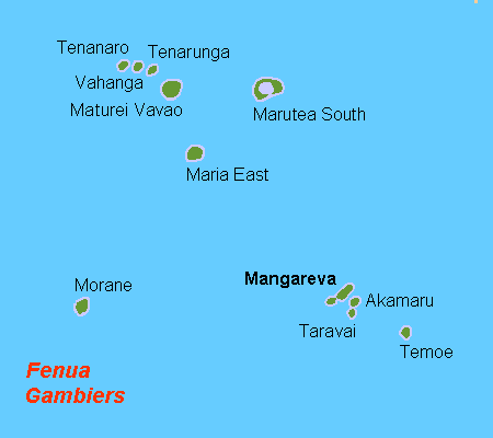
Gambier mk.png - MacedonianBoy

241 of 'Grundzüge der physischen Erdkunde ... Mit ... 20 Karten in Farbendruck' (11092187443).jpg - Artix Kreiger 2

99 of '(Geology.) On Coral Reefs and Islands ... From the author's Exploring Expedition Report on Geology, with additions' (11042506345).jpg - FlickreviewR 2

186 of '(The Geological Observer.)' (11230313164).jpg - Artix Kreiger 2

241 of 'The Geological Observer' (11230875676).jpg - Artix Kreiger 2

210 of '(The Geological Observer.)' (11233218194).jpg - Artix Kreiger 2

1799 published Gambier Island map by James Wilson of ship Duff.jpg - Deadstar

Admiralty Chart No 1112 South Pacific Pau Motu or Low Archipelago. Manga Reva or Gambier Islands (inhabitied), Published 1831.jpg - Kognos

Pacific Ocean laea Oceanian countries map.jpg - Trecătorul răcit

Mangareva 1974 nautical chart with traditional districts added.jpg - Ratzer