Wikimedi'Òc
Modes d'emploi

Cet album fait partie des albums


1591 De Bry and Le Moyne Map of Florida and Cuba - Geographicus - Florida-debry-1591.jpg - BotMultichillT
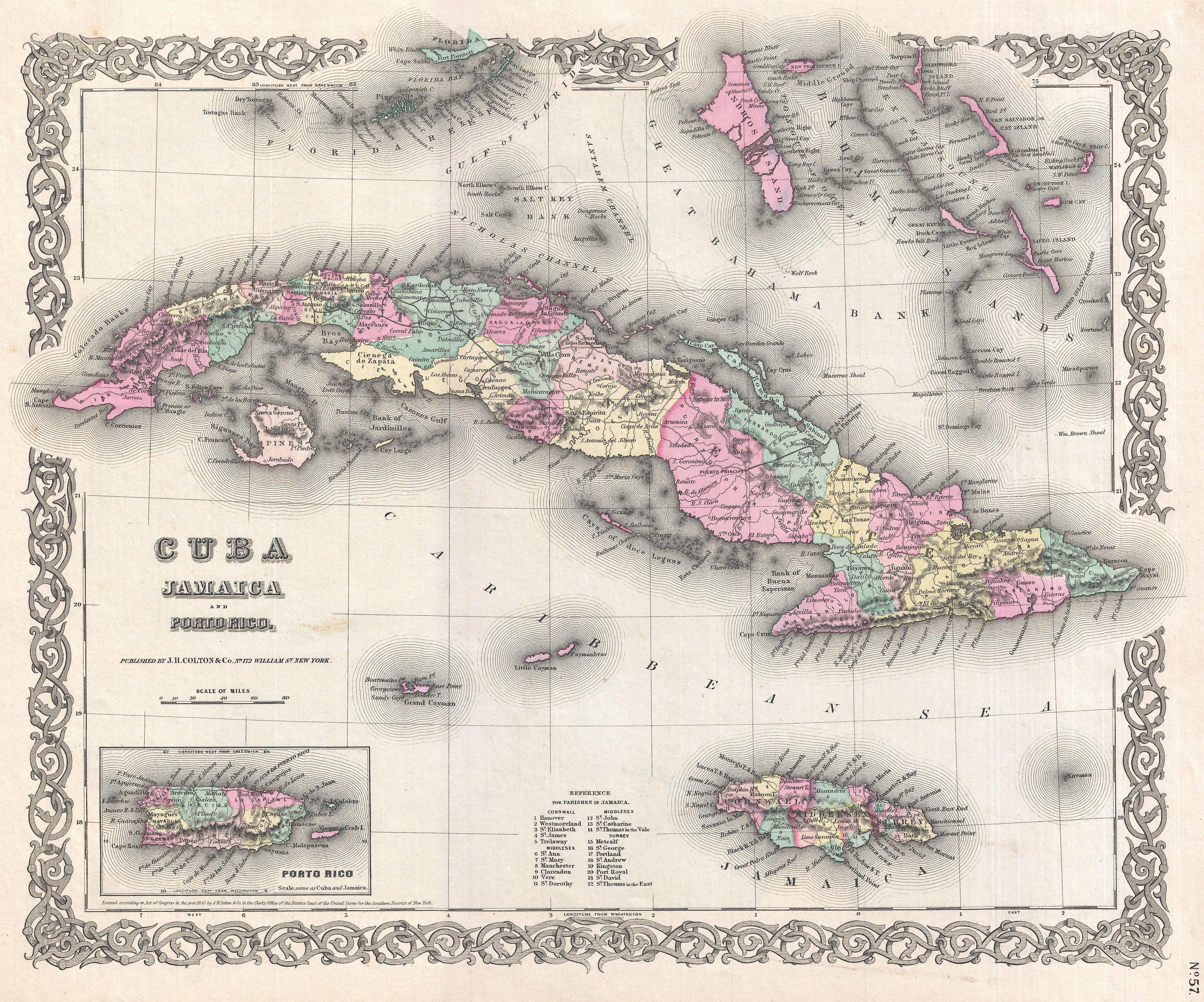
1855 Colton Map of Cuba, Jamaica and Porto Rico - Geographicus - Cuba-colton-1855.jpg - BotMultichillT

1798 Cassini Map of Florida, Louisiana, Cuba, and Central America - Geographicus - MessicoFlorida-cassini-1798.jpg - BotMultichillT

1780 Raynal and Bonne Map of Cuba, West Indies - Geographicus - Cuba-bonne-1780.jpg - BotMultichillT

1763 Terreni - Coltellini Map of Cuba and Jamaica - Geographicus - Cuba-terrini-1763.jpg - BotMultichillT

1815 Thomson Map of Cuba. Bermuda ^ the Bahamas - Geographicus - Cuba-t-1816.jpg - BotMultichillT

1591 De Bry and Le Moyne Map of Florida and Cuba - Geographicus - Florida-debry-1591 part.jpg - Swiper, nicht klau'n

Viceroyalty of the New Spain 1800 (without Philippines).png - Giggette

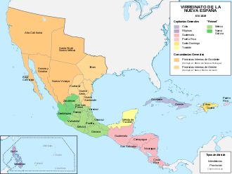
Viceroyalty of the New Spain 1819 (without Philippines).png - Giggette

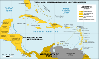
Spanish Caribbean Islands in the American Viceroyalties 1600.png - Giggette

The Spanish Borderlands (1921), map of New Spain (fragment).jpg - Fæ

DeBry Map of Caribbean & Florida1594.jpg - Tektonson

Mapa del Virreinato de la Nueva España (1819).svg - Milenioscuro

Mapa del Virreinato de la Nueva España (1794).svg - Milenioscuro

Spain, 1873-74.png - Samtoutcours

Mapa de La Habana Vieja.JPG - Akasenn

Viceroyalty of New Spain Location 1819 (without Philippines).png - Ahonc