Wikimedi'Òc
Modes d'emploi

Cet album fait partie des albums
Cet album photos contient les sous-albums suivants :


B&A on US map cropped.png - SPUI~commonswiki

B&A on US map.png - SPUI~commonswiki

Map of the railroads of Massachusetts running west from Boston (3855707941).jpg - File Upload Bot (Magnus Manske)

1837 Western Railroad map, Worcester to Springfield.jpg - Pi.1415926535

1837 Western Railroad map, Springfield to State Line.jpg - Pi.1415926535
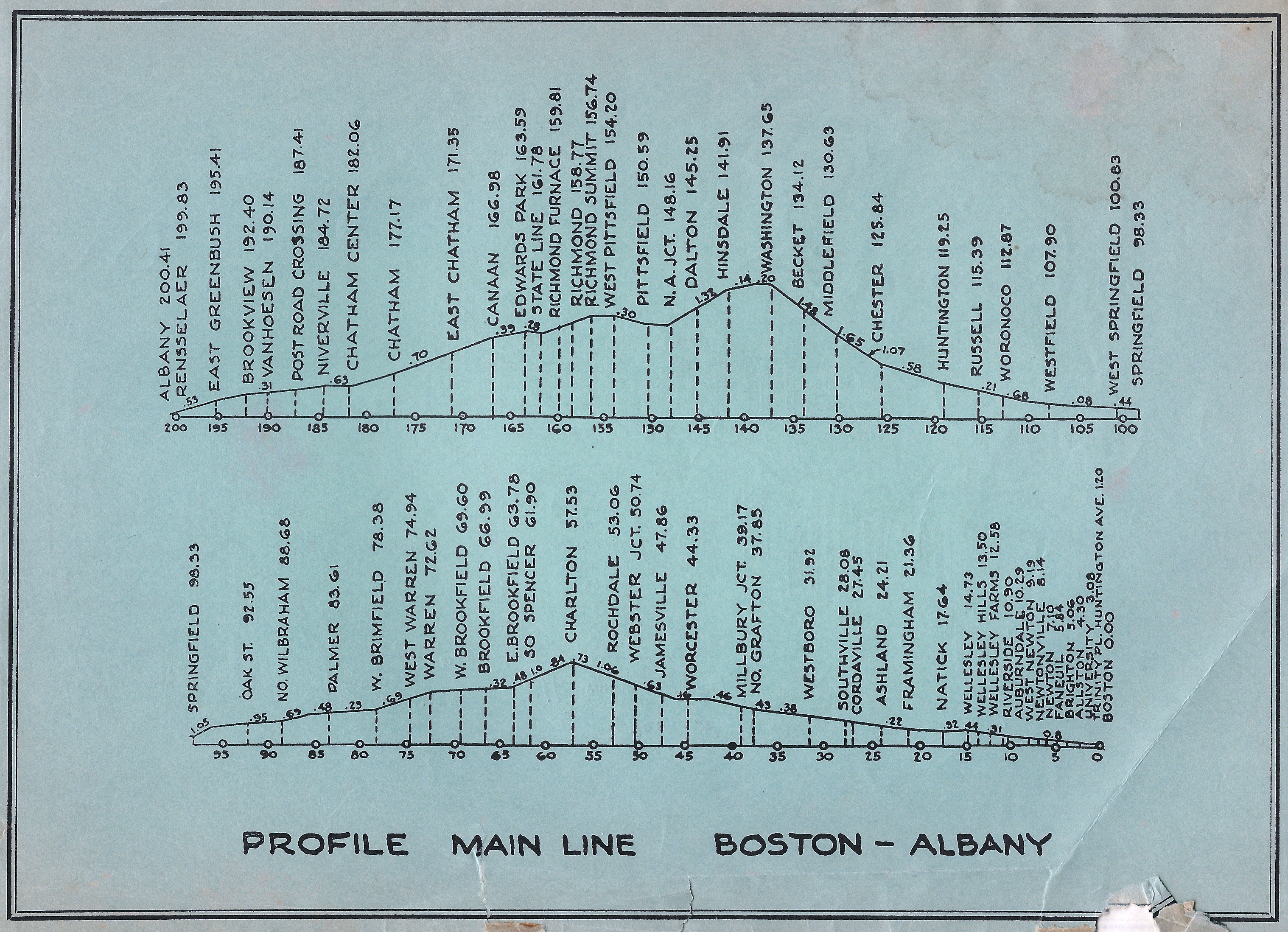
B&A 19560429 Profile.png - Lexcie

B&A 19560429 Map.png - Lexcie

1891 Lake View, Worcester map.jpg - Pi.1415926535

Survey for a proposed branch railroad between Allston and Newton.jpg - Pi.1415926535

Plan and profile of the proposed alterations of the Brighton Branch Railroad.jpg - Pi.1415926535

1882 (circa) Map of the New York Central & Hudson River and Boston & Albany Railroads, sea shore and summer resorts of New York and New England, from the Digital Commonwealth - commonwealth wd3763183.jpg - Daderot

Connections to Greylock by Boston & Albany R.R..jpg - Pi.1415926535

Map of Worcester grade revision and profile of Boston and Albany entrance, 1908.jpg - Pi.1415926535