Wikimedi'Òc
Modes d'emploi

Cet album fait partie des albums


Aleutian Islands xrmap.png - Subn~commonswiki

Map of alaska volcanoes gilbert.jpg - GarciaB~commonswiki

Map of alaska volcanoes bogoslof.jpg - GarciaB~commonswiki

Map of alaska volcanoes carlisle.jpg - GarciaB~commonswiki
Map amutka.gif - GarciaB~commonswiki

Western Aleutians.png - Thingg
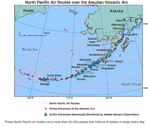
North-Pacific-air-routes.png - Maksim

AleutianIslands.jpeg - Maksim

Aleuty.png - Maksim
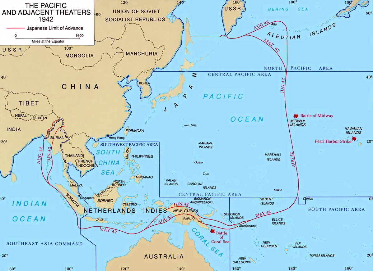
PacificTheaterAug1942.jpg - Gladiool

Aleutian Islands.PNG - Michiel1972

Mapa Hipsometryczna-Aleuty i Rów Aleucki.png - MARCIN N
Blueak.png - Patricknoddy~commonswiki

KiskaMap.jpg - Vaya

Cooper Islands.svg - Valencia~commonswiki

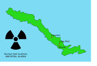
AmchitkaTestSites.svg - Adam~commonswiki

AmchitkaTestSites-es.svg - Estoymuybueno

AmchitkaTestSites he.svg - ערן
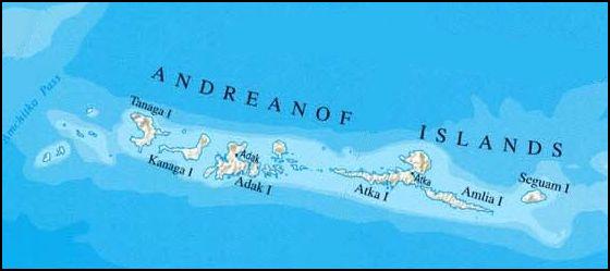
Andreanof Map.jpg - Ulrich Kaden
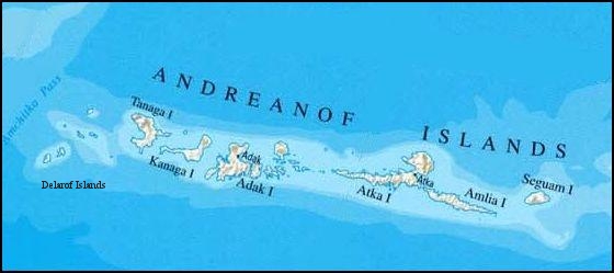
Andreanof Map Delarof.jpg - Ulrich Kaden
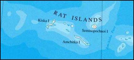
Rat Islands II.jpg - Ulrich Kaden

Fox Islands.jpg - Ulrich Kaden

Near Islands.jpg - BetacommandBot

Aleuten Lage.png - Carport
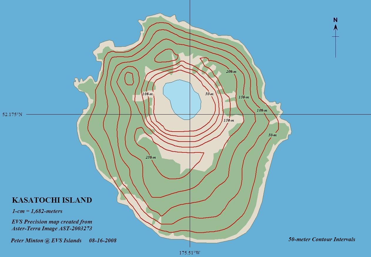
Kasatochi Island map.jpg - Telim tor
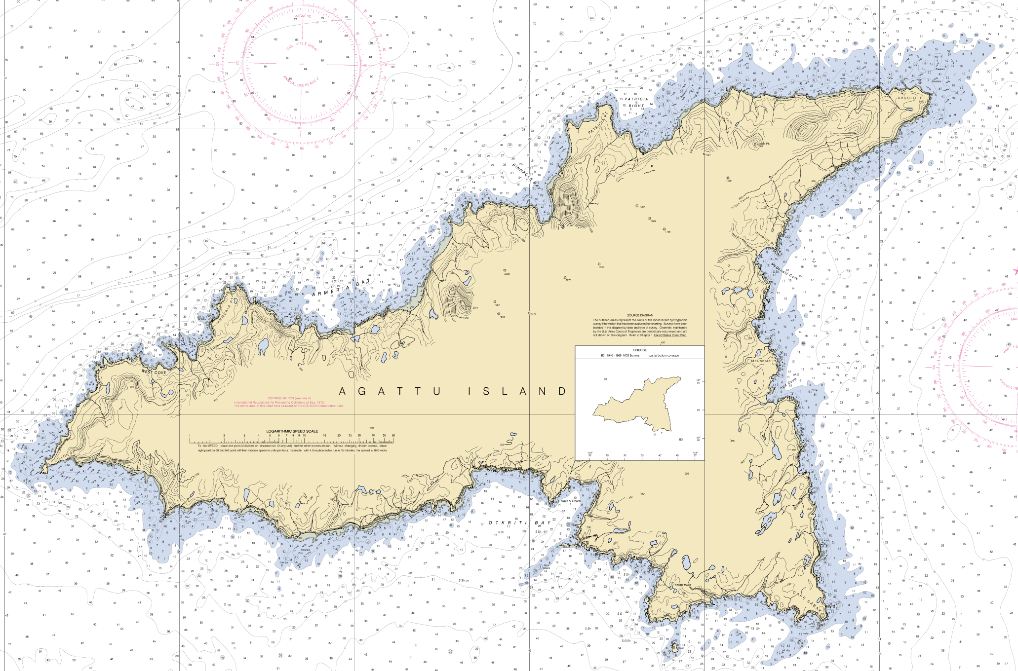
Agattu Island.png - Cmdrjameson

NizkiMap.png - Edibobb

SemisopochnoiMap.png - Edibobb

SemisopochnoiNauticalChart.png - Edibobb

BobrofMap.png - Edibobb

Littlesitkin.png - Edibobb
Avo map 46.png - Edibobb
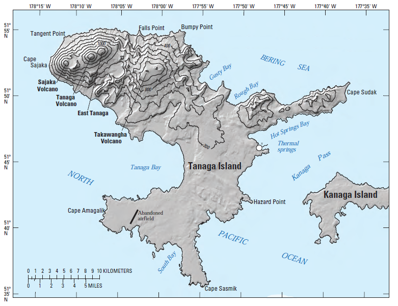
TanagaMap.png - Edibobb

KoniujiMap.png - Edibobb

Amaknak Island EO 5243 illustration.png - Clindberg

Amak Island EO 5318 illustration.png - Obscure2020

Aleutian Islands Reservation EO 1733 illustration.jpg - Clindberg
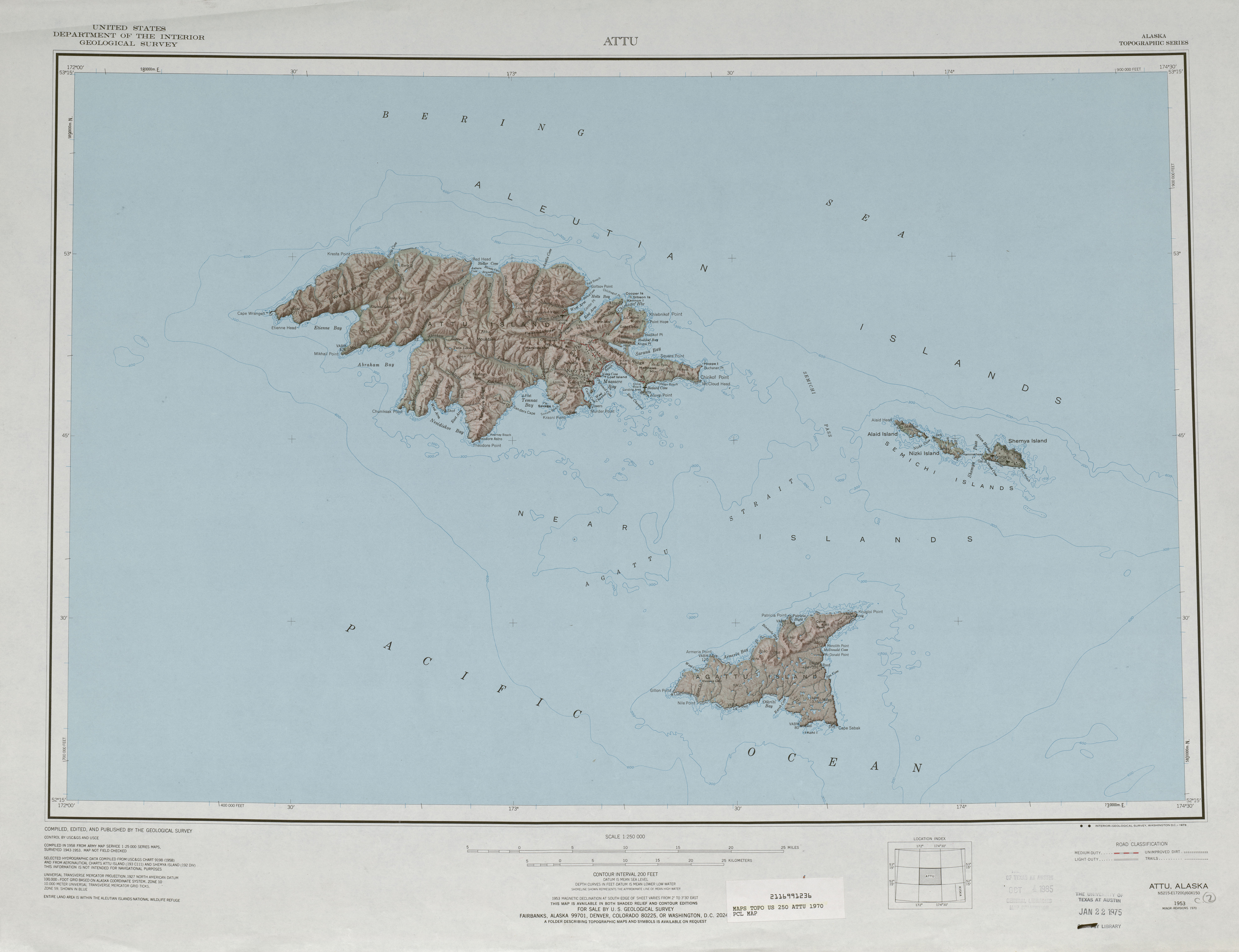
Txu-pclmaps-topo-us-attu-1970.jpg - Ratzer
Aleutians.jpg - WikiCopter

1873 U.S. Coast Survey Map of the Aleutian Islands, Alaska - Geographicus - AleutianIslands-uscs-1873.jpg - BotMultichillT
Amchitka Island Map.jpg - Bomazi
Aleuten Lage-blank.png - Amirki

Aleuten Lage-he.png - Amirki

Aleuudide-idaosa.png - Geonarva

Foxi-saarte-kaart.png - Geonarva

Map Presenting the Discoveries of Russian Navigators in the Pacific Ocean, as Well as Those of Captain Cook WDL127.png - Fæ
Rigobert-Bonne-Atlas-de-toutes-les-parties-connues-du-globe-terrestre MG 0007.tif - Hansmuller

Alaska.PNG - UWCTransferBot

Aleutian Islands map - 2.png - GifTagger

AttuIslandWW2.png - GifTagger
Operational Navigation Chart E-11, 4th edition.jpg - Revent

Operational Navigation Chart E-12, 3rd edition.jpg - Revent

Operational Navigation Chart E-13, 2nd edition.jpg - Revent

EB9 Aleutian Islands.jpg - Library Guy
EQuakes-aleutian-beachballl-2014.pdf - OgreBot

The American Museum journal (c1900-(1918)) (17537803104).jpg - SteinsplitterBot

Fur-seal fisheries. Hearings before the Committee on Conservation of Natural Resources on bill (S.7242) entitled "An act to protect the seal fisheries of Alaska, and for other purposes (1910) (14597636957).jpg - SteinsplitterBot

FMIB 37656 Alaska Peninsula Fisheries Reservation, including the waters of the Aleutian Islands Reservation.jpeg - BMacZeroBot

Atlas and zoogeography of common fishes in the Bering Sea and Northeastern Pacific - M. James Allen, Gary B. Smith (1988) (20156926900).jpg - Fæ

Reports of the Department of the Interior for the Fiscal Year ended June 30, 1909 (1910) (14577807837).jpg - Fæ
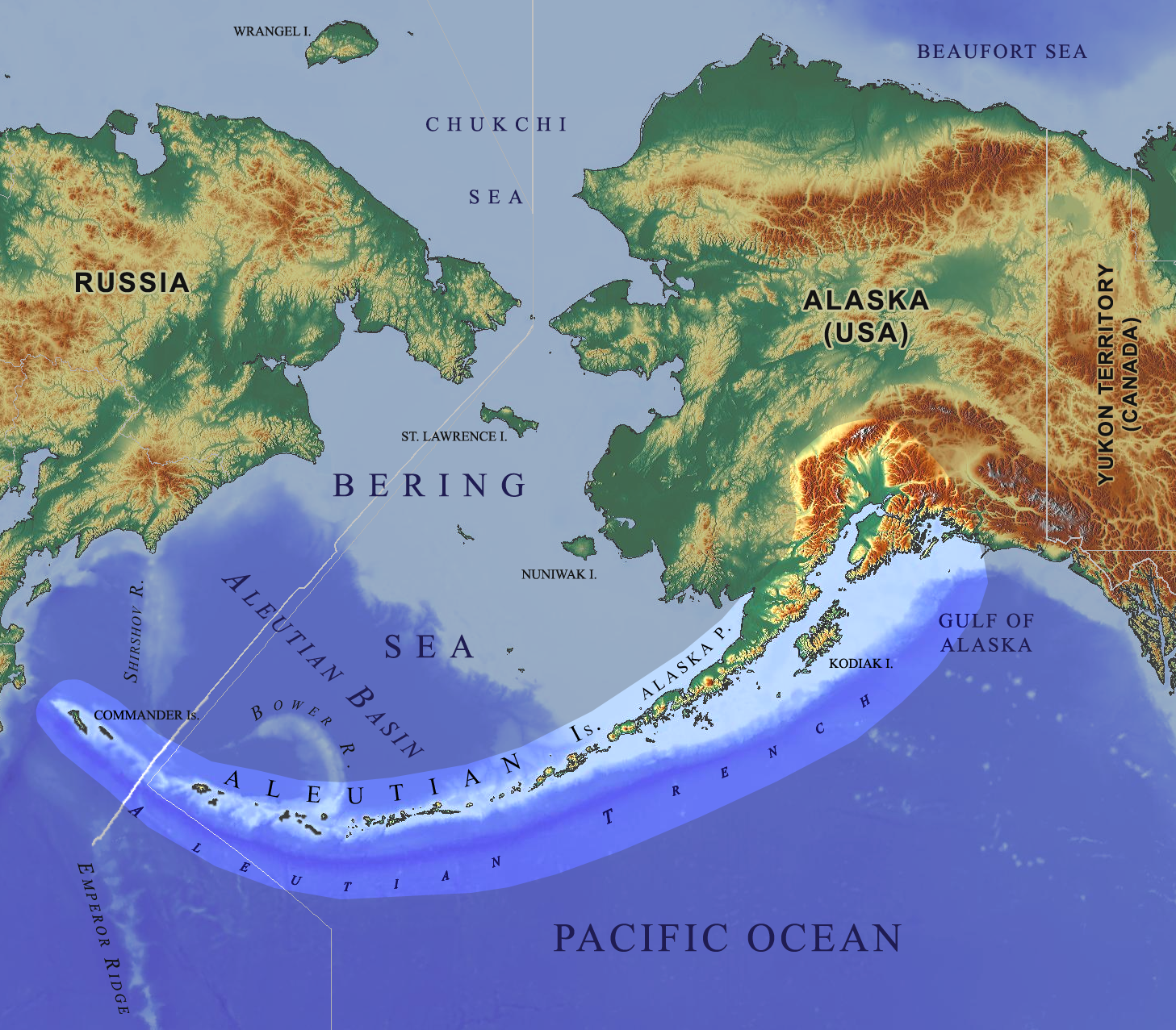
Bering Sea Aleutian Is Alaska map.png - Gretarsson
Aleutian arc physical geography.png - Gretarsson
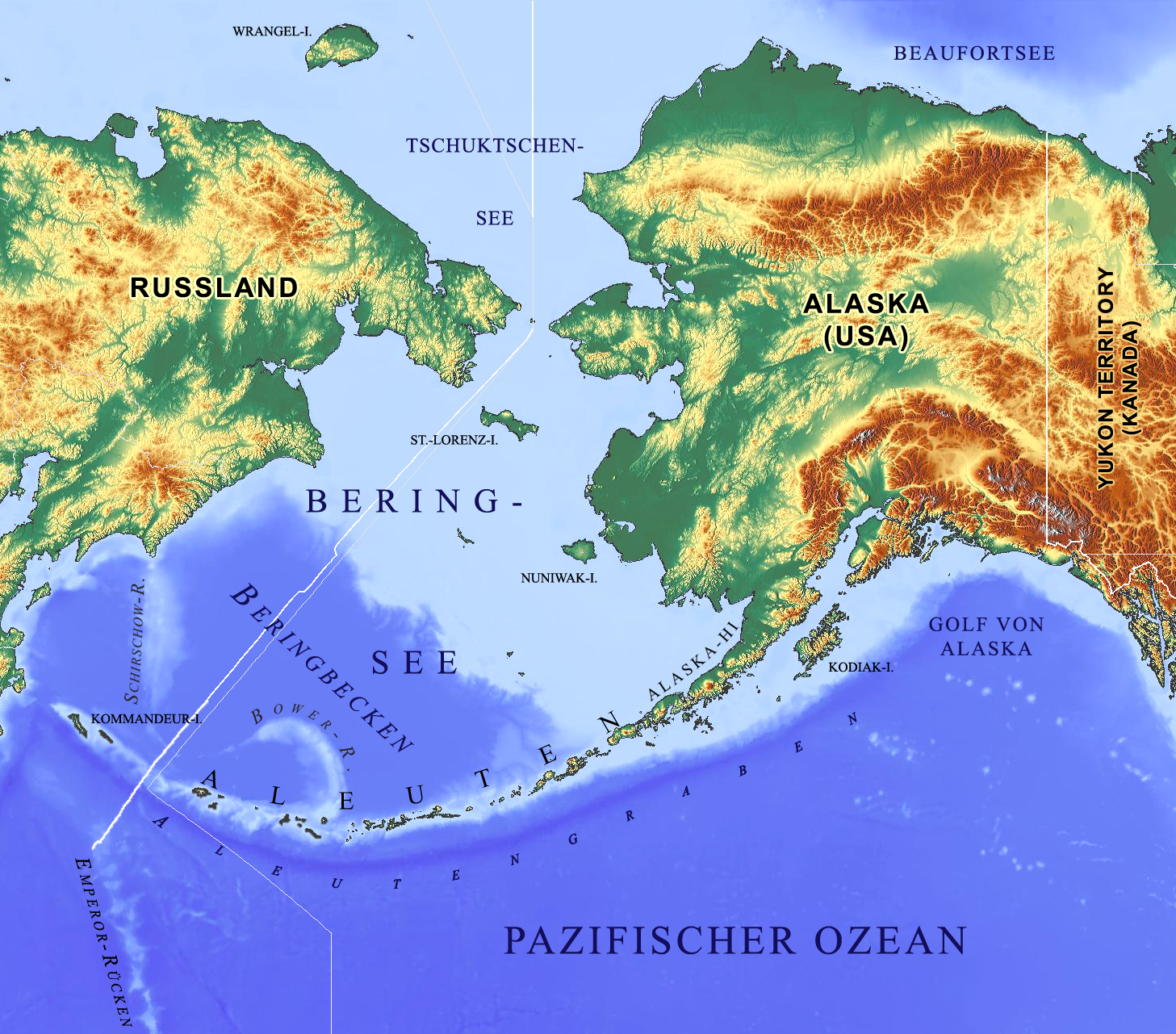
Beringmeer-Aleuten-Karte.png - Gretarsson

Karte Aleuten-Vulkanbogen.png - Gretarsson

Aleutian Islands map nationalatlas.jpg - Gretarsson

Image taken from page 47 of 'History of the Pacific States of North America' (15970447213).jpg - Artix Kreiger 2

Image taken from page 94 of 'The Native Races of the Pacific States of North America. (With maps.)' (16590198315).jpg - Artix Kreiger 2

102 of '(The Imperial Gazetteer; a general dictionary of geography, physical, political, statistical and descriptive ... Edited by W. G. Blackie ... With ... illustrations, etc.)' (11063826264).jpg - Artix Kreiger 2

M 7.9 - 19km SE of Little Sitkin Island, Alaska - intensity.jpg - Theodore Xu

Adak be.svg - Frantishak

Aleutian Islands, outlined in red.png - Unschool

Alaska and the Aleutians.jpg - Zoozaz1

Alaska and the Aleutians Map.jpg - Zoozaz1

Карта Восточного океана, 1851.jpg - Vladis13

Kiska Island.png - Vallee

Admiralty Chart No 2460 Kamchatka to Kodiak Island, Published 1884, New Edition 1917.jpg - Kognos

Admiralty Chart No 2460 Kamchatka to San Francisco, Published 1942, Large Corrections 1960.jpg - Kognos
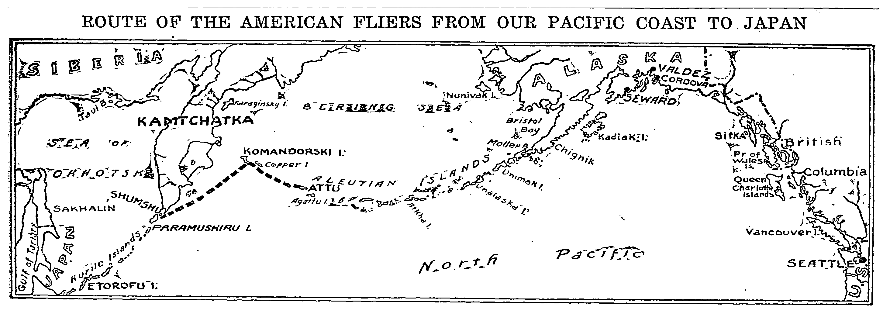
1924 map of American fliers route from Alaska to Japan.png - Abzeronow