Wikimedi'Òc
Modes d'emploi

Cet album fait partie des albums
Cet album photos contient les sous-albums suivants :


MapMarne.jpg - Maksim
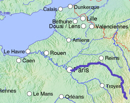
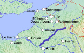
MapOise.jpg - Maksim

Rance.map.wmt.png - Wmeinhart

Lorraine hydrologic map.svg - Sting

Panneau Calonne.JPG - Fab27~commonswiki

Deule.png - Bilou~commonswiki

BarragesCarteCassini.jpg - Lamiot
MapAisne.jpg - SieBot
MapAin1.jpg - SieBot
MapSomme.jpg - SieBot

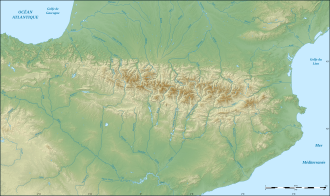
Pyrenees relief map with rivers-fr.svg - Sting

Location Authie and Bresle River-fr.svg - Sémhur
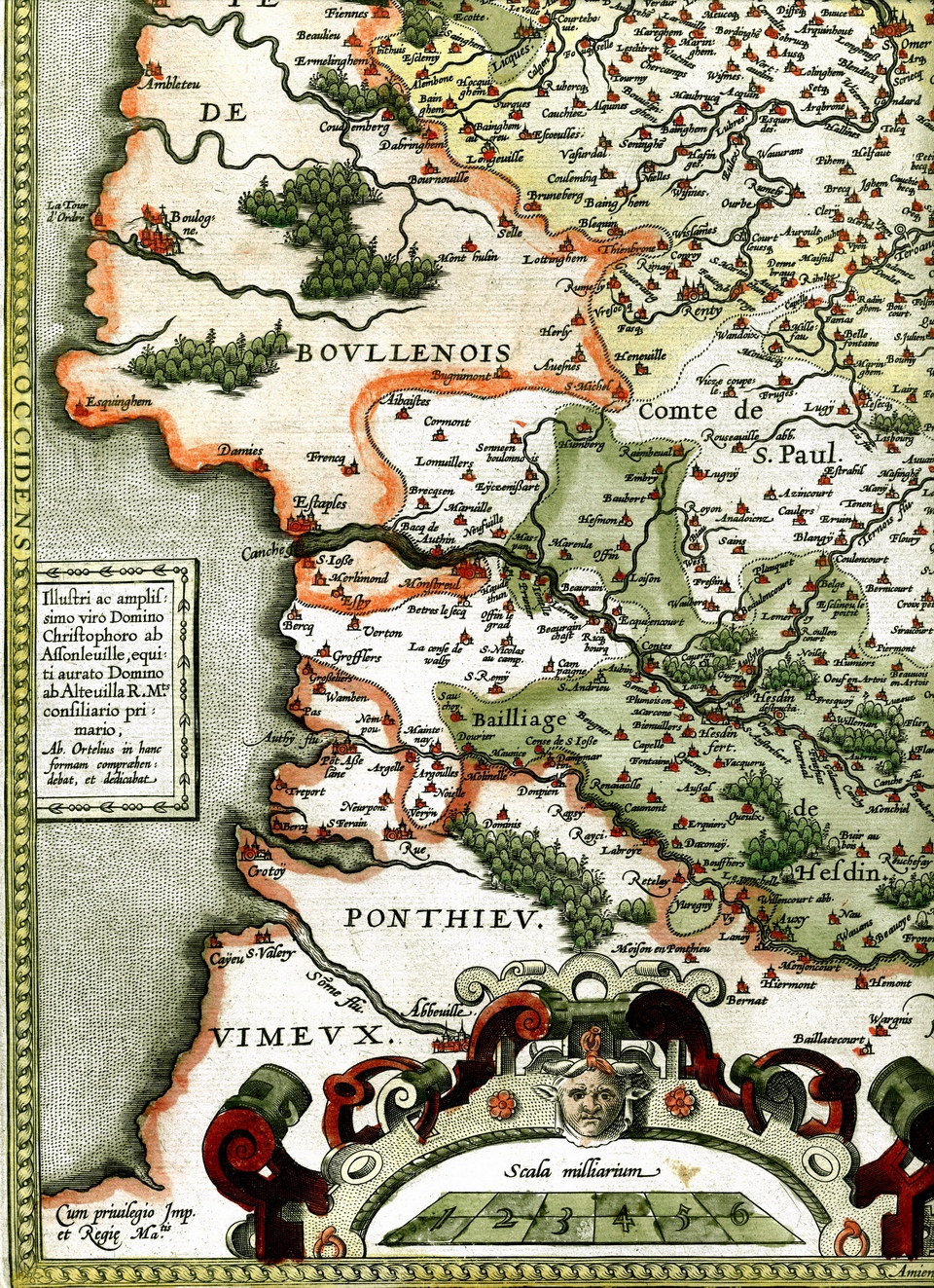
1576 Ortellius ARTOIS.jpg - Royonx

Méménil Vosges Hydrographie.svg - Infofiltrage

Hydrologie en Isère.svg - Kyro

Karte der Moselstaustufen.png - Chumwa

Rivières Lannemezan.JPG - Hey65

Rivière la Maine Vendée.png - Cyril5555

Topographic map of South-West France with main rivers and cities.svg - Pethrus

Topographic map of Garonne and Adour.svg - Pethrus

France Rivers of Gers.svg - Pethrus

France Rivers of Gers with 1977 inundation effects.svg - Pethrus
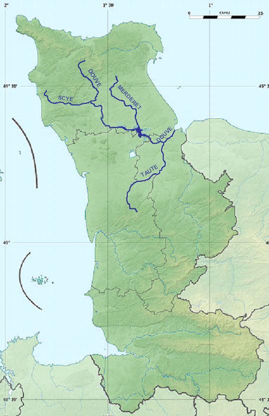
Douve.jpg - LEMEN

Bassinversantnpdc.svg - Pichasso

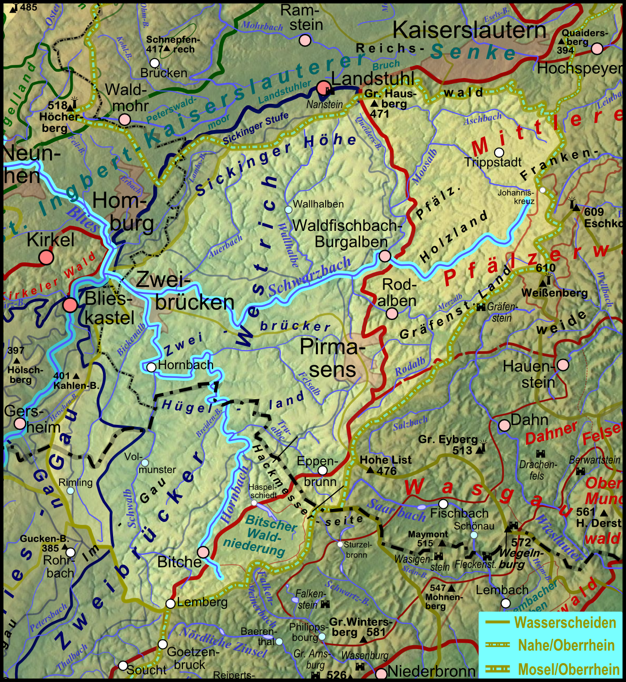
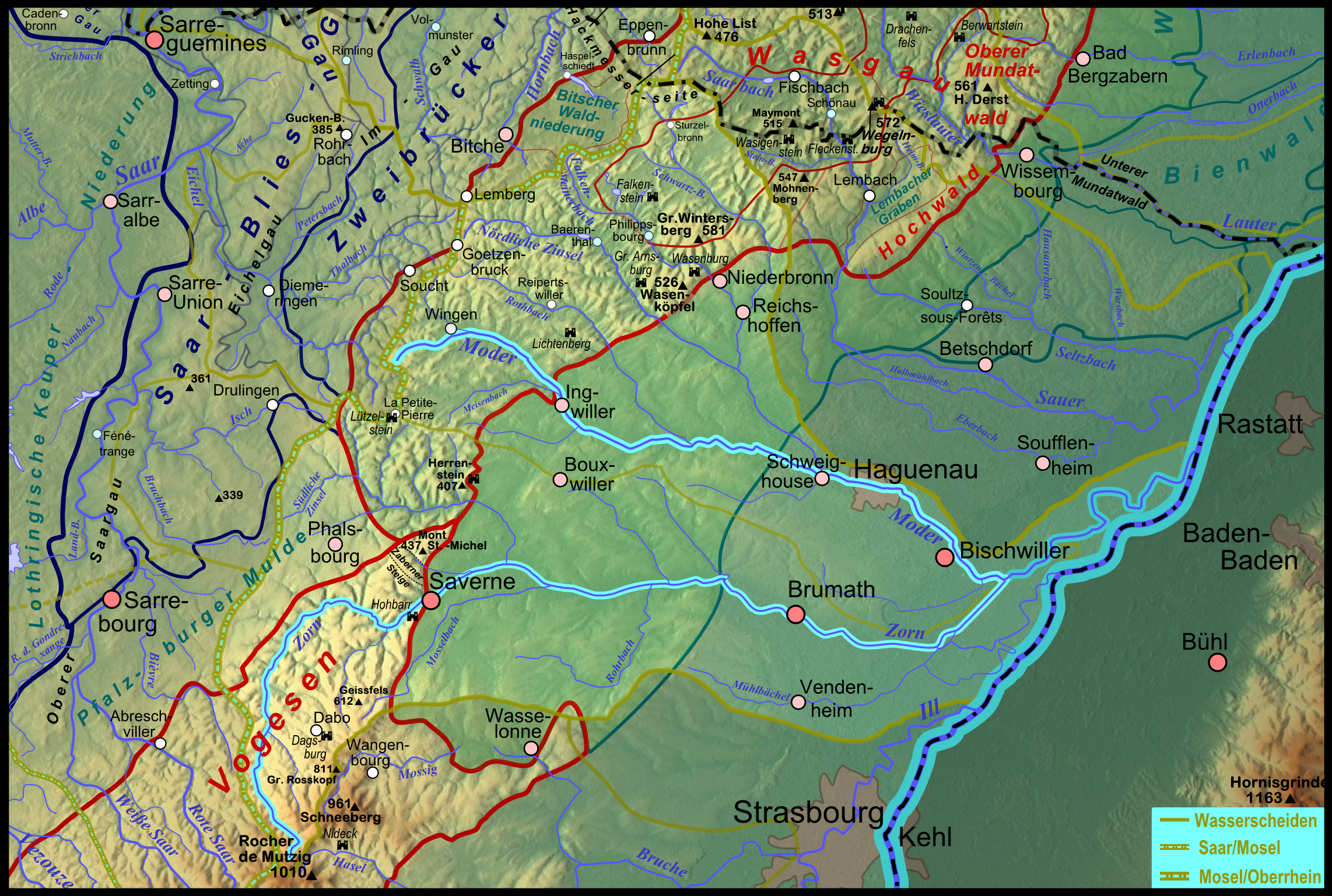
Pfaelzerwaldkarte Flussgebiete.png - Elop
Pfaelzerwaldkarte Flussgebiete Schwarzbach.png - Elop

Pfaelzerwaldkarte Flussgebiete Wieslauter.png - Elop

Pfaelzerwaldkarte Flussgebiete Sauer.png - Elop

Pfaelzerwaldkarte Flussgebiete Hauptwasserscheiden.png - Elop

Pfaelzerwaldkarte Flussgebiete Blies.png - Elop

Pfaelzerwaldkarte Flussgebiete Hornbach.png - Elop

Pfaelzerwaldkarte Flussgebiete Isch.png - Elop

Pfaelzerwaldkarte Flussgebiete Eichel.png - Elop
Pfaelzerwaldkarte Flussgebiete Moder.png - Elop

Pfaelzerwaldkarte Flussgebiete Zorn.png - Elop

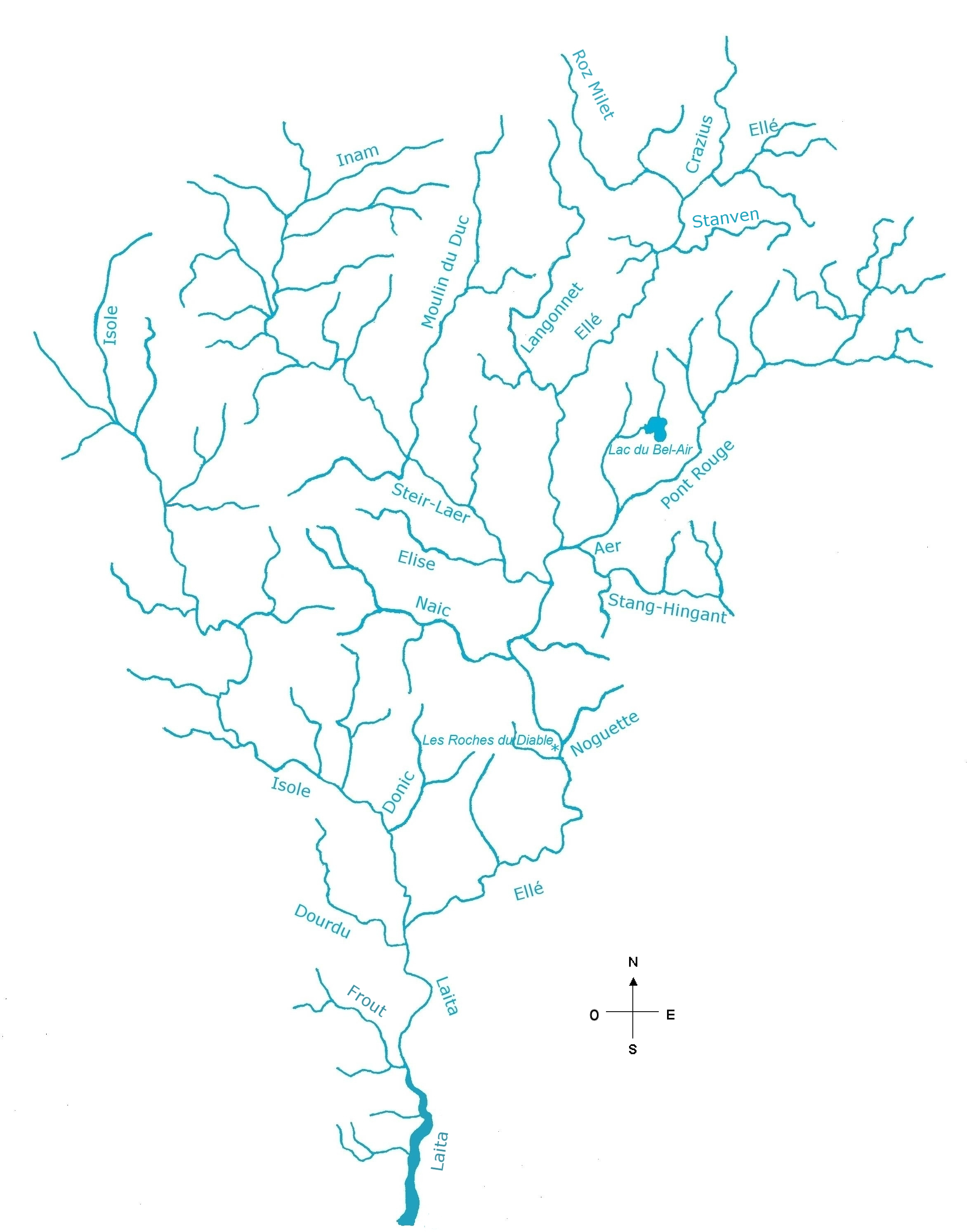
Affluents de la rivière Ellé carte.jpg - Lanzonnet

Rivière Aven.jpg - Lanzonnet

Laita carte.jpg - Lanzonnet

Scorff03.jpg - Lanzonnet
Laita affluents.png - Lanzonnet
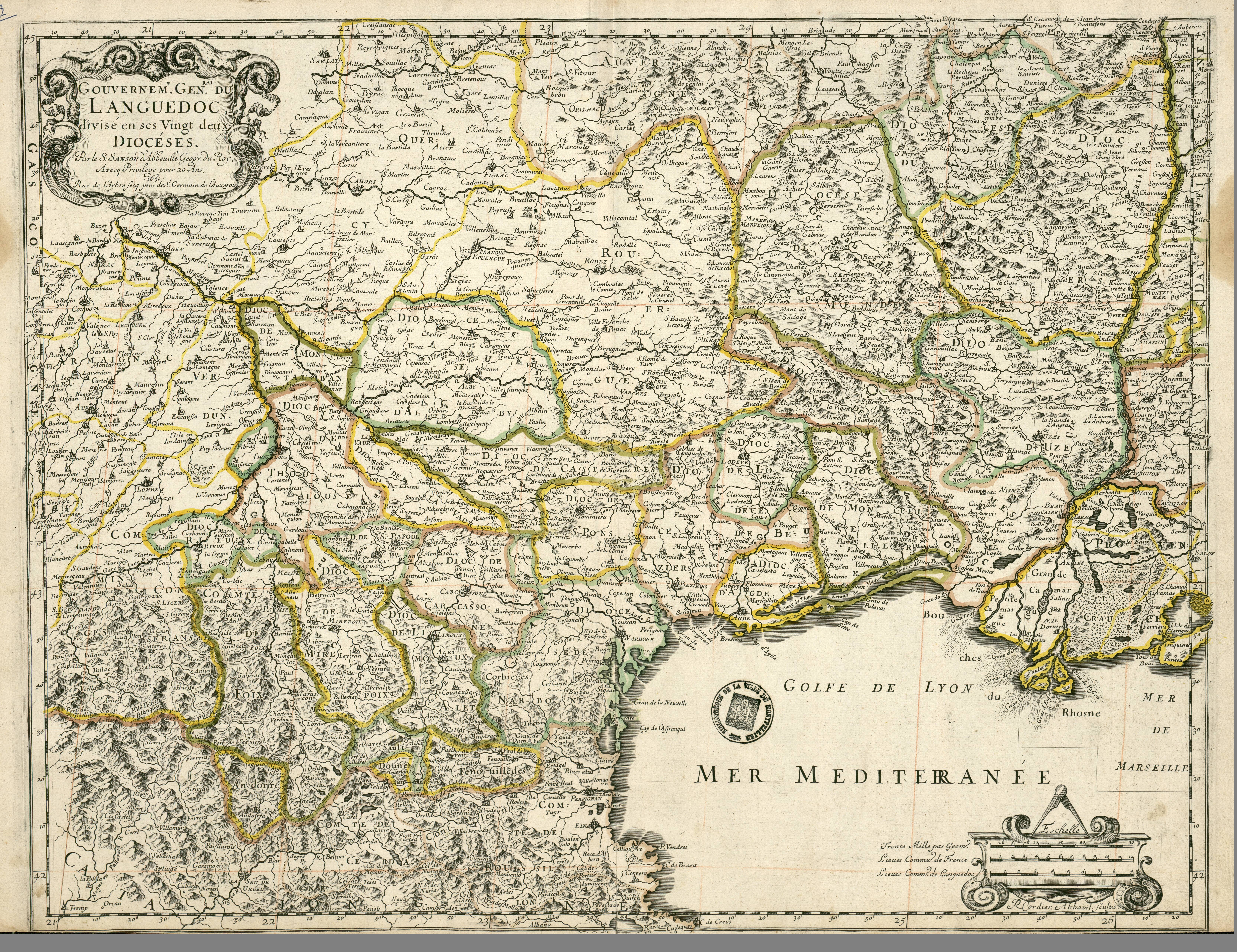
Gouvernement général du Languedoc (Nicolas Sanson, 1651).jpg - Ancalagon
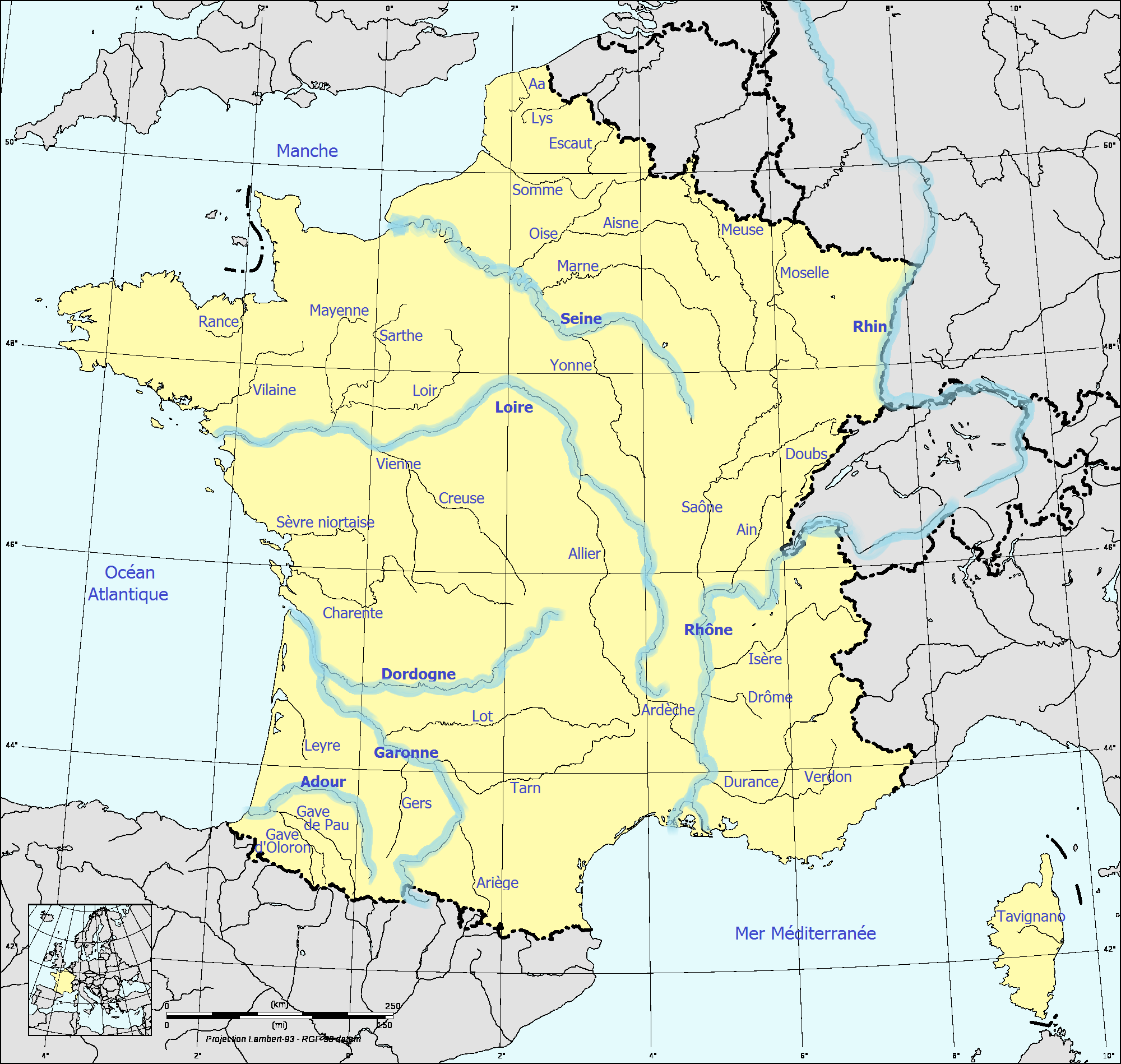
France fluvial.png - Lvcvlvs

Cenischia location map.jpg - F Ceragioli

Besançon location map.svg - Bourrichon

Planloing.png - Mat147

Planclery.png - Mat147

Planclery1.png - Mat147
Planbiberonneetbeuvronne.png - Mat147

Rivière Aven carte.png - Cadouf
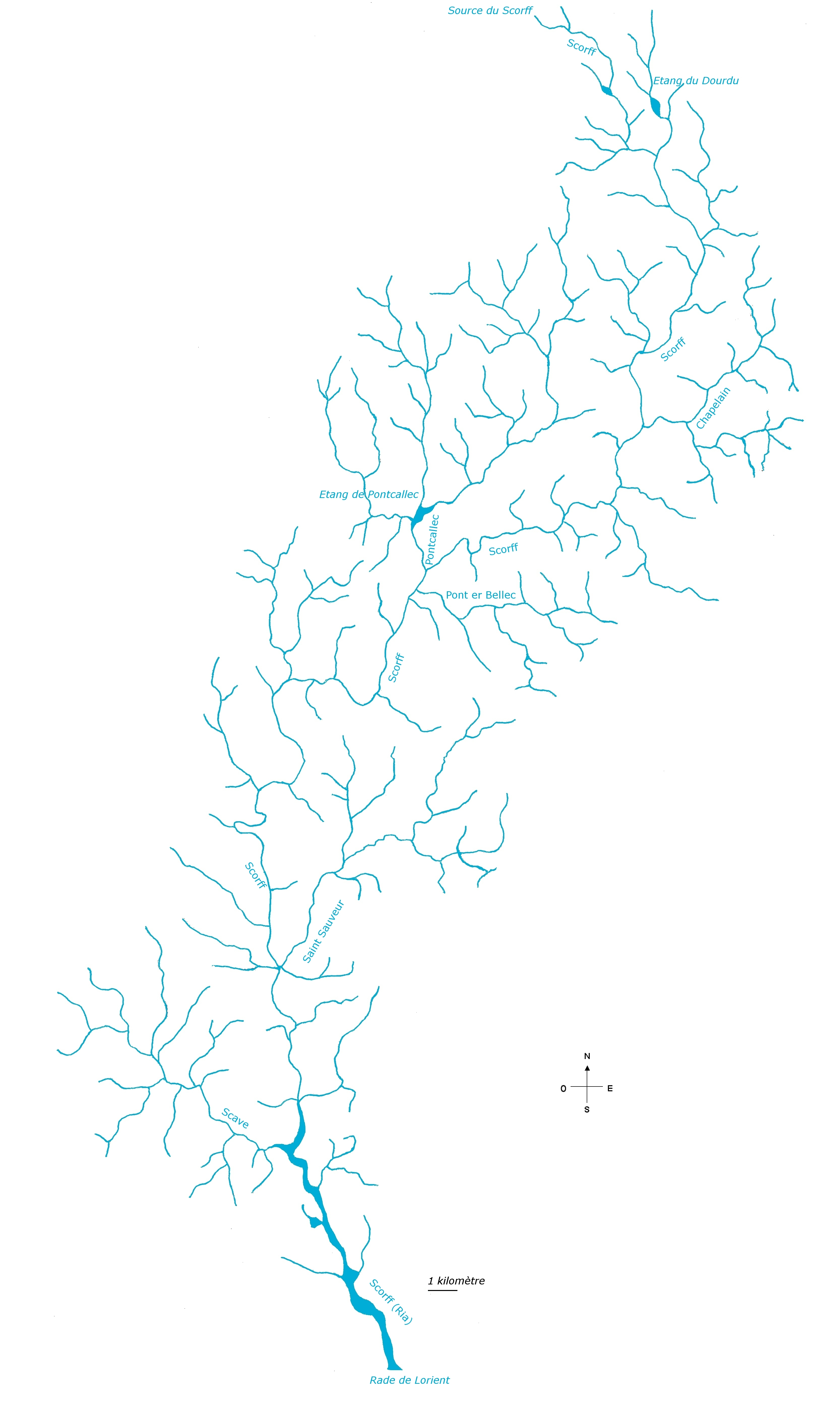
Rivière Scorff carte.png - Cadouf

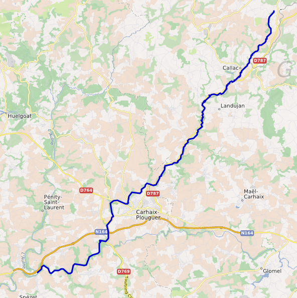
Rivière Aulne carte.png - Cadouf

Rivers and Lakes of France.png - Poulpy

Carte Eutie pi Brele Riviere-pcd.png - Geoleplubo
Lorraine Zorn.PNG - Anael Hagner

Rio san luigi mappa.png - Pampuco

Former stream bed of the Adour river (France).jpg - Tangopaso

Raille - Oron.png - Ulamm

Les Collières DE.png - Ulamm

Les Collières FR.png - Ulamm

Haut Calavon, Riaille, Largue+loc.png - Ulamm

River Aa location.jpg - David-waterways

Aa and connecting waterways.jpg - David-waterways

River Scarpe waterway location.jpg - David-waterways

Sarthe river.jpg - David-waterways

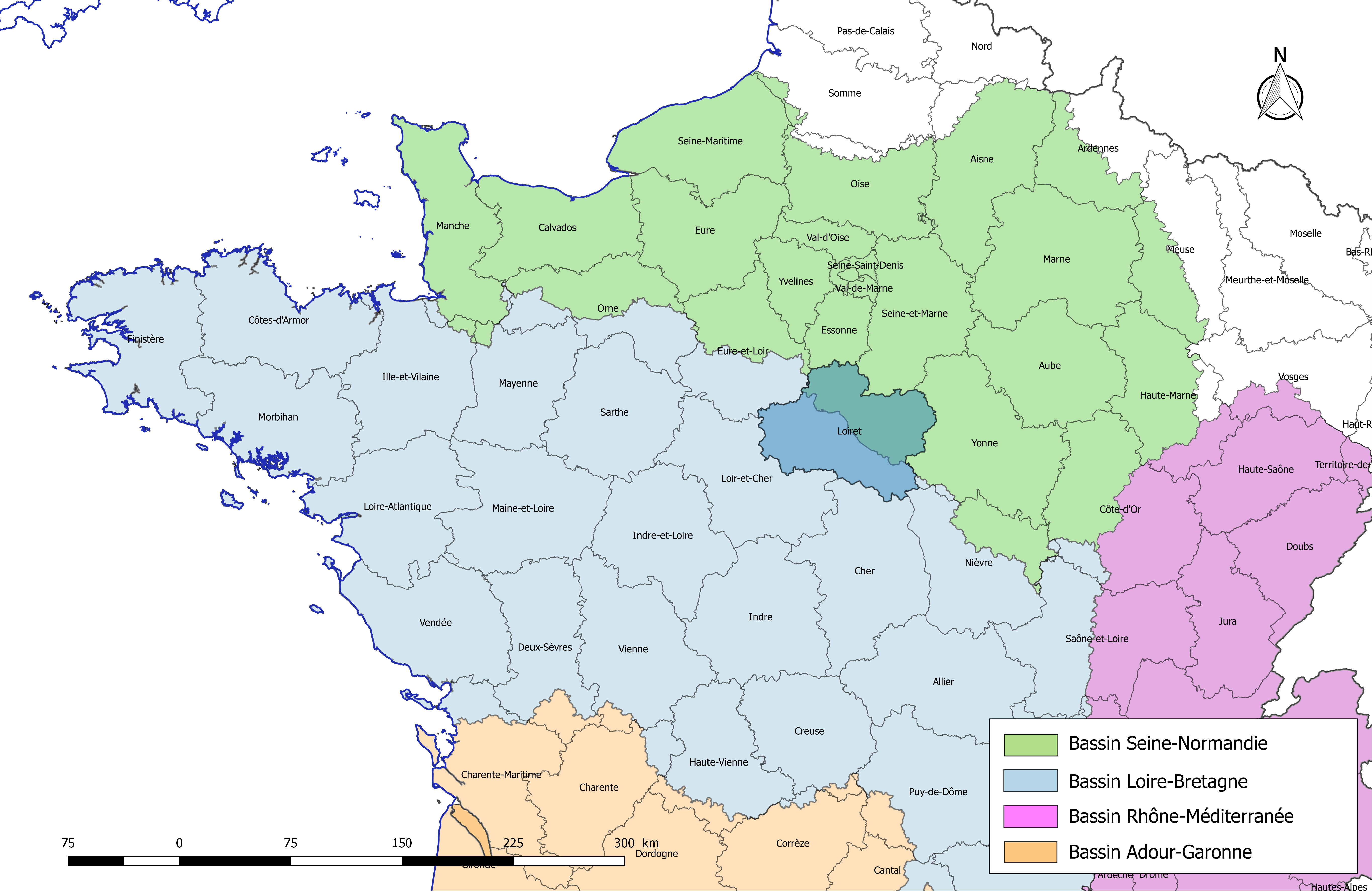
France-Régions-hydro.png - Roland45

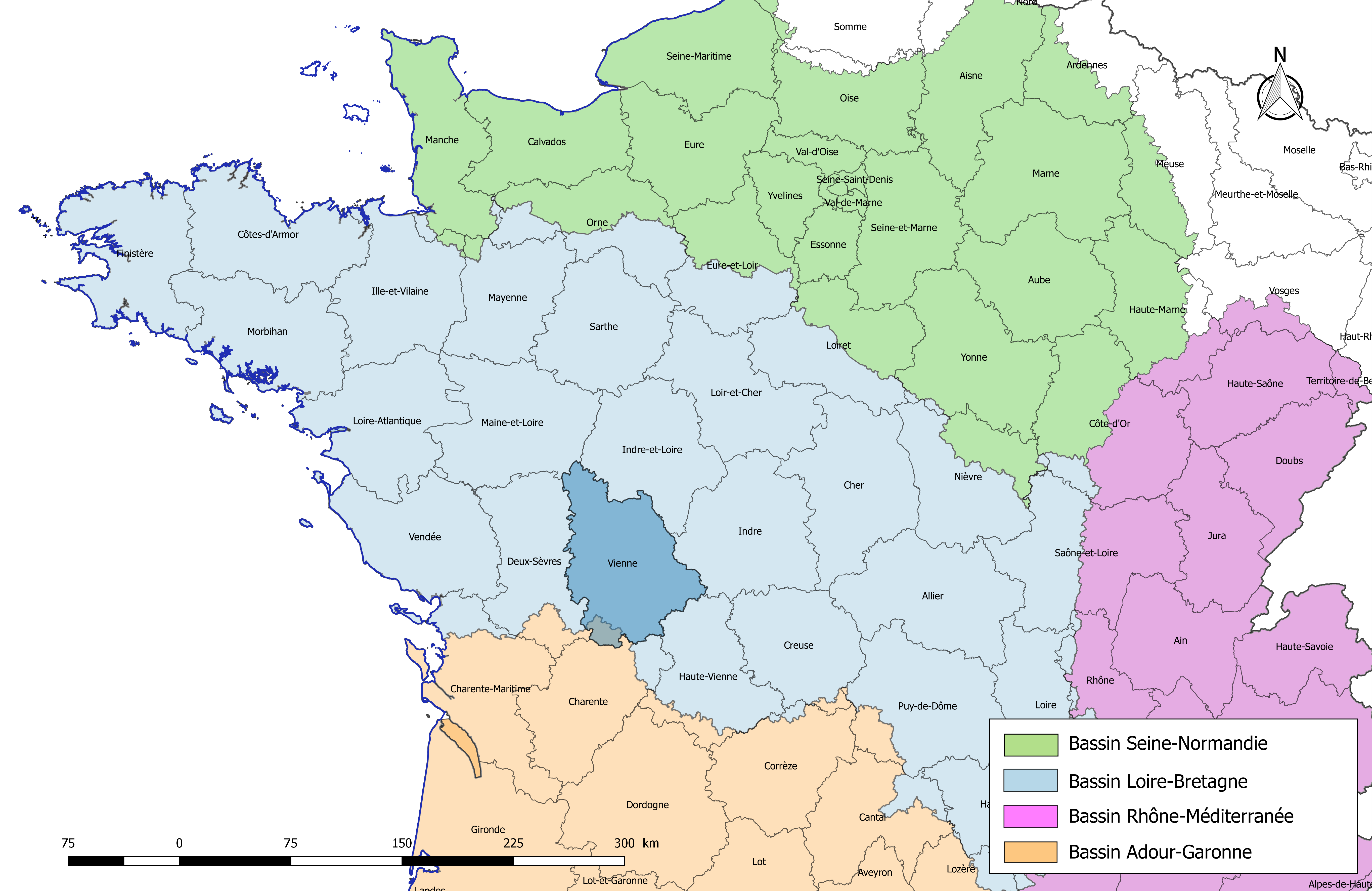
France-Bassins-hydro.png - Roland45

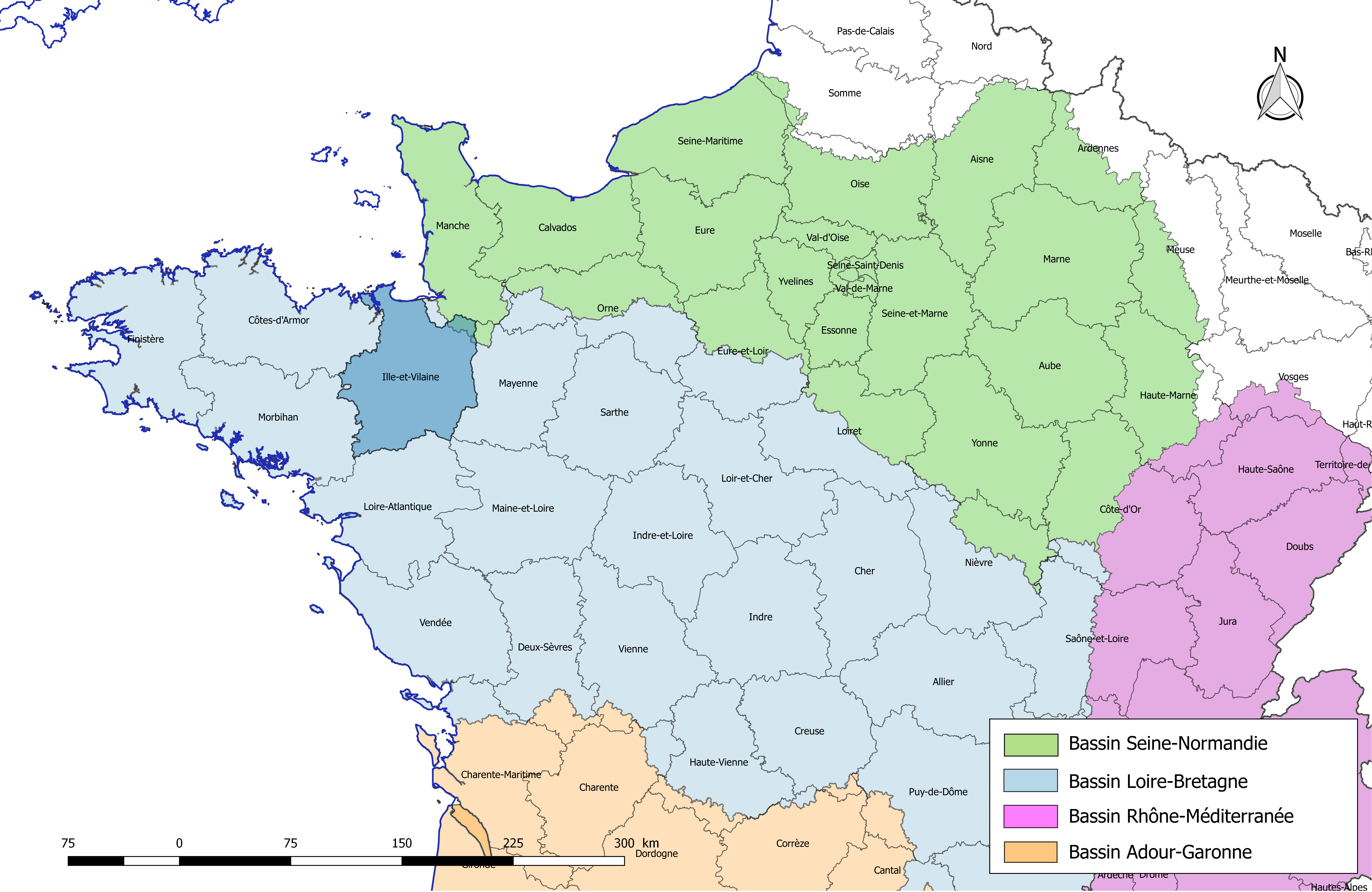
LB-Régions-hydro2.png - Roland45

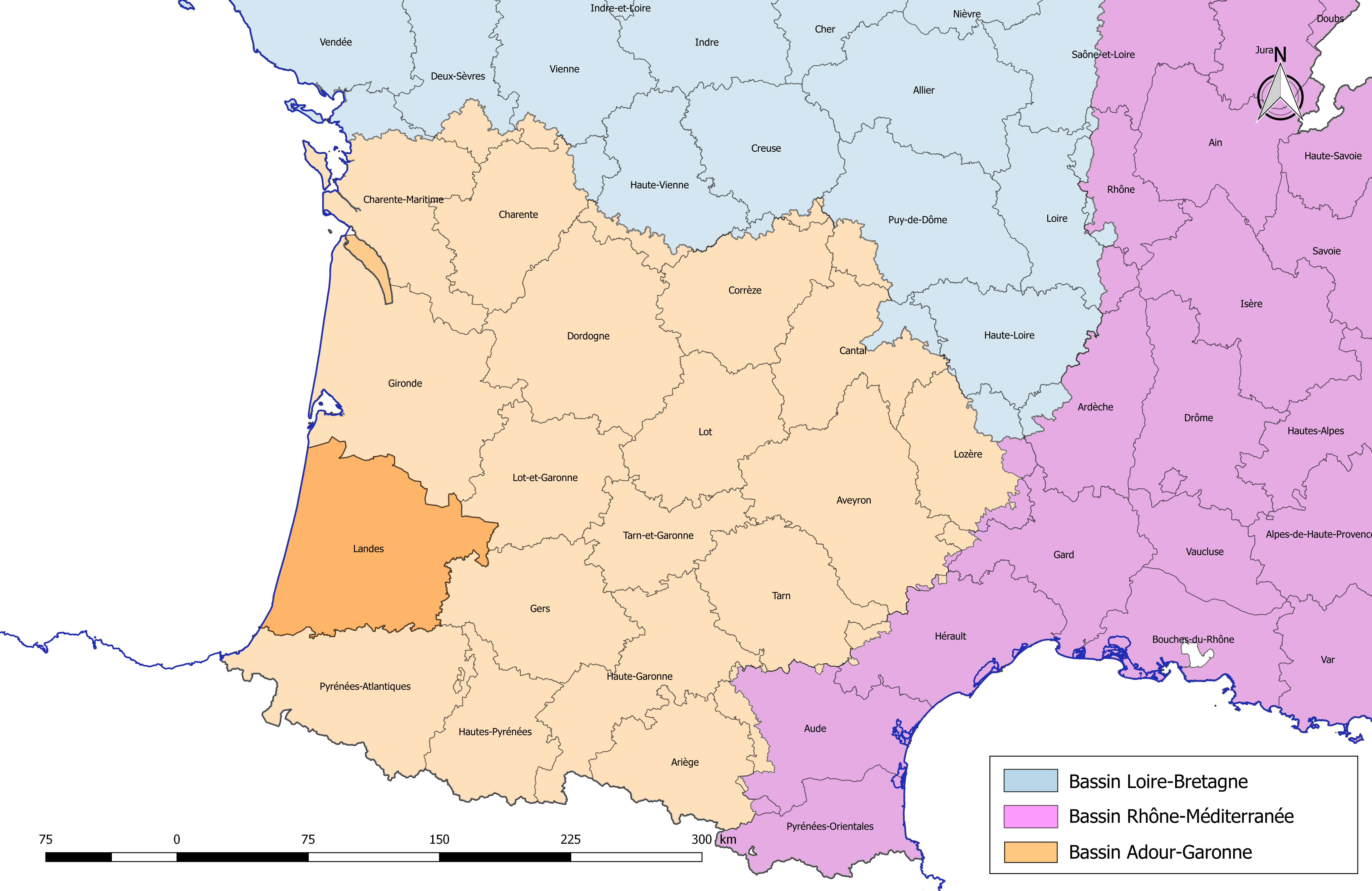
AP-Régions-hydro.png - Roland45

RM-Régions-hydro.png - Roland45

RMC-Régions-hydro.png - Roland45
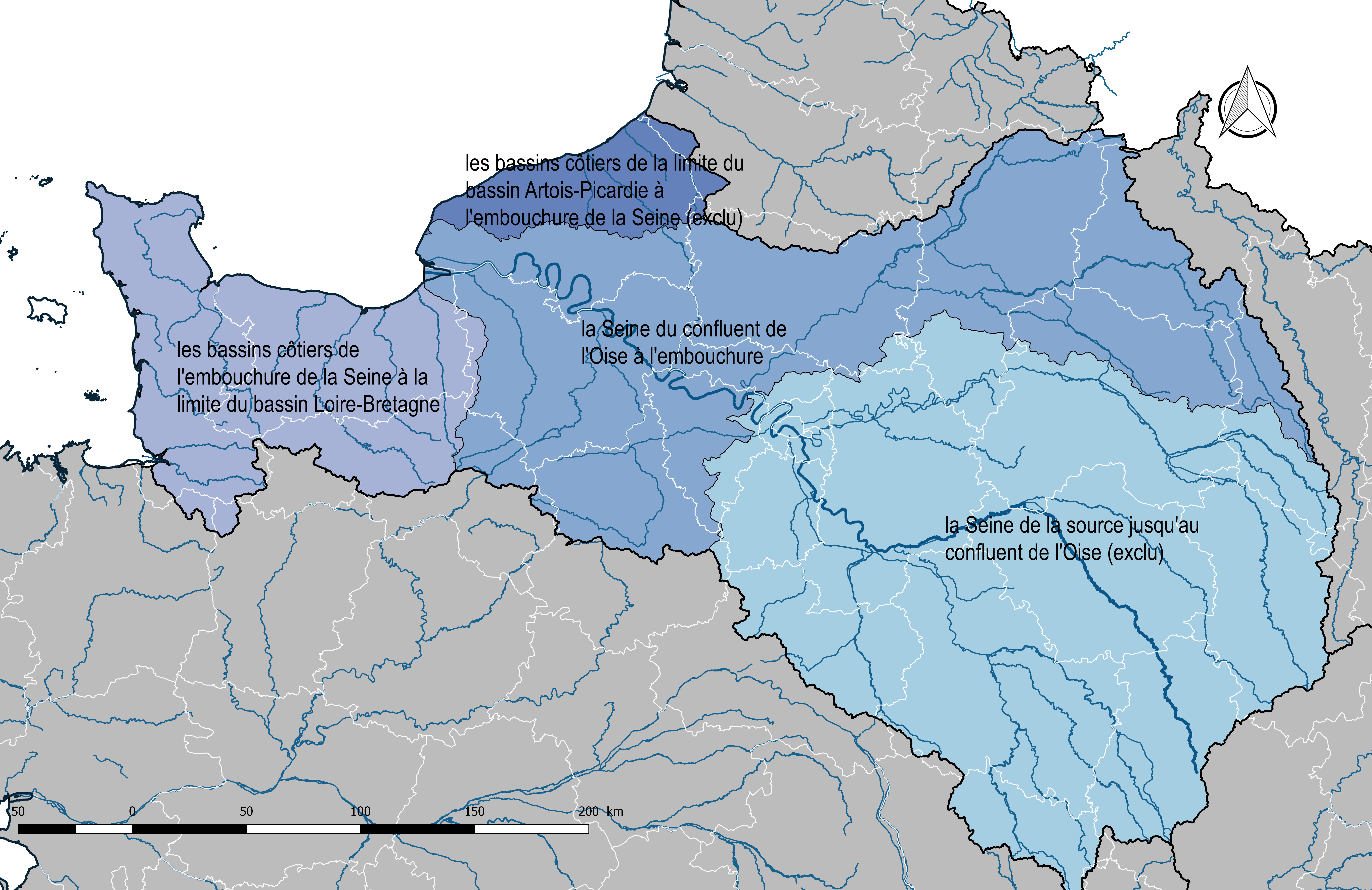
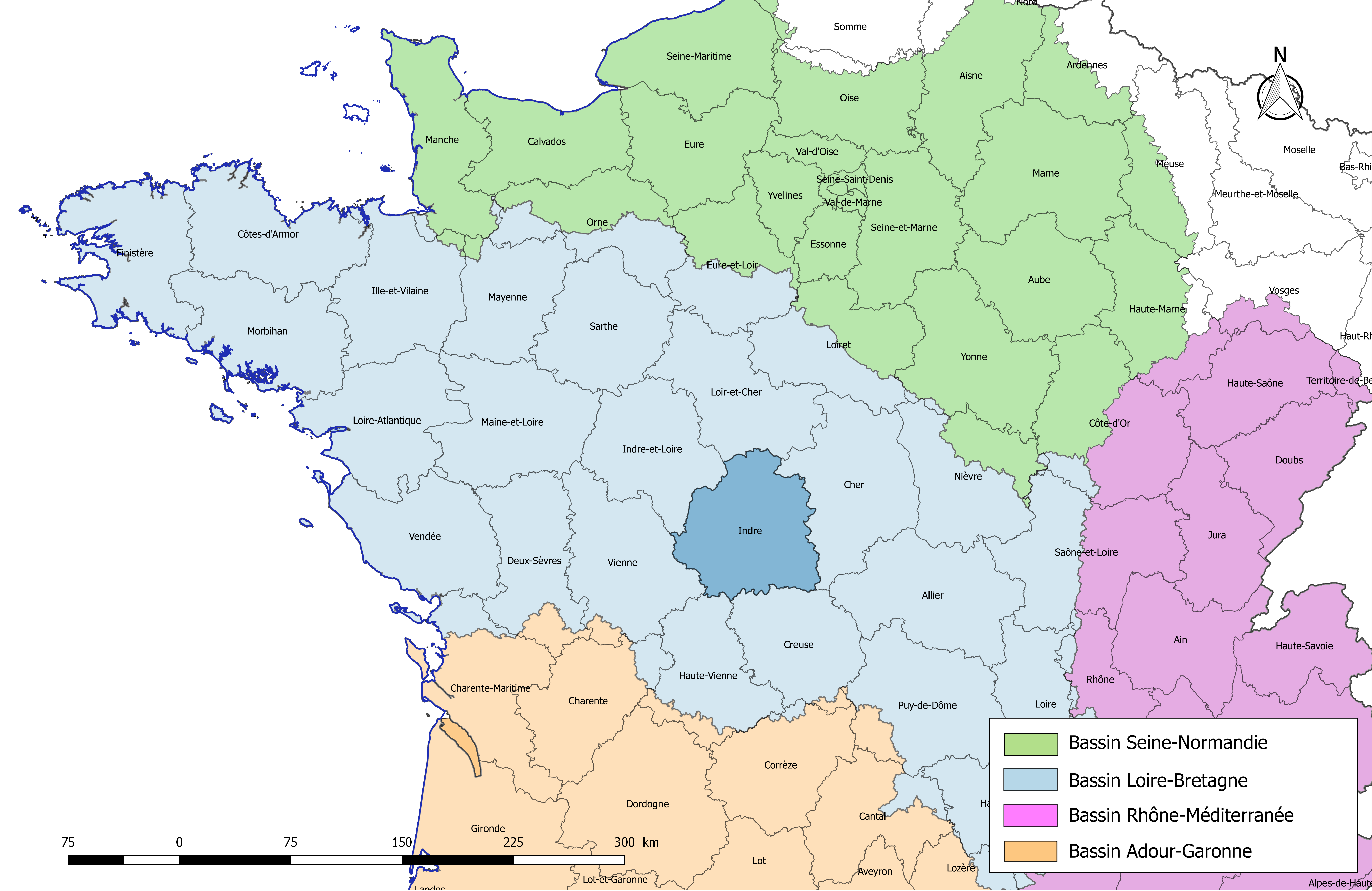
SN-Régions-hydro.png - Roland45

Hydrographie du Soissonnais.png - Fdouchet

Bassin versant de la Jamagne.jpg - Rémiparmentelat

21 of 'Nouveau cours d'instruction primaire. ... Cours général de géographie, etc' (11185443883).jpg - Artix Kreiger 2

FR07-Bassins.png - Roland45

FR03-Bassins.png - Roland45

FR09-Bassins.png - Roland45

FR11-Bassins.png - Roland45
FR15-Bassins.png - Roland45

FR12-Bassins.png - Roland45

FR16-Bassins.png - Roland45

FR17-Bassins.png - Roland45

FR18-Bassins.png - Roland45

FR19-Bassins.png - Roland45
FR21-Bassins.png - Roland45

FR22-Bassins.png - Roland45

FR23-Bassins.png - Roland45

FR24-Bassins.png - Roland45

FR28-Bassins.png - Roland45

FR30-Bassins.png - Roland45

FR29-Bassins.png - Roland45

FR31-Bassins.png - Roland45

FR32-Bassins.png - Roland45

FR33-Bassins.png - Roland45

FR34-Bassins.png - Roland45
FR35-Bassins.png - Roland45

FR37-Bassins.png - Roland45
FR40-Bassins.png - Roland45
FR36-Bassins.png - Roland45

FR42-Bassins.png - Roland45

FR43-Bassins.png - Roland45

FR44-Bassins.png - Roland45
FR45-Bassins.png - Roland45

FR46-Bassins.png - Roland45

FR47-Bassins.png - Roland45

FR49-Bassins.png - Roland45

FR48-Bassins.png - Roland45

FR53-Bassins.png - Roland45

FR63-Bassins.png - Roland45

FR56-Bassins.png - Roland45

FR58-Bassins.png - Roland45

FR64-Bassins.png - Roland45

FR66-Bassins.png - Roland45

FR65-Bassins.png - Roland45

FR71-Bassins.png - Roland45

FR79-Bassins.png - Roland45

FR72-Bassins.png - Roland45

FR81-Bassins.png - Roland45

FR82-Bassins.png - Roland45

FR84-Bassins.png - Roland45

FR85-Bassins.png - Roland45
FR86-Bassins.png - Roland45

FR87-Bassins.png - Roland45

Bassin-Creuse-Dep.jpg - Roland45

Bassin-Creuse.jpg - Roland45

Bassin-versant-Orgeval.jpg - Irstea

Réseau de drainage actuel.jpg - PETITGRAVESON

Carte France hydrographie cours d'eau fond bleu foncé.png - Aldo.cl.jr

Wa-mape corantès aiwes do Marok al Walonreye.jpg - Lucyin

Tracé de la Loue.jpg - PetitRobert

Bassin de la Durance.png - Ccmpg

Epte (rivière).png - Ccmpg

Orge (rivière).png - Ccmpg

Bonne (rivière).png - Ccmpg
Hyères (rivière).png - Ccmpg

Jabron (Rhône).png - Ccmpg

Eyrieux.png - Ccmpg

RíosNoresteDeFranciaYBélgica.svg - Rowanwindwhistler

Couesnon.png - Ccmpg

Loisance.png - Ccmpg

Minette (rivière).png - Ccmpg

Logne (affluent de la Boulogne).png - Ccmpg

Aa and connecting waterways-pcd.jpg - Geoleplubo

Yar (cours d'eau breton).png - Ccmpg

Bélon cours d'eau.png - Cadouf

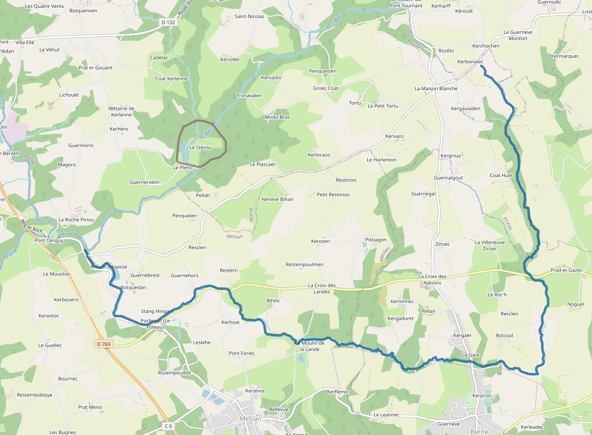
Aër cours d'eau.png - Cadouf

Inam cours d'eau.png - Cadouf

Aff OSM.png - Ccmpg

Goyen cours d'eau.png - Cadouf

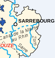
Sarre cours d'eau.png - Cadouf

Naïc cours d'eau.png - Cadouf

Isole cours d'eau.png - Cadouf

Trieux cours d'eau.png - Cadouf

Ruisseau de Kerustang cours d'eau.png - Cadouf

Evel cours d'eau.png - Cadouf

Gouët cours d'eau.png - Cadouf
Doré cours d'eau.png - Cadouf

Rance cours d'eau.png - Cadouf

Moulin du Duc cours d'eau.png - Cadouf

Loc'h cours d'eau.png - Cadouf

Gouessant cours d'eau.png - Cadouf
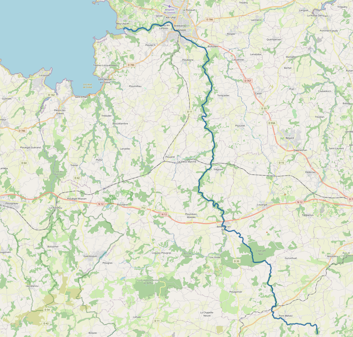
Léguer cours d'eau.png - Cadouf

Ic cours d'eau.png - Cadouf

Ellez cours d'eau.png - Cadouf

Arguenon cours d'eau.png - Cadouf

Langonnet cours d'eau.png - Cadouf
Stang Hingant cours d'eau.png - Cadouf

Coet Organ carte topo.png - Cadouf

Brandifrout carte topo.png - Cadouf

Arz (rivière) OSM.png - Ccmpg

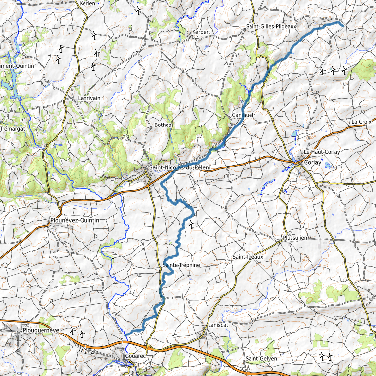
Poulancre carte topo.png - Cadouf
Sulon carte topo.png - Cadouf

Daoulas carte topo.png - Cadouf

Mès OSM.png - Ccmpg

Le kergoat.png - Tdahweb

Semnon OSM.png - Ccmpg

Ruisseau de Palet OSM.png - Ccmpg

Illet OSM.png - Ccmpg

Canut de Renac OSM.png - Ccmpg

Piccola Dora location map.png - Pampuco

Aube river map.png - Novokaine

Douze river map OSM-fr.png - Antimuonium

Rivière de Penzé - btv1b53015003k.jpg - Gzen92Bot

Luy de France river map OSM-fr.png - Antimuonium

Midou river map OSM-fr.png - Antimuonium

Midouze river map OSM-fr.png - Antimuonium

Le Rhin - Strasbourg et son arrière - pays - édité par la "Navigation du Rhin" ; G. Knoerr, dessinateur - btv1b102233989.jpg - Gzen92Bot

Adour river watershed.jpg - Mheberger

BudS - Frankreich - Städte und Flüsse.jpg - Bernhard Uff dem Sand

Carte Arguenon fin XVIIIe.png - Moreau.henri