Wikimedi'Òc
Modes d'emploi

Cet album fait partie des albums


Apalachicola watershed.png - Pfly
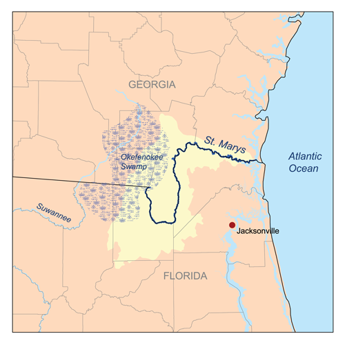
Stmarysflrivermap.png - Kmusser

Stjohnsrivermap.png - DanMS

Ocklawaharivermap.png - Kmusser

Kissimmeerivermap.png - DanMS
Caloosahatcheerivermap.png - Kmusser

Peaceflrivermap.png - Kmusser

Myakkarivermap.png - Kmusser

Manateerivermap.png - Kmusser

Littlemanateerivermap.png - Kmusser
Alafiarivermap.png - Kmusser

Hillsboroughrivermap.png - Kmusser

Withlacoocheesouthrivermap.png - Kmusser

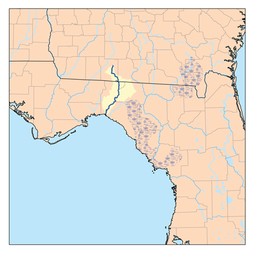
Suwanneerivermap.png - Kmusser

Santaferivermap.png - Kmusser

Alapaharivermap.png - Kmusser

Withlacoocheenorthrivermap.png - Kmusser

Econfinarivermap.png - Kmusser

Stmarksrivermap.png - Kmusser
Aucillarivermap.png - Kmusser

Ochlockoneerivermap.png - Kmusser

Chipolarivermap.png - Kmusser

Choctawhatcheerivermap.png - Kmusser

Yellowflrivermap.png - Kmusser

Blackwaterflrivermap.png - Kmusser
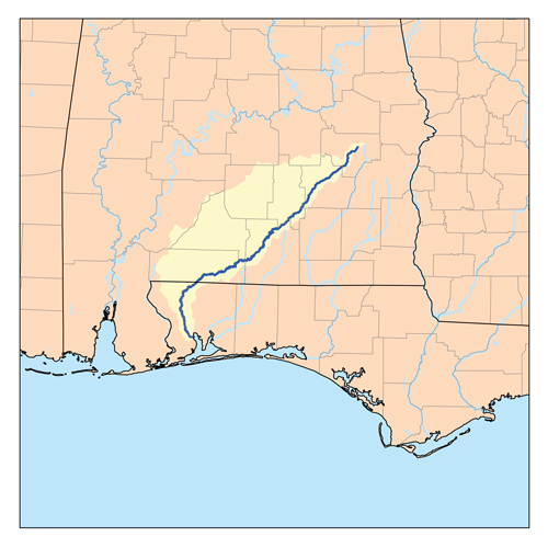
Conecuhrivermap.png - Kmusser

Perdidorivermap.png - Kmusser
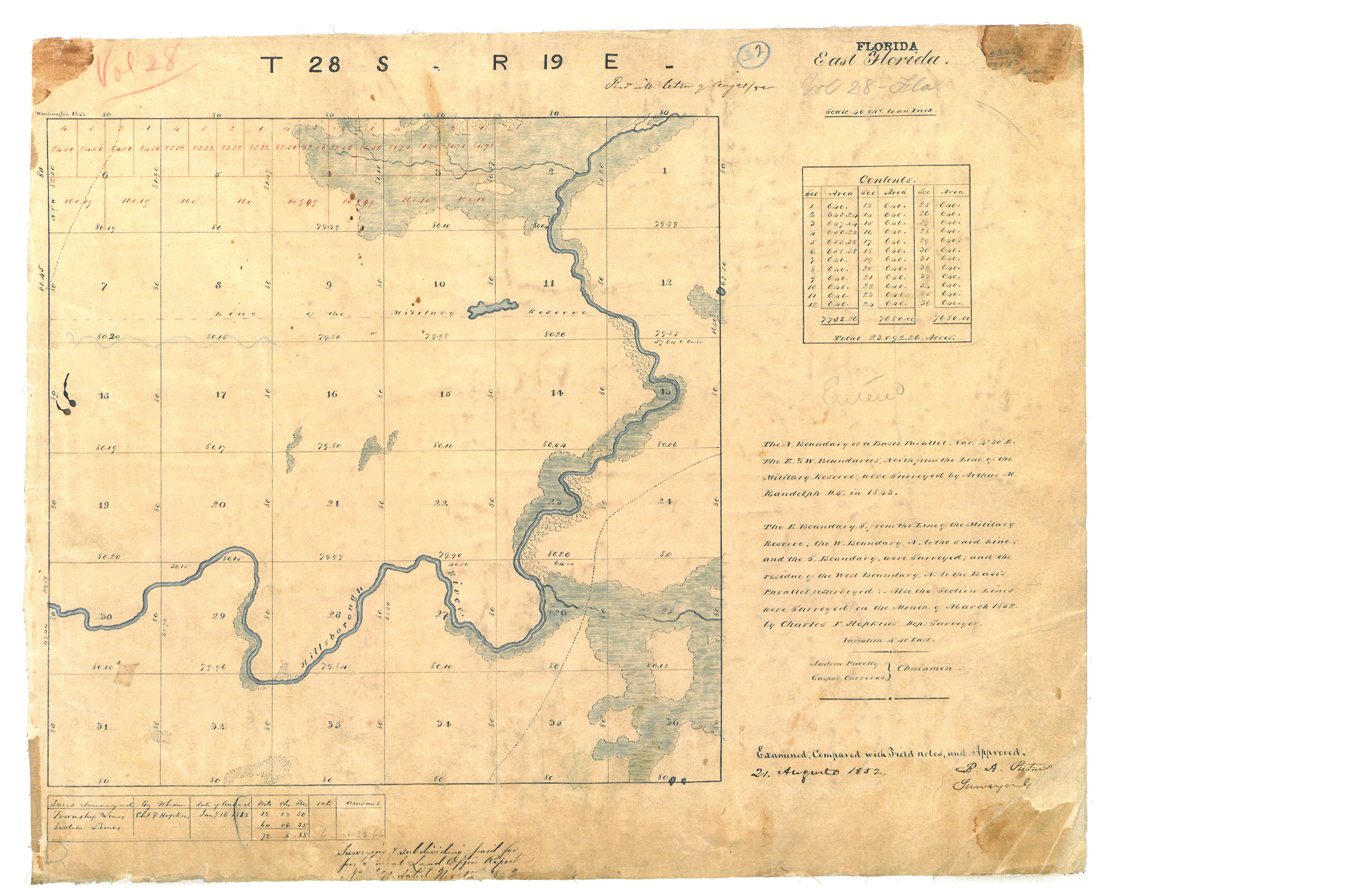
TT survey 1843.jpg - Toltec

Halifaxrivermap fl.png - Kmusser

South Florida Big Cypress Swamp.jpg - Viriditas

Stjohnsriver detailmap.svg - Kmusser

Stjohnsriver detailmap.png - Kmusser
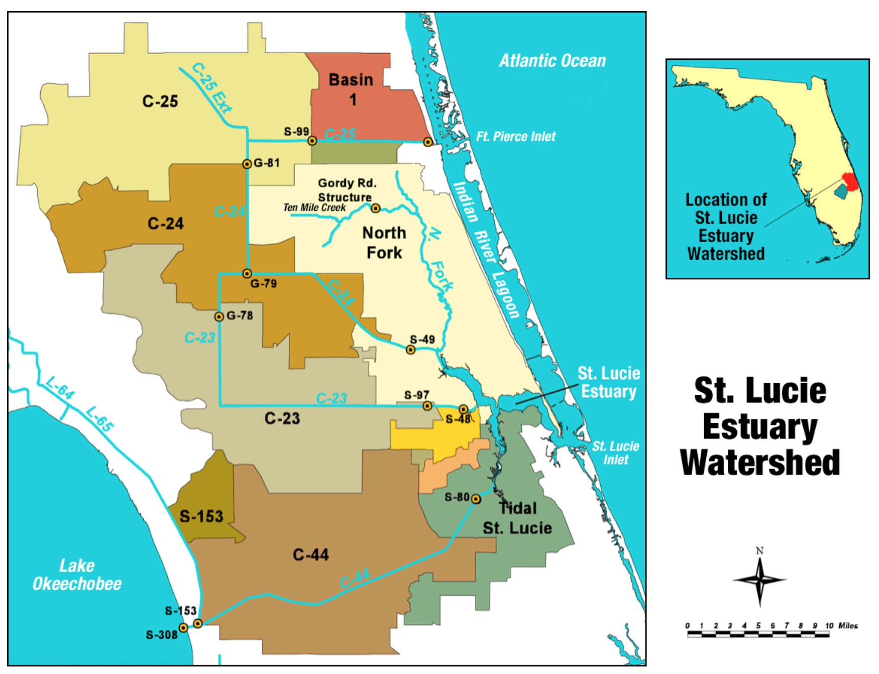
St. Lucie Estuary Watershed.png - Sharpnosepuffer

A plan of part of the rivers Tombecbe, Alabama, Tensa, Perdido, & Scambia in the province of West Florida; with a sketch of the boundary between the nation of upper Creek Indians and that part of the LOC 73691550.jpg - Fæ

FlaWaterwaysMap.png - OgreBot