Wikimedi'Òc
Modes d'emploi

Cet album fait partie des albums
Cet album photos contient les sous-albums suivants :


Woolwich Ferry map.svg - Ritchie333

Shooter's Hill location.PNG - File Upload Bot (Magnus Manske)
LondonMBWoolwich.png - Voyager

Victoria Docks 1872.jpg - File Upload Bot (Magnus Manske)

Flickr - davehighbury - Royal Arsenal Woolwich London 009.jpg - Matanya

Flickr - davehighbury - Royal Arsenal Woolwich London 011.jpg - Matanya

Flickr - davehighbury - Royal Arsenal Map Woolwich London 012.jpg - Matanya

Flickr - davehighbury - Royal Arsenal Woolwich London 015.jpg - Matanya

Flickr - davehighbury - Royal Arsenal Woolwich London 042.jpg - Matanya

Flickr - davehighbury - Royal Artillery Museum Woolwich London 228.jpg - Matanya

Flickr - davehighbury - Royal Artillery Museum Woolwich London 230.jpg - Matanya

Ordnance Survey Drawings - Woolwich (OSD 130).jpg - LibraryBot

London, Woolwich Ferry10.jpg - Adam37

London, Woolwich Ferry11.jpg - Adam37
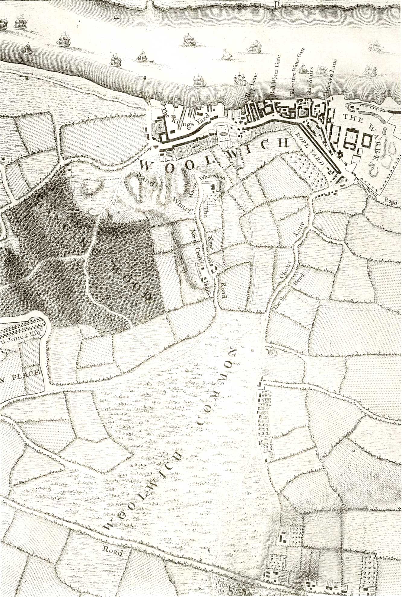
Map of Woolwich, 1746.jpg - Kleon3

Map of Woolwich, 1746 - detail.jpg - Kleon3

Royal Arsenal Map, 1877.jpeg - Kleon3

Metropolitan Borough of Woolwich.svg - Mirrorme22

The Pictorial handbook of London - comprising its antiquities, architecture, arts, manufacture, trade, social, literary, and scientific institutions, exhibitions, and galleries of art - together with (14760111976).jpg - Fæ

The Pictorial handbook of London - comprising its antiquities, architecture, arts, manufacture, trade, social, literary, and scientific institutions, exhibitions, and galleries of art - together with (14596466008).jpg - Fæ

Woolwich1983Constituency.svg - Sam11333

Printed Map Descriptive of London Poverty. Sheet 13(?) covering Woolwich (22643234567).jpg - Fæ

Woolwich Map, 1799.jpg - Kleon3

Woolwich map 1863-66, Bathway Quarter.jpg - Kleon3
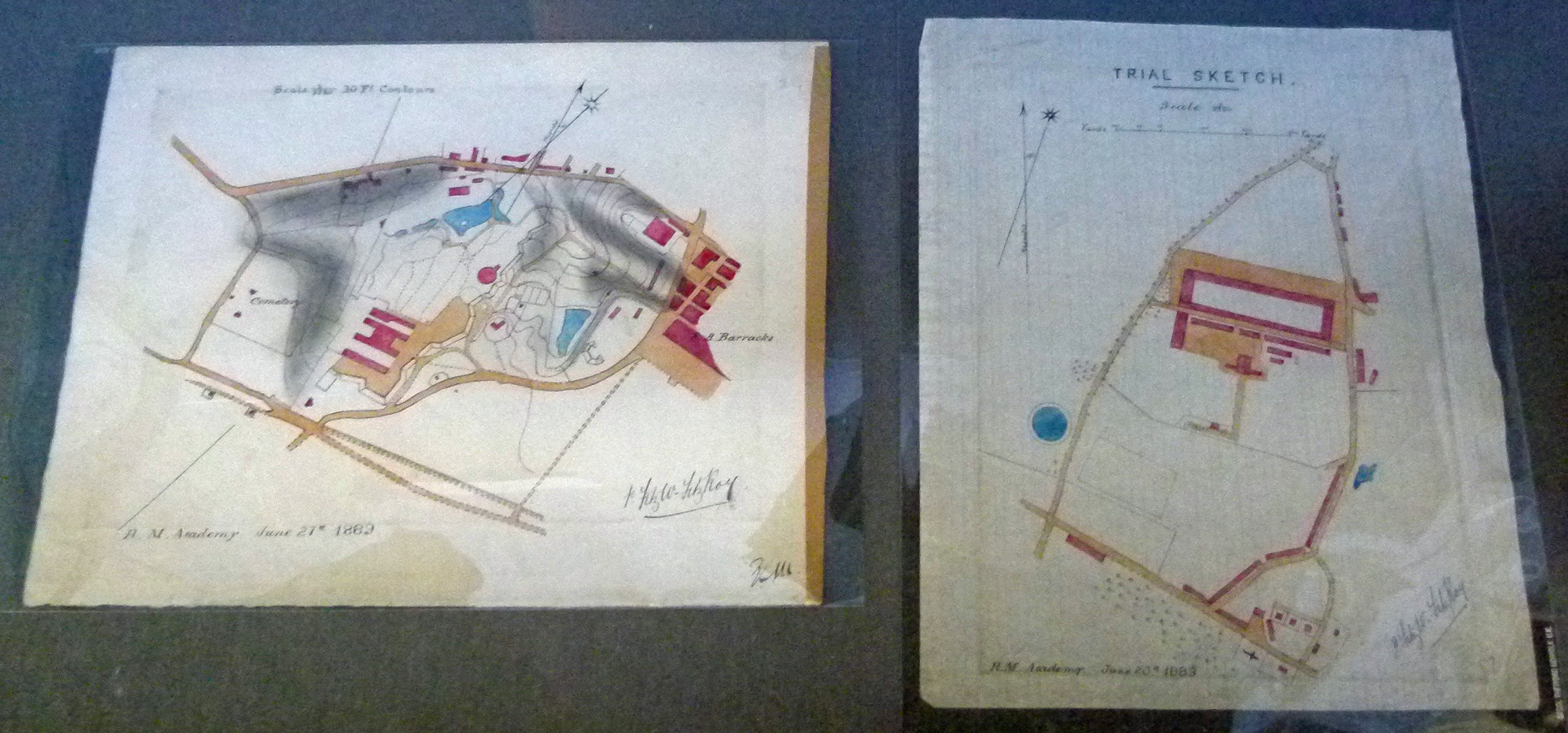
Greenwich Heritage Centre, Woolwich - RA & RMA exhibition 33.jpg - Kleon3

Greenwich Heritage Centre, Royal Arsenal map.jpg - Kleon3

Printed Map Descriptive of London Poverty. Sheet 13(?) covering Woolwich (22643234567) (cropped).jpg - Kleon3

2015-Greenwich Heritage Centre, Woolwich 06.jpg - Kleon3

Woolwich, Beresford Square, Ordnance Survey Map, 1853.jpg - Kleon3
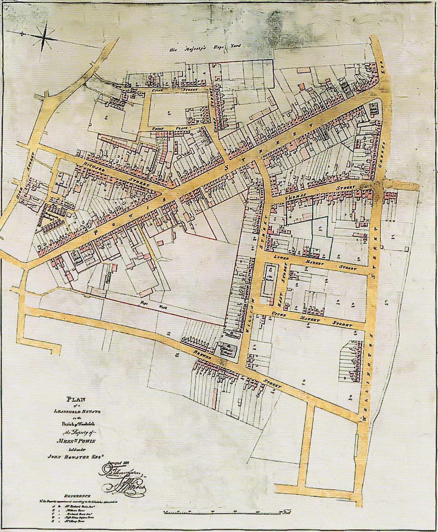
Woolwich, Powis Estate, 1825.jpg - Kleon3

Woolwich, Powis St - Hare St, Goad Map, 1908.jpg - Kleon3

Map of Woolwich, 1740s.jpg - Kleon3

Map of Woolwich, 1740s (cropped).jpg - Kleon3

Printed Map Descriptive of London Poverty. Sheet 13(?) covering Woolwich (22643234567) (cropped) (cropped).jpg - Kleon3

View of Woolwich, 1841 (R. Rixon).jpg - Kleon3
Admiralty Chart No 2484 River Thames from London to Gravesend. Surveyed by Captain F. Bullock and Lieut. E. Burstal, 1830-1833 RMG B1786, Published 1865.tiff - Fæ

Map of part of the River Thames (C) Third plan making three wet docks by digging a new channel for the River from Woolwich Reach to Bell Dock and Cherry Garden Stairs RMG L9709-001.jpg - Adam37

Map of part of the River Thames (C) Third plan making three wet docks by digging a new channel for the River from Woolwich Reach to Bell Dock and Cherry Garden Stairs RMG L9709-002.jpg - Fæ

Map of part of the River Thames (B) Second plan making two wet docks by means of a new channel being dug for the River from Woolwich Reach to Limehouse in a right line RMG L9708-002.jpg - Fæ

Image taken from page 653 of 'Old & New London. By W. Thornbury and Edward Walford. Illustrated' (11241426476).jpg - Artix Kreiger 2

17 of 'Woolwich. Guide to the Royal Arsenal. (Reprint of “Warlike Woolwich.”) Tenth thousand' (11178377185).jpg - Artix Kreiger 2

111 of 'Woolwich. Guide to the Royal Arsenal. (Reprint of “Warlike Woolwich.”) Tenth thousand' (11177277976).jpg - SteinsplitterBot

154 of 'The Records of the Woolwich District' (11290142403).jpg - Artix Kreiger 2

16 of 'Woolwich. Guide to the Royal Arsenal. (Reprint of “Warlike Woolwich.”) Tenth thousand' (11178595734).jpg - Artix Kreiger 2

118 of 'Woolwich. Guide to the Royal Arsenal. (Reprint of “Warlike Woolwich.”) Tenth thousand' (11175584073).jpg - Barabbas1312

140 of 'The Records of the Woolwich District' (11103459375).jpg - Artix Kreiger 2

354 of 'The rivers of Great Britain. The Thames, from source to sea, etc. (With “Rivers of the east coast”.)' (11298498025).jpg - Artix Kreiger 2

Ordnance Survey One-Inch Sheet 107 London and Epping Forest, Published 1935.jpg - Kognos

London City Airport DLR and Crossrail.png - Cnbrb

Admiralty Chart No 3337 River Thames London Bridge to Woolwich, Published 1903.jpg - Kognos

Admiralty Chart No 3191 River Thames Woolwich to Erith, Published 1901.jpg - Kognos

Elevation and Plan of Woolwich Dockyard, Thomas Milton, 1753.jpg - Barabbas1312

Map of Woolwich Warren, John Barker, 1749.jpg - Barabbas1312

Map of Woolwich Dockyard, 1774.jpg - Barabbas1312

Map of Woolwich, John Barker, 1749.jpg - Barabbas1312