Wikimedi'Òc
Modes d'emploi

Cet album fait partie des albums
Cet album photos contient les sous-albums suivants :


Vvm-Location.png - Srbauer

Washington 77.03160W 38.89260N.jpg - Rex

Dc satellite image.jpg - Leslie

DCQUADS.jpg - Otto Normalverbraucher

DC-old-and-new.jpg - Eoghanacht
DC-old-and-new-Jefferson-Pier.jpg - Eoghanacht
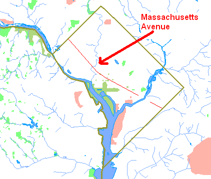
Mass Ave DC.png - Mareino

Dc-unemployment aug2006.png - Aude
Washington DC map1.png - Kmusser

Capitole.gif - Urban~commonswiki

DChomicides.jpg - Aude

National mall (east) satellite image.jpg - Corker1

USNOmap.gif - GearedBull
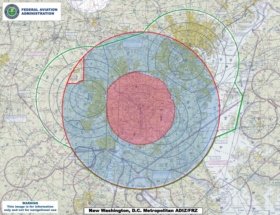
070727 New Washington ADIZ-FRZ.jpg - Sarfa~commonswiki
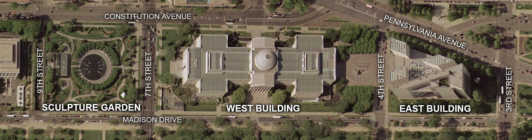
National Gallery of Art map.jpg - Postdlf
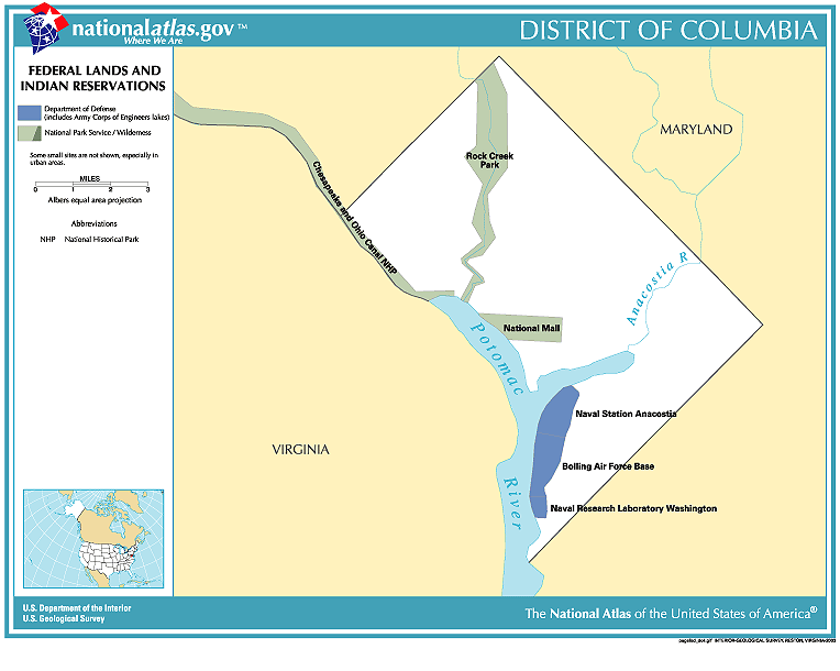
National-atlas-district-of-columbia.gif - BetacommandBot

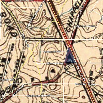
Map Harpers Ferry.JPG - Bjoertvedt

Dc msa map.png - Kmusser
Beltway sniper map.png - Tom
Artigas statue map.jpg - LlywelynII

Munitionsbldgmap.jpg - Aude
Dcmapanimated.gif - Druffeler

Dupontmap.png - Aude
JCCIC.JPG - TonyTheTiger

Washington-DC-TF.jpg - Rtmi1
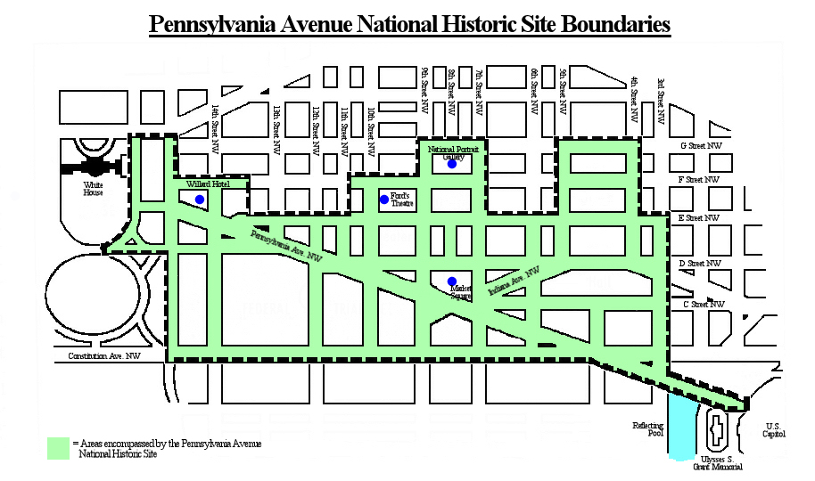
Pennsylvania Avenue Historic Site boundaries.jpg - Tim1965
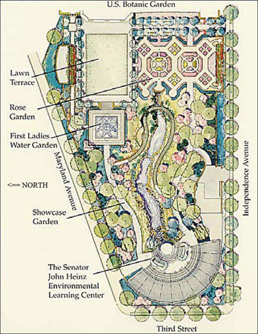
Us botanic-garden map.jpg - Nconwaymicelli
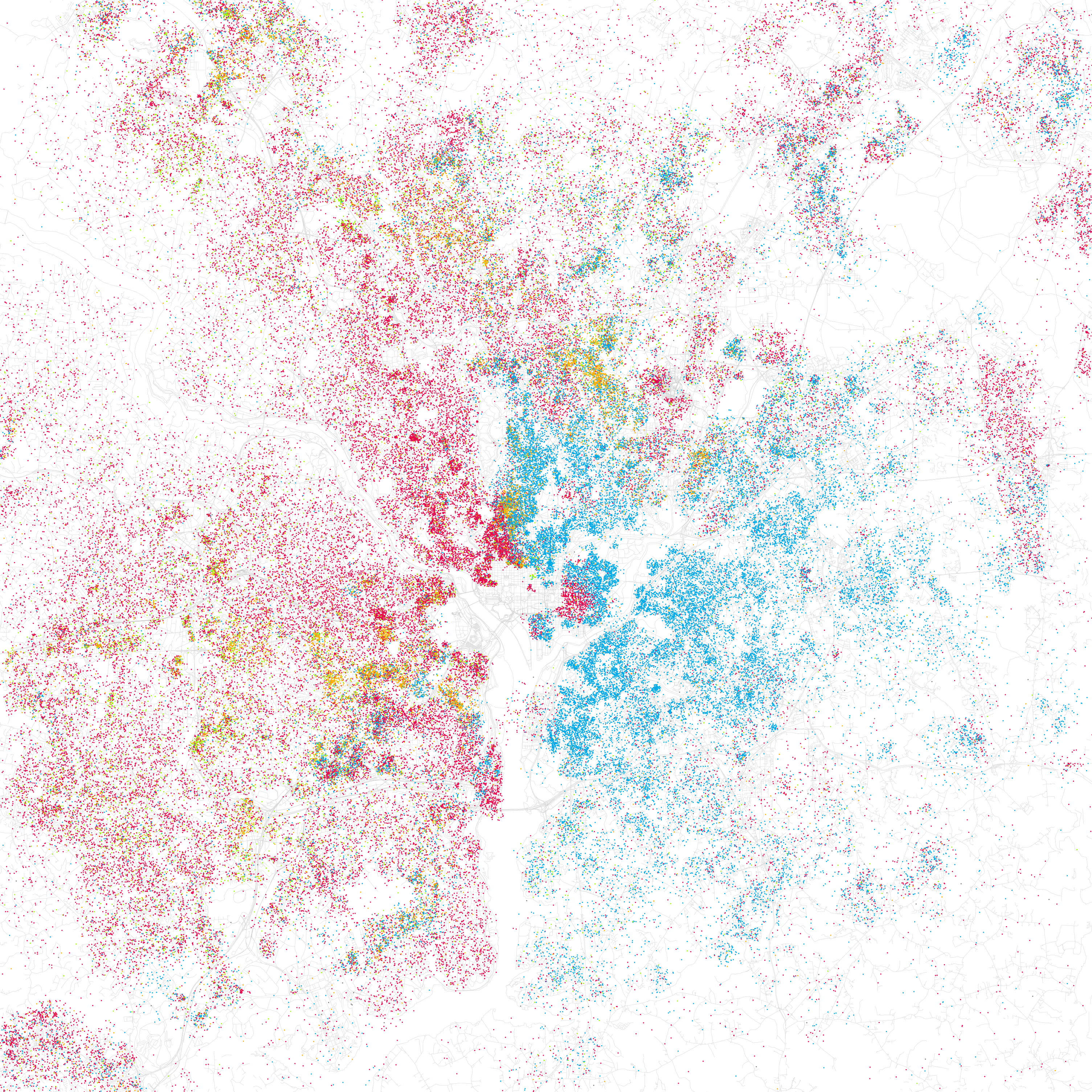
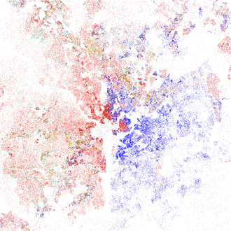
Race and ethnicity Washington, DC (2000).png - Flickr upload bot
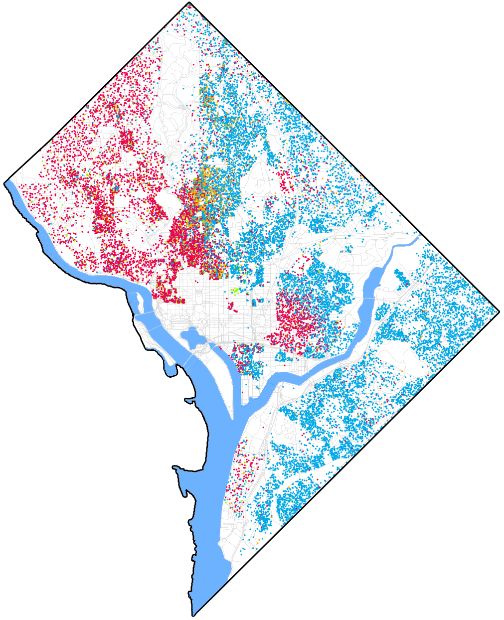
Race and ethnicity map of Washington, D.C..png - Patrickneil

Memorials and Museums Master Plan map.png - Presidentman

Race and ethnicity in Washington, D.C. 2010.png - Patrickneil

Farmers Markets Search - Flickr - USDAgov.jpg - BotMultichillT

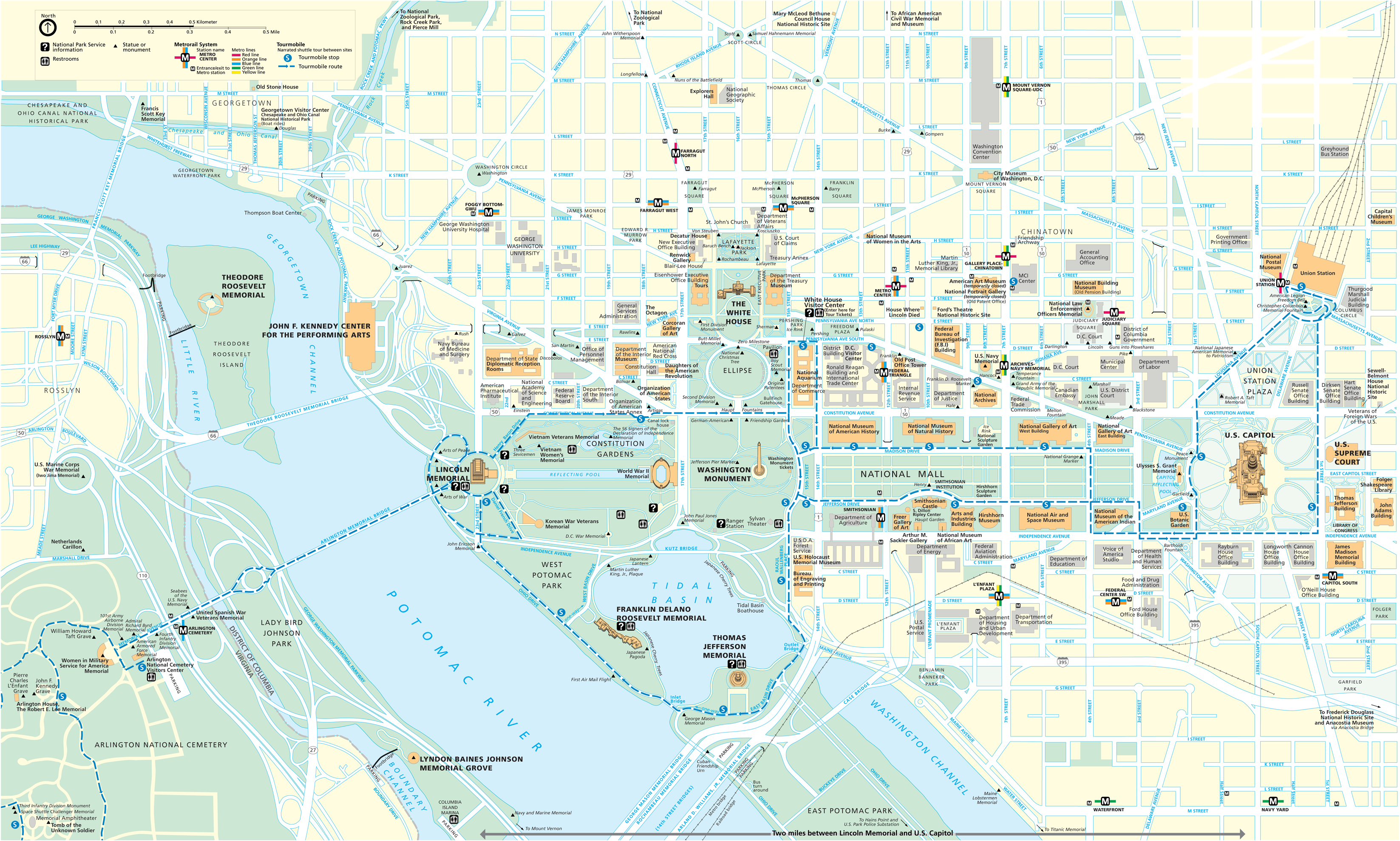
Washington DC printable tourist attractions map.jpg - Parimucha
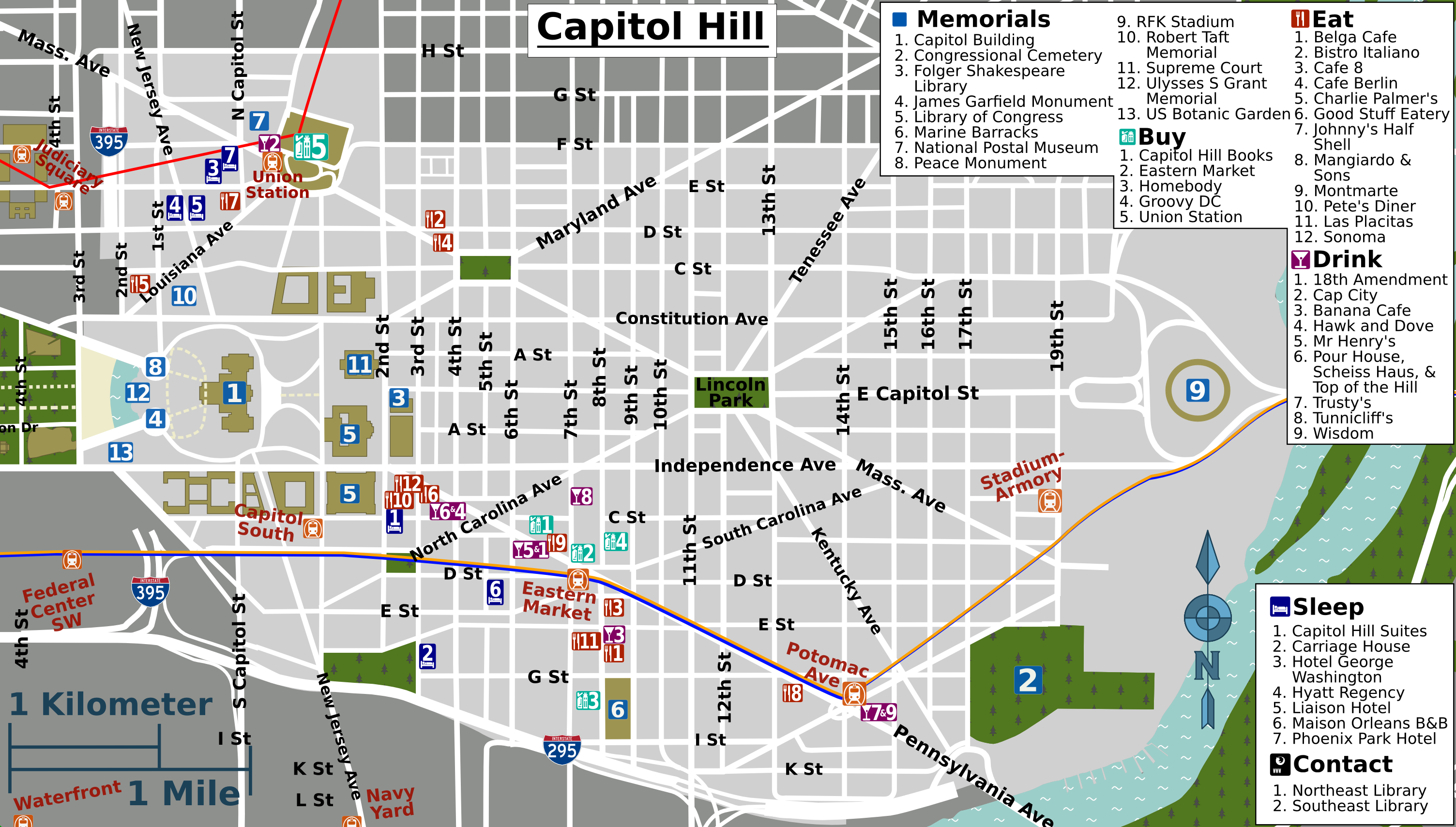
Capitol Hill map.png - OgreBot

DC districts map.png - OgreBot

DC print districts map.png - OgreBot

Dcmap-eastend.jpg - OgreBot

Dcmap-westend.jpg - OgreBot
Dupont Circle Map.pdf - Dbwright3

Georgetown zoning sub-zones - approved November 1974 - Washington DC.png - Tim1965

Three-dimensional replicas of the Lincoln Memorial and White House are affixed to a 40-by-60-foot map on the floor of the District of Columbia Armory 121212-F-AV193-103.jpg - Fæ

Washington DC Tourist Map.jpg - Sancholibre
Map of Analostan Island from Map of the City of Washington by Robert King Plate No. 1 - General John Mason House, Analostan Island or Theodore Roosevelt Island, Washington, HABS DC,WASH,131-82.tif - Fæ

Center Market, Washington, D.C. 1924.jpg - Meisam

DChomicides-zh-hant.png - GifTagger

SBA Projects in the Washington Metropolitan Region.jpg - Sbamarketing

Map of Start Spangled Banner Trail.png - Atlas337
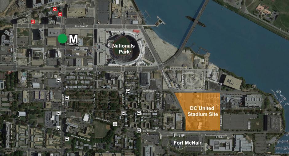
DC United Buzzard Point Stadium satellite view.jpg - Adeletron 3030
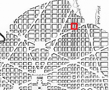
Ellicott Plan 1792 Square No 15.jpg - BKRandolph

Book of the Royal blue (1897) (14761127635).jpg - Fæ

Washington DC metropolitan map.jpg - Djehouti

Washington, D.C. monuments map.gif - Kingofthedead

Chandra Levy map.png - Canadaolympic989
National Capital Planning Commssion map of Washington, D.C LCCN2011633173.tif - Fæ

Red Top meter Map in Washington DC.jpg - Maleid

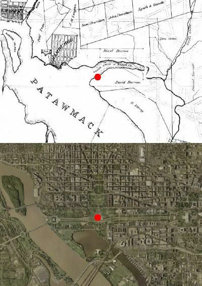
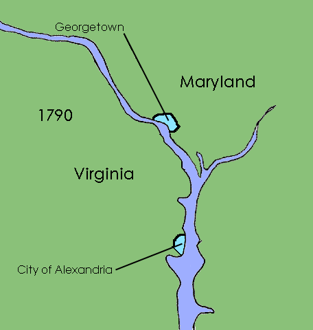
Washington, D.C. 1790–1791.png - Kingofthedead

District of Columbia 1846–1871.png - Kingofthedead

Washington, D.C. 1791–1801.png - Kingofthedead

Race and ethnicity 2010- Washington, DC (5559893527).png - WhisperToMe

Detail from map 179 Sanborn Fire Insurance Map from Washington, DC. 1903-1916.png - Blazingliberty

587 of 'La Vie Américaine. Ouvrage illustré, etc' (11215564964).jpg - Artix Kreiger 2

DC population density 2020.png - Crossover1370

I66.png - Nechaniz

Starburst Intersection - Washington DC - OpenStreetMap.png - Tagishsimon
Map of the Oxon Run Parkway.png - Volcycle

Shaw School Urban Renewal Area map 1973.jpg - Keizers

2010 Census tract map Shaw, U Street, Logan Circle area.png - Keizers

2010 census map of Tract 44, Washington, D.C.png - Keizers

Dc-map-2.jpg - Viscountrapier

Muhlenberg Park street map.jpg - Rockhead126

Map-dc-matro-area.png - Ser Amantio di Nicolao

Plot Plan - NARA - 102280122.jpg - US National Archives bot
District of Columbia - NARA - 26335496.jpg - US National Archives bot

Environs of Washington Prepared from original Surveys in the Engineer Department. -ca. 1864-66.- - NARA - 305582 (page 1).jpg - US National Archives bot

Environs of Washington Prepared from original Surveys in the Engineer Department. -ca. 1864-66.- - NARA - 305582 (page 2).jpg - US National Archives bot

Environs of Washington Prepared from original Surveys in the Engineer Department. -ca. 1864-66.- - NARA - 305582 (page 3).jpg - US National Archives bot

Environs of Washington Prepared from original Surveys in the Engineer Department. -ca. 1864-66.- - NARA - 305582 (page 4).jpg - US National Archives bot

Environs of Washington Prepared from original Surveys in the Engineer Department. -ca. 1864-66.- - NARA - 305582 (page 5).jpg - US National Archives bot

Environs of Washington Prepared from original Surveys in the Engineer Department. -ca. 1864-66.- - NARA - 305582 (page 6).jpg - US National Archives bot

Environs of Washington Prepared from original Surveys in the Engineer Department. -ca. 1864-66.- - NARA - 305582 (page 7).jpg - US National Archives bot

Environs of Washington Prepared from original Surveys in the Engineer Department. -ca. 1864-66.- - NARA - 305582 (page 8).jpg - US National Archives bot

Environs of Washington Prepared from original Surveys in the Engineer Department. -ca. 1864-66.- - NARA - 305582 (page 9).jpg - US National Archives bot

Environs of Washington Prepared from original Surveys in the Engineer Department. -ca. 1864-66.- - NARA - 305582 (page 10).jpg - US National Archives bot

Environs of Washington Prepared from original Surveys in the Engineer Department. -ca. 1864-66.- - NARA - 305582 (page 11).jpg - US National Archives bot

A General Map of the Chesapeake & Ohio Canal Surveys - NARA - 102279159.jpg - US National Archives bot

Location of Deaths for the Year Ending June 30, 1888 - NARA - 109182580.jpg - US National Archives bot

-Map of area in the vicinity of Hagerstown, Funkstown, and Williamsport, Washingotn County, Md., and Falling Waters, W. Va.- - NARA - 305581 (page 1).jpg - US National Archives bot

-Map of part of Montgomery County showing- Topographical Approaches on the Left Bank of the Potomac to Washington City from the North West. Surveyed by Parties of U. S. Coast Survey detailed by A. D. Bache, Supt., (...) - NARA - 305574.jpg - US National Archives bot

Washington DC, United States (5461524068).jpg - Ser Amantio di Nicolao

USA Greater Washington D.C.png - Hmdwgf

United States Capitol Washington 09.jpg - Pimpinellus

District of Columbia POI.png - Mpwood33

Map of Golden Triangle from OpenStreetMap.png - Keizers

Capitol 2020 Perspektiven 22.jpg - Pimpinellus

Capitol 2020 Perspektiven 24.jpg - Pimpinellus

Capitol 2020 Perspektiven 23.jpg - Pimpinellus

2008 map of Downtown area and emerging Center City areas.jpg - Keizers

Map of National Service Medical Centers (Reeve 091540), National Museum of Health and Medicine (3298887658).jpg - Netha Hussain

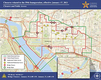
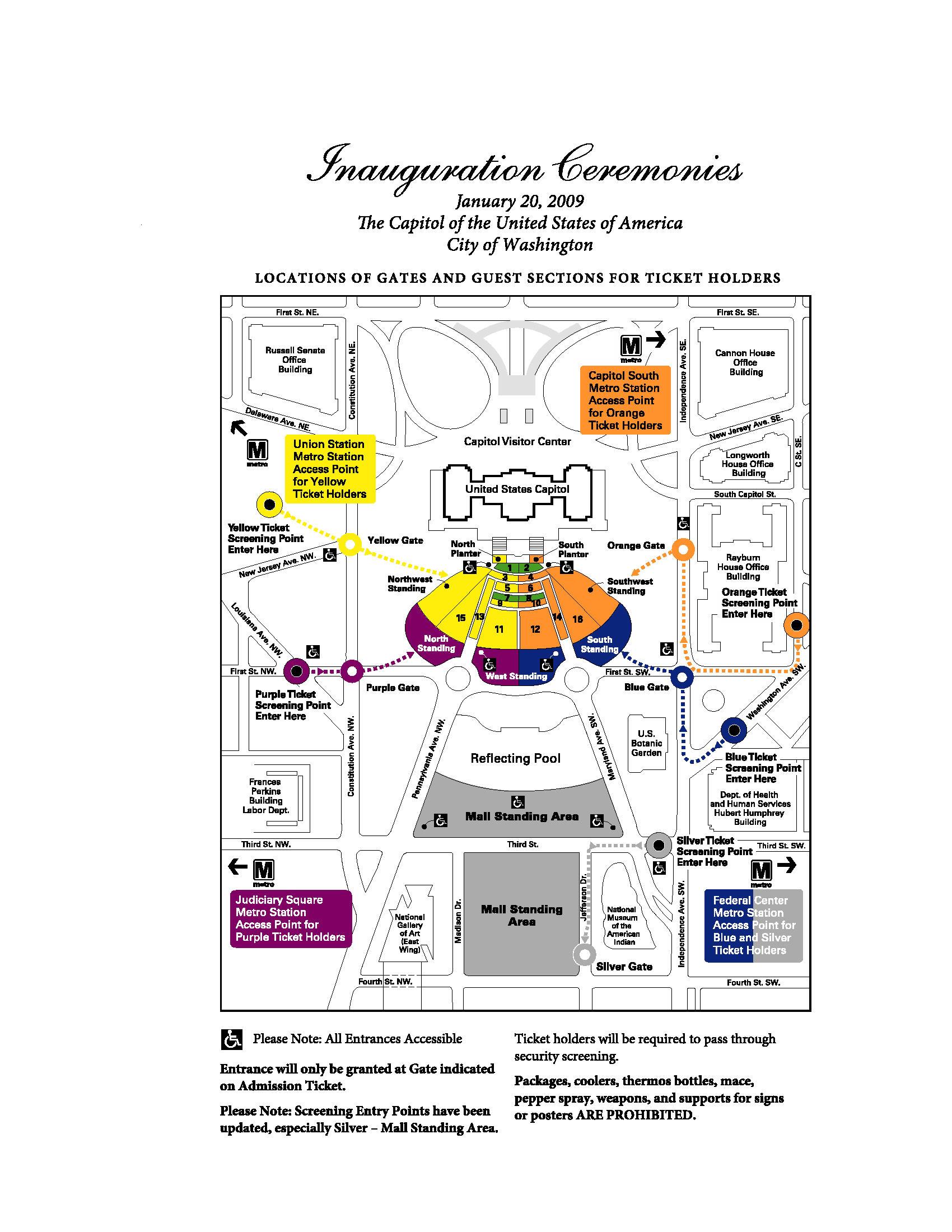
2021 Inauguration Public Access Map.jpg - Frontman830

Mcmillan-2-map.jpg - F DMR32

1954 National Test Exercise - Operation Ivy, by the Federal Civil Defense Administration, from the Digital Commonwealth - commonwealth h128rw43v.jpg - Daderot

Columbia blancs.png - Semoziade

DC districts map grouped (jp).png - Kensakak

Air Quality Monitoring Stations in Washington D C (SVS5107).png - OptimusPrimeBot

Entrance Ellipse and Summerhouse Paths (35690c67-b677-bef0-24c9-e3c9611e8e5a).jpg - BMacZeroBot

Washington DC and Baltimore MD US street map.svg - Kirill Shrayber

Washington DC US street map.svg - Kirill Shrayber
Washington D C Map Highlighting NASA Headquarters (SVS5106).webm - OptimusPrimeBot