Wikimedi'Òc
Modes d'emploi

Cet album fait partie des albums


Early map of swan river colony.jpg - Roke~commonswiki

Swan River Australien Japanese.png - Junki

Battye freycinet swanriver lg.jpg - Moondyne

Swan River Map.png - MSchnitzler2000

NarrowsBridgeLocation.gif - GordonE

Swan river land allocation gnangarra.jpg - Gnangarra

Colonie de la rivière Swan (Australie).png - Treehill

The Visit of Charles Fraser, map.png - Cygnis insignis

Perth Water c.1909.png - Moondyne
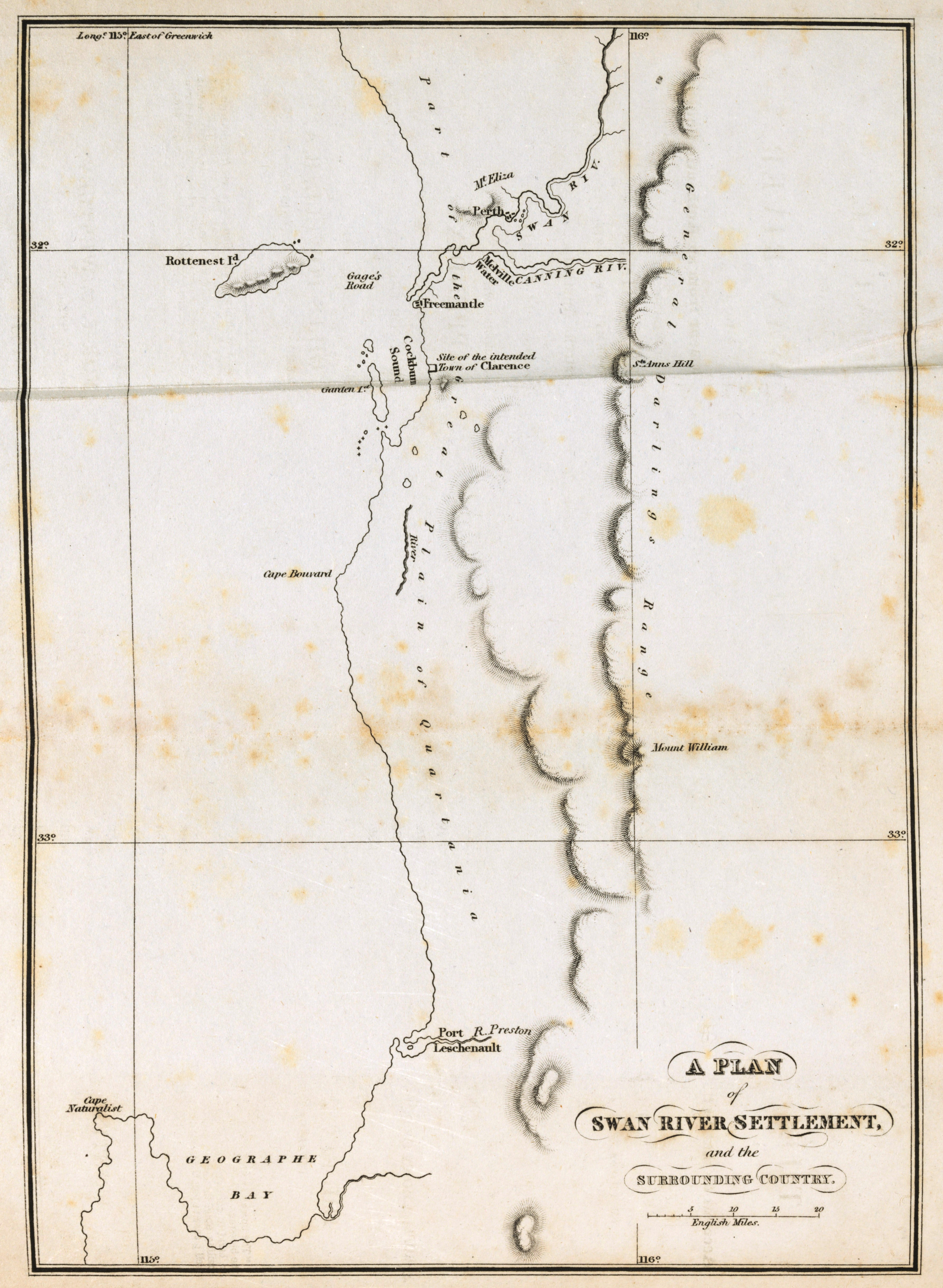
A Plan of Swan River Settlement and Surrounding Country.jpg - Moondyne
WA coast JS.png - File Upload Bot (Magnus Manske)

Perth Wetlands Map1.png - IgnorantArmies

Swan River Australien Karte.png - RokerHRO

Perth Water 1838.jpg - JarrahTree

Burswood peninsula - being a part of the 1838 plan.jpg - JarrahTree

Cropped section of ANZAAS 1926 Map of Perth.jpg - JarrahTree

Improvement to Swan River Navigation 1830-1840.png - Moondyne

Swan River Exploration.png - Fredlyfish4

Admiralty Chart No 1033 Australia W. coast Champion Bay to Cape Naturaliste including Swan River, Published 1877.jpg - Kognos

Admiralty Chart No 1700 Western Australia Swan River and Rottnest Island, Published 1845.jpg - Kognos

Admiralty Chart No 1058 Western Australia Cockburn Sound Gage Road and Swan River, Published 1831.jpg - Kognos