Wikimedi'Òc
Modes d'emploi

Cet album fait partie des albums
Cet album photos contient les sous-albums suivants :


Earthquakes and faults in the San Francisco Bay Area (1970-2003).jpg - Kognos

Alcatraz Loc.jpg - Urban~commonswiki

Sfbay srt 1906108.jpg - Holly Cheng
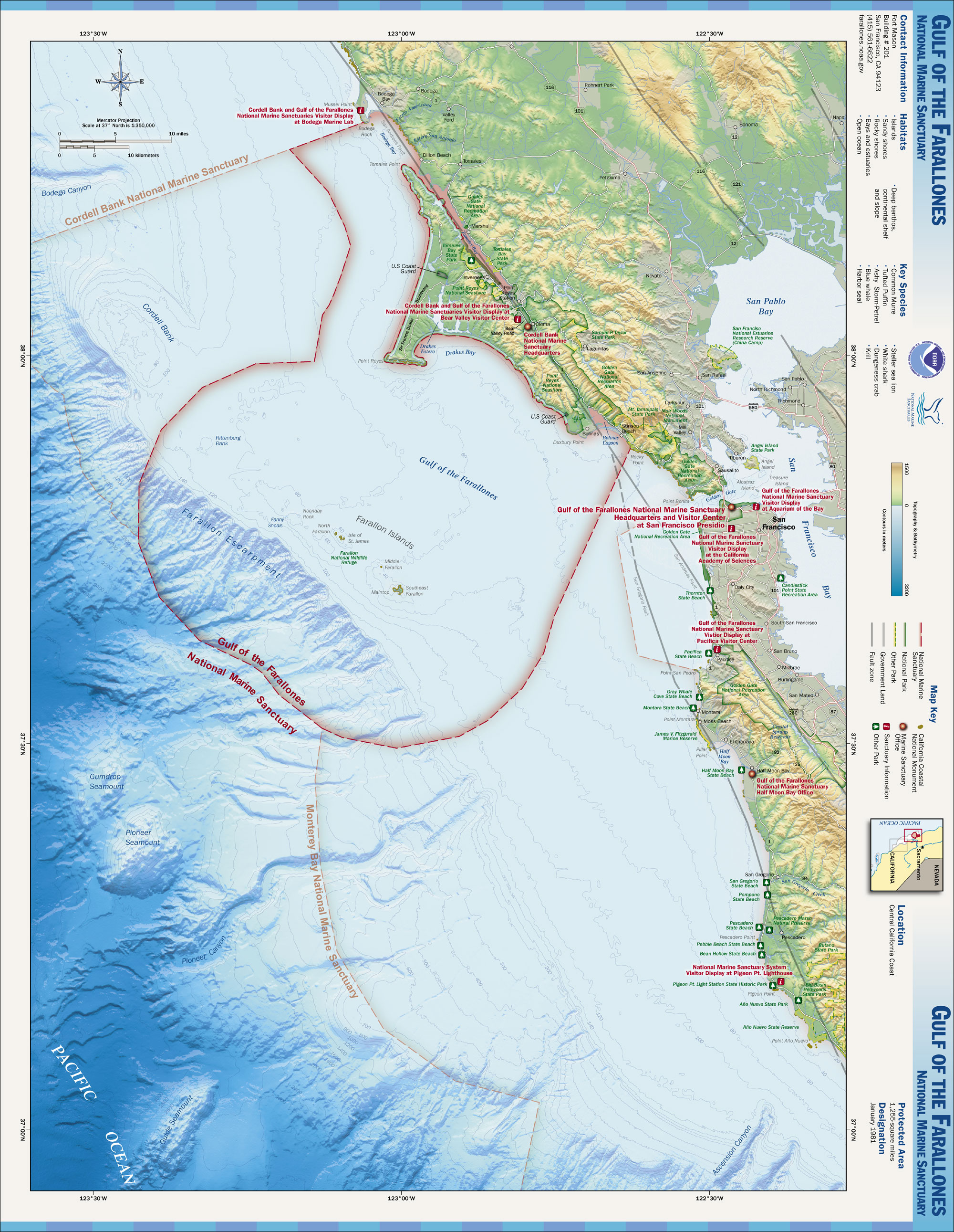
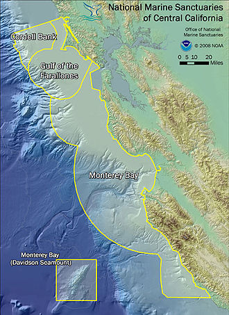
Gulf of the Farallones NMS map.jpg - Davepape

Cordell Bank NMS map.jpg - Davepape
Wpdms usgs photo san francisco bay.jpg - Ilmari Karonen

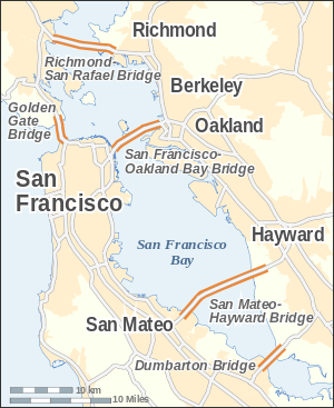
San Francisco Bay bridges.svg - Cmglee

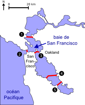
Carte baie de San Francisco.svg - SVGWorkaroundBot

Map baie de San Francisco.svg - SVGWorkaroundBot
Carte baie de San Francisco2.png - Urban~commonswiki
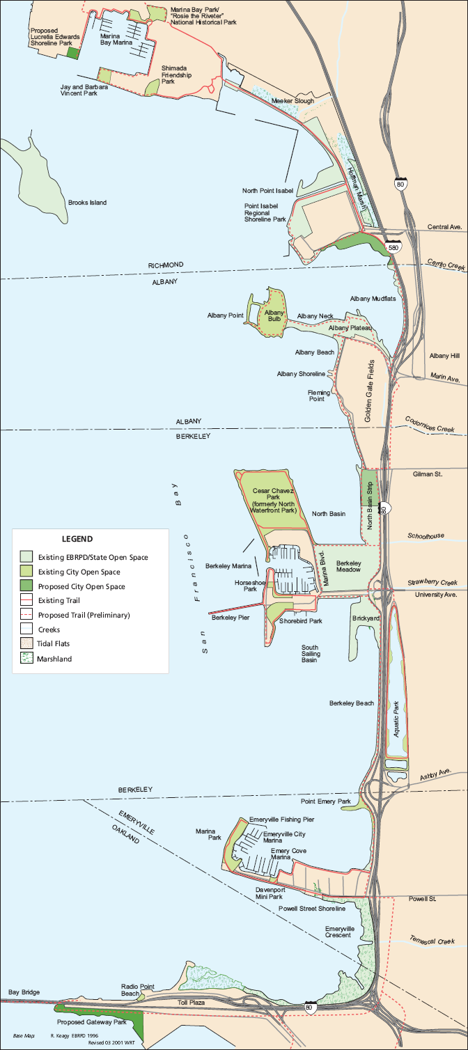
EastshoreSPmap.png - Dgies

San Francisco Bay Bridges map en.svg - Alexrk

Santa Fe Railroad Barge Route Map.jpg - RogerTaft

Sfbnerrs.gif - IGTaylor
Wpdms usgs photo drakes bay large.jpg - Matanya
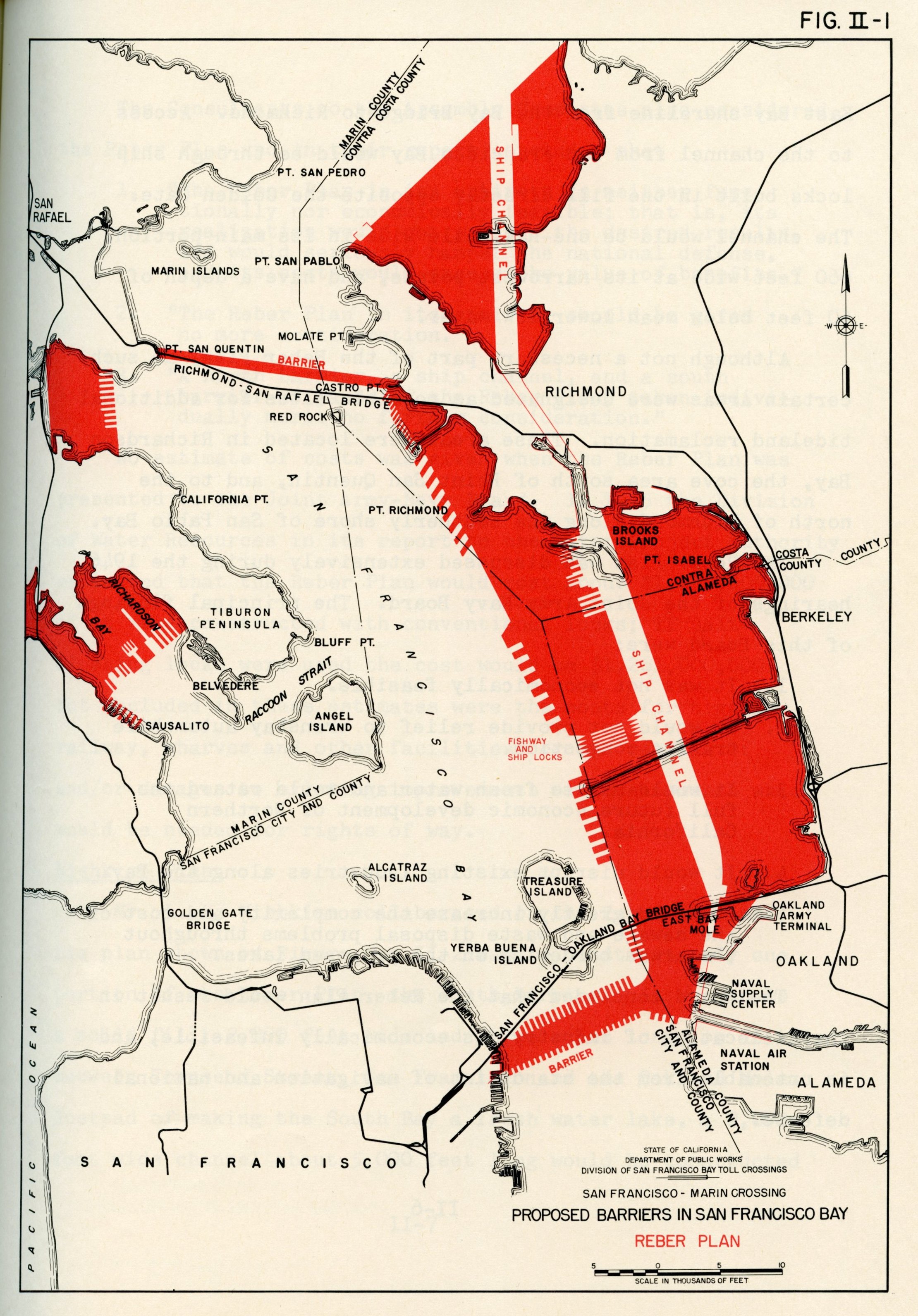
Reber Plan.jpg - Zscout370
Wpdms usgs photo bolinas bay large.jpg - MGA73bot2
Wpdms usgs photo point reyes large 2.jpg - MGA73bot2
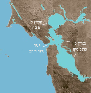
Wpdms usgs photo san francisco bay he.jpg - Matanya
San Francisco Bay Bridges map ar.png - باسم

San Francisco Bay Bridges map ar.svg - وهراني
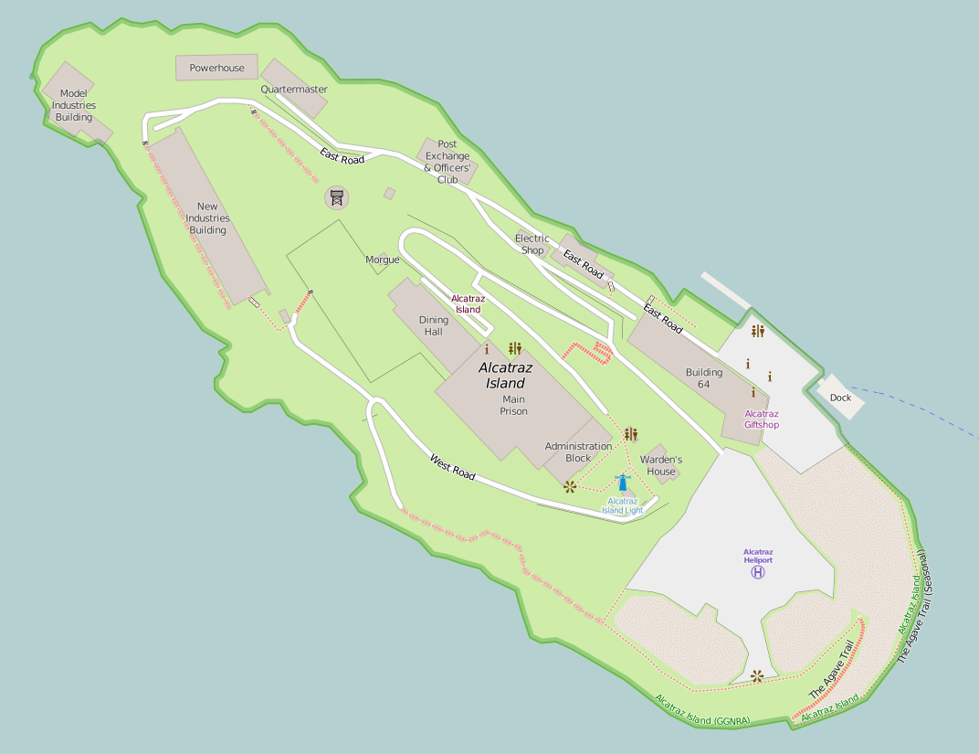
Map of Alcatraz.png - Jeanjung212

Central California Marine Sanctuaries.jpg - DimiTalen

Springvalley-lg2.gif - File Upload Bot (Magnus Manske)

California fish and game (19891236514).jpg - Ruff tuff cream puff

Illustrated album of Alameda County, California; its early history and progress-agriculture, viticulture and horticulture-educational, manufacturing and railroad advantages-Oakland and (14574279390).jpg - Fæ

GolfoDeSanFrancisko.png - NMaia

07154-San Francisco-1906-Mt. Tamalpais Railway overlocking S. Franc. Bay-Brück & Sohn Kunstverlag.jpg - Brück & Sohn Kunstverlag Meißen
Garrity.tif - Achahrour

Race and ethnicity 2010- San Francisco, Oakland, Berkeley (5560477152).png - WhisperToMe
Carneros AVA map.jpg - Kingofthedead

United States San Francisco Bay Area location map.svg - Mliu92

Image taken from page 253 of 'Tourists' Illustrated Guide to the celebrated Summer and Winter Resorts of California adjacent to ... the lines of the Central and Southern Pacific Railroads, etc' (11164864636).jpg - Artix Kreiger 2

San Francisco, San Jose and Oakland, California, United States (5460923461).jpg - Ser Amantio di Nicolao
Sf Estuary Historical.gif - Noahedits

Bathymetric map of the northern portion of San Francisco Bay (MLLW).jpg - MartinB29

"8-bit" hachures - Flickr - Eric Fischer.png - Red panda bot

Map of San Francisco.jpg - Zoozaz1

NOAA Bathymetry Image of San Francisco Bay Area (2020).png - Ashersea
Green Island, USGS map CA Cuttings Wharf 289711 1949 24000.png - JPxG

Brewer Island, USGS, 1899.png - JPxG

Brewer Island, USGS, 1949.png - JPxG

Brewer Island, USGS, 1956.png - JPxG

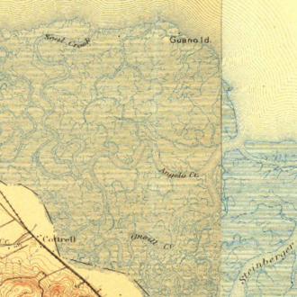
Hooks Island, California, USGS survey map 1899 (1899 edition).png - JPxG

Hooks Island, California, USGS survey map 1953 (1955 edition).png - JPxG

Hooks Island, California, USGS survey map 2018 (2018 edition).png - JPxG
Aramburu Island, USGS, 1955.png - JPxG

Aramburu Island, USGS, 1980.png - JPxG

Aramburu Island, USGS, 1999.png - JPxG

CA San Francisco 301577 1915 62500.jpg - Taylor.valci

San francisco bay.svg - Jhbdel

Admiralty Chart No 591 San Francisco Harbor and Approaches, Published 1952.jpg - Kognos

Admiralty Chart No 591 Habour of San Francisco, Published 1833.jpg - Kognos

Admiralty Chart No 591 Habour of San Francisco, Published 1833 (cropped).jpg - Kognos

Race and ethnicity 2010- San Francisco, Oakland, Berkeley (5560477152) (cropped).png - Cristiano Tomás

East part of East Bay San Francisco Bay Area California street road map SVG.svg - Kirill Shrayber

San Francisco Bay Area California US street road map SVG.svg - Kirill Shrayber