Wikimedi'Òc
Modes d'emploi

Cet album fait partie des albums
Cet album photos contient les sous-albums suivants :


Map of Rhode Island highlighting Providence County.svg - Nux

Map of Providence County Rhode Island With Municipal Labels.PNG - Ruhrfisch

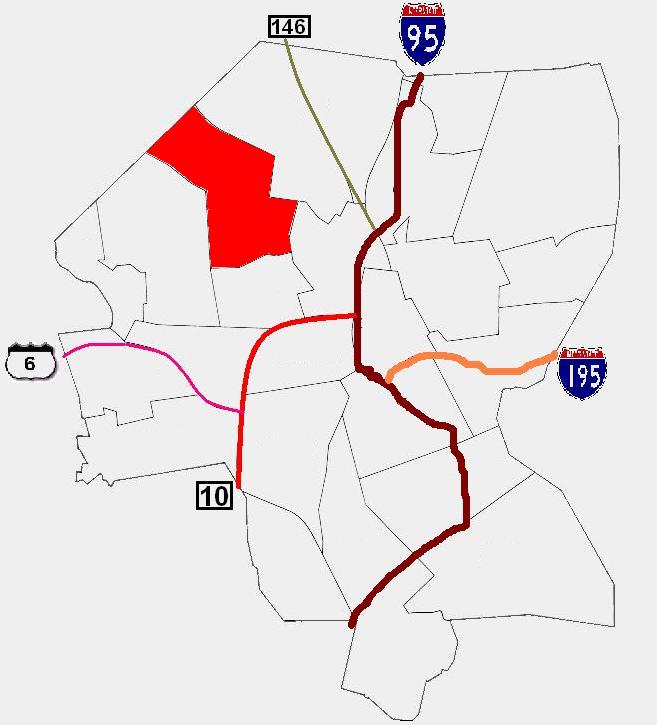
Woonsocket RI lg.PNG - MGA73bot2
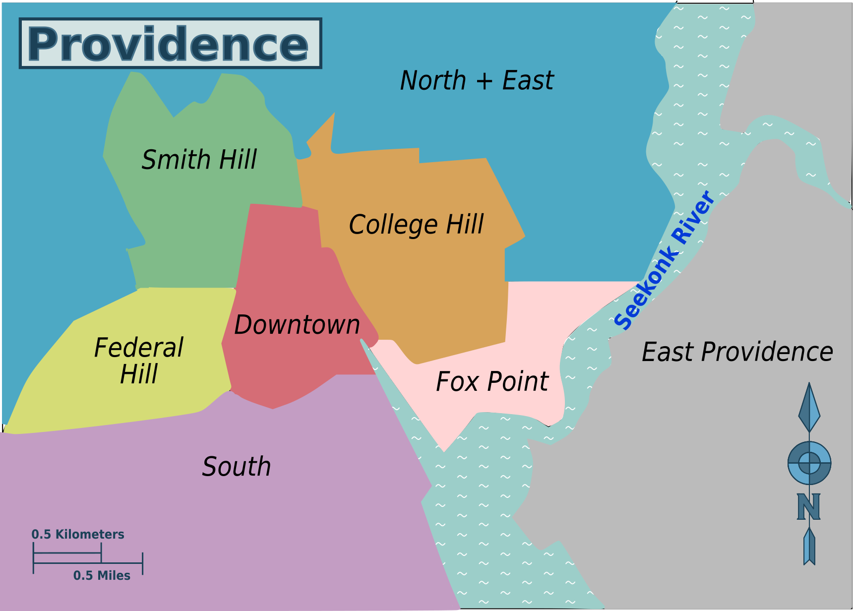
Wikivoyage Providence map PNG.png - Ar2332

Wikivoyage Providence map.svg - Ar2332
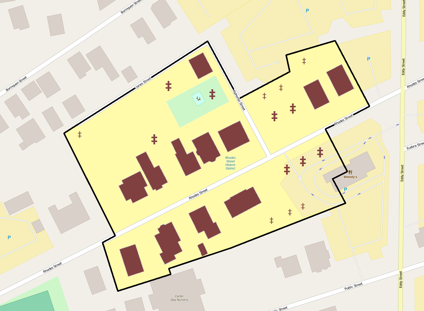
Rhodes Street HD boundary map.png - Ipoellet

Rhodes Street HD contributing resources.png - Ipoellet

Provneigh-fedhill.JPG - FastilyClone
Flood plain management study, Pascoag Reservoir upper and low dams, flood inundation map, Burrillville, Rhode Island - November 1988 LOC 89696935.tif - Fæ

Flood plain management study, Pascoag Reservoir upper and low dams, flood inundation map, Burrillville, Rhode Island - November 1988 LOC 89696935.jpg - Fæ
ProvneighElm.JPG - Loodog