Wikimedi'Òc
Modes d'emploi

Cet album fait partie des albums


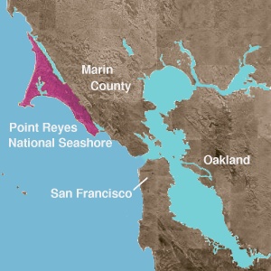


NPSmap.jpg - Marcia Wright~commonswiki
Wpdms usgs photo point reyes large.jpg - Nachcommonsverschieber
Wpdms usgs photo point reyes large 2.jpg - MGA73bot2
Wpdms usgs photo point reyes national seashore.jpg - MGA73bot2

Point-reyes-map.jpg - Wrh2

Point Reyes National Seashore map.png - DimiTalen

Historic alphabet designations of Point Reyes Ranches, 1860–1990.jpg - Frank Schulenburg

California fish and game (20325794368).jpg - Fæ
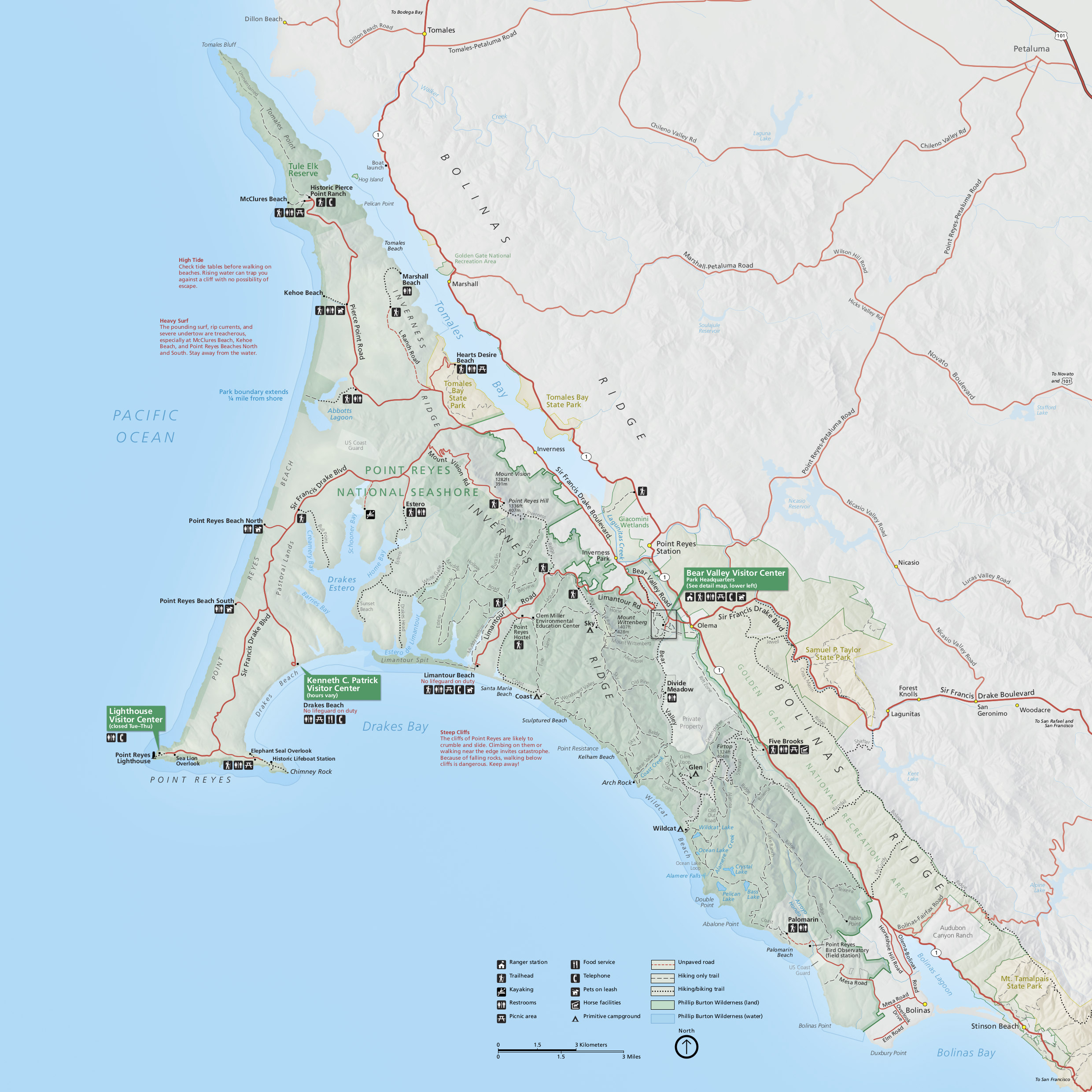
NPS point-reyes-map.jpg - RKBot
NPS point-reyes-map.pdf - RKBot

NPS point-reyes-regional-map.jpg - RKBot
NPS point-reyes-regional-map.pdf - RKBot

NPS point-reyes-trail-map-north.gif - RKBot

NPS point-reyes-trail-map-south.gif - RKBot
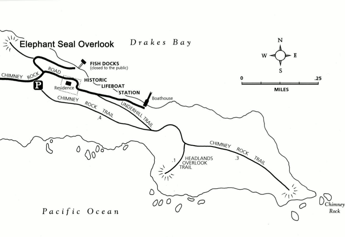
NPS point-reyes-chimney-rock-trail-map.gif - RKBot
NPS point-reyes-chimney-rock-trail-map.pdf - RKBot

NPS point-reyes-bear-valley-trail-map.jpg - RKBot
NPS point-reyes-bear-valley-trail-map.pdf - RKBot

NPS point-reyes-sky-campground-map.jpg - RKBot
NPS point-reyes-sky-campground-map.pdf - RKBot

NPS point-reyes-glen-campground-map.jpg - RKBot
NPS point-reyes-glen-campground-map.pdf - RKBot

NPS point-reyes-coast-campground-map.jpg - RKBot
NPS point-reyes-coast-campground-map.pdf - RKBot

NPS point-reyes-wildcat-campground-map.jpg - RKBot
NPS point-reyes-wildcat-campground-map.pdf - RKBot

NPS point-reyes-boat-in-camping-map.jpg - RKBot
NPS point-reyes-boat-in-camping-map.pdf - RKBot

Desde el puerto, o boca de Sn. Franco. asta el puerto de la Bodega.png - Missvain

Admiralty Chart No 229 Point Pinos to Bodega Head, Published 1868, Large Corrections 1959.jpg - Kognos

Admiralty Chart No 3120 Bodega Head to Abalone Point, Published 1900.jpg - Kognos