Wikimedi'Òc
Modes d'emploi

Cet album fait partie des albums
Cet album photos contient les sous-albums suivants :


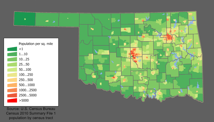
Oklahoma population density 2020.png - Crossover1370
CherokeeOTSA.PNG - QuartierLatin1968

Map of Oklahoma highlighting Panhandle.png - Waterguy~commonswiki

Okterritory.png - Kmusser

OklawahaCounty.gif - Machawk1

Land between the Red River and the North Fork of the Red River in Oklahoma.png - Jecowa

Enid Pond Creek 1894.png - File Upload Bot (Magnus Manske)

Day County OT map 1905.png - File Upload Bot (Magnus Manske)

Big Pasture 1905.png - File Upload Bot (Magnus Manske)

Wichita Mtns Wildlife Reserve locator.jpg - File Upload Bot (Magnus Manske)

Swanson Co OK map.png - File Upload Bot (Magnus Manske)
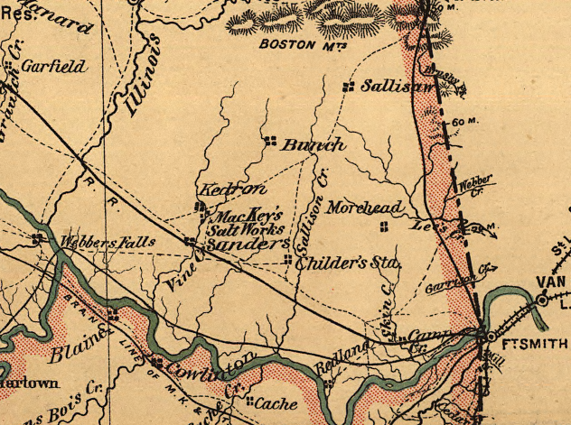
Map of MacKey Salt Works 1887.png - File Upload Bot (Magnus Manske)
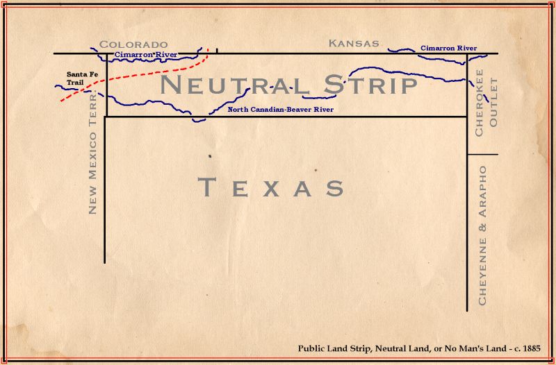
No Mans Land Oklahoma.jpg - File Upload Bot (Magnus Manske)

Unassigned Lands 1885.jpg - Michbich
Oklahoma relief map.png - File Upload Bot (Magnus Manske)
Oklahoma population map.png - JimIrwin
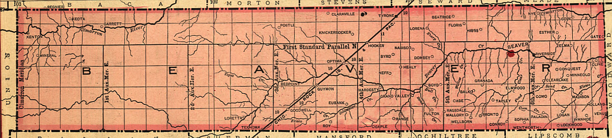
Old Beaver County.png - File Upload Bot (Magnus Manske)
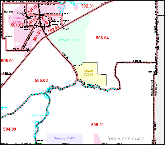
Tiawah CDP map.png - File Upload Bot (Magnus Manske)
WyandotteOTSA.PNG - File Upload Bot (Magnus Manske)

Wellston OK map 1887.png - File Upload Bot (Magnus Manske)

CSM - FAA airport diagram.png - BetacommandBot

Isla bayou.jpg - Miriam Roviralta
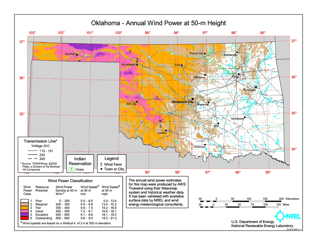
Oklahoma wind resource map 50m 800.jpg - Teratornis

Ogallala area freshwater ground withdrawals all aquifers.png - Kbh3rd

Salt Plains Wildlife Refuge EO 5314 illustration.png - Clindberg

Map of World War II Japanese American internment camps.png - Ras67

Okfuskee-County-map-1972.jpg - ChrisO

IndianTerritory1885.jpg - Clindberg

Choctaw nation map.png - Urbanative

OK district 2.gif - MGA73bot2
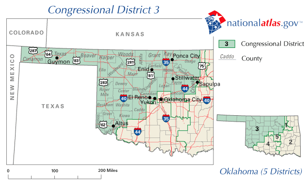
OK district 3.gif - MGA73bot2

OK district 4.gif - MGA73bot2
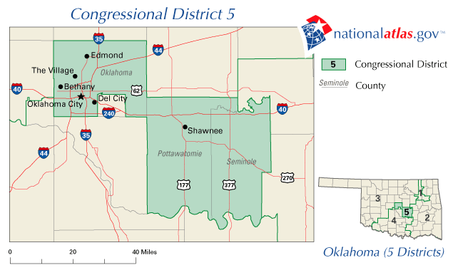
OK district 5.gif - MGA73bot2
Map of Oklahoma highlighting Panhandle (small).png - File Upload Bot (Magnus Manske)

OKregions.png - Xltel

OklahomaDistrictLCMS.png - Jared82ca~commonswiki

Lawton WXK-86 County Map.gif - Master of Time
Oklahoma City WXK-85 County Map.gif - Master of Time

Ponca City WWF-42 County Map.gif - Master of Time
Stillwater WNG-654 County Map.gif - Master of Time

Wewoka KJY-95 County Map.gif - Master of Time

Woodward WWG-46 County Map.gif - Master of Time

Wichita Falls WXK-31 County Map.gif - Master of Time

Altus WWG-97 County Map.png - GifTagger

Ardmore KXI-57 County Map.png - GifTagger

Atoka KWN-49 County Map.png - GifTagger

Pawnee Nation Map of the Boarding School Historic District.jpg - Steven C. Price
USGS Chouteau Quad.tif - Kopiersperre

Chickasha KJY-94 County Map.png - GifTagger

Clinton WXK-87 County Map.png - GifTagger

Enid WXL-48 County Map.png - GifTagger

Oklahoma Regions.PNG - Fufemu

Bandblocations.PNG - BD2412

United States Central change 1907-11-16.png - Golbez
Lake-Texoma-Map.gif - Fkbowen

Map of texoma area New.jpg - Fkbowen

County Map of Texoma.jpg - Fkbowen

County Map of Texoma Region.jpg - Fkbowen

Annual report of the Bureau of American Ethnology to the Secretary of the Smithsonian Institution (1895) (19174400088).jpg - Fæ

The encyclopædia britannica; a dictionary of arts, sciences, literature and general information (1910) (14775239511).jpg - SteinsplitterBot

Indians of the Southwest (1903) (14765144625).jpg - Faebot

Oklahoma Cherokee.png - FastilyClone

OK-patotenilo.png - NMaia

Oklahoma Governors by county.png - BD2412

Oklahoma Köppen.png - Redtitan
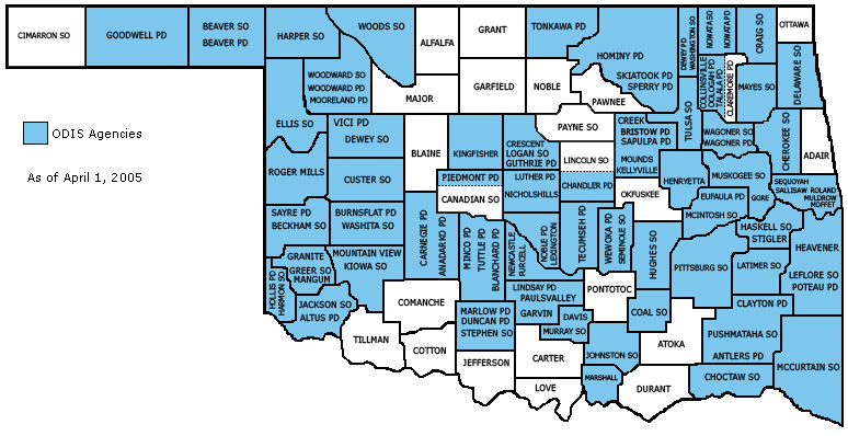
ODISAgencyList.jpg - BD2412

Terremoto de oklahoma de 2016.jpg - JoaquinVasquez6

2016 Oklahoma seismic hazard map.gif - Master of Time

Oklahoma gis.jpg - Lbonura

OK IT map 1905.png - Ionutzmovie
Ouachita Mountains ecoregion, Level III.png - Brandonrush
Arkansas Valley ecoregion, Level III.png - Brandonrush

South Central Plains ecoregion, Level III.png - Brandonrush
Ozark Highlands ecoregion, Level III.png - Brandonrush

23 of 'La Vie Américaine. Ouvrage illustré, etc' (11125271785).jpg - Artix Kreiger 2

Wichita Uplift fault map.png - Pi3.124

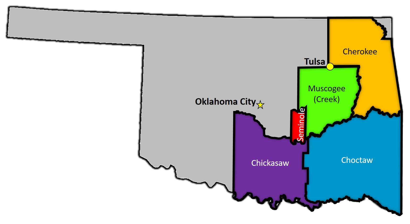
Muscogee Creek Nation Territory.png - Chipermc
Boundaries of the Five Tribes in 1866.jpg - Chipermc

Amended Fractional Map No. 1 Superseding Fractional Map No. 1 . . . Showing the Revised Location in Oklahoma of the Spur from POAG, --West--of the Midland Valley Railroad Co. . . . Miles 1 to 3.35 Inc'l - NARA - 6093357.jpg - US National Archives bot

Amended Location Map of Sallisaw, McAlester and Southern Ry., Lands Required for Right-Of-Way . . . Segregated Land 41.48 Acres, Allotted Land 17.18 . . . McAlester, Okla. - NARA - 6093374.jpg - US National Archives bot

Amended Location Map of Sallisaw, McAllester and Southern Ry., Land Required for Right-Of-Way . . . Oklahoma - NARA - 6093376.jpg - US National Archives bot

Oklahoma Panhandle.svg - Eschwanitz

Ouachita Mountains Counties Map.png - LegionaryIX

Muscogee Nation Jurisdiction.png - Kaldari

OKregions Map.gif - Houstonman6
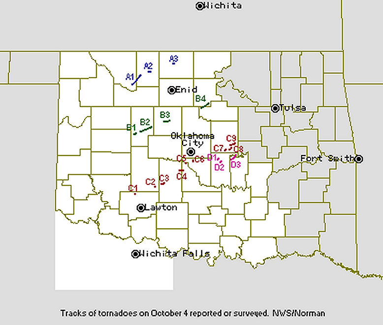
19981004map.png - 453Brax

Oklahoma Area Codes.png - Bryanbethea
MO-OK CSA Map.png - Cjs9c9
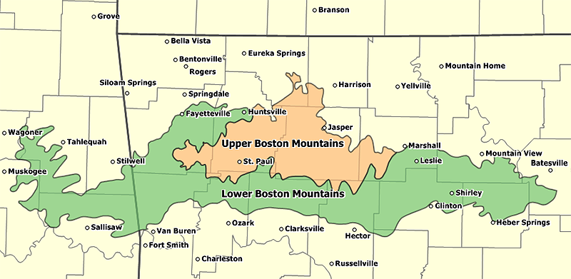
BostMtnOv2.png - Tosborn

Cut-throat Massacre - map with kiowa camp in Oklahoma and osage villages i Kansas.png - Indianertosset

Physiographic provinces of Oklahoma and Texas (26308261684).jpg - Ltn12345

Kort med kiowa-lejren ved Wolf Creek og cheyennerne og arapahoernes rute mod den.png - Indianertosset

Map relating to the attack on the Kiowas at Wolf Creek, Oklahoma, in 1838 by the Cheyennes and Arapahoes png.png - Indianertosset

Possible Coronado Expedition Routes as found by Bolton, Riley and Winship.png - Indianertosset

Possible Coronado Expedition Routes as found by Day, Donoghue and Wedel.png - Indianertosset
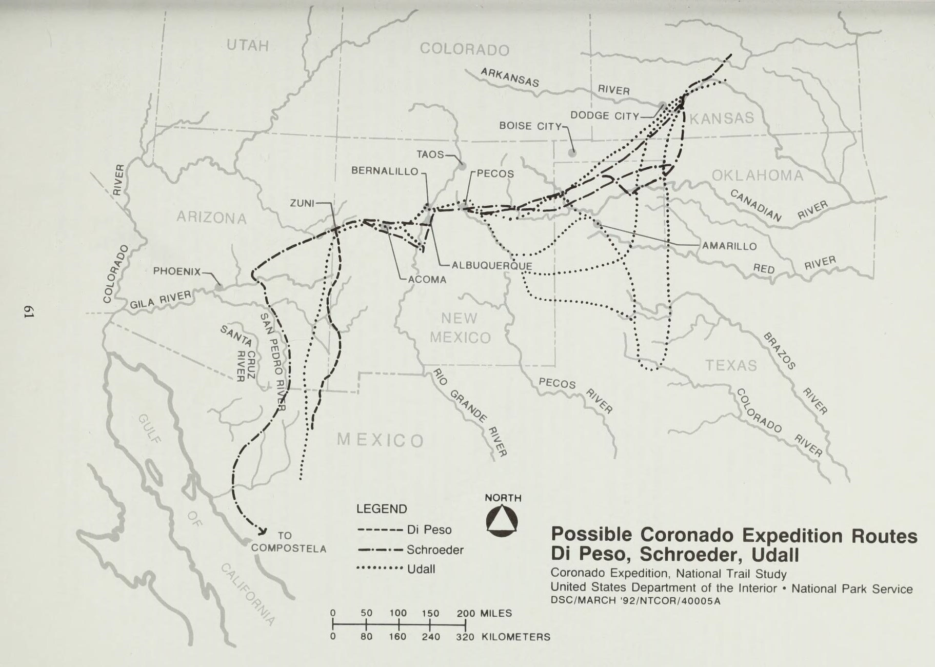
Possible Coronado Expedition Routes as found by Di Peso, Schroeder, Udall.png - Indianertosset

Population density of Oklahoma counties (2020).png - Austiger

2011 okc ward map.png - Urbanative
Oklahoma Level IV ecoregions.pdf - TimK MSI

A sketch map of the location of the Tonkawa Massacre, 1862.png - Indianertosset

A map of Cherokee land ownership from the Treaty of 1828 at the Tahlonteeskee museum and visitor center in Gore, Oklahoma (6035bea8-4942-4f28-8cc2-950ba60b697a).JPG - BMacZeroBot

An exhibit panel at the Fort Smith National Historic Site Visitor Center Museum in Fort Smith, Arkansas (98fd0966-9b8c-46cd-8395-11ce42aed1e8).JPG - BMacZeroBot

Chickasha city limits on Grady county.png - Qorymij37
Oklahoma - PPP Route.pdf - Anemonununennium

Wichita native areas and some archaeological sites in Kansas, Oklahoma and Texas.png - Indianertosset

Topographical map of Black Mesa.png - Louis P. Boog

Black Mesa Topo Map-text-paint.png - Louis P. Boog

Oklahoma County Flips 2004.svg - Putitonamap98

Ok House District 2000.svg - IagoQnsi
Geothermal resources of Oklahoma.pdf - Jengod

Homeland and reservations of the Missouria and Otoe.png - Indianertosset

Tonkawa - the way from Texas to Tonkawa Tribal Reserve, Oklahoma.png - Indianertosset