Wikimedi'Òc
Modes d'emploi

Cet album fait partie des albums
Cet album photos contient les sous-albums suivants :


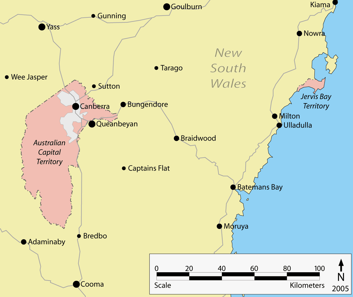
ACT-Jervis Bay-MJC.png - Ian Fieggen

MoreetoBoggabilla.png - Cartman02au

Tuggerah Lake map.png - David Levy

Outline map of the Mallee and Sunraysia district (red circle) predominantly within the Rural City of Mildura.gif - VirtualSteve

New South Wales cadastral divisions.png - Roke~commonswiki
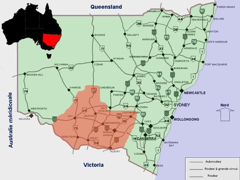
Riverina NSW copie.png - Berichard

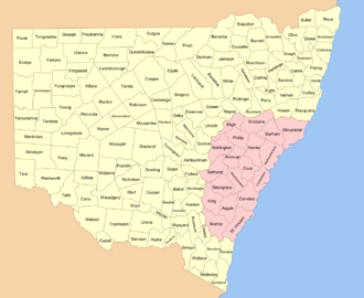
NSW LGA.svg - Seb26
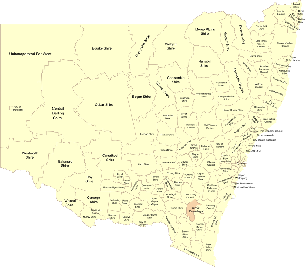
NSW LGA map (cropped).png - Seb26
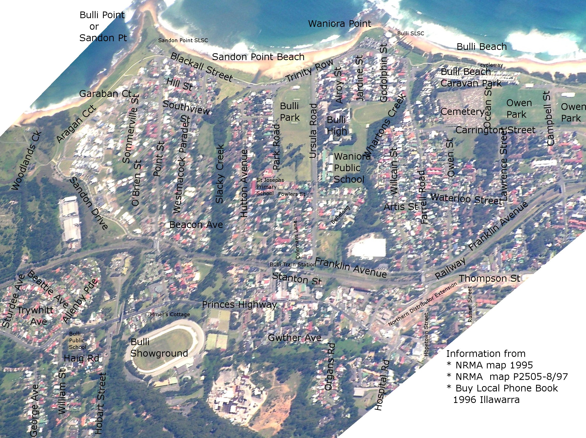
Bulli Map.jpg - Graeme Bartlett
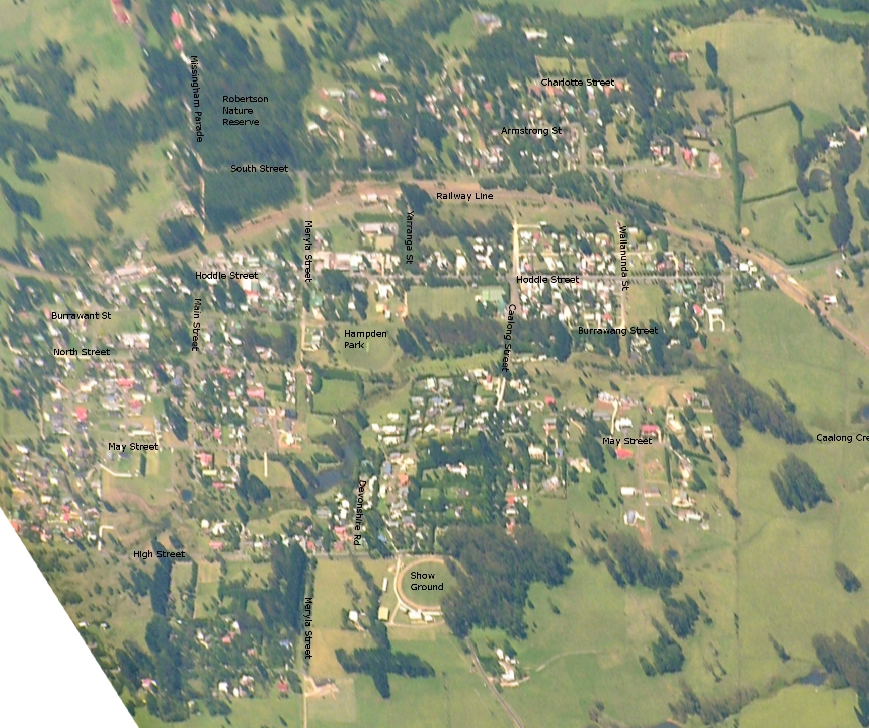
Robertson Map.jpg - Graeme Bartlett

SVG-Koort Nee-Süüd-Wales.svg - Slomox

Flag-map of New South Wales.svg - Allice Hunter
Burrawang Map.xcf - Graeme Bartlett

Burrawang Map.jpg - Graeme Bartlett
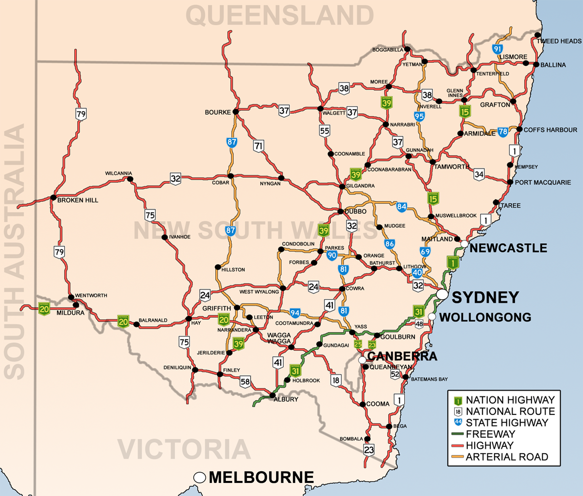
Map of NSW Highways.png - Bidgee

Wagga Wagga Suburbs and Towns (Development V1).png - Bidgee

HumeHwy-StripMap.png - MagpieShooter~commonswiki

New England.jpg - Cgoodwin

New South Wales Districts Map.svg - Wilimut

Location Kamilaroi Hwy.svg - Saebhiar~commonswiki

NSW floods by LGA 20101205.png - Cartman02au

Rylstone-street map.png - Geez-oz

Speers Point, New South Wales map.svg - File Upload Bot (Magnus Manske)

ACT-Jervis Bay-Sydney-MJC minimap.png - Albinfo

ACT-Jervis Bay-MJC minimap.png - Albinfo

ACT-Jervis Bay-MJC.svg - TUBS

Sydneyclimatezone.jpg - Lionhead99

Ward Map of Woollahra.gif - Rgrundle28

Tourism in the 1930s (5691841050).jpg - File Upload Bot (Magnus Manske)

NSW region map.png - OgreBot

OTA Zone map.jpg - Nswota

Milsons Passage & Milson Island.jpg - Selkcerf0142

Riverina 1916.jpg - Roke~commonswiki
Road towards the Monaro region, within Murray County.jpeg - Nbound
Blaxland's route across the mountains in 1813.jpg - Collywolly

The-eastern-swamp-crayfish-Gramastacus-lacus-sp.-n.-(Decapoda-Parastacidae)-a-new-species-of-zookeys-398-053-g004.jpg - Recitation-bot

An account of a voyage to New South Wales (1810) (14593956418).jpg - Fæ

Persooniaterminalisrgemap.png - Casliber

Total Full Time Workload Equivalent GPs in New South Wales.png - Drbajrangbali

New South Wales Köppen.svg - Redtitan

Photograph showing a map of the extension of the Railway Terminus to the Devonshire Street Cemetery recommended by Public Works Committee 1900 (15724387853).jpg - Fæ

Plan of the wharves carried out from the Premises of John Kellick and Thomas Day in Darling Harbour (14086131984).jpg - Fæ

Police Districts Campbell Town, Camden, Narellan and Picton also Liverpool (14086767594).jpg - Fæ

South Australia - Eastern boudary of South Australia coloured red and the boundary proposed by Governor Grey coloured greeen, by Sir T L Mitchell coloured yellow (Sketch book 4 folio 214) (14623585442).jpg - Fæ

Map of where planets (signs) are located - panoramio.jpg - Panoramio upload bot

Aboriginal Tribes of Riverena.png - D A R C 12345

Traditional lands of Aboriginal tribes in Central NSW.png - D A R C 12345
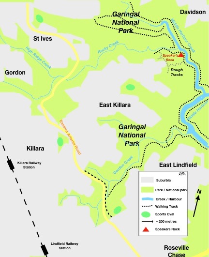
Rostrum Speakers Rock Middle Harbour MAP.001.jpg - Robert (Bic) Bicknell

PooleCounty3.png - D A R C 12345

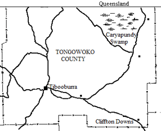
Tongowoko County1.png - D A R C 12345

Delilah County1.png - D A R C 12345

EvelynCounty1.png - D A R C 12345

LangParish 11.png - D A R C 12345

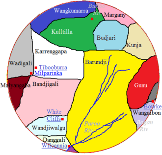
Map of Karrenggapa Traditional Lands.png - D A R C 12345

Kulltilla Map.png - D A R C 12345

Badjari Map.png - D A R C 12345

Packsaddle, New South Wales.png - D A R C 12345
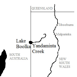
Yandaminta Creek.png - D A R C 12345
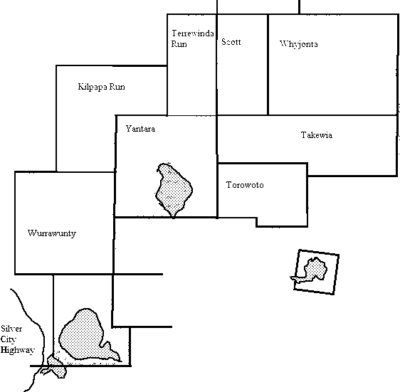
Yantara Map2.png - D A R C 12345
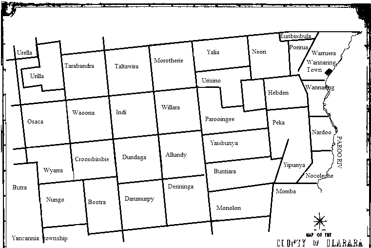
UlararaCounty1map.png - D A R C 12345

Bolderogery Parish Sketch Map.png - D A R C 12345

Narromine Parish (Oxley County) map.png - D A R C 12345

Narromine Parish (Oxley County) map2.png - D A R C 12345

Cobham lake1.png - D A R C 12345

Mouramba County map 1886.png - D A R C 12345

Hundred of Heathcote.png - D A R C 12345

Hundred of Richmond2.png - D A R C 12345

HUndred of Bingelley.png - D A R C 12345
Barranbinya Lands.png - D A R C 12345
MuruwariLands.png - D A R C 12345
Ngunawal Lands.png - D A R C 12345

McClay River.png - D A R C 12345
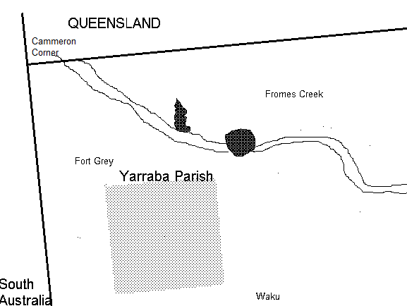
Map of Yarraba Parish.png - D A R C 12345

Sturt Parish Pool County (NSW).png - D A R C 12345

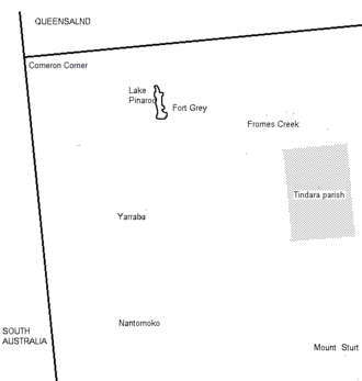
Tindara Parish, Poole County1.png - D A R C 12345

StewartParish-NSwmap12.png - D A R C 12345

ClarenceRiver.png - D A R C 12345

Map of the Colo River.png - D A R C 12345

Map of the traditional lands of the Gundangurra people.png - D A R C 12345
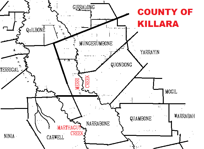
Killara County (NSW) 1941.png - D A R C 12345

Map of the Willandra Lakes Region, showing the World Heritage Area boundaries, 2008.jpg - Kerry Raymond

Map of Campbells Creek, Fowlers Gap New South Wales.png - D A R C 12345
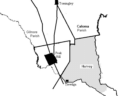
Harvey Parish (Peak Hill) NSW.png - D A R C 12345

County of Farnell Parishs.png - D A R C 12345

Morfotts Creek (Fowlers Gap) NSW map1.png - D A R C 12345

Johns River parish Macquaire County.png - D A R C 12345

Cundletown, New South Wales.png - D A R C 12345

Map of Burns, New South Wales.png - D A R C 12345

Map of Thackaringa.png - D A R C 12345

Stephens Creek map.png - D A R C 12345

Fowlers Gap, New South Wales.png - D A R C 12345

NNTT Map of the Yuin South Coast native title claim NSW.png - Sanglorian
National Native Title Tribunal Map of the application area (South Coast).pdf - Sanglorian

Map showing the location of Parry County (NSW).png - D A R C 12345

Map showing the location of Gulgo County, New South Wales.png - D A R C 12345

Map showing the location of Windeyer County (New South Wales).png - D A R C 12345

Map showing the location of Tara County, New South Wales.png - D A R C 12345

Map of Yandagulla Parish, near Louth, New South Wales.png - D A R C 12345

Map of Lismore Parish near Wanaaring, New South Wales.png - D A R C 12345

Map of Wanaaring and Tibubuirra, far western New South Wales.png - D A R C 12345

Map showing the location of Wanaaring, New South Wales.png - D A R C 12345

Map showing the location of Cockle Creek South of Newcastle, NSW.png - D A R C 12345
Parro River Map.png - D A R C 12345

Map of Tilpa New South Wales.png - D A R C 12345

Map of Wanaaring, New South Wales.png - D A R C 12345

Map of the Unincorperated area of Far Western New South Wales.png - D A R C 12345

Map of Little Topar, New South Wales.png - D A R C 12345

Map of Broughams Gate.png - D A R C 12345

1789 - Great North Road, Between Mt Manning and Wollombi - SHR Plan 2238 (5060554b10).jpg - Kerry Raymond

Campbells Creek Map.png - D A R C 12345

Covid 19 hotspot map for New South Wales (12 April 2020).png - D A R C 12345

Stage 1 map.png - Pkum5154

Three cities.png - Pkum5154

Sydney statistical areas.png - Randwicked
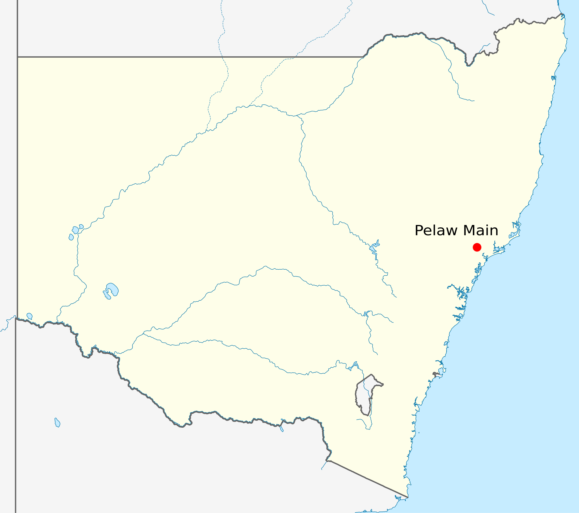
Pelaw Main Map.png - Jenaemadden

RCC Operational Area Overview.jpg - RobertJazwinski

Wrrambungles diagram.png - D A R C 12345

LiverpoolNSWmap.jpg - Thats Just Great

NSW Map 25 04 2021.png - Greenie2020

NSW Metropolitan Map 25 04 2021.png - Greenie2020

Australia, NSW COVID-19 cases map 2021-07-24 11.15AM.png - Gryllida

Map of location of Windolay in NSW Australia.png - D A R C 12345

County of Landsborough 1914.png - D A R C 12345

Map of lang ParishNSW.png - D A R C 12345
Great Darling Anabranch Map.jpg - TheJosh

Beecroft in NSW.jpg - Penhilgocl

Tuggerah lake map.jpg - Tirin
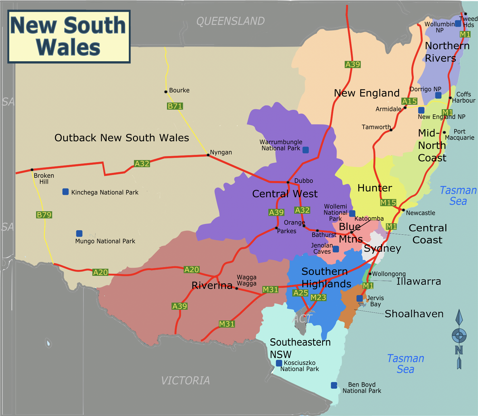
New South Wales regions map.png - SHB2000

Southeastern New South Wales regions map.svg - SelfieCity

Southeastern New South Wales regions map.png - SelfieCity

Great North Walk.jpg - Hikingluvva1337

EB1911 - New South Wales.png - DivermanAU

NSW Warrumbungles Tourist drives.jpg - Jghaines

Map of the tourist districts of the Blue Mountains, the Illawarra and the Southern Highlands of New South Wales.jpg - Austiger

Denham County 1876 map.png - D A R C 12345

Map of Cowper county in 1876.png - D A R C 12345

Map of Clyde County in New South Wales 1876.png - D A R C 12345

Map showing Parishes of Yanda County.png - D A R C 12345

Murchison County (NSW) Map 1886.png - D A R C 12345

Electoral divisions of Australia, 2004 (New South Wales).gif - Adam Carr

Admiralty Chart No 1379 Plans in New South Wales, Published 1965.jpg - Kognos

Admiralty Chart No 1021 Port Jackson to Fraser Island, Published 1957.jpg - Kognos

Admiralty Chart No 1020 Tathra to Wollongong, Published 1961.jpg - Kognos

Admiralty Chart No 1028 Crowdy Head to Wooli Head, Published 1955.jpg - Kognos

Hunter River 1901 SLNSW FL10521075.jpg - Eothan

Admiralty Chart No 1025 Kiama to Norah Head, Published 1957, New Edition 1966.jpg - Kognos

Admiralty Chart No 1027 Norah Head to Crowdy Head, Published 1957.jpg - Kognos

Admiralty Chart No 1017 Cape Everard to Montagu Island, Published 1963, New Edition 1966.jpg - Kognos

Outback NSW regions map.png - SHB2000

Outback NSW regions map.svg - SHB2000

Map showing main prickly pear areas of Queensland and New South Wales, circa 1930.jpg - Kerry Raymond

NSW REZs.jpg - MCE89

Map of Flinders Country in 1876.png - Returned dude12345

Mid-North Coast regions map.png - SHB2000

Mid-North Coast regions map.svg - SHB2000