Wikimedi'Òc
Modes d'emploi

Cet album fait partie des albums


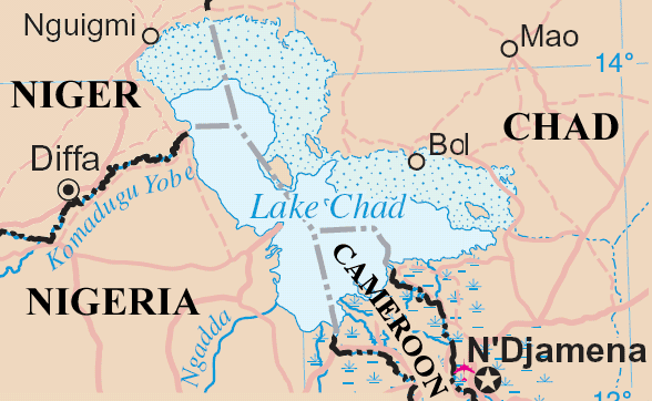
Lakechad map.png - Amcaja
Lakechad mapfr.png - Kimdime

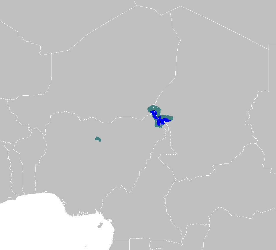
Zhadehu.png - Jnlin
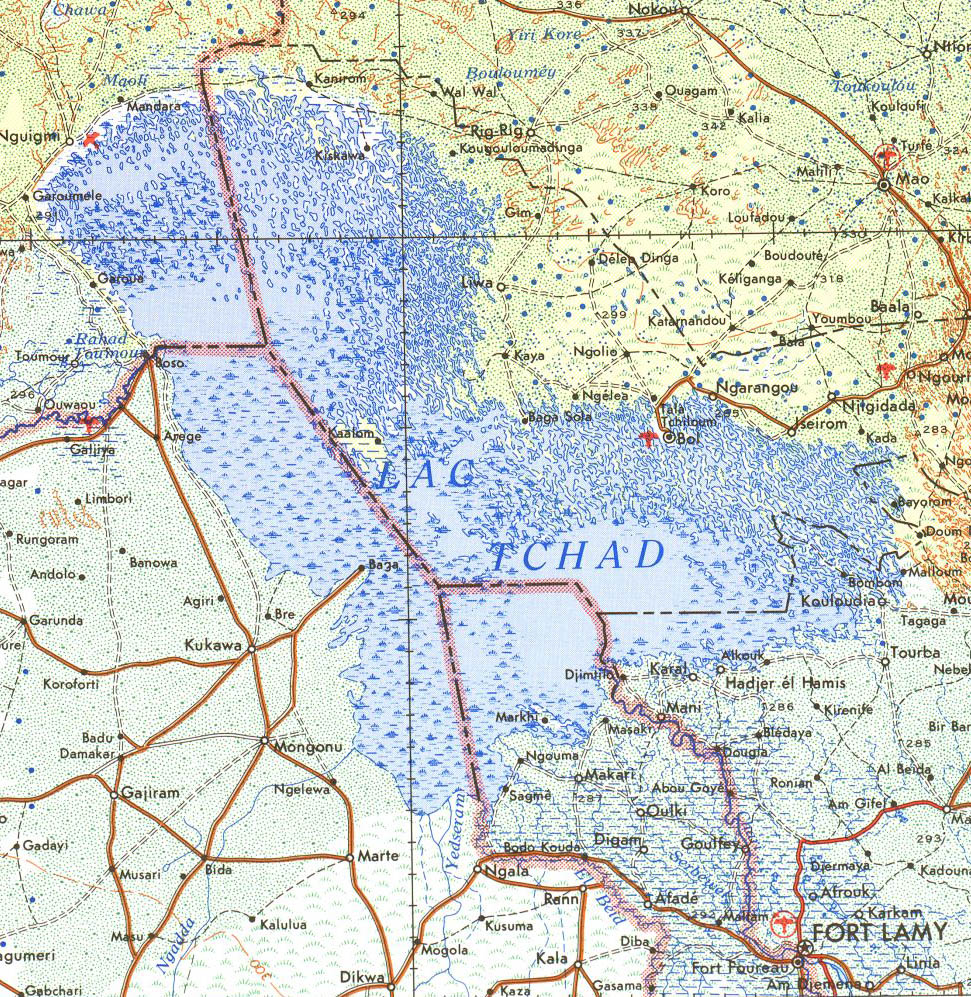
Lake Chad 1973.jpg - Roke~commonswiki
AT0904 map.png - Doreano~commonswiki

Zhadehu-tw.png - Shizhao

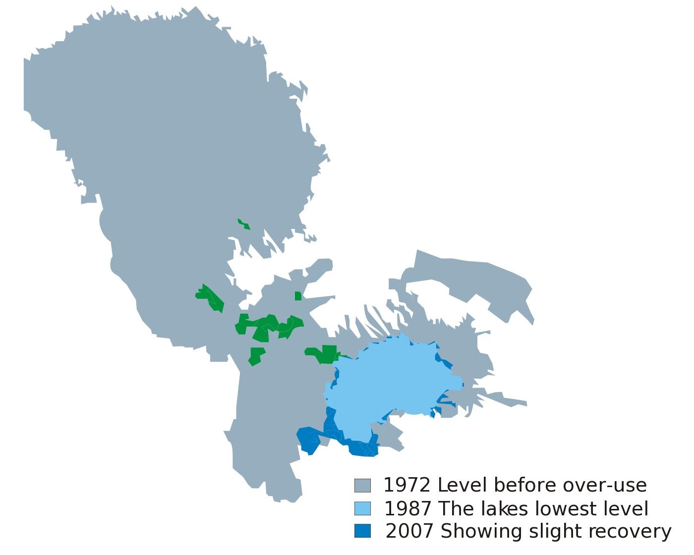
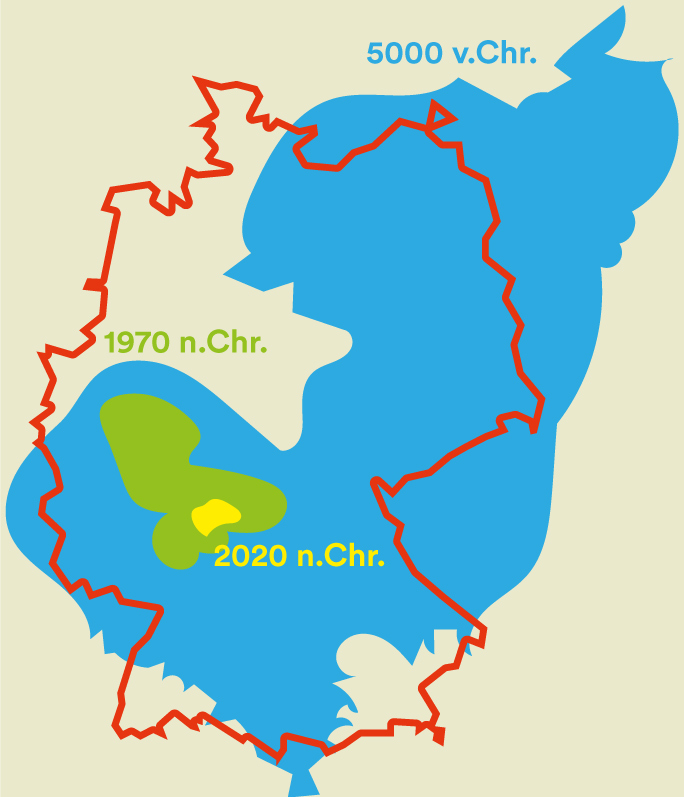
Lake Chad map showing receding water area and level 1972-2007.svg - KajenCAT

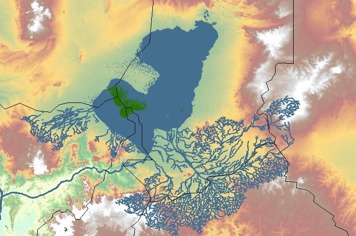
Lake Mega Chad Topography.jpg - 120
Lake Chad.jpg - Newbamboo

1911French Congo.png - LlywelynII

Tšaadi järv.png - Pikne

Stielers Handatlas 1891 68 Tsad-See.jpg - Funke
Megatschad GIS.PNG - Peter in s
Map Lake Chad 1876 B002.png - Katharinaiv

EB1911 Lake Chad.jpg - DivermanAU

44 of '(Travels and Discoveries in North and Central Africa- being a journal of an expedition undertaken under the auspices of H.B.M.'s Government, in the years 1849-55.)' (11053093203).jpg - Artix Kreiger 2

Chad-Nigeria border map.png - WisDom-UK

AFR V3 D411 Routes of the Explorers in the Tsad Basin.jpg - Ineuw

ISWAP and Boko Haram territory in early 2019.png - BorysMapping

Rabih az-Zubayr State.svg - DaniCBP

Rabih az-Zubayr 1896.png - DaniCBP

Mission Tilho. Lac Tchad. Aspect en avril 1908 tel qu'il résulte des levés faits de novembre 1907 à mai 1908 - par Tilho... - btv1b53062223p.jpg - Gzen92Bot

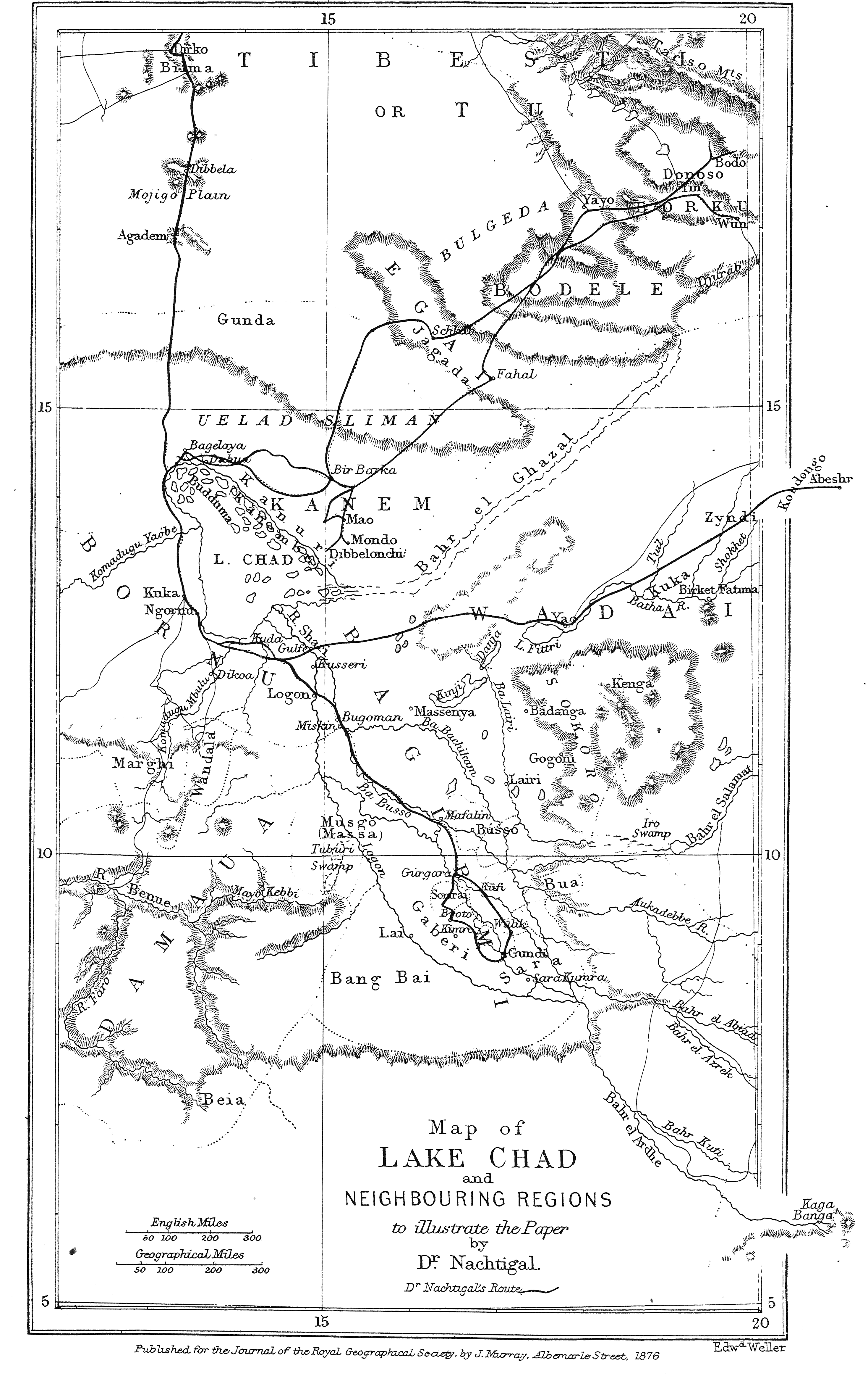
Karte zu Dr G. Nachtigal's Reisen in Bornû, Kânem u. Bagirmi - von Dr G. Nachtigal - btv1b53071040c.jpg - Gzen92Bot

La Mission Joalland - Meynier (Itinéraire du Niger jusqu'au lac Tchad) - btv1b53069930t.jpg - Gzen92Bot

Mission scientifique et économique Chari-Lac Tchad - dirigée par A. Chevalier, 1902-1904. Croquis des itinéraires. 1 - 5 000 000 ; Dessiné par J. Hansen - btv1b530711774.jpg - Gzen92Bot
Tschadsee Schrumpfung.jpg - FrankvEck

Megachad en disappearance of lake chad.jpg - FrankvEck

20230118 LakeChad ComplexCrisis(3).png - OptimusPrimeBot