Wikimedi'Òc
Modes d'emploi

Cet album fait partie des albums
Cet album photos contient les sous-albums suivants :


Crocker county railroad map.png - Elli

Kossuth County, Iowa, 1902.png - Firsfron
Kossuth County Iowa.png - Voyager

Map of Iowa highlighting Kossuth County.svg - Nux
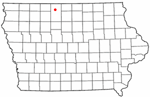
IAMap-doton-Algona.PNG - SieBot
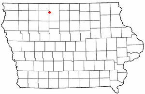
IAMap-doton-Bancroft.PNG - SieBot
IAMap-doton-Burt.PNG - SieBot
IAMap-doton-Fenton.PNG - SieBot
IAMap-doton-Lakota.PNG - SieBot
IAMap-doton-Ledyard.PNG - SieBot
IAMap-doton-LoneRock.PNG - SieBot
IAMap-doton-SweaCity.PNG - SieBot
IAMap-doton-Titonka.PNG - SieBot
IAMap-doton-Wesley.PNG - SieBot
IAMap-doton-WestBend.PNG - SieBot
IAMap-doton-Whittemore.PNG - SieBot

Kossuth County Iowa Incorporated and Unincorporated areas Algona Highlighted.svg - ArkyBot~commonswiki

Kossuth County Iowa Incorporated and Unincorporated areas Bancroft Highlighted.svg - ArkyBot~commonswiki

Kossuth County Iowa Incorporated and Unincorporated areas Burt Highlighted.svg - ArkyBot~commonswiki

Kossuth County Iowa Incorporated and Unincorporated areas Fenton Highlighted.svg - ArkyBot~commonswiki

Kossuth County Iowa Incorporated and Unincorporated areas Lakota Highlighted.svg - ArkyBot~commonswiki

Kossuth County Iowa Incorporated and Unincorporated areas Ledyard Highlighted.svg - ArkyBot~commonswiki

Kossuth County Iowa Incorporated and Unincorporated areas Lone Rock Highlighted.svg - ArkyBot~commonswiki

Kossuth County Iowa Incorporated and Unincorporated areas Lu Verne Highlighted.svg - ArkyBot~commonswiki

Kossuth County Iowa Incorporated and Unincorporated areas Swea City Highlighted.svg - ArkyBot~commonswiki

Kossuth County Iowa Incorporated and Unincorporated areas Titonka Highlighted.svg - ArkyBot~commonswiki

Kossuth County Iowa Incorporated and Unincorporated areas Wesley Highlighted.svg - ArkyBot~commonswiki

Kossuth County Iowa Incorporated and Unincorporated areas West Bend Highlighted.svg - ArkyBot~commonswiki

Kossuth County Iowa Incorporated and Unincorporated areas Whittemore Highlighted.svg - ArkyBot~commonswiki