Wikimedi'Òc
Modes d'emploi

Cet album fait partie des albums


Charltonisland.png - Jonesy22

GRAND Canal proposal (James Bay to Lake Huron).jpg - File Upload Bot (Magnus Manske)

Carte du fond de la baie d'Hudson en 1744.jpg - AYE R

Fond de la baie d'Hudson avec les fort anglais pris par les Français en 1686.jpg - AYE R

Fort Ruppert après sa prise par les Français en 1686.jpg - AYE R
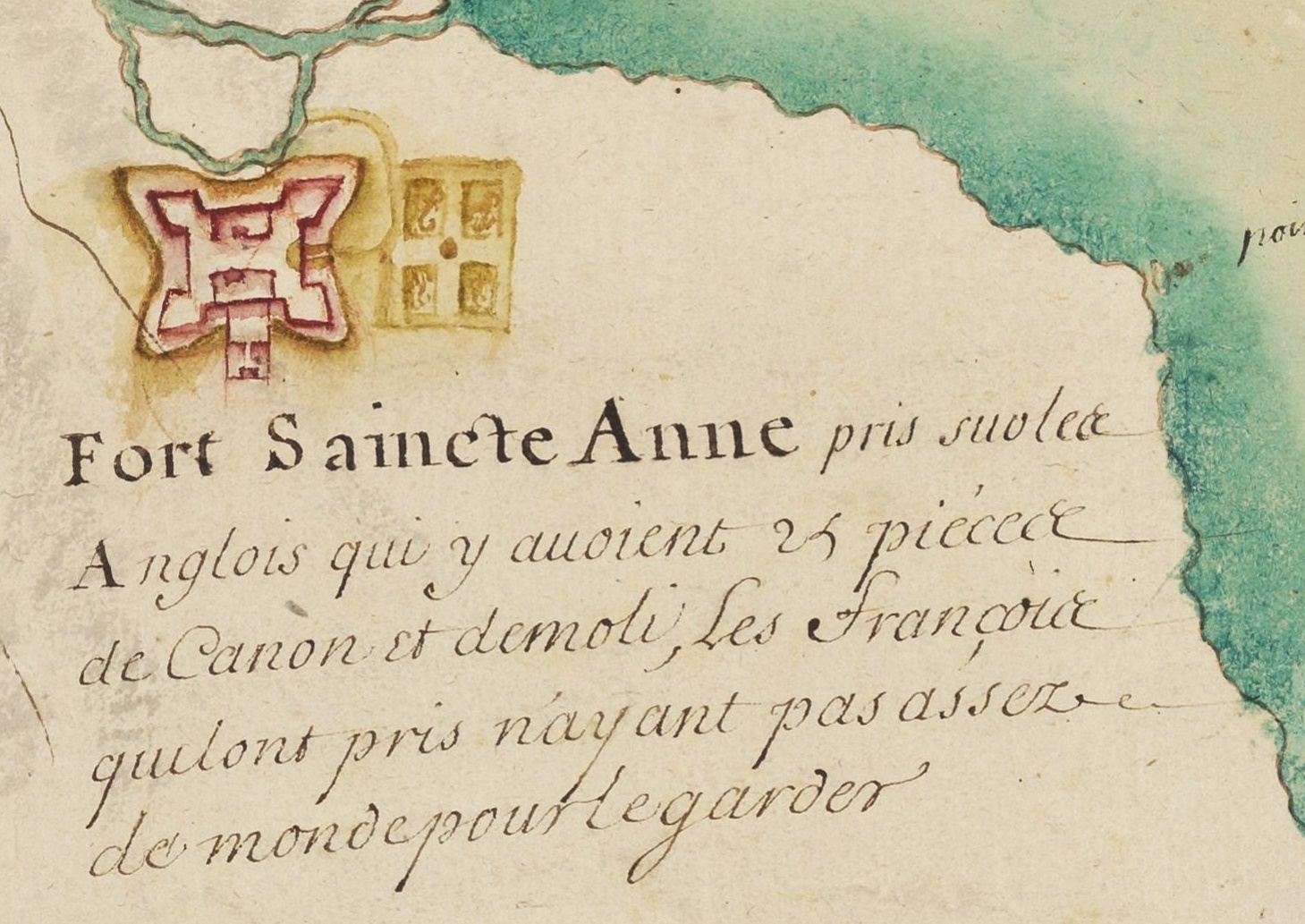
Fort Albany rebaptisé Fort Sainte-Anne aprés sa prise par les Français en 1686.jpg - AYE R

Moose Factory rebaptisé Fort St-Louis après sa capture par les Français en 1686.jpg - AYE R

Hudson Bay expedition (1686) map.svg - Flappiefh

Hudson Bay expedition (1686) map-fr.svg - Flappiefh

The Strange and Dangerous Voyage (Thomas James, 1633) - 2 foldout map The Platt of Sayling - 1 full view.png - Wikipetzi

The Strange and Dangerous Voyage (Thomas James, 1633) - 5 foldout map The Platt of Sayling - 4 Cape Henrietta Maria.png - Wikipetzi

Luke Foxe voyage account (North-West Fox, 1635) - 2 foldout map -1 full view.png - Wikipetzi

Luke Foxe voyage account (North-West Fox, 1635) - 3 foldout map - 2 Hudson Bay.png - Wikipetzi