Wikimedi'Òc
Modes d'emploi

Cet album fait partie des albums
Cet album photos contient les sous-albums suivants :


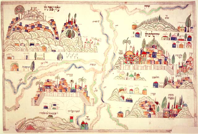
Four holy cities plaque.jpg - Zubosud 89

WestBank Hebron.png - Abhijitsathe

Hebron closures 2011 - OCHAoPt.jpg - Wickey-nl

Hebron H2 area 2011-ochaopt.jpg - Wickey-nl

Hebron redeployment 1997.jpg - Wickey-nl

Map of Hebron (1912).jpg - Racconish

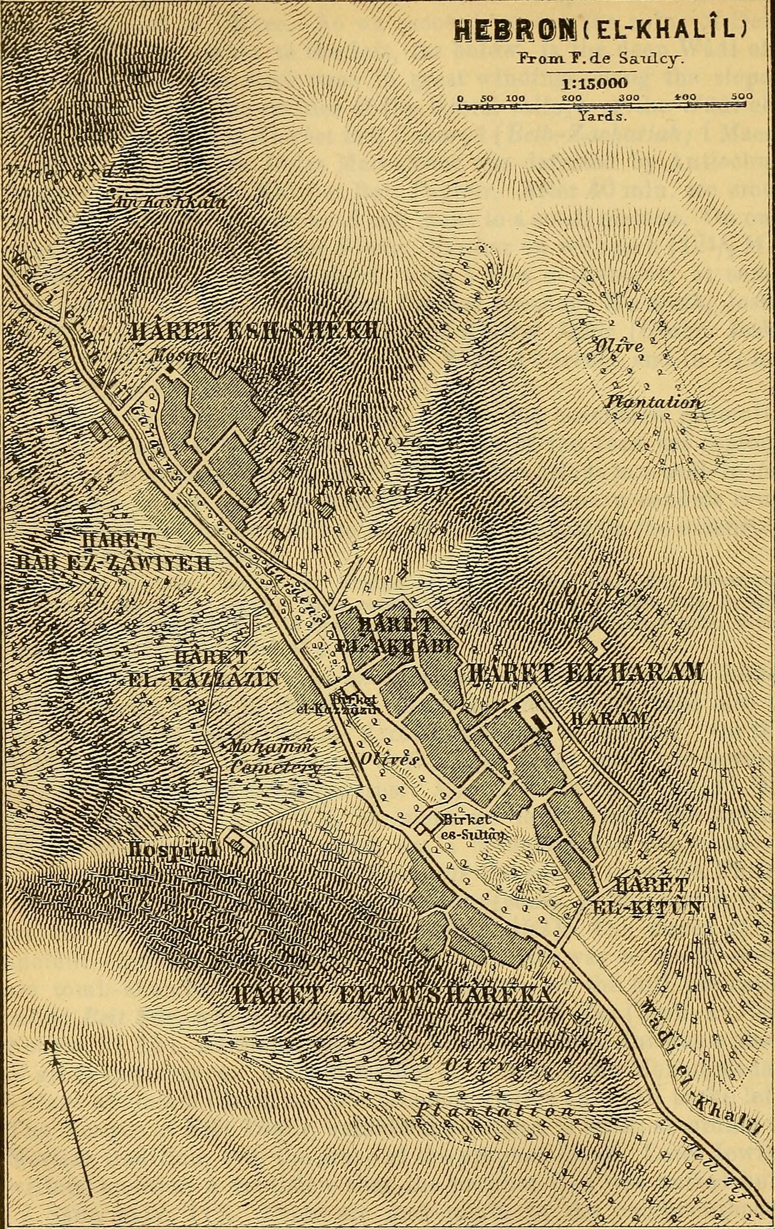
MACCOUN(1899) p039 HEBRON.jpg - Metilsteiner

(1881) PLAN DE MACPÉLAL OU TOMBEAU DES PATRIARCHES A HÉBRON.jpg - Metilsteiner
Palestine and Syria - with the chief routes through Mesopotamia and Babylonia - handbook for travellers (1906) (14773228282).jpg - Fæ

Palestine and Syria with the chief routes through Mesopotamia and Babylonia; handbook for travellers; (1906) (14781461651).jpg - Fæ

Halhul map.JPG - جار الله

Hebron map.jpg - جار الله

Hebron District Before 1948.png - جار الله

הסכם חברון 1997.png - Gabi S.

Floor plan of the Cave of the Patriarchs - 202 of 'Cradle Lands. (Travels in Egypt and the Holy Land' (11242649545).jpg - Fl.schmitt

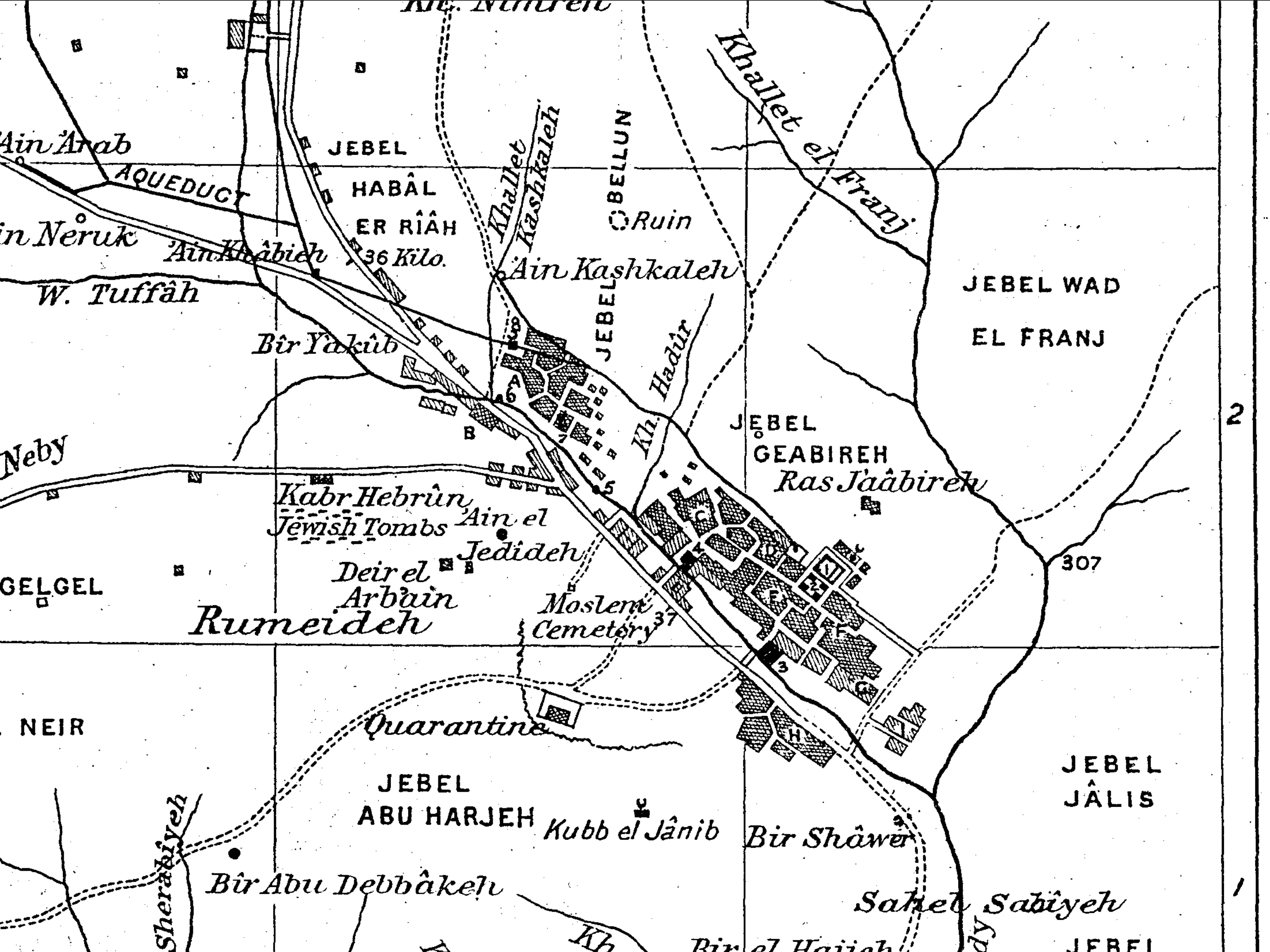
Plan of the Vicinity of Hebron from the 1871-77 Palestine Exploration Fund Survey of Palestine.jpg - Onceinawhile

Khalil er Rahman (Hebron) by Louis Félicien de Saulcy.jpg - Onceinawhile
1898 map of the Old City of Hebron.png - Onceinawhile

1940s Survey of Palestine map of Hebron.png - Onceinawhile

Hebron redeployment 1997-ar.jpg - باسم

Humanitarian impact of Israeli settlements in Hebron city (2019).jpg - Onceinawhile