Wikimedi'Òc
Modes d'emploi

Cet album fait partie des albums
Cet album photos contient les sous-albums suivants :


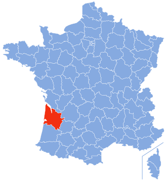


Gironde.jpg - Follavoine~commonswiki

Entree-du-Bassin-Arcachon.png - Pline
Gironde map blank.svg - Sting
Gironde map blank.png - Mtu33260
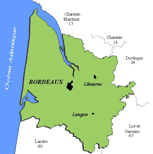
GirondePays.png - Larrousiney

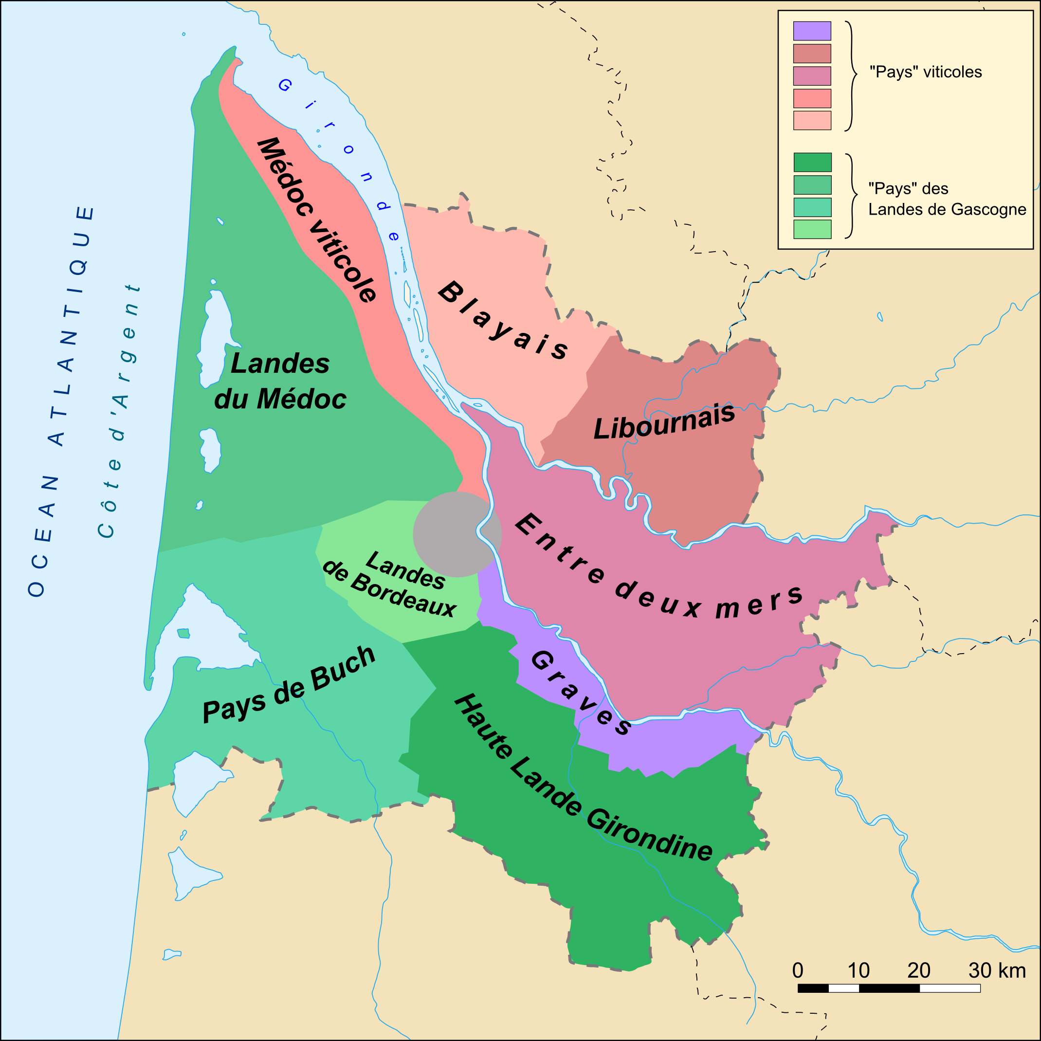
CarteGascogne.png - Mtu33260

Talence CUB.png - Ludo33

PointedeGraveSituation.png - Frokor

Quartiers Pessac.png - Ludo33

Entrada Bahía de Arcachón.png - SanchoPanzaXXI~commonswiki

Gironde-Position.svg - Marmelad

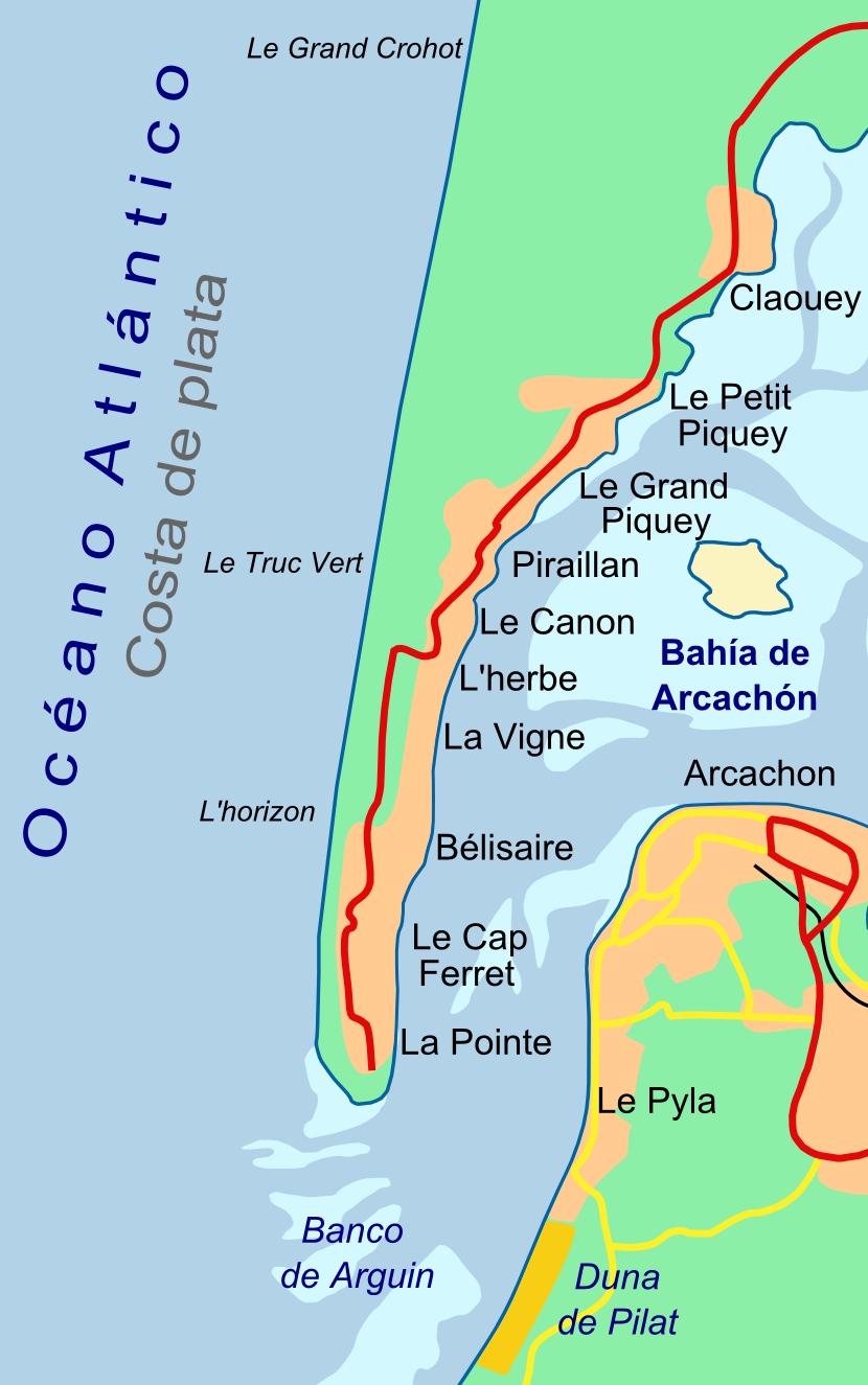
PresquileCapFerret.png - Larrousiney
CaboFerret.png - Larrousiney

Fargues plan Wiki dynamiques.jpg - Charrié

CUB begles.JPG - Maxriviere

Bayas-france-map.JPG - Abrahami

COBAS.png - Larrousiney
Blank Map of Gironde Department, France, with Communes.svg - Max93600

Bordeaux wine region.png - OgreBot

Gironde department location map.svg - Flappiefh

Entre-deux-Mers hydrology map.svg - Flappiefh

Région naturelle de l'Entre-deux-Mers ECPI map.svg - Flappiefh

Camin Arriaou.jpg - A1AA1A

Juridiction de Saint-Émilion.jpg - Wald-Burger8

Petite Gavacherie (Gironde).png - Vida Nova
Petite Gavacherie (Gironde) - détail.png - Vida Nova

Carte de la Communauté de communes du Grand Cubzaguais, Gironde, France au 1er janvier 2017.svg - Grandcubzaguais
ETH-BIB-Gironde Mündung-Dia 247-Z-00395.tif - ETH-Bibliothek

Railway map of France - 33 - animated - fr.gif - Benjism89

Carte topographique - par le chevalier de Clerville... - btv1b531428225 (1 of 2).jpg - Gzen92Bot