Wikimedi'Òc
Modes d'emploi

Cet album fait partie des albums
Cet album photos contient les sous-albums suivants :


France-LouisXIV-Traité de Ryswick.jpg - Spyro90fr
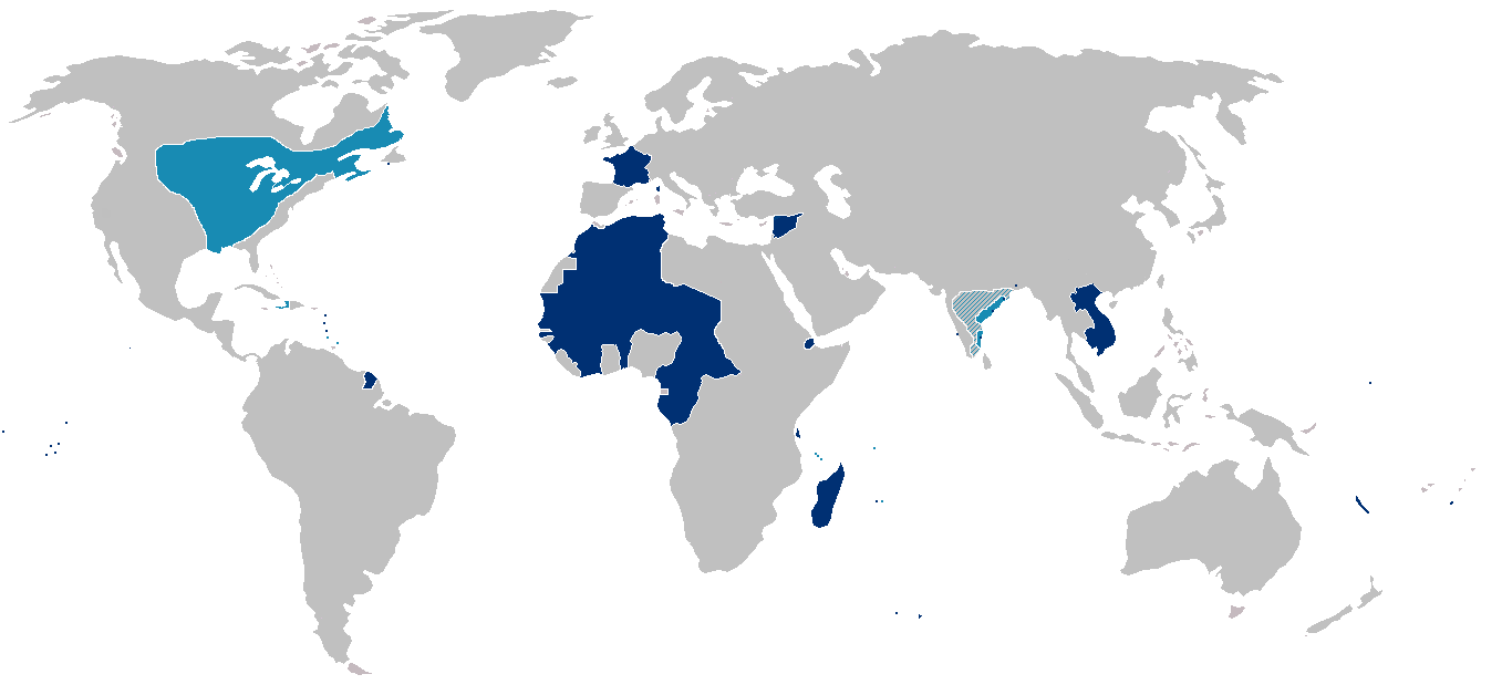
France colonial Empire10.png - Rzzgn
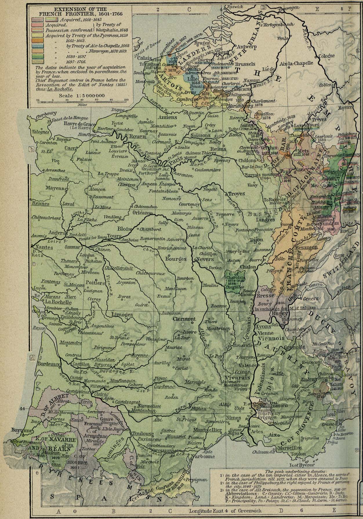
France frontiers 1601 1766.jpg - Henrysalome

Conquêtes de Louis XIV de 1648 à 1681.jpeg - Electionworld

Battle of Bantry Bay,11 May 1689-fr.svg - Historicair

Battle of Bantry Bay,11 May 1689-en.svg - FrozenCourgette

Battle of Beachy Head (1690)-fr.svg - Historicair

Battle of Beachy Head (1690)-en.svg - Historicair

The Upper Rhine region, with Alsace on the left bank..jpg - Lubiesque

Battle of Bantry Bay,11 May 1689-es.svg - Rowanwindwhistler

Export1.svg - Boldair

Plan et légende.png - Frédéric Rabat

Battle of Beachy Head (1690)-es.svg - Rowanwindwhistler

France1911dev.png - LlywelynII

Spruner-Menke Handatlas 1880 Karte 55.jpg - A. Wagner

Généralité-de-Montauban 1635-1715.jpg - Michelarquie

Image taken from page 397 of 'Outlines of Universal History. Designed as a text-book and for private reading' (11215919684).jpg - Artix Kreiger 2

89 of 'Géographie historique. Leçons en regard des cartes. Résumant l'histoire de la formation territoriale des pays civilisés et l'histoire de la civilisation, etc' (11196551085).jpg - Artix Kreiger 2

Battle of Bantry Bay,11 May 1689-hu.svg - Szajci

Battle of Beachy Head (1690)-hu.svg - Szajci
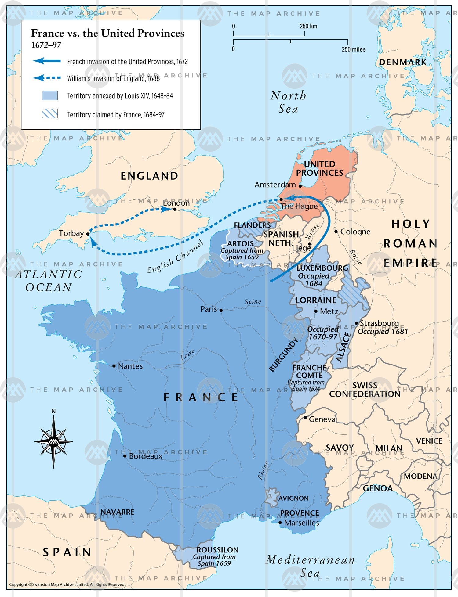
France vs United Provinces 1672 - 1697.jpg - Gvelion

Hugonotes1685.svg - Rowanwindwhistler

Spruner-Menke Hand-Atlas fur die Geschichte des Mittelalters und der neueren Zeit. 1880 (137087292).jpg - Enyavar

C. 1601-1766 France (extensions of northeastern frontier).jpg - Ty's Commons

C. 1601-1766 France (extensions of southern frontier).jpg - Ty's Commons

C. 1790 France (1600-1790).jpg - Ty's Commons

C. 1650 France.jpg - Ty's Commons

C. 1601-1766 France frontiers.jpg - Ty's Commons