Wikimedi'Òc
Modes d'emploi

Cet album fait partie des albums


Falmouth - Cornwall dot.png - Cnyborg

South Devon and south Cornwall, with a full description of Dartmoor and the Isles of Scilly (1900) (14782272372).jpg - Fæ

131 of 'Sailing Directions for the English Channel. Part I. The South coast of England ... Part II. The North coast of France' (11187493676).jpg - SteinsplitterBot

39 of 'The Pictorial Guide to Falmouth and its surroundings' (11245550144).jpg - Artix Kreiger 2

38 of 'The Pictorial Guide to Falmouth and its surroundings' (11246512795).jpg - Artix Kreiger 2

247 of '(Our own country. Descriptive, historical, pictorial.)' (11298610423).jpg - Artix Kreiger 2

247 of '(Our own country. Descriptive, historical, pictorial.)' (11292743963).jpg - Artix Kreiger 2
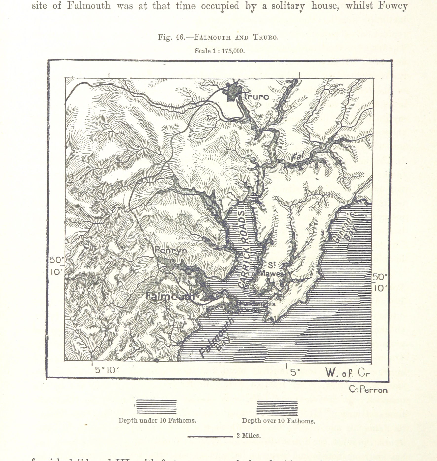
116 of 'The Earth and its Inhabitants. The European section of the Universal Geography by E. Reclus. Edited by E. G. Ravenstein. Illustrated by ... engravings and maps' (11123354253).jpg - Artix Kreiger 2

Ordnance Survey One-Inch Sheet 190 Truro & Falmouth, Published 1961.jpg - Kognos

Ordnance Survey One-Inch Sheet 190 Truro and Falmouth, Published 1946.jpg - Kognos

Ordnance Survey One-Inch Sheet 146 Land's End & Lizard, Published 1919.jpg - Kognos

Admiralty Chart No 777 St Agnes Head to Gerrans Bay, Published 1892.jpg - Kognos

Ordnance Survey Sheet SW 83 (10 83) Falmouth, Published 1951.jpg - Kognos

Falmouth Harbour - btv1b53056629z.jpg - Gzen92Bot

Falmouth and Carreg road ; Helford sound - btv1b53010366t.jpg - Gzen92Bot

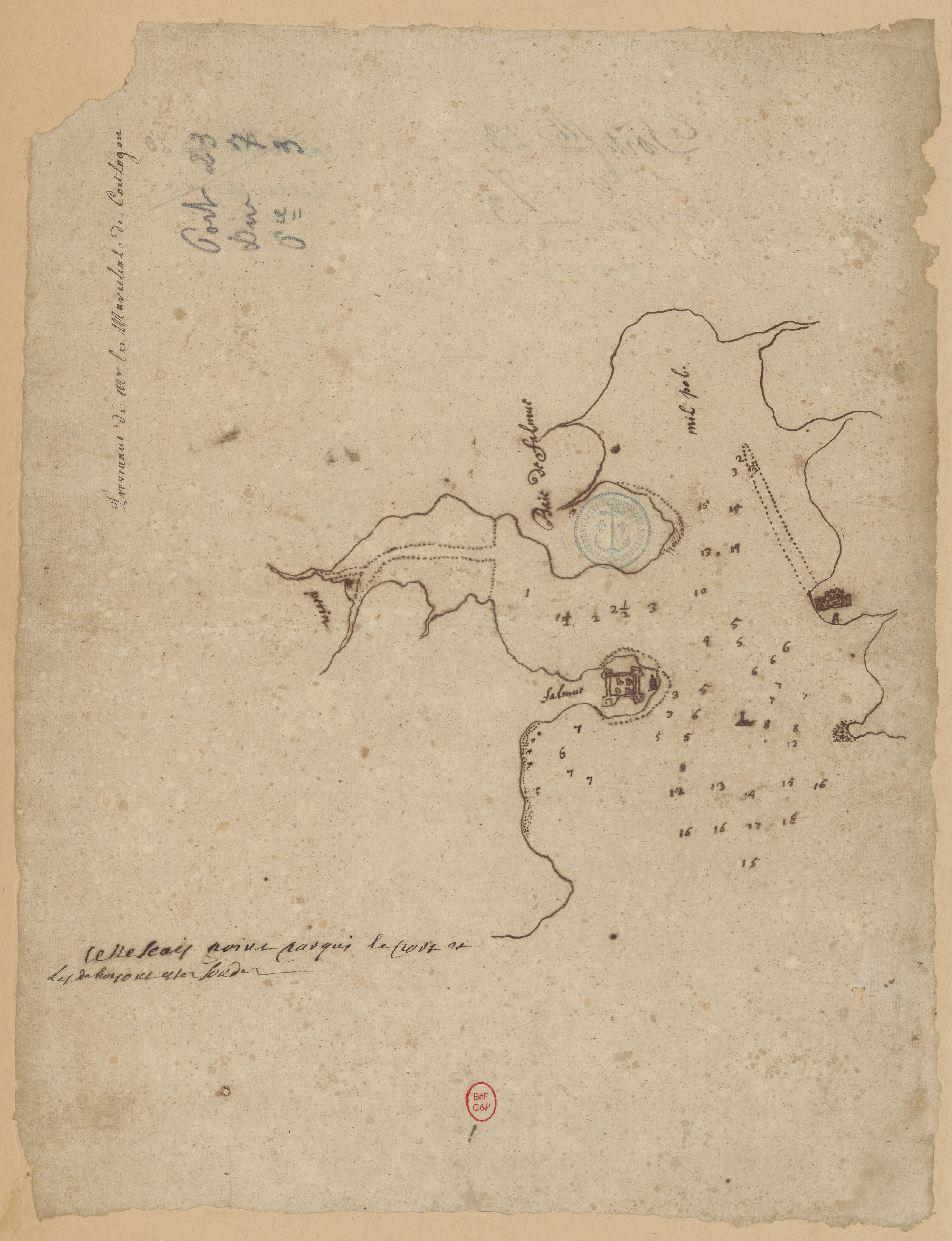
Tableau hidrographique qui contient le détail maritime des principaux ports qui se trouvent représentés dans la carte de la Manche - d'après des manuscrits (...) de Beaurain - btv1b53052864r.jpg - Gzen92Bot

Falmouth - btv1b53010232d.jpg - Gzen92Bot

Falmouth - To Se. Peter Killegrew Baronet ; This Map is Dedicated and Presented by Capt. Greenvile Collins... - btv1b530564061.jpg - Gzen92Bot
Falmouth - btv1b53010553t.jpg - Gzen92Bot

Ordnance Survey One-Inch Sheet 190 Truro & Falmouth, Published 1972.jpg - Kognos