Wikimedi'Òc
Modes d'emploi

Cet album fait partie des albums
Cet album photos contient les sous-albums suivants :


Ireland map County Galway Magnified.png - Bastique
IrelandGalway.png - Twincinema~commonswiki

Galway West (Dáil Éireann constituency).png - Cmdrjameson

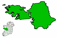
Galway East (Dáil Éireann constituency).png - Cmdrjameson

GalwayEire.PNG - Hogweard
Connemara and Joyce country.png - MacTire02
Ireland map County Galway.png - File Upload Bot (Magnus Manske)

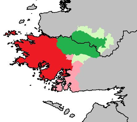
Baronies of Galway.jpg - Jnestorius
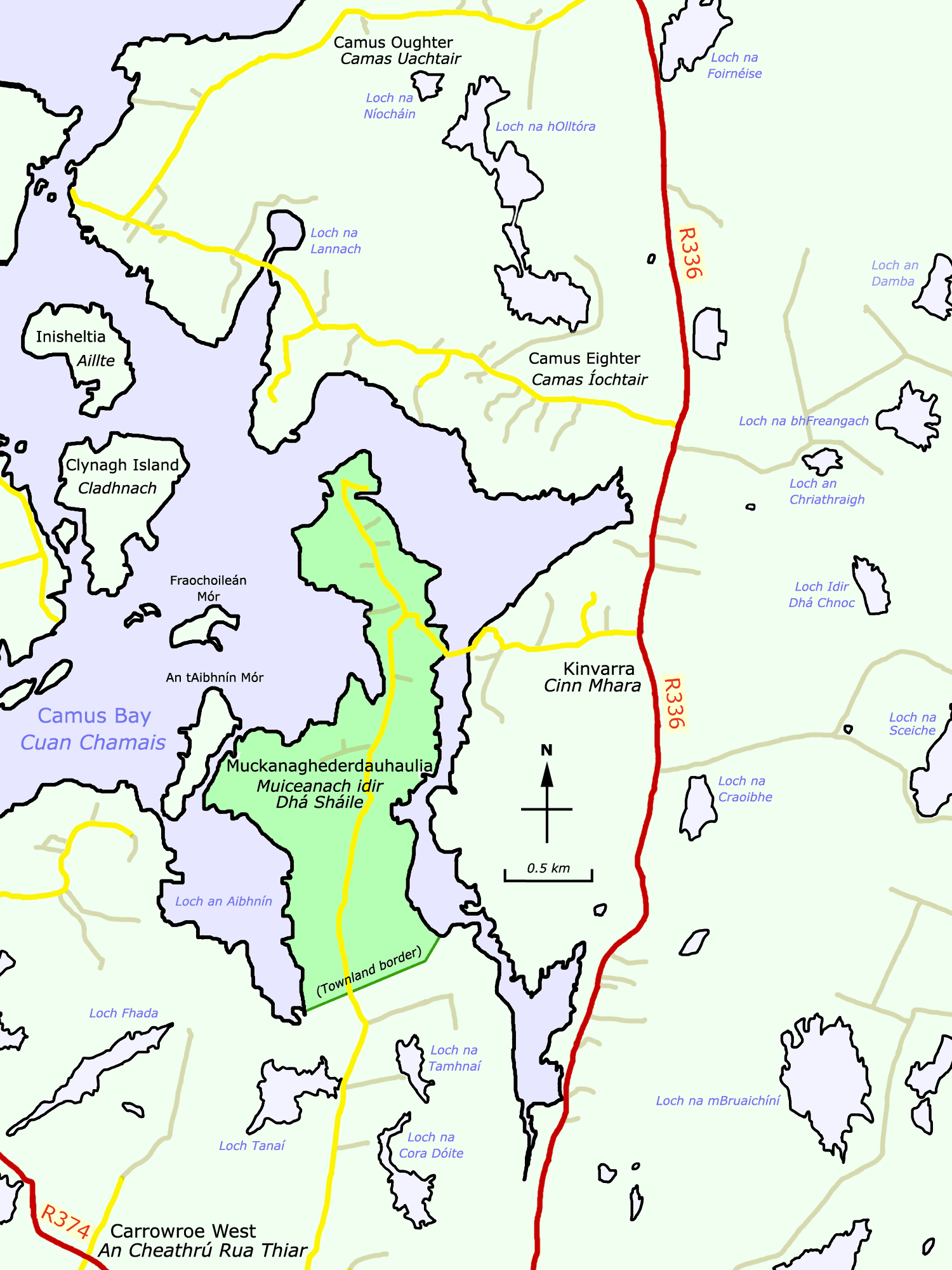
Muckanaghederdauhaulia.png - Spideog

Map of ERRIS and GALWAY.jpg - Metilsteiner

Galway - British Isles.svg - Visitor from Wikishire

Galway Ireland (BI Sect 7).svg - Visitor from Wikishire

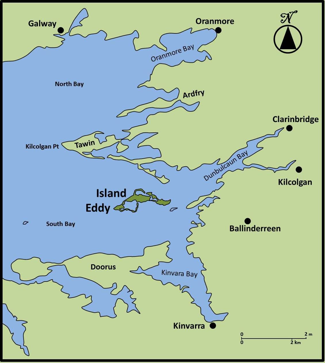
Map of eastern end of Galway Bay showing the location of Island Eddy.jpg - Pjgoslyng

Island Eddy in 1654-56.jpg - Pjgoslyng

Island Eddy in 1690.jpg - Pjgoslyng

Island Eddy - Location Map.jpg - Pjgoslyng
Island Eddy - Location Map (corrected).jpg - Pjgoslyng

Picturesque Ireland - a literary and artistic delineation of the natural scenery, remarkable places, historical antiquities, public buildings, ancient abbeys, towers, castles, and other romantic and (14778948272).jpg - Fæ

Map of Galway.png - Charlesolivercork

Admiralty Chart No 2096 Ireland west coast Roundstone Birterbuy (Bertraghboy) Kilkieran Greatman and Cashla Bays, Published 1852.jpg - Kognos

Location map Ireland County Galway.png - JohnArmagh

Admiralty Chart No 2709 Slyne Head, Published 1860.jpg - Kognos

Admiralty Chart No 2708 Clifden and Mannin Bays, Published 1860.jpg - Kognos

Admiralty Chart No 2707 Inishbofin, Published 1860.jpg - Kognos

Admiralty Chart No 2420 Achill Head to Slyne Head, Published 1855.jpg - Kognos

The Counties of Gallway - By H. Moll Geographer - btv1b53056434c.jpg - Gzen92Bot

The Province of Connaught Divided into its Counties and the Counties into their severall Barronies and c. - By H. Moll Geographer - btv1b53056320s.jpg - Gzen92Bot

Lusmagh-parish-1024x715.jpg - FranzSebastianvH