Wikimedi'Òc
Modes d'emploi

Cet album fait partie des albums
Cet album photos contient les sous-albums suivants :


CornwallKernowMappa.png - Lader Gwiader

Algal bloom 20040615.jpg - Dual Freq
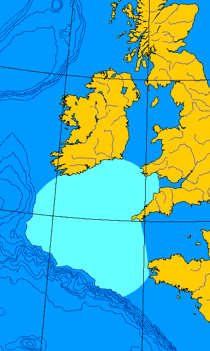
Mappa an Mor Keltek.png - QuartierLatin1968

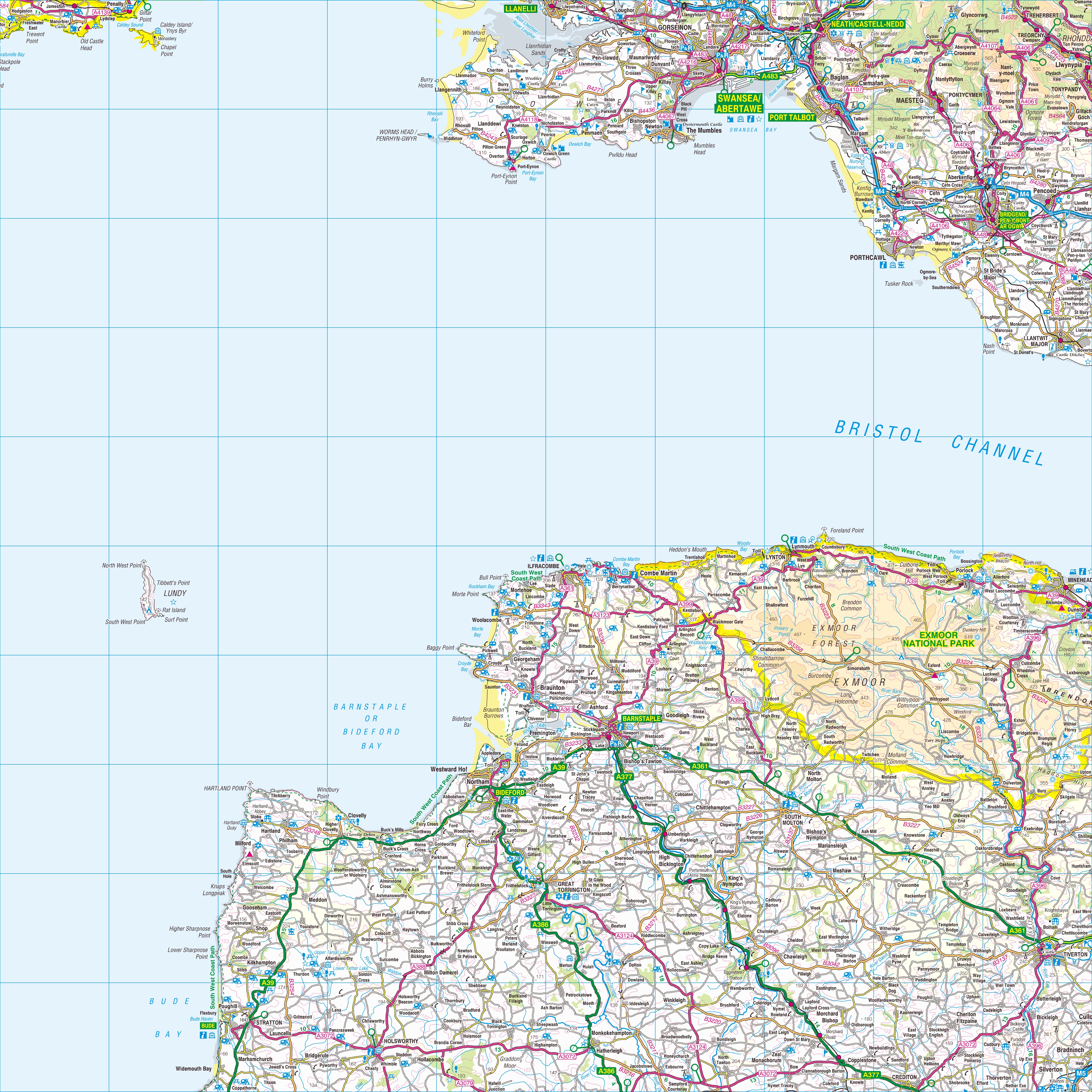
Cornwall-NASA-250.jpg - Bdk

Kernow Hundreds.png - Inops
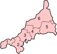
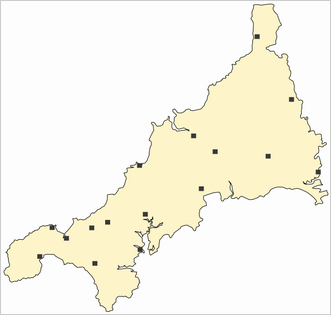
CornwallScillyNumbered.png - Kooma

Coccoliths in the Celtic Sea-NASA.jpg - Saperaud~commonswiki
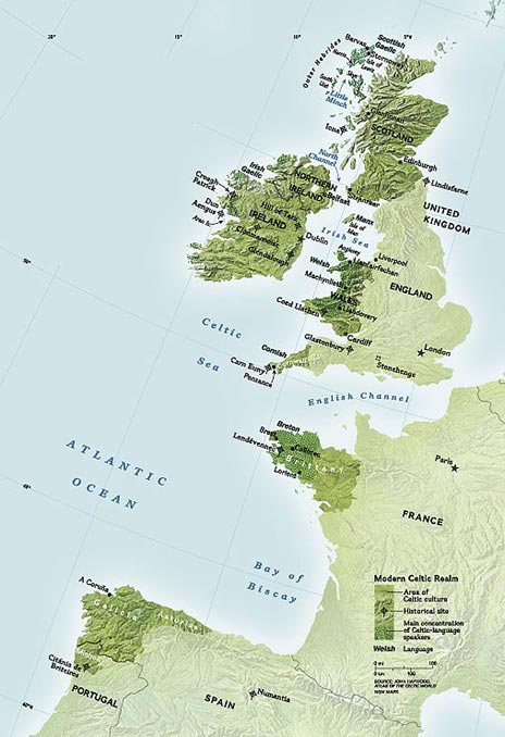
CelticNationsMap.jpg - Apabardexu~commonswiki

Map of Celtic Nations.svg - Kerneweger

Map of Cornwall.png - Mats Halldin~commonswiki
Southcroftylocatormap.png - Kmusser

Map of Celtic Nations-flag shades.svg - QuartierLatin1968
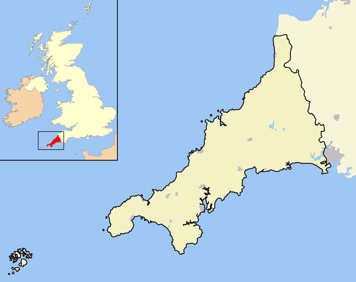
Cornwall outline map with UK.png - Warofdreams
Cornwall map small.png - Joowwww

Kernow lb.png - Szajci

Cornwall white.svg - Joowwww

Cornwall outline map with UK (2009).png - Mahahahaneapneap

Cornwall outline map with UK (1974 - 2009).png - Warofdreams

WestcountryCheddar-Counties.svg - Owain

Cornish language shift.svg - Joowwww

St. Michael’s Mount map 01.jpg - Oltau

Flag-map of Cornwall.svg - Nux

Cornish Language Shift.svg - TastyCakes

SketchMapOfSlaughterbridgeCornwallUk.jpg - Andy F

MapOfRiverCamelCornwallUK.jpg - Andy F

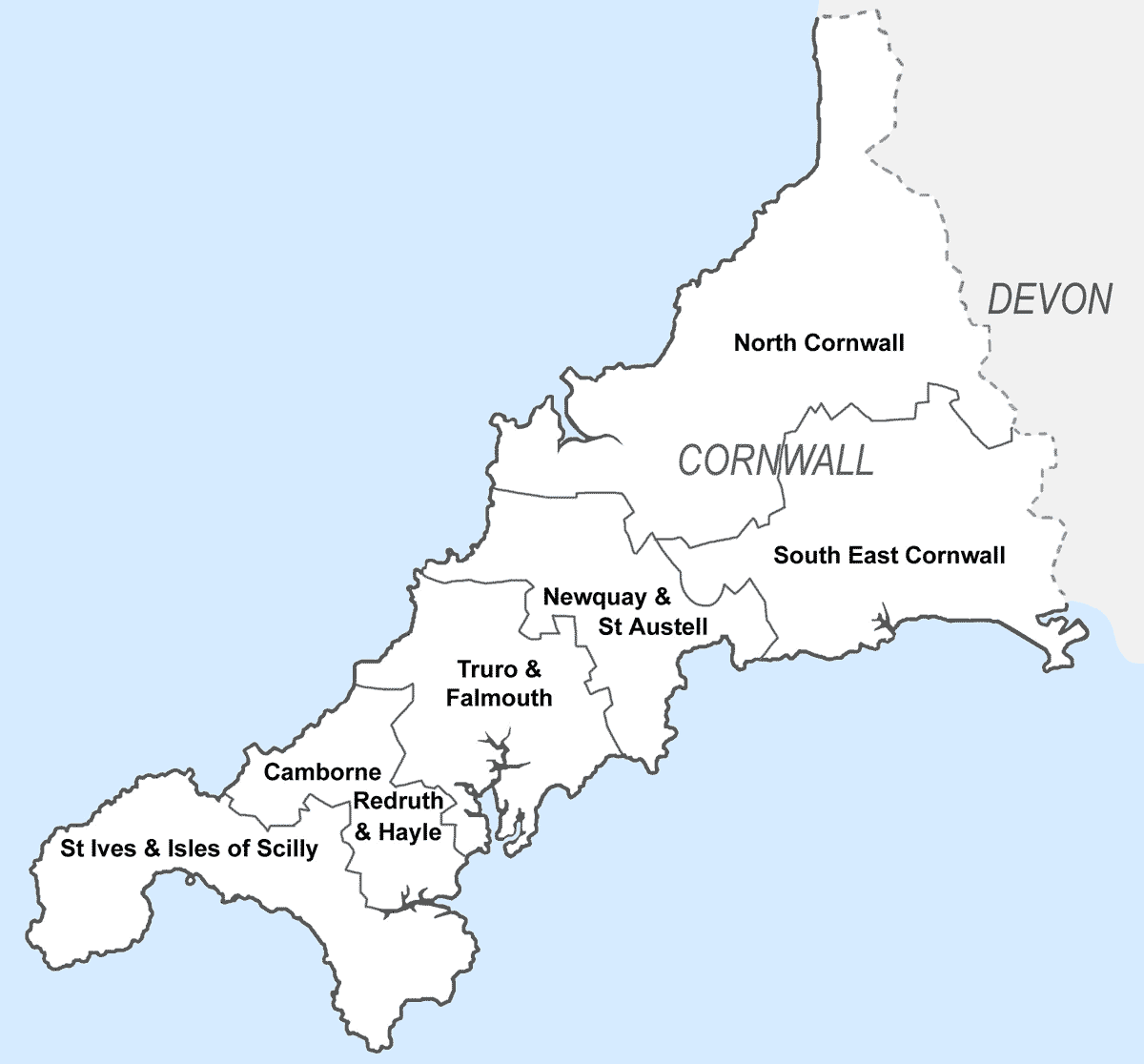
Cornwall Community Network Areas.svg - Joowwww
MapRiversSoutheastCornwallUK.gif - Andy F

CornwallMapOfParishesOnTheLizard.gif - Hohum

StAustellCornwallNewParishes.gif - Andy F
CornwallConstituencies2010.gif - Andy F
CornwallNumbered.png - File Upload Bot (Magnus Manske)

Celtic countries.svg - Alexandre Vigo~commonswiki
Ordnance Survey 1-250000 - SS.jpg - OrdnanceSurveyBot

Ordnance Survey 1-250000 - SW.jpg - OrdnanceSurveyBot

Ordnance Survey 1-250000 - SX.jpg - OrdnanceSurveyBot
Cornwall UK district map (blank).svg - Nilfanion

Cornwall UK location map.svg - Nilfanion

Stivesbaymap.gif - File Upload Bot (Magnus Manske)

South east Cornish Rivers Kernoweg.gif - Llywelyn2000

Southwest Cornwall.png - Blofeld Dr.

Southwest Cornwall UK location map.svg - Nilfanion

Map of Celtic Nations (alternate).svg - NikNaks

The Carracks map.png - Prioryman

Godrevy Island map.png - Prioryman

Godrevy Cornwall map.png - Prioryman

Isles of Scilly OS map.png - Prioryman

West Cornwall with Scilly.png - Hogweard

Cornwall AONB locator map.svg - Nilfanion

AONB within Cornwall map.svg - Nilfanion

NNRs within Cornwall map.svg - Nilfanion

SSSIs within Cornwall map.svg - Nilfanion

Bude canal.gif - OgreBot

BassettSeatsMap.jpg - Lobsterthermidor

Bretagnes.png - EwenRD

River Inny map.png - Nilfanion
River Kensey map.png - Nilfanion

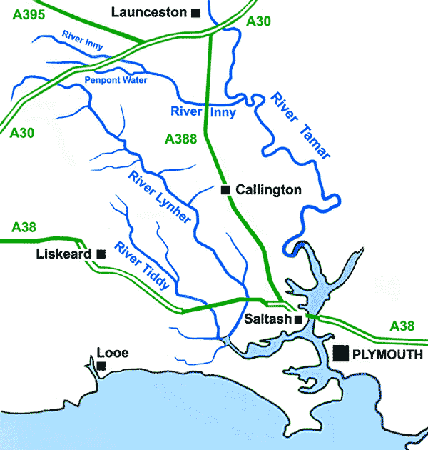
River Lynher map.png - Nilfanion

River Ottery map.png - Nilfanion
River Tamar map.png - Nilfanion

River Tiddy map.png - Nilfanion

Cornish National Identity 2011 Census.png - SkateTier

CornwallMap2.png - GifTagger

Cornish Constituencies 1832-1868.svg - MrPenguin20
Arwenack Falmouth Cornwall Map.PNG - Lobsterthermidor
Aberplymm Mappa.png - CommonSupporter

Dowrgleudh Kesunyans Lyskerrys ha Logh.gif - Sambrown1993

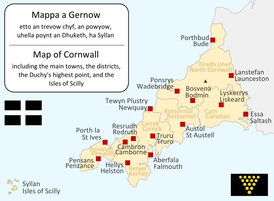
Cornwall UK location map placenames.png - Lingzhi

Cornish Riviera.jpg - Rathfelder

Cornwall Hundreds.svg - Hogweard

Cornwal1832Map.png - XrysD

Cornwall-Flagmap.svg - Kamran.nef

Porthcurno Valley map (August 2020).jpg - Jowaninpensans
Sancreed Beacon Information Board.jpg - Jowaninpensans

Happy Easter (10 years of IPlymouth competitions).jpg - Kroger4

White Downs information board (01).jpg - Jowaninpensans

White Downs information board (02).jpg - Jowaninpensans
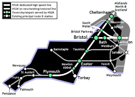
South West England route map.png - Jcb0L4zy

Degibna Information Board.jpg - Jowaninpensans

2018-01-01-00 00 2018-01-01-23 59 CORINE Land Cover Corine Land Cover (25).jpg - Sentinel user

Cornwall UK district map (numbered).svg - Fenn-O-maniC

Rumps Point, naufragi del Maria Asumpta 1995 05 30.png - Josep Estruch Traité

Cornwall map mural on side of Threemilestone Social Club, Cornwall - June 2022.jpg - Mutney
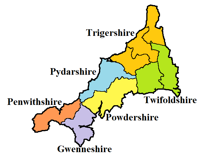
Shires of Cornwall.png - Bodrugan

Medieval Deaneries of Cornwall.png - Bodrugan
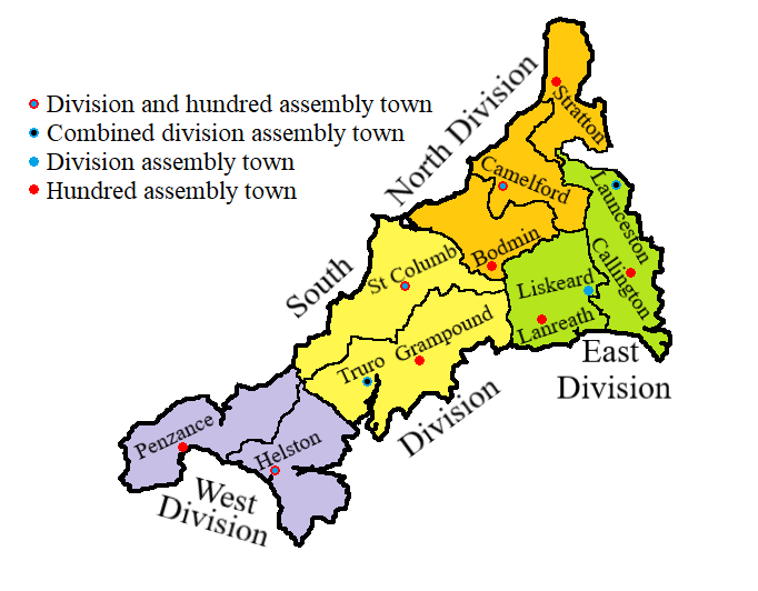
Divisions of Cornwall.png - Bodrugan

Steuziadur ar c'herneveureg.png - Adriendelucca

Seven Stones Cropped from Admiralty Chart No 1168 Plans on the North Coasts of Devon and Cornwall, Published 1954.jpg - Kognos

CornwallKernowMappa.svg - Hogweard

Devon and Cornwall UK PCC election 2024.svg - Into oblivion

Mounts Bay lifeboat stations.png - Geof Sheppard