Wikimedi'Òc
Modes d'emploi

Cet album fait partie des albums
Cet album photos contient les sous-albums suivants :


WalesConwy.png - Nichtbesserwisser

CardiganBay.svg - DankJae

Wales Conwy.png - WarXboT

Conwymap1947.png - Geni
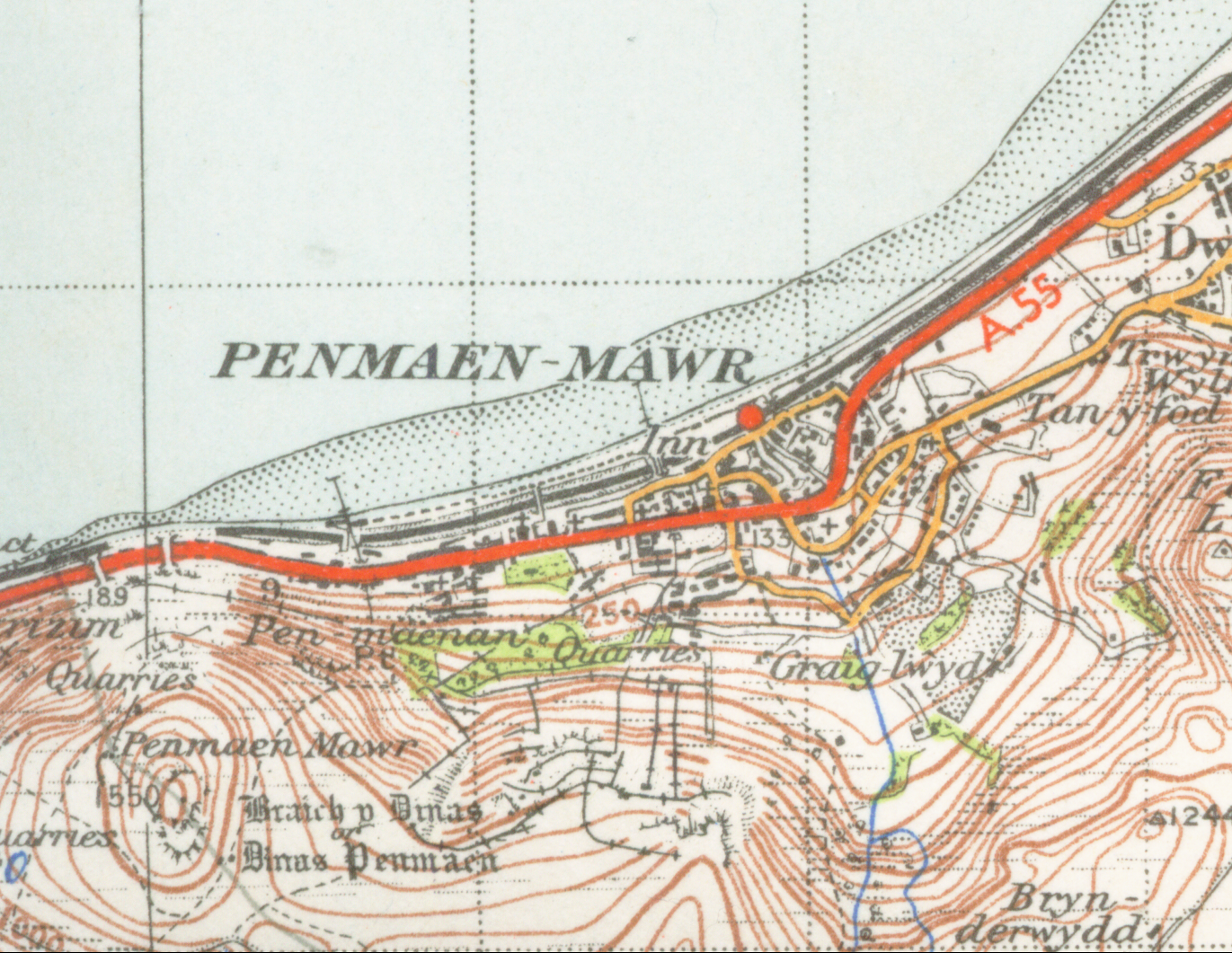
Penmaen-mawrmap 1947.png - Geni

WalesColwyn1974.png - File Upload Bot (Magnus Manske)

Anglesey and Carnarvan.jpg - Seriykotik

Wales Conwy locator map.svg - NordNordWest

Conwy UK map.svg - Nilfanion

Conwy UK location map.svg - Nilfanion
Conwy UK ward map (blank).svg - Nilfanion
Conwy UK community map (blank).svg - Nilfanion

Conwy in Wales.svg - TUBS

Conwy town wall plan.jpg - Hchc2009

CardiganBay cy.svg - Homo lupus

Conwy UK relief location map.jpg - Nilfanion

BaeCeredigion.svg - Hogweard

CardiganBay2.svg - Hogweard

CardiganBay mk.svg - Bjankuloski06en
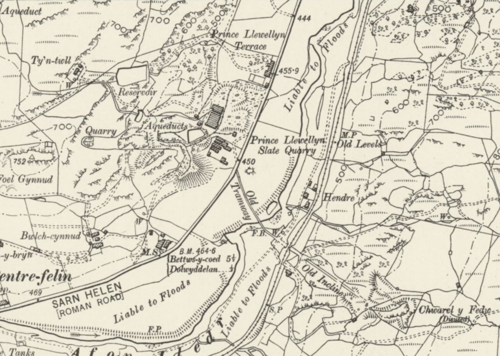
1899 map of Prince Llewellyn quarry.png - The Mirror Cracked
Map of Chwarel Ddu in 1888.png - The Mirror Cracked

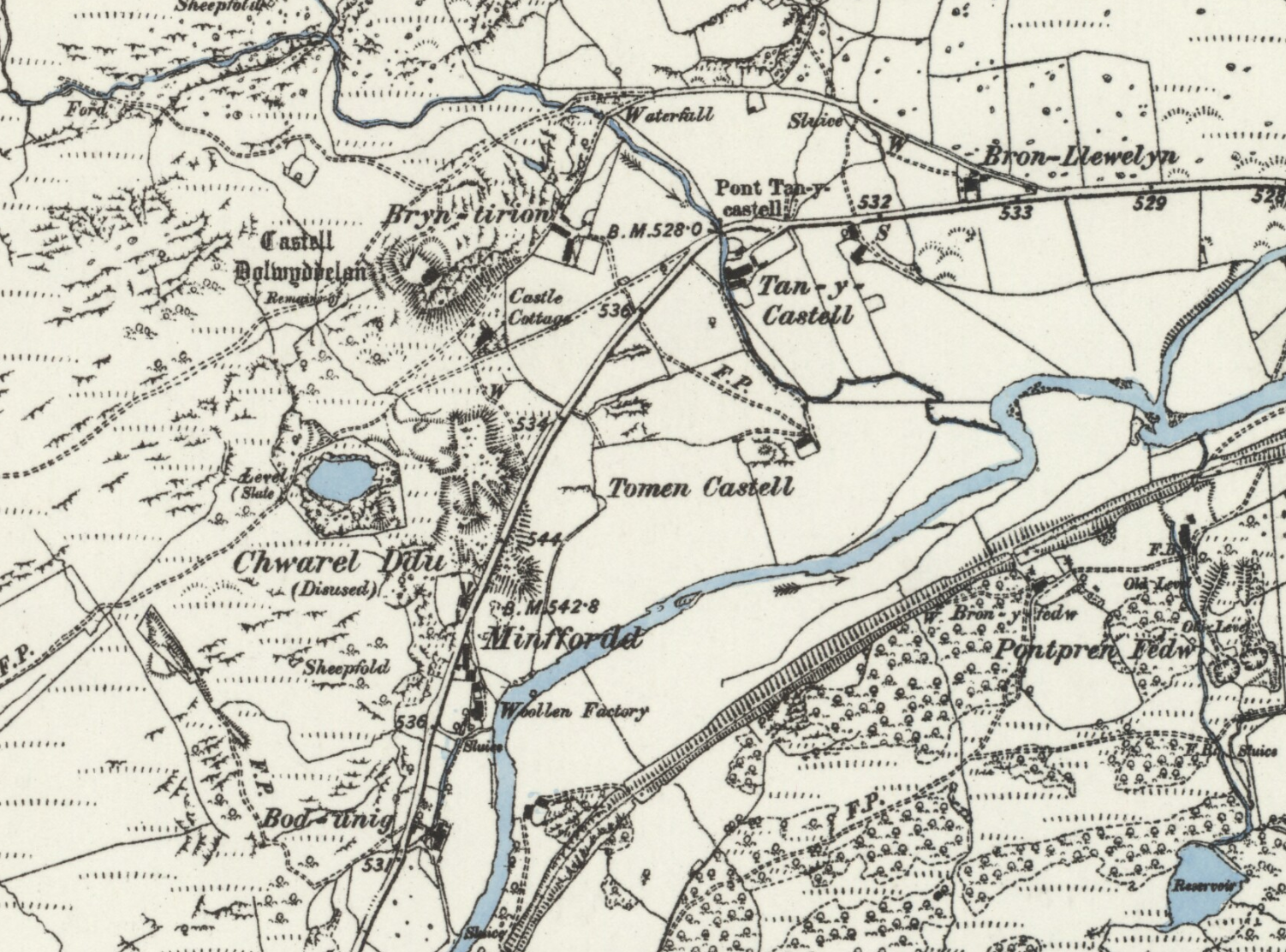
Map of Ty'n-y-bryn and Penllyn quarries, 1911.png - The Mirror Cracked

YOU ARE HERE - Lower Gate Street, Conwy - geograph.org.uk - 2586263.jpg - GeographBot

Wales Conwy.svg - DankJae

2024 Wales Conwy Constituencies map.svg - DankJae