Wikimedi'Òc
Modes d'emploi

Cet album fait partie des albums
Cet album photos contient les sous-albums suivants :


Connecticut population density 2020.png - Crossover1370
Historical Transportation in Connecticut, 1826-1911.svg - Deerpuppy
Detailed Connecticut Transportation Map, 2025.jpg - Deerpuppy

Connecticut 90.jpg - Severino666~commonswiki
Ctpanhandle.png - Kmusser

CT-15 map.png - Polaron~commonswiki

CtUScensusMap.png - Karlhahn
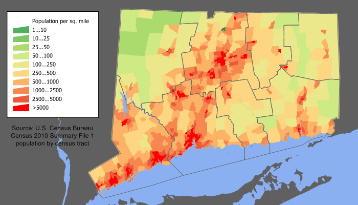
Connecticut population map.png - JeffyP

Connecticut wind resource map 50m 800.jpg - Teratornis

CTswineflu.png - Noddy

HighlandsConnecticutNewJerseyNewYorkPennsylvaniaMap.jpg - Kcboling

Joshuas Trust Towns.png - Secantline
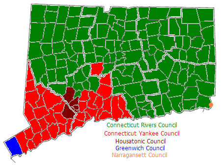
US-CT-BSA-COUNCILS.PNG - File Upload Bot (Magnus Manske)

Wpdms ev26188 blockislandsound.jpg - SreeBot
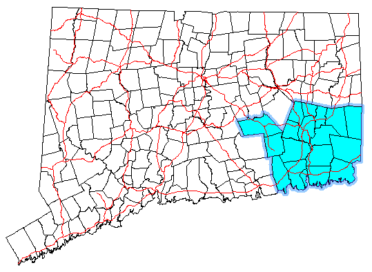
Southeastct.png - MGA73bot2

Southwestct.png - MGA73bot2

CT regions 2013.jpg - MGA73bot2

Greater Hartford.png - MGA73bot2

Goldcoastct.png - MGA73bot2

Map of Connecticut Regions.png - MGA73bot2

2012NewtownShootingLocation.png - Jean27

Southport (Conn.) census tract.gif - Fredlyfish4

A map showing the majority racial or ethnic group in Connecticut by census block.png - JeffyP

CT - DOC Facilities Map.png - Addihockey10

Map of the Atlantic Highway WDL11556.png - Fæ

Ct trunklines.jpg - BD2412

FMIB 37689 Oyster Grounds - State of Connecticut, 1889.jpeg - BMacZeroBot
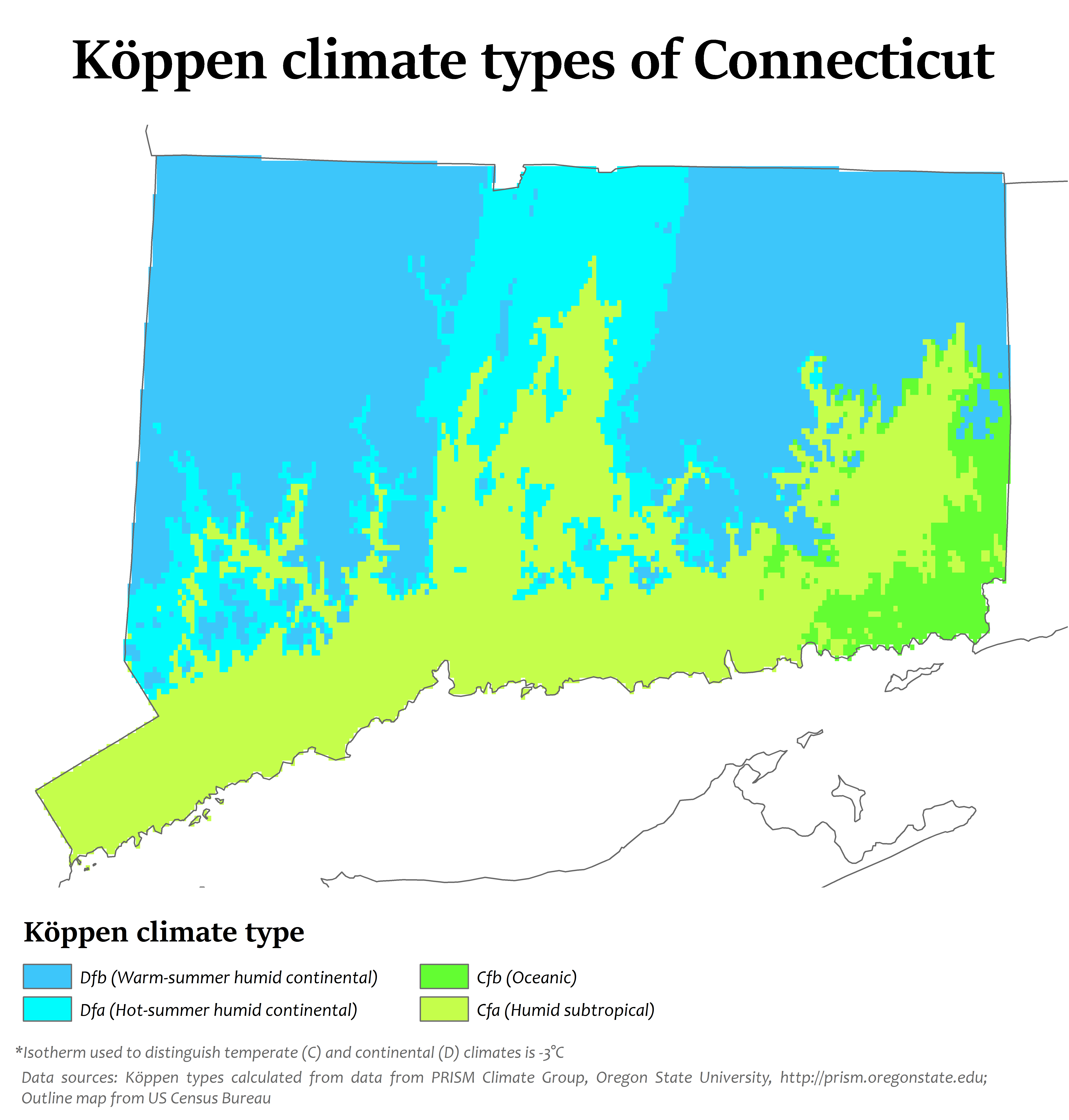
Connecticut Köppen.png - Redtitan

Pagegen ct-page-001.jpg - JJBers

Raymark Superfund Site Map 2016.png - Moreau1

Long island1.jpg - Unknown-Tree

Whitneyville1868BeersMap.jpg - Pausau

Dave's Redistricting 2020 - Connecticut.png - Aaronw1109

2320R Mohegan Reservation Locator Map.svg - Awmcphee

COVID-19 Cases in Connecticut by counties.png - Khu'hamgaba Kitap

Connecticut POI.png - Mpwood33

Map of the state of Connecticut showing Indian trails, villages and sachemdoms (3332840235).jpg - Orizan

Population density of Connecticut counties (2020).jpg - Austiger

BartlettCT.png - CoolGuySlate
CT Counties by Population (2020 census).png - Infrarrojo00

Connecticut Communities by per capita income.png - Infrarrojo00
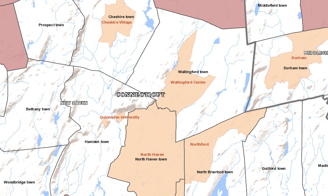
Quinniapic University CDP (2020).jpg - Patapsco913

Borough of Woodmont CT FEMA flood map 2013.jpg - Joravetz

Franklin CT Map 1811.png - CatharticHistorian

Meshomasic State Forest Locator Map.jpg - Gdisanto

1713 border map of Massachusetts and Connecticut.jpg - CitrusHemlock

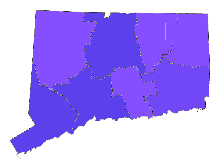
Map State of Connecticut, USA, main roads with numbers, colored counties with names SVG.svg - Kirill Shrayber

USA New York Tri State NYC area.svg - Hmdwgf