Wikimedi'Òc
Modes d'emploi


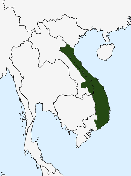
Chamic groups in Vietnam.png - Sgnpkd

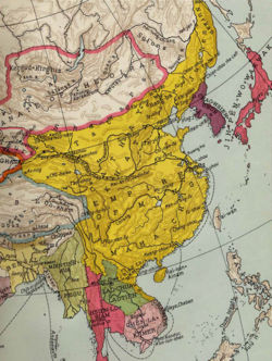
B26056104B - India orientalis.jpg - NLSingapore

Map-of-southeast-asia 1400 CE-vi.svg - Leeaan

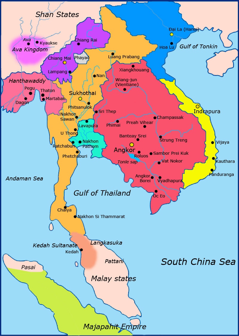
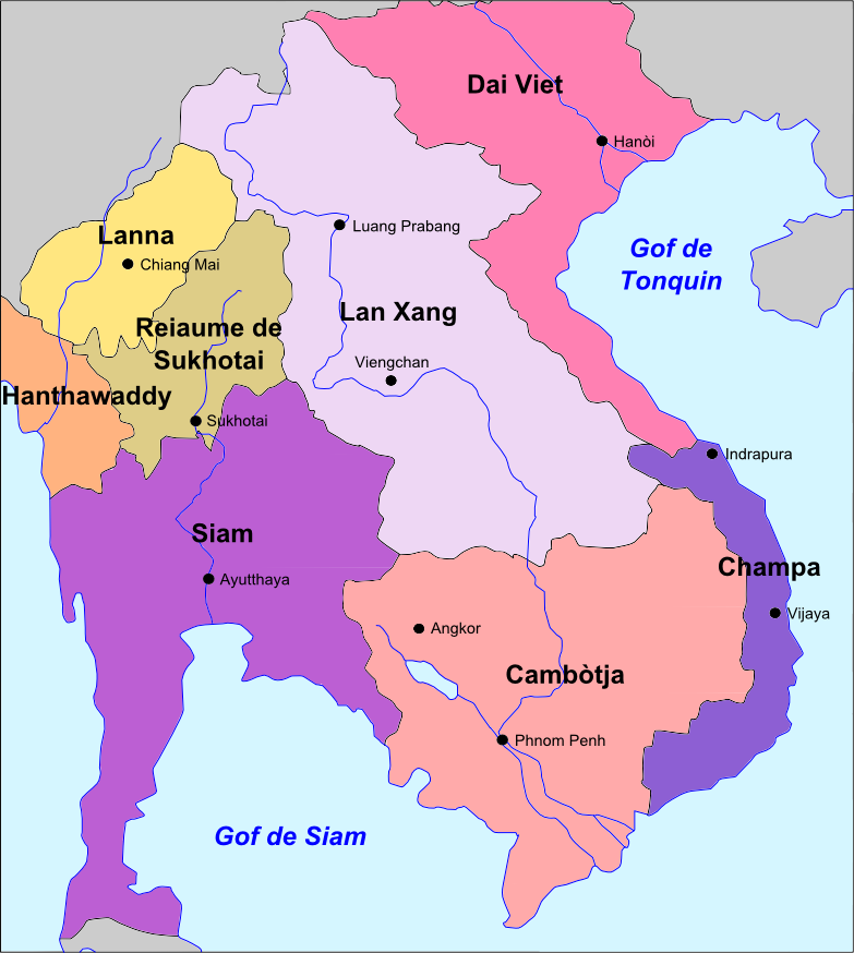
Southeast Asian history - Around 1540.png - RJFF
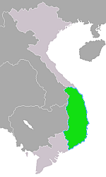
ChampaMap.png - Gryffindor
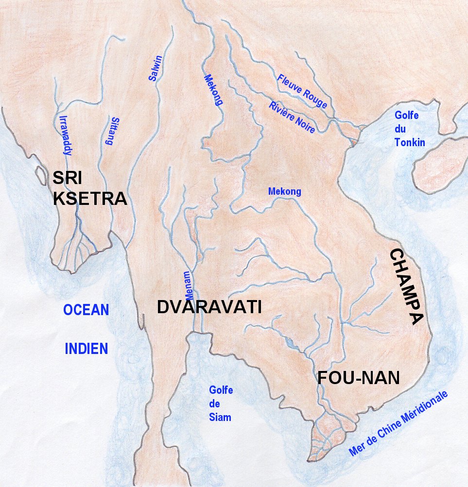
Map indianized kingdoms indochina.jpg - EdC

Old map of Vietnam.jpg - Dragfyre

FunanMap001.jpg - KnightxxArrow
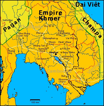
Carte Empire-Khmer.png - Lozère

VietnamChampa1.gif - Sgnpkd

VietnamMac1540.gif - Tonbi ko
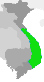
Czampa Mapa.png - Gryffindor
Ming China and Asia.jpg - Jjarivera~commonswiki

Ming Domination of Vietnam.jpg - Clioherodotus

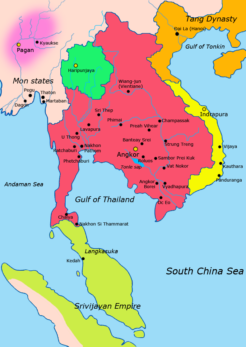
Asia 600ad 2.jpg - トムル

Regions of Champa.jpg - Clioherodotus

Cham People in Vietnam and Cambodia.jpg - Roxanna
Map-of-southeast-asia 900 CE.png - Ras67

Map-of-southeast-asia 1000 - 1100 CE.png - Ras67
Map-of-southeast-asia 1300 CE.png - Javierfv1212
Map-of-southeast-asia 1400 CE.png - Yourlocallordandsavior

郑和下西洋路线图.png - 玖巧仔

万历年间的明朝(简).png - 玖巧仔

万历年间的明朝(繁).png - 玖巧仔
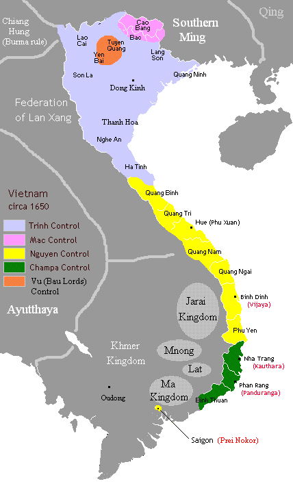
Vietnam1650.GIF - Sgnpkd

VietnamChampa-fr.svg - Augusta 89

FunanMap001 km.jpg - Nisetpdajsankha

交州497.jpg - 沧海微沤

Map of Later Lê dynasty during the reign of Lê Thánh Tông (1460-1497).png - Greenknight dv

Map of Southern and Northern Dynasties of Vietnam.png - A

Đàng Trong - Đàng Ngoài (1757).png - TRMC

Khoi nghia lam son 500 01 (1) (Copy).jpg - Bienkhachthanhchu

Indochina - Sègle V.png - Nicolas Eynaud
Laos - Reiaume de Lan Xang.png - Nicolas Eynaud

Cambòtja - Empèri Khmer dins lo corrent dau sègle XII.png - Nicolas Eynaud

Map-of-southeast-asia 900 CE-es.svg - Rowanwindwhistler

VietnamChampa-ru.svg - Ле Лой

Map-of-southeast-asia 1400 CE-es.svg - Rowanwindwhistler
Map of the Kingdom of Champa (1380) during the reign of King Che Bunga.png - A
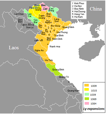
Vietnam (1009-1225).png - Sgnpkd
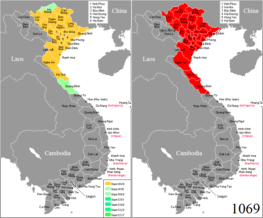
Vietnam (1069).png - Doãn Hiệu

Vietnam (1407).png - Doãn Hiệu

Bản đồ Việt Nam thời Lý năm 1085.png - Trương guy

Map-of-southeast-asia 1000 - 1100 CE-es.svg - Rowanwindwhistler

Map-of-southeast-asia 1300 CE-es.svg - Rowanwindwhistler

Southeast Asian history - 13th century-es.svg - Rowanwindwhistler

Southeast Asian history (around 1540) es.svg - Rowanwindwhistler

Manipur map of Khagemba Period.png - Simon0117
Manipur of loiyumba period.png - Simon0117

Indochina 1300 CE.png - Ltn12345

Champa civilization height.png - Cornycator11

Champa civilization height2.png - Cornycator11
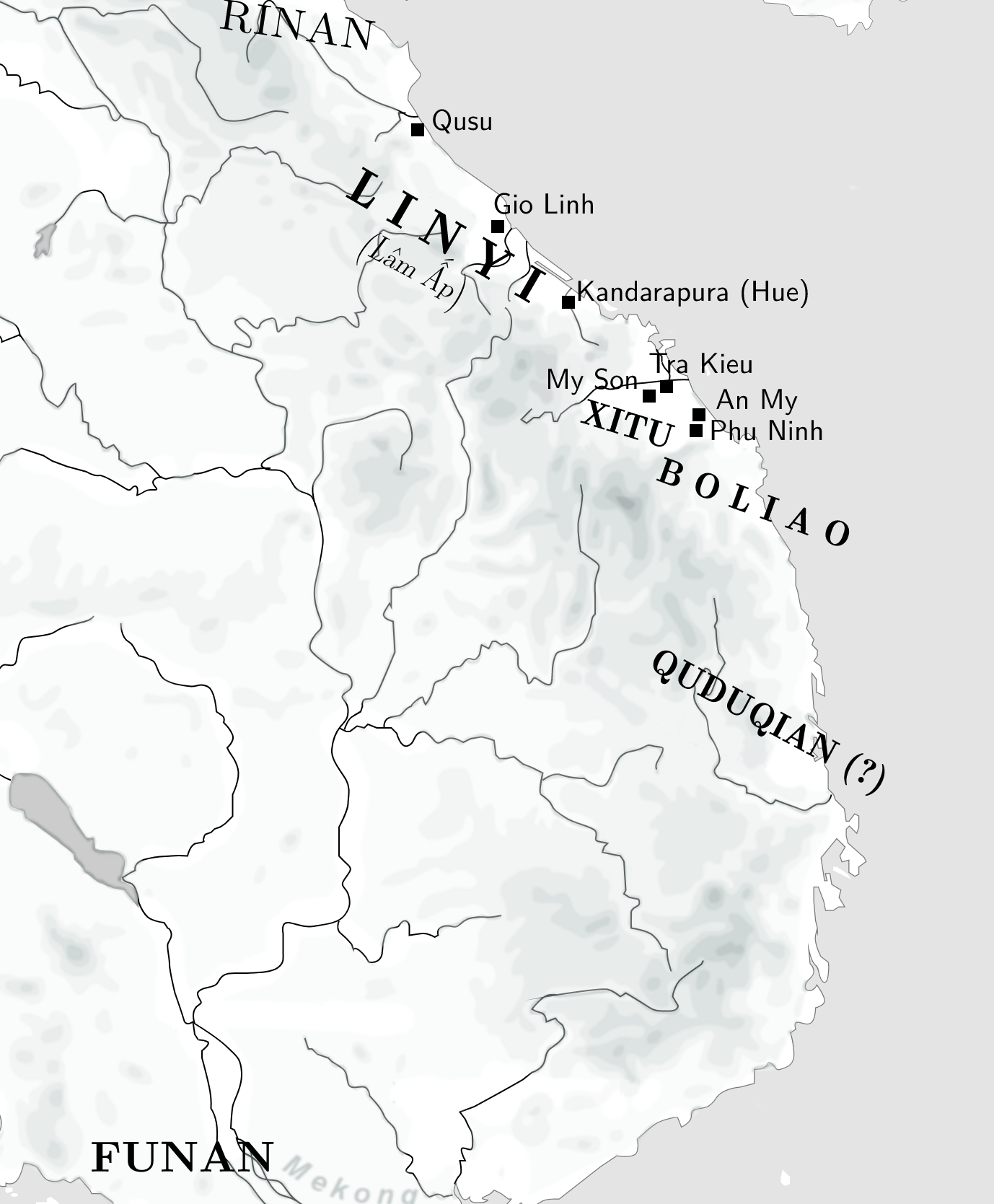
Linyi and Chamic states of the fifth century AD.png - Laska666

Mongol empire 1290 and the travel of Marco Polo.png - Laska666
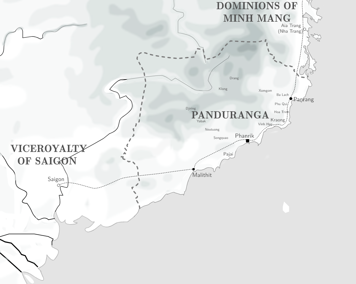
Panduranga and the last decades.png - Laska666

Champa ca. 1000-1300.png - Laska666

1801 Cary Map of the East Indies and Southeast Asia signifying Champa.png - Laska666

1837 Malte-Brun Map of India, Burma and Southeast Asia (Disapperance of Champa).png - Laska666

Kiepert, Heinrich 1856 map of Hinter Indien (cropped).png - Laska666

Martin, R.M.; Tallis, J. & F.; 1851 Malay Archipelago, Or East India Islands (cropped).png - Laska666

Map of the Lam Sơn uprising (2).png - Leeaan

Mongol empire 1290.jpg - Eaglewanli

Yuan Dynasty 1290.jpg - Eaglewanli
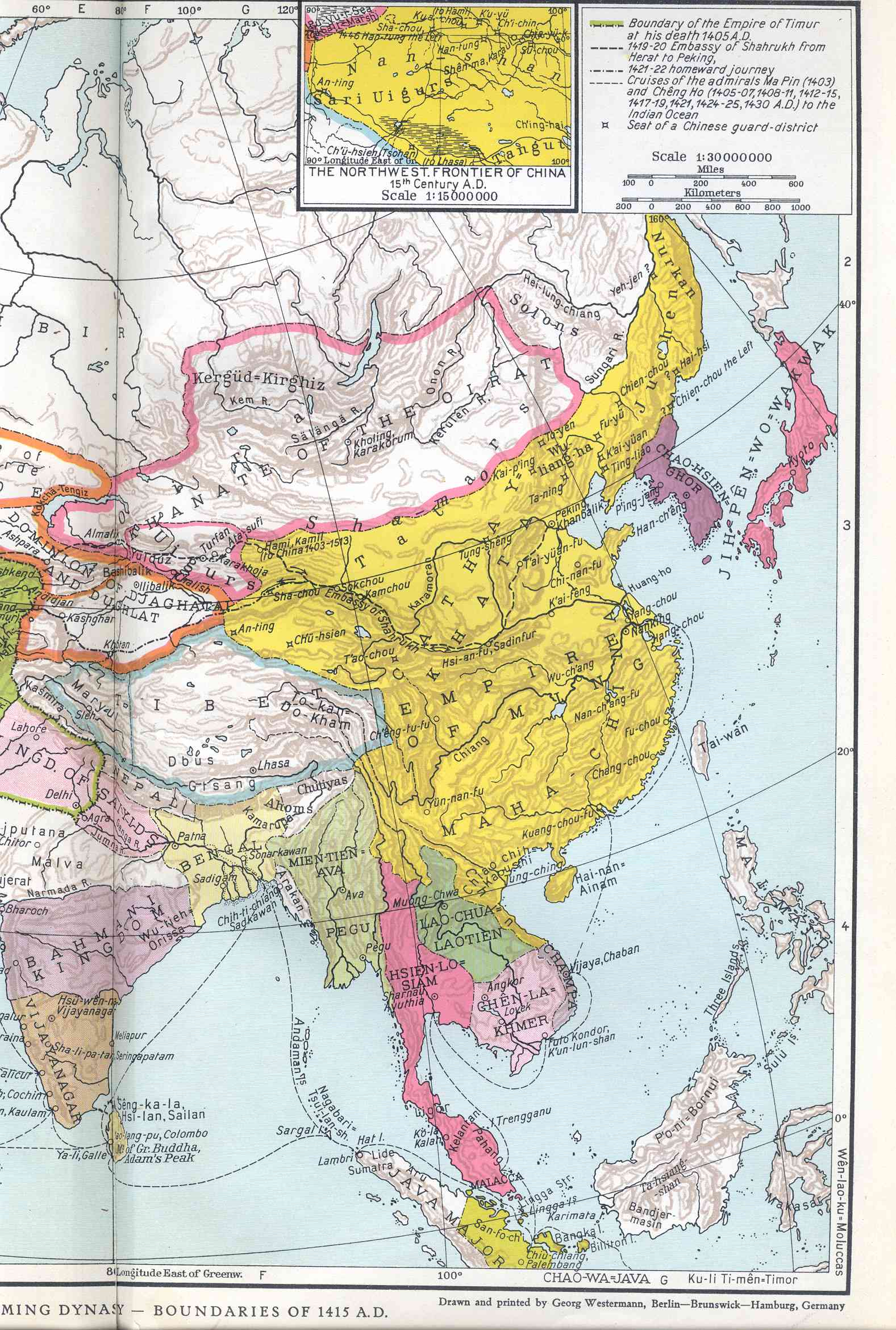
Map of Ming Chinese empire 1415.jpg - 我乃野云鹤

Map of Ming Chinese empire 1415 (cropped).jpg - ديفيد عادل وهبة خليل 2

Map of Ming Chinese empire 1415 (cropped 2).jpg - Remsense

Mainland Southeast Asia in 1415.jpg - Artanisen

Portolan Chart of South China Sea (Siam Indochina) Joan Blaeu 1679.jpg - Artanisen