Wikimedi'Òc
Modes d'emploi

Cet album fait partie des albums
Cet album photos contient les sous-albums suivants :


Baltimore, Maryland 1955 Yellow Book.jpg - SPUI~commonswiki

Map of Maryland highlighting Baltimore City.svg - Tom

Baltimore-map.jpg - Faigl.ladislav

I-95 in Baltimore map.png - Algorerhythms
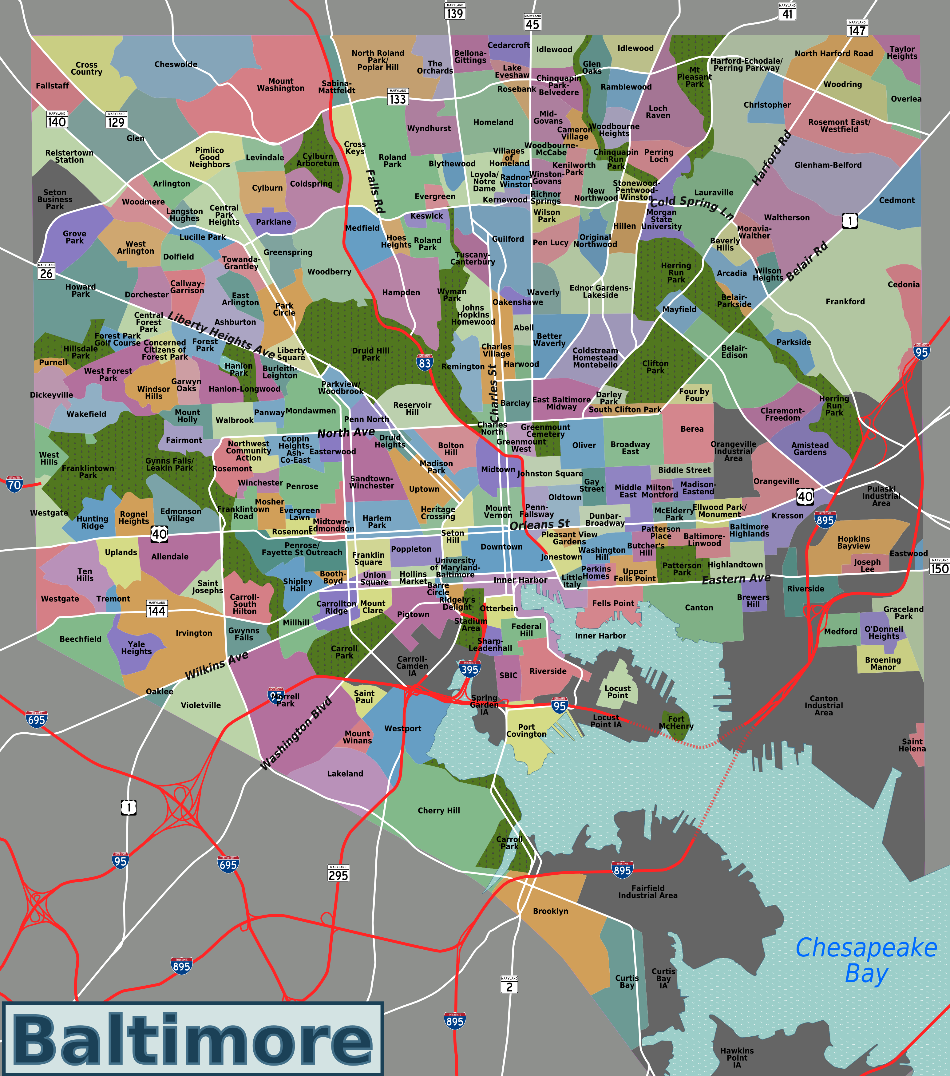
Baltimore neighborhoods map.png - Peterfitzgerald

Race and ethnicity Baltimore.png - JohnnyMrNinja
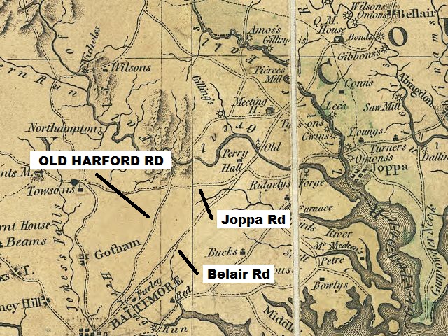
Map MD Griffith1794 OldHarfordRd wideLABELED.jpg - Accas1
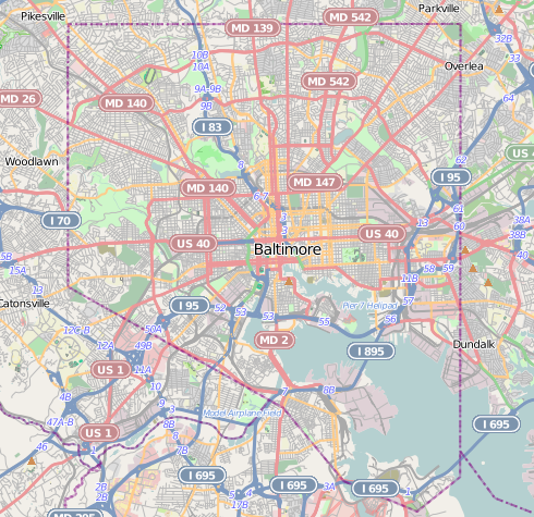
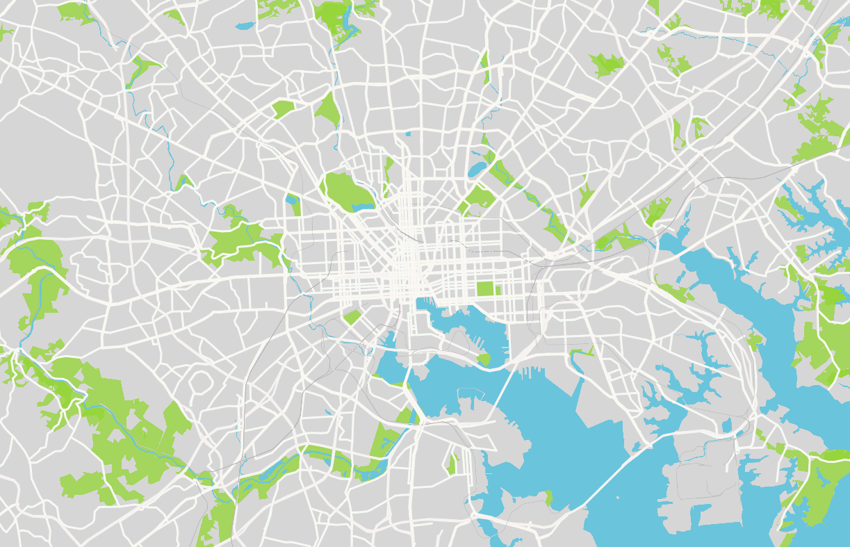
Baltimore osm-mapnik location map.png - Alexrk2
United States Congressional Districts in Maryland (metro highlight), 1973–1982.tiff - 7partparadigm
United States Congressional Districts in Maryland (metro highlight), 1983–1992.tiff - 7partparadigm
United States Congressional Districts in Maryland (metro highlight), 1993–2002.tiff - 7partparadigm
United States Congressional Districts in Maryland (metro highlight), 2003–2013.tiff - 7partparadigm
United States Congressional Districts in Maryland (metro highlight), since 2013.tif - 7partparadigm

Map of Start Spangled Banner Trail.png - Atlas337

Baltimore - its history and its people (1912) (14582587980).jpg - Fæ
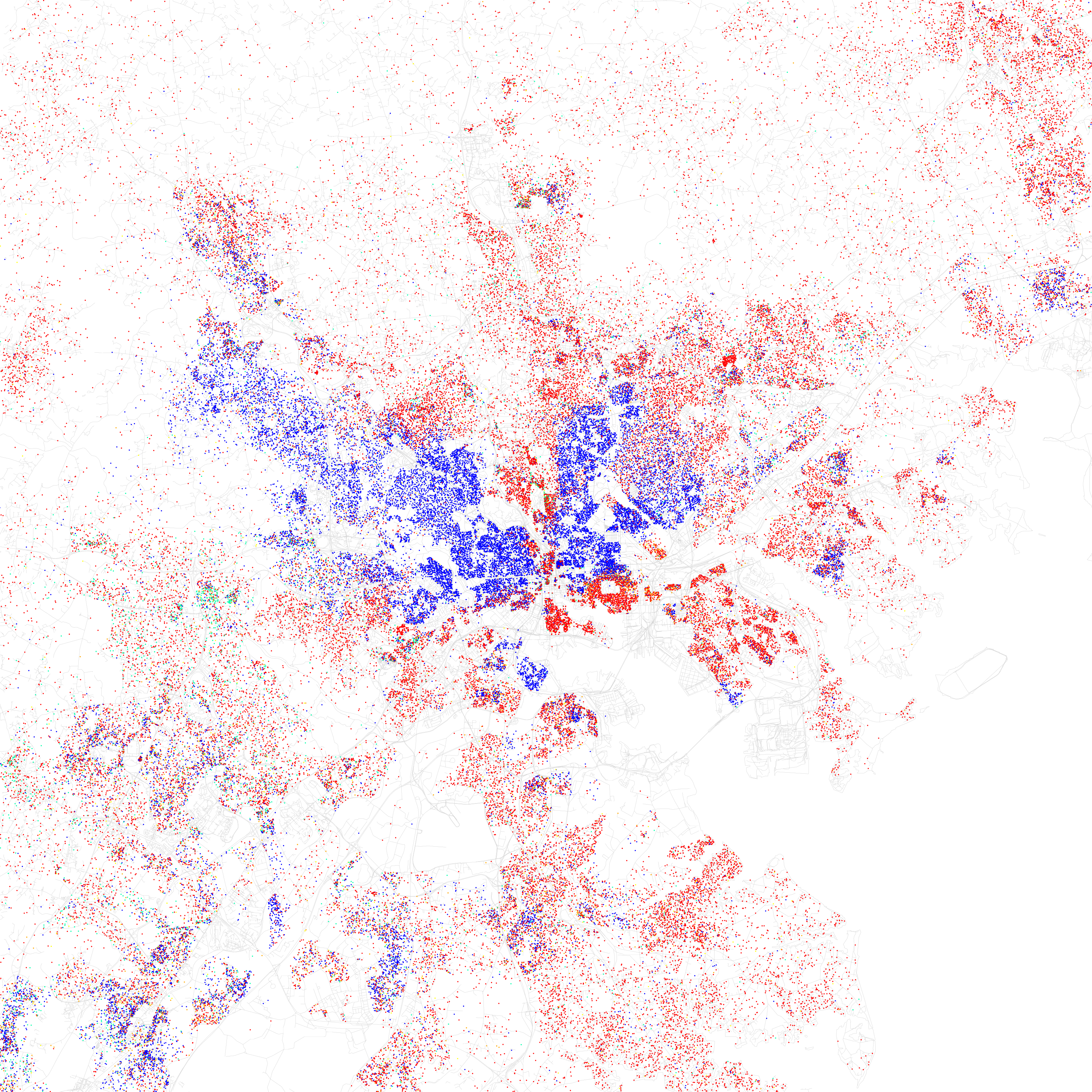
Race and ethnicity 2010- Baltimore (5559896701).png - WhisperToMe

203 of 'A History of the United States for schools ... With topical analysis, suggestive questions ... by F. A. Hill. (With maps.)' (11227330723).jpg - FlickreviewR 2
Baltimore, MD.png - Winston Samuel

Jones Falls Valley Map.png - Scott218

National Scenic Byway - Historic Charles Street (Maryland) - NARA - 68886407.jpg - US National Archives bot

Baltimore - NARA - 26335518.jpg - US National Archives bot

Map of the City of Baltimore, Sheet 1N1W - NARA - 124451357.jpg - US National Archives bot

Map of the City of Baltimore, Sheet 2N1W - NARA - 124451349.jpg - US National Archives bot

Map of the City of Baltimore, Sheet 3N1W - NARA - 124451351.jpg - US National Archives bot

Baltimore Wikivoyage city regions map.png - ויקיג'אנקי

Riverside Baltimore 1869 Sachse map.png - Alx bio
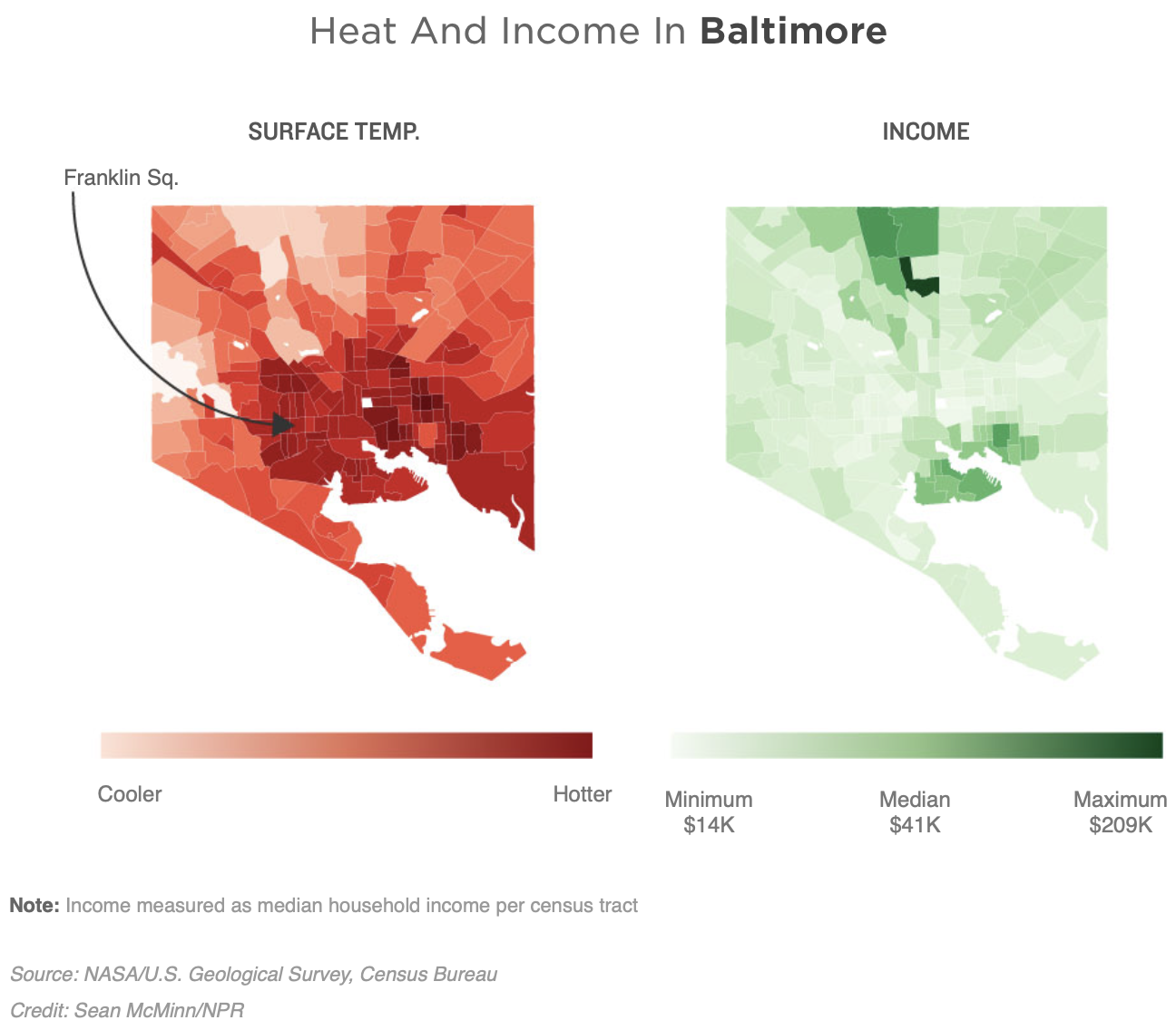
NPR HEAT GRAPH.png - Thatsojj
Baltimore City Historical Growth (1977).pdf - عُثمان

Baltimore City Historical Growth (1977).jpg - عُثمان
2010 Census Public Use Microdata Area Reference Map for Baltimore City--Inner Harbor, Canton & Bayview, Maryland - DPLA - bbeb742b45e2a98857ce240361f237fa.pdf - DPLA bot

Redlining in Baltimore.png - SamuelSThomas

Baltimore Maryland US Street map.svg - Kirill Shrayber

Washington DC and Baltimore MD US street map.svg - Kirill Shrayber