Wikimedi'Òc
Modes d'emploi

Cet album fait partie des albums
Cet album photos contient les sous-albums suivants :


Omani Empire 2 SVG.svg - بربرتا الماكروبي البنطي
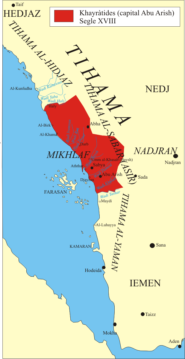
Asir-1800.PNG - Jolle~commonswiki

1771 Bonne Map of Abyssinia (Ethiopia), Sudan and the Red Sea - Geographicus - Abissine-bonne-1771.jpg - BotMultichillT
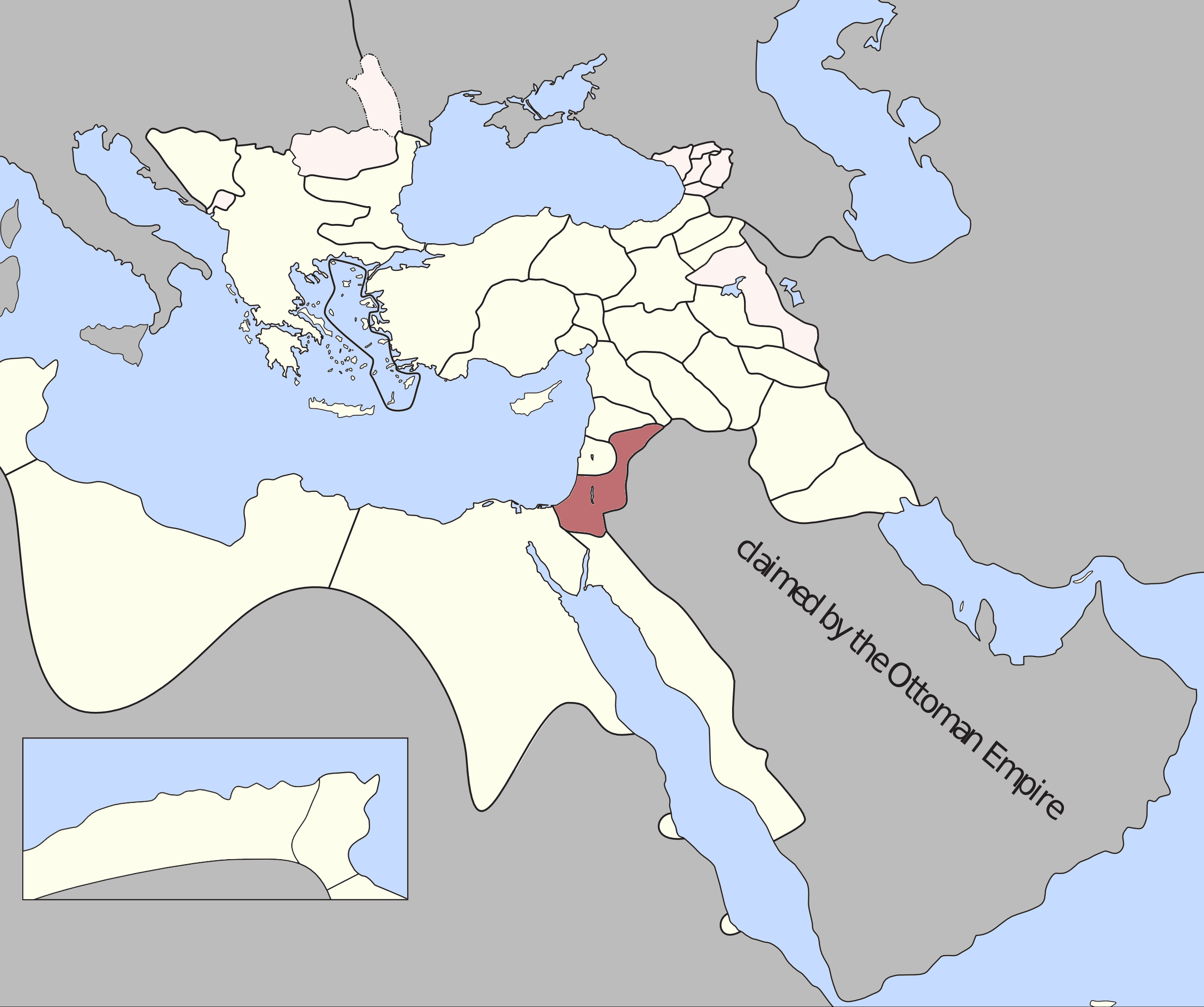
Damascus Eyalet, Ottoman Empire (1795).png - Underlying lk
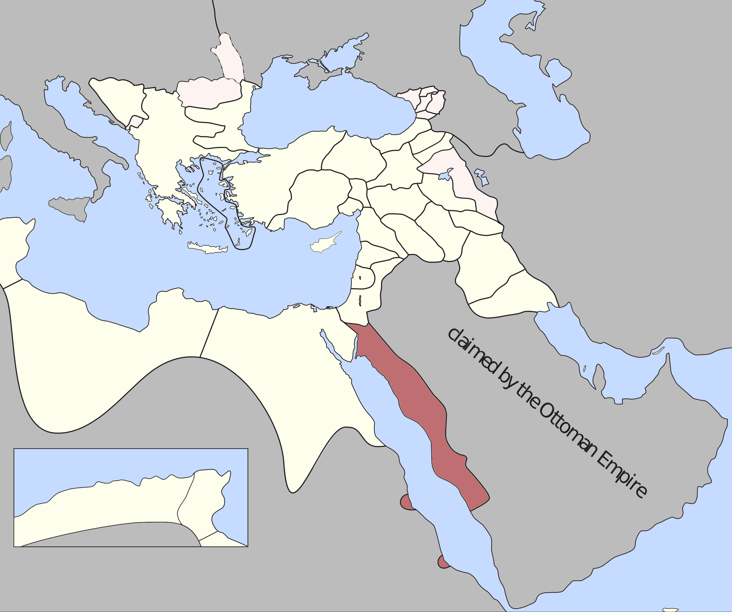
Jeddah Eyalet, Ottoman Empire (1795).png - Underlying lk
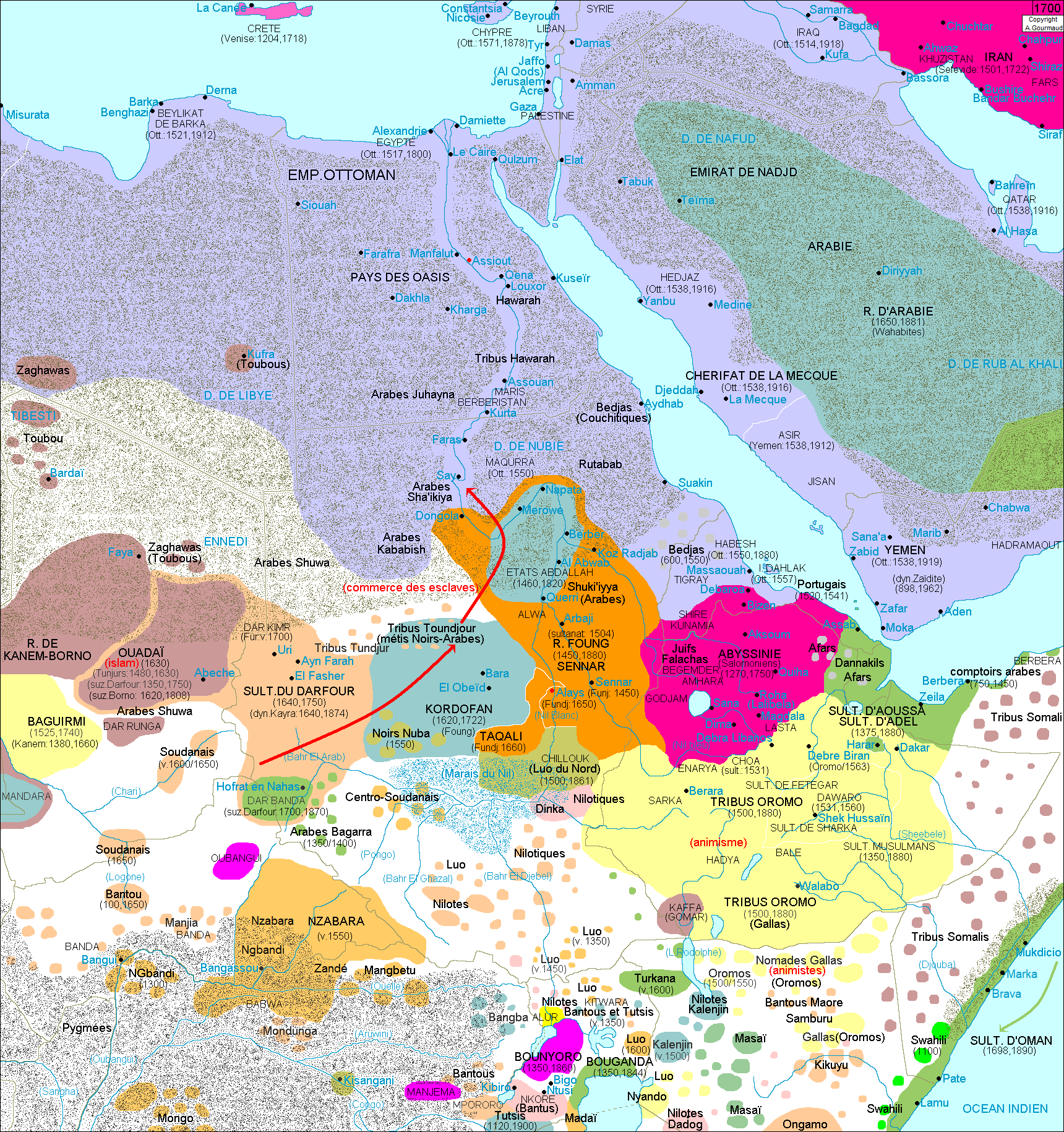
Af.Est 1700.png - Alain.gourmaud

خرائط الدولة السعودية التاريخية 6.jpg - Tarawneh

Sheikhdom of Diriyah.png - Userd898

Sheikhdom of Diriyah-ar.png - Michel Bakni
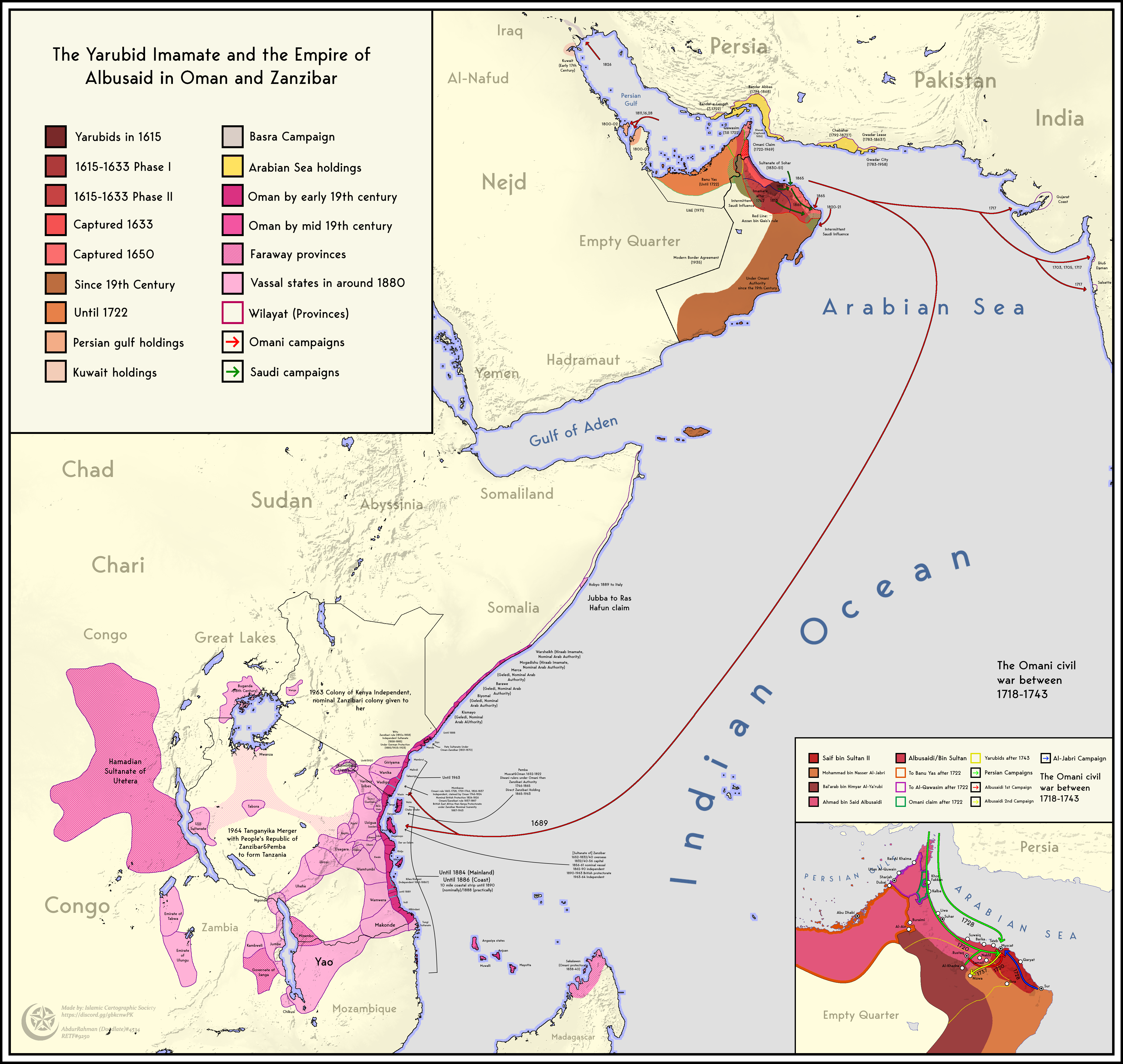
Omani Empire 2.png - Userd898

Map of Al Qawasim.jpg - M Waleed

خارطة اراضي الشيخ جديع بن هذال.jpg - Sheikh Bin Hathal