Wikimedi'Òc
Modes d'emploi

Cet album fait partie des albums
Cet album photos contient les sous-albums suivants :


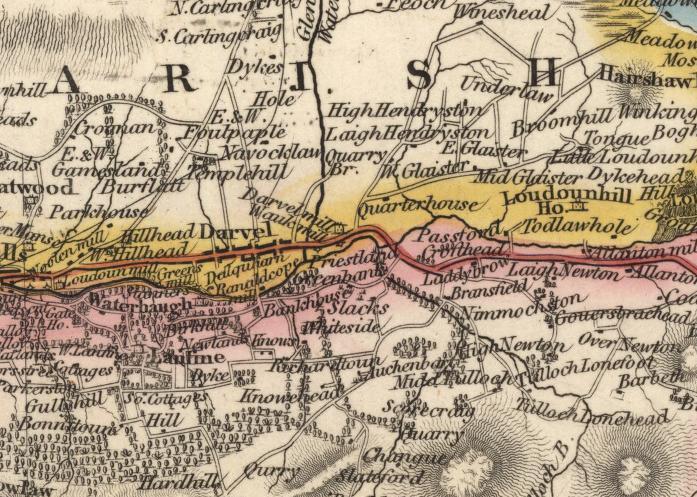
Darvel1832.JPG - Britishagent

Blaeu - Atlas of Scotland 1654 - ABERDONIA & BANFIA - Aberdeenshire and Banffshire.jpg - Simplicius

Blaeu - Atlas of Scotland 1654 - ÆBUDÆ INSULÆ - The Hebrides.jpg - Simplicius
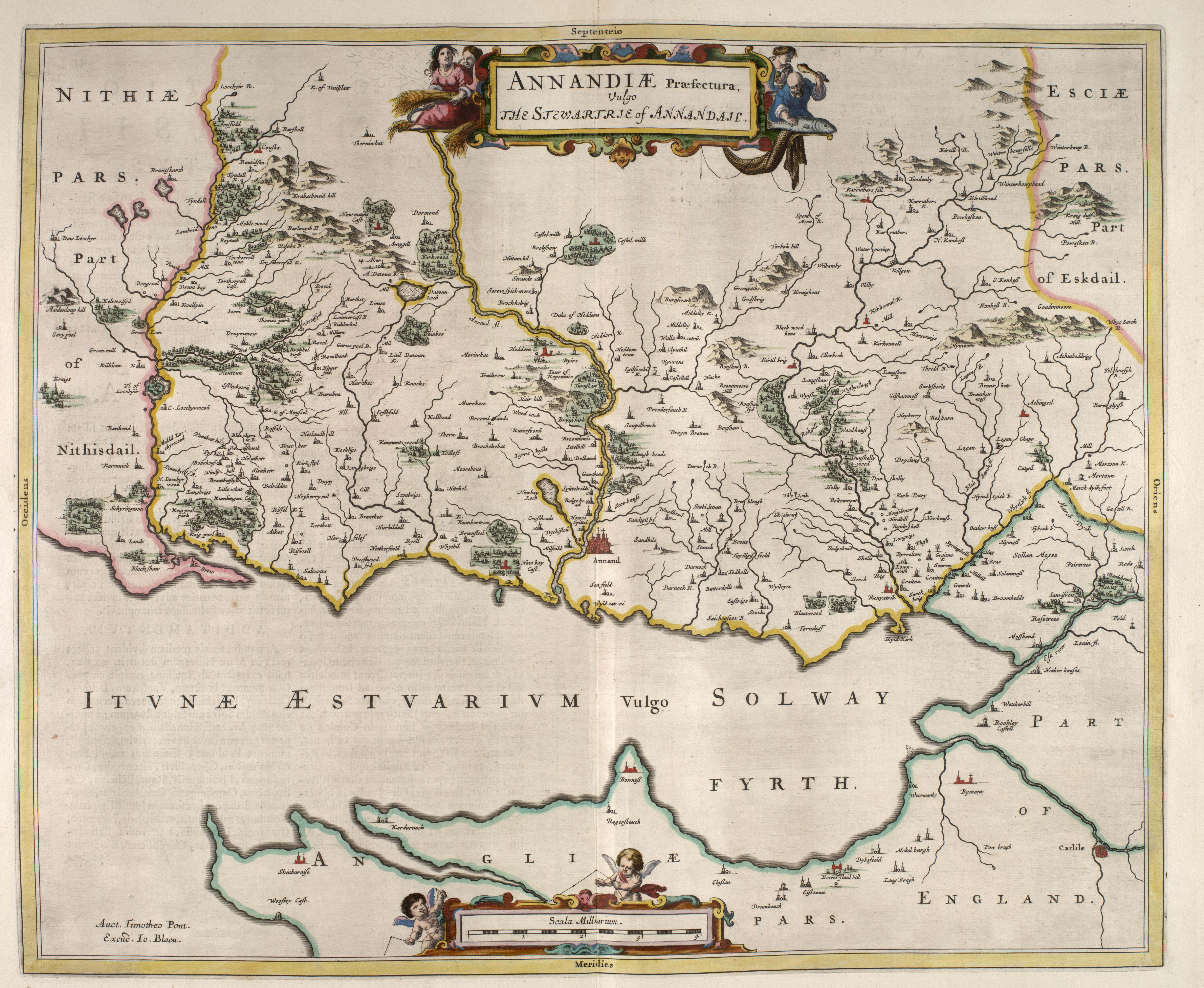
Blaeu - Atlas of Scotland 1654 - ANNANDIÆ - Lower Annandale.jpg - Simplicius

Blaeu - Atlas of Scotland 1654 - BUTHE INSULA - The Isle of Bute.jpg - Simplicius

Blaeu - Atlas of Scotland 1654 - BRAID-ALLABAN - The Central Highlands.jpg - Simplicius

Blaeu - Atlas of Scotland 1654 - ARANIA - The Isle of Arran.jpg - Simplicius
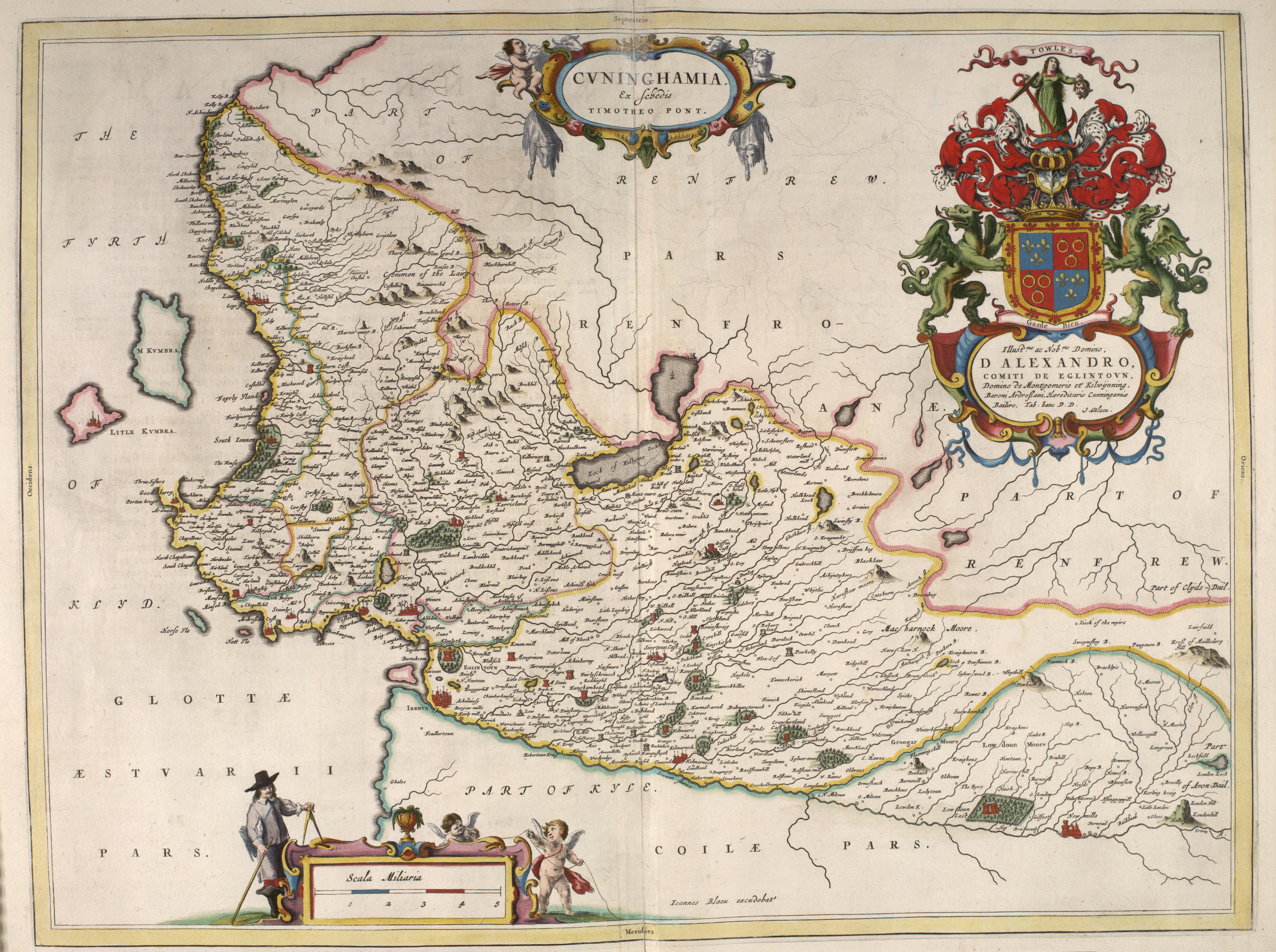
Blaeu - Atlas of Scotland 1654 - CVNINGHAMIA - Cunningham.jpg - Simplicius

Blaeu - Atlas of Scotland 1654 - COILA - Kyle.jpg - Simplicius

Blaeu - Atlas of Scotland 1654 - CATHENESIA - Caithness.jpg - Simplicius
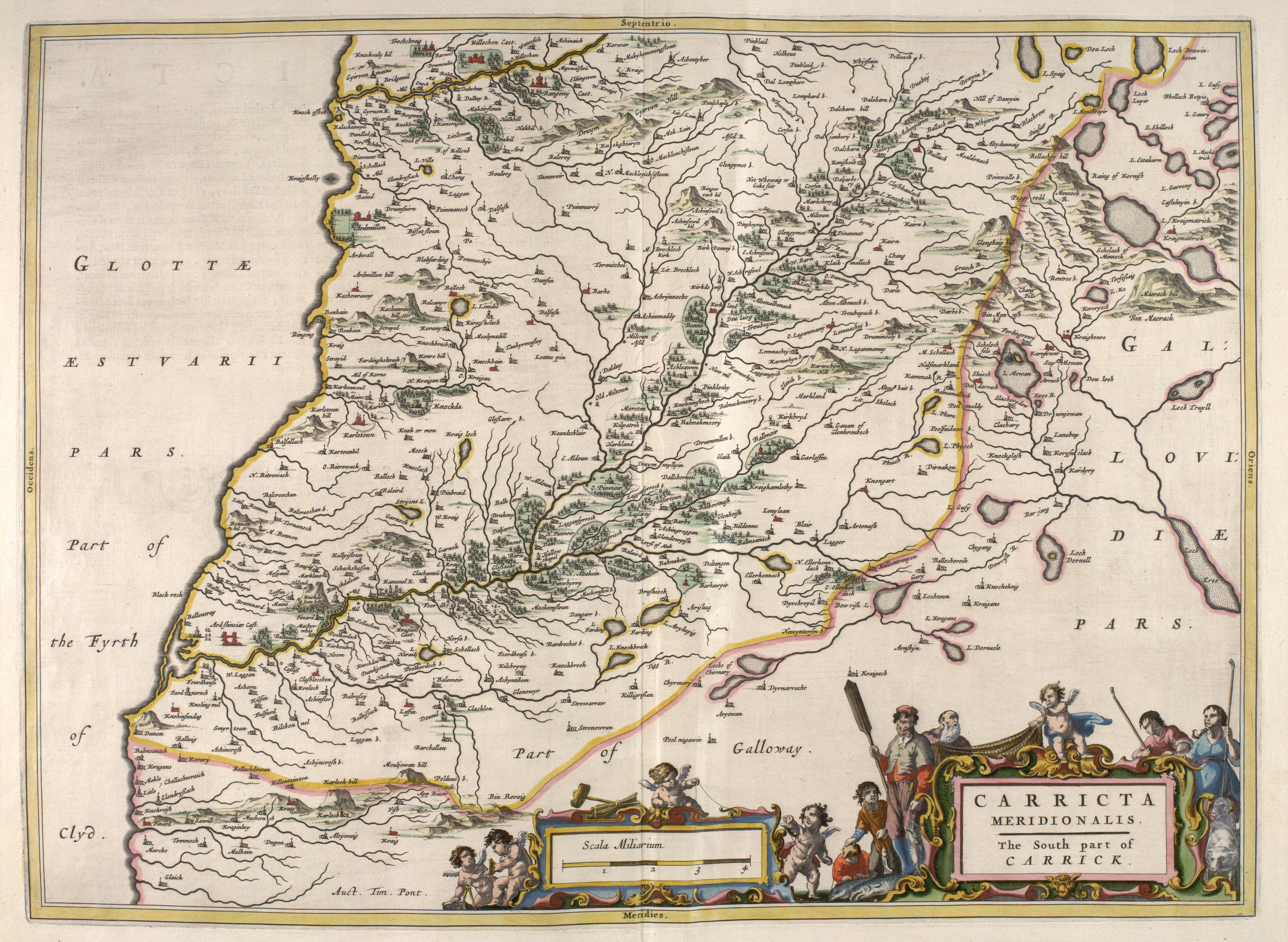
Blaeu - Atlas of Scotland 1654 - CARRICTA MERIDIONALIS - Carrick.jpg - Simplicius

Blaeu - Atlas of Scotland 1654 - CANTYRA - Kintyre.jpg - Simplicius

Blaeu - Atlas of Scotland 1654 - CARRICTA BOREALIS - Mid Ayrshire.jpg - Simplicius

Blaeu - Atlas of Scotland 1654 - EVIA ET ESCIA - Eskdale.jpg - Simplicius

Blaeu - Atlas of Scotland 1654 - EXTIMA SCOTIÆ - Northern Scotland.jpg - Simplicius

Blaeu - Atlas of Scotland 1654 - FIFÆ PARS OCCIDENTALIS - The West Part of Fife.jpg - Simplicius

Blaeu - Atlas of Scotland 1654 - FIFÆ PARS ORIENTALIS - The East Part of Fife.jpg - Simplicius

Blaeu - Atlas of Scotland 1654 - FIFÆ VICECOMITATUS - Fife.jpg - Simplicius

Blaeu - Atlas of Scotland 1654 - GALLOVIDIA - Galloway.jpg - Simplicius

Blaeu - Atlas of Scotland 1654 - GALLOVIDIÆ PARS MEDIA - West Kirkcudbright.jpg - Simplicius

Blaeu - Atlas of Scotland 1654 - GALLOVIDIÆ PARS OCCIDENTALIOR - Wigtownshire.jpg - Simplicius

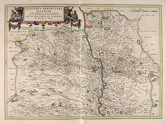
Blaeu - Atlas of Scotland 1654 - GLOTTIANA PRÆFECTVRA INFERIOR - Lower Clydesdale.jpg - Simplicius

Blaeu - Atlas of Scotland 1654 - GLOTTIANA PRÆFECTVRA SVPERIOR - Upper Clydesdale.jpg - Simplicius

Blaeu - Atlas of Scotland 1654 - ILA INSVLA - The Isle of Ila.jpg - Simplicius
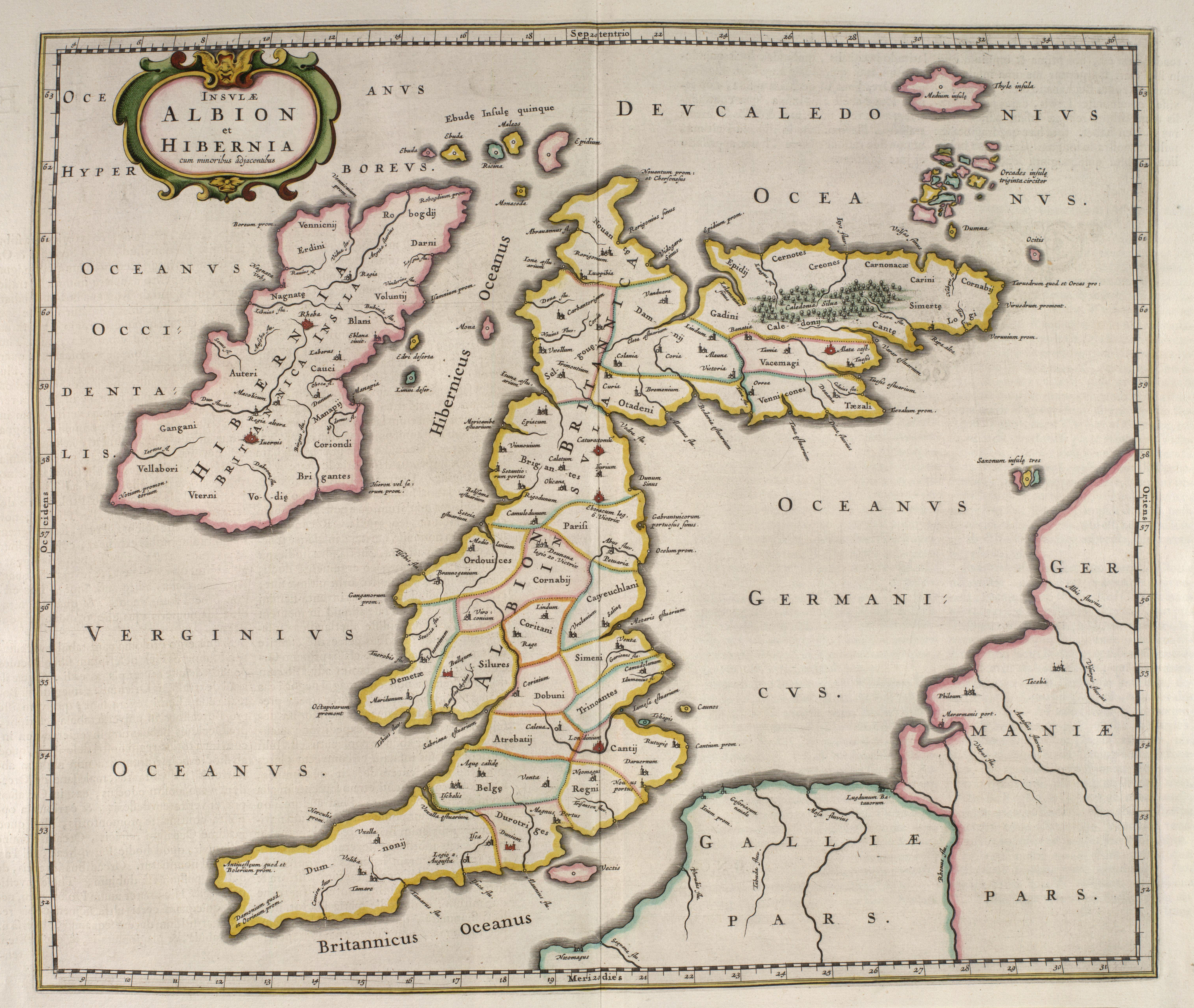
Blaeu - Atlas of Scotland 1654 - INSULÆ ALBION et HIBERNIA cum minoribus adjacentibus - British Isles.jpg - Simplicius

Blaeu - Atlas of Scotland 1654 - VISTVS INSVLA - The Uists and Barra.jpg - Simplicius

Blaeu - Atlas of Scotland 1654 - SKIA - The Isle of Skye.jpg - Simplicius

Blaeu - Atlas of Scotland 1654 - SCOTIA REGNUM - Kingdom of Scotland.jpg - Simplicius

Blaeu - Atlas of Scotland 1654 - SCOTIA ANTIQUA - Old Scotland.jpg - Simplicius
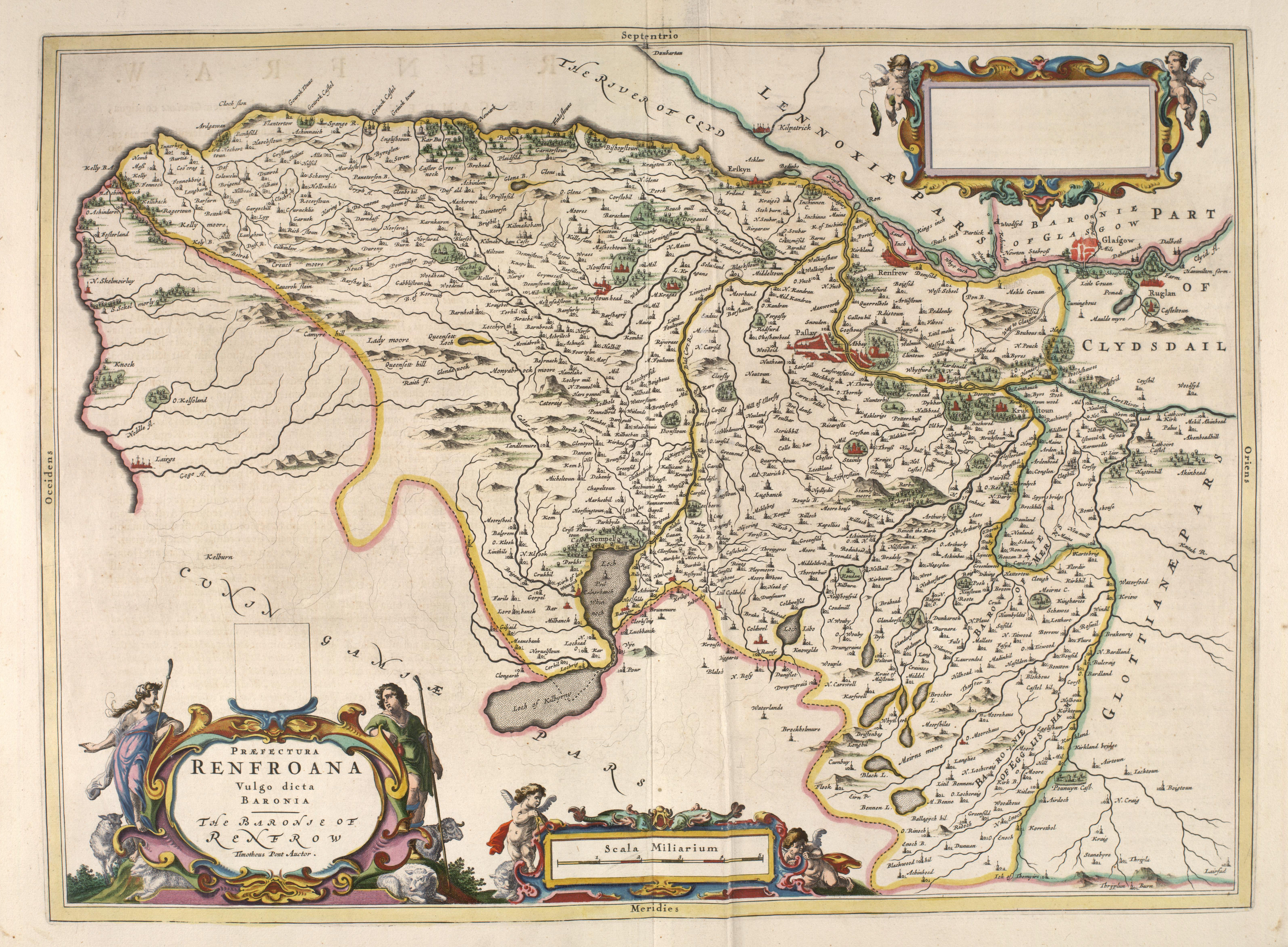
Blaeu - Atlas of Scotland 1654 - RENFROANA - Renfrew.jpg - Simplicius
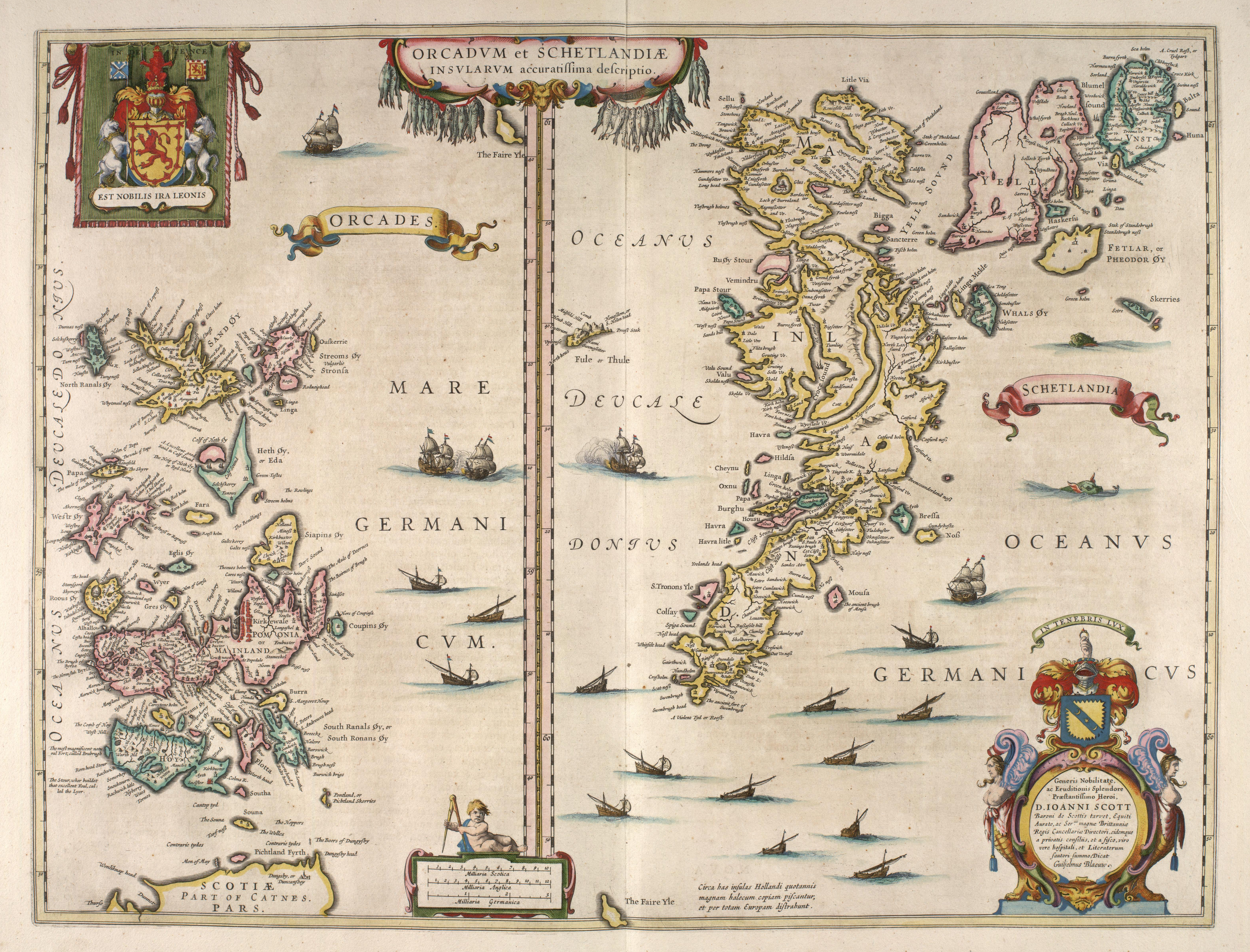
Blaeu - Atlas of Scotland 1654 - ORCADVM ET SCHETLANDIÆ - Orkney and Shetland.jpg - Simplicius

Blaeu - Atlas of Scotland 1654 - MORAVIA - Moray and Nairn.jpg - Simplicius

Blaeu - Atlas of Scotland 1654 - MERCIA - Berwickshire.jpg - Simplicius

Blaeu - Atlas of Scotland 1654 - NITHIA - Nithsdale.jpg - Simplicius

Blaeu - Atlas of Scotland 1654 - MVLA INSVLA - The Isle of Mull.jpg - Simplicius

Blaeu - Atlas of Scotland 1654 - LOTHIAN AND LINLITQVO - The Lothians.jpg - Simplicius

Blaeu - Atlas of Scotland 1654 - LAVDELIA - Lauderdale.jpg - Simplicius

Blaeu - Atlas of Scotland 1654 - LEOGVS ET HARAIA - Lewis and Harris.jpg - Simplicius

Blaeu - Atlas of Scotland 1654 - LEVINIA - Dunbarton.jpg - Simplicius

Blaeu - Atlas of Scotland 1654 - LIDALIA - Liddesdale.jpg - Simplicius
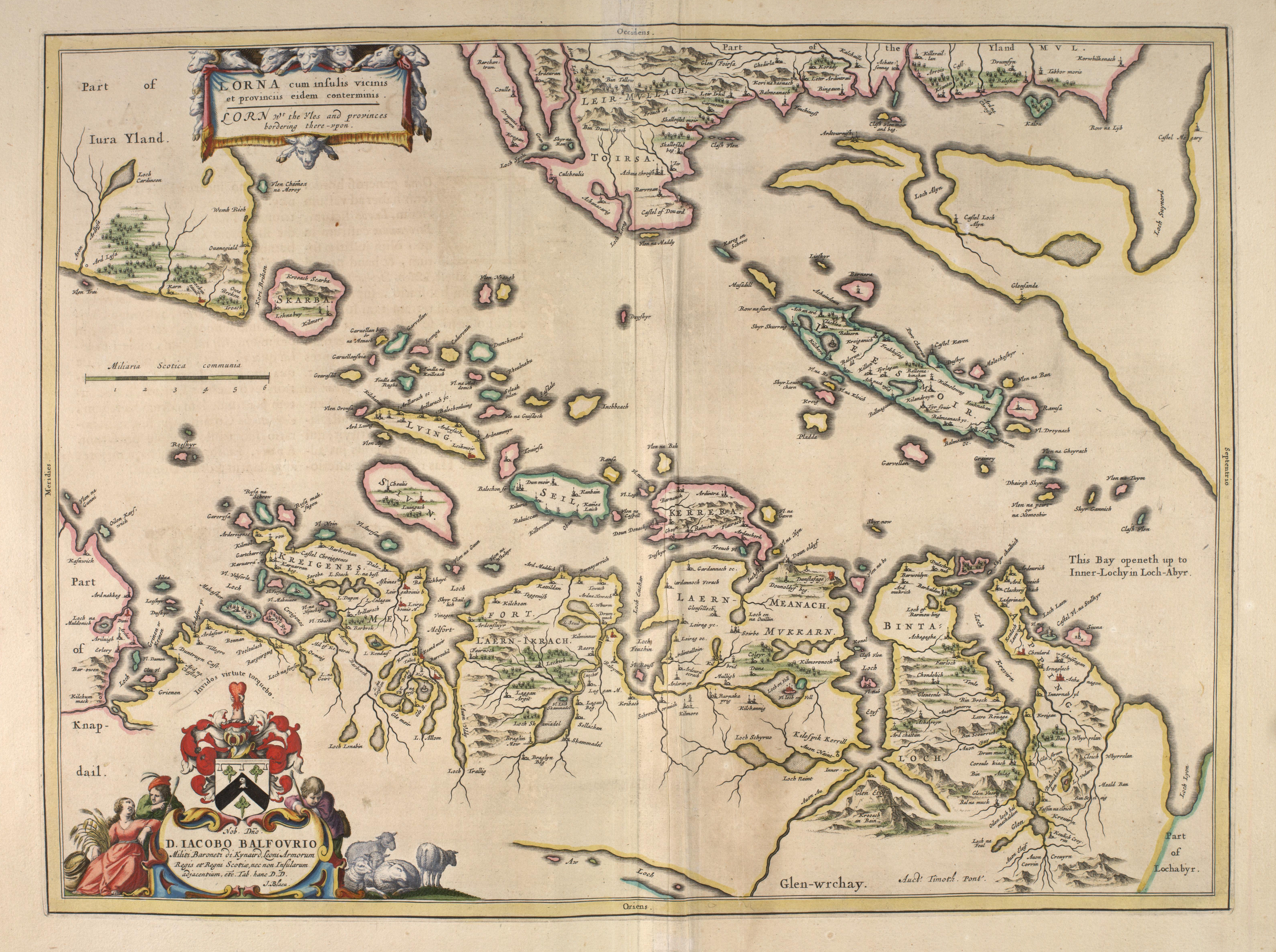
Blaeu - Atlas of Scotland 1654 - LORNA - The Firth of Lorn.jpg - Simplicius

Blaeu - Atlas of Scotland 1654 - KNAPDALIA - Knapdale.jpg - Simplicius

Blaeu - Atlas of Scotland 1654 - KIRCVBRIENSIS - East Kirkcudbright.jpg - Simplicius

Blaeu - Atlas of Scotland 1654 - IVRA INSVLA - The Isle of Jura.jpg - Simplicius

Blaeu - Atlas of Scotland 1654 - TVEDIA - Upper Tweedsdale.jpg - Simplicius

Blaeu - Atlas of Scotland 1654 - INSVLÆ QVÆDAM MINORES - The Small Isles.jpg - Simplicius

Blaeu - Atlas of Scotland 1654 - STRATH-NAVERNIA - Strath Naver and Strathmore.jpg - Simplicius

Blaeu - Atlas of Scotland 1654 - STERLINENSIS - Stirlingshire.jpg - Simplicius

Blaeu - Atlas of Scotland 1654 - TEVIOTIA - Teviotdale.jpg - Simplicius

Blaeu - Atlas of Scotland 1654 - SOVTHERLANDIA - Southeast Sutherland.jpg - Simplicius

Palestine N.JPG - Marku1988

Blaeu.1654.submap.Ptolemy.Damnij.jpg - Notuncurious

Mansewood1747-1755.jpg - Djspatrick
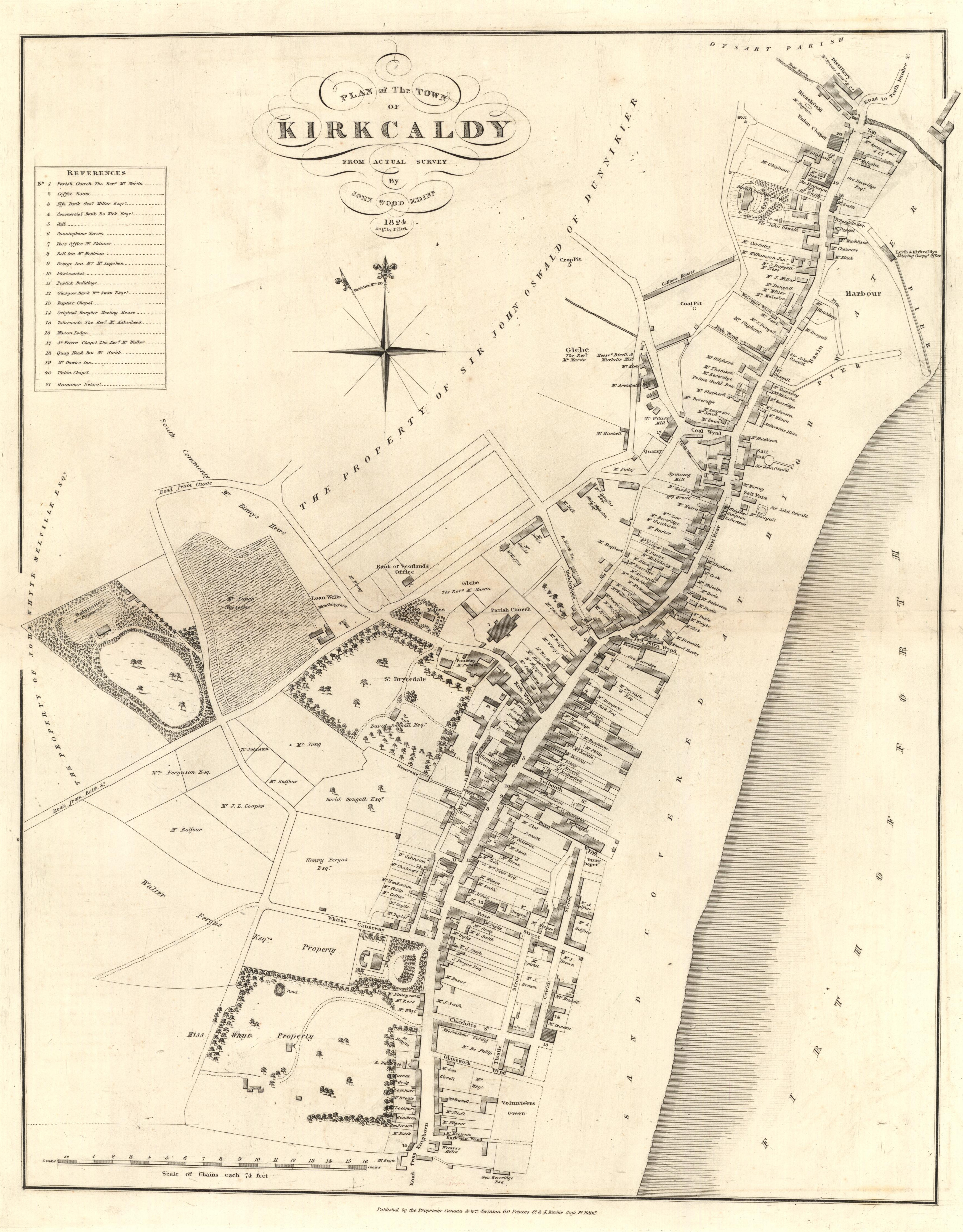
Map of the Royal Burgh of Kirkcaldy 1824.jpg - Knochen

Dùn an Achaidh (OS map, 1881).jpg - File Upload Bot (Magnus Manske)

William Roy Plate XXIX Roman Station Camelon Antonine Wall.jpg - Kognos

Map of the Flight of locks at Falkirk.png - Knipptang

St Kilda Map Mathieson 1928.png - Kognos

Map of Sutherland 1833 NLS.jpg - Kognos

Railway Map Edinburgh Glasgow District 1915.jpg - Kognos

Railway Map Edinburgh Glasgow District 1915 - cropped Balerno loop line.jpg - Kognos

View of Carsaig Bay and Loch Buie cropped from Admiralty Chart No 2813.jpeg - Kognos

North East Coast of Orkney Mackenzie 85449280.jpg - Kognos

North part of the Lewis and part of Mainland Scotland Mackenzie 85449289.jpg - Kognos

South East Coast of the Lewis Mackenzie 85449292.jpg - Kognos

Orkney Islands Mackenzie 85449271.jpg - Kognos

North part of the Lewis Mackenzie 85449286.jpg - Kognos

The west side of the island Mull with the islands Tiri and Coll Mackenzie 74400891.jpg - Kognos

North west coast of Orkney Mackenzie 5449283.jpg - Kognos

The Lewis or north part of Long Island Mackenzie 74400899.jpg - Kognos

The north part of Sky island and the adjacent main of Scotland Mackenzie 74400894.jpg - Kognos

A general chart of the west coast and western islands of Scotland from Cantire to Cape Wrath and Butt of the Lewis Mackenzie 74400887.jpg - Kognos

The west coast of Scotland from Ila to Mull Mackenzie 74400889.jpg - Kognos

The south part of Sky Island and the adjacent main of Scotland Mackenzie 74400893.jpg - Kognos

The sound of Mull. Mackenzie 74400890.jpg - Kognos

The channel between Sky I and the Lewis Mackenzie 74400898.jpg - Kognos

Pomona or main-land Mackenzie 85449277.png - Kognos

South isles of Orkney Mackenzie 85449274.jpg - Kognos
Railway Clearing House Map of Scotland 1923.jpg - Kognos

Ordnance Survey Sheet NU 21 Alnmouth, Published 1954.png - Kognos

Ordnance Survey Sheet NU 22 Embleton, Published 1954.jpg - Kognos

Ordnance Survey Sheet NU 23 Farne Islands, Published 1954.jpg - Kognos

Ordnance Survey Sheet NU 13, Bamburgh, Published 1954.jpg - Kognos

Ordnance Survey Sheet NU 12 Charlton, Published 1954.jpg - Kognos

Ordnance Survey Sheet NU 11 Alnwick, Published 1954.jpg - Kognos

Ordnance Survey Sheet NU 20 Amble, Published 1954.jpg - Kognos

Ordnance Survey Sheet NU 10 Longframligton, Published 1954.jpg - Kognos

Ordnance Survey Sheet NU 03 Lowick, Publihed 1954.jpg - Kognos

Ordnance Survey Sheet NU 04 Lindisfarne, Published 1954.jpg - Kognos

Northumberland Coast 1954 Composite Map.jpg - Kognos

Ordnance Survey Sheet NT 63, Published 1954.jpg - Kognos

Ordnance Survey Sheet SW 32 Land's End, Published 1960.png - Kognos

Ordnance Survey Sheet SV 91 St Mary's, Published 1960.png - Kognos

Cowley Argyll Map 1734.jpg - Kognos

Cowley North Britain Map 1734.jpg - Kognos

Cowley Map of Coasting Lines 1734.jpg - Kognos

Caledonian Railway Tourist Map, Published 1900.jpg - Kognos

Penwortham 1888.png - MossW268

Penwortham 1840.png - MossW268

Penwortham 1949.png - MossW268

Aberdeen - Coast between Dee and Don, Published 1756.jpg - Kognos

Plan of the River Spey, Published 1761.jpg - Kognos

Plan of the Barony of Castle Leod, Published 1796.jpg - Kognos

Callapoda Portolan Chart of Europe 1560.jpg - Kognos

Joan Blaeu - Merse - 1654 - Area 'Duns Grinnla Fogo'.png - Franz van Duns