Wikimedi'Òc
Modes d'emploi

Cet album fait partie des albums
Cet album photos contient les sous-albums suivants :


Map from Isle of Wight (1908) John Bartholomew & Co..jpg - Pineway

West Africa in a John Bartholomew & Co. map published c. 1914.jpg - Philafrenzy
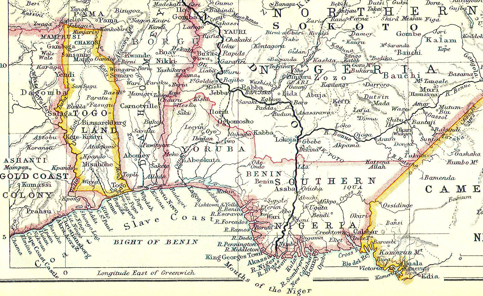
The Slave Coast on a John Bartholomew & Co. map published c. 1914 (part).jpg - Philafrenzy

Karachi map 1911.jpg - Nizil Shah

928 of 'Gazetteer of the British Isles, statistical and topographical. Edited by J. Bartholomew. With appendices and special maps and plans' (11190665535).jpg - FlickreviewR 2

929 of 'Gazetteer of the British Isles, statistical and topographical. Edited by J. Bartholomew. With appendices and special maps and plans' (11190383135).jpg - FlickreviewR 2

Paris International Assembly - guide plan of Paris, 1900 by John Bartholomew & Son - Stanford Libraries.jpg - Paris 16
Gazetteer of the British Isles, statistical and topographical by John Bartholomew (1887). Original from British Library. Digitally enhanced by rawpixel. (50623714617).jpg - Eyes Roger
Dominion of Canada & northern United States, by John Bartholomew. (IA bp 32618).pdf - Fæ

Bartholomew Africa 1875 UTA.jpg - Michael Barera

Bartholomew's Map of North-Eastern France, Belgium and the Rhine - btv1b53121363d.jpg - Gzen92Bot

Plan of Plevna showing Turkish fortifications and Russian lines of investment..png - Kristián Czerny

The Environs of Kars..png - Kristián Czerny

Map showing the kingdom of Lahore (Sikh Empire) during the last years of Sikh rule, probably published in the 1900's.jpg - MaplesyrupSushi

John Bartholomew & Co., Palestine - Orographical General map showing roads & communications (FL46962154 3907122).jpg - Geagea

Edinburgh Geographical Institute, Palestine (FL36012252 3896582).jpg - Geagea

Map of Central Asia depicting the northern International boundary of Kashmir in India on the Kuen Lun Range.jpg - Hindutashravi