Wikimedi'Òc
Modes d'emploi

Cet album fait partie des albums


A topographical map of the northn. part of New York island, exhibiting the plan of Fort Washington, now Fort Knyphausen... (NYPL Hades-118162-54925).tif - Fæ

A topographical map of the northn. part of New York Island... (2674343553).jpg - File Upload Bot (Magnus Manske)
A topographical map of the northn. part of New York Island, exhibiting the plan of Fort Washington, now Fort Knyphausen, with the rebels lines to the southward, which were forced by the troops under LOC gm71000651.tif - Fæ

BattleOfFortWashingtonMapBySauthier.jpg - Magicpiano

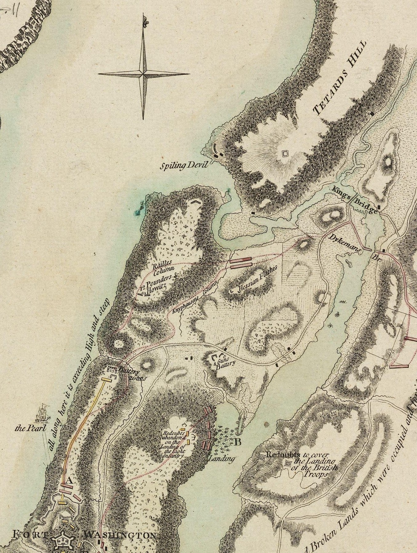
Detail of Battle Of Fort Washington Map By Sauthier.jpg - Wikiuser100

Battle of Fort Washington.jpg - Muhranoff
Forts Washington Tryon Cockhill.jpg - The rakish fellow

A plan of the attack of Fort Washington, now Fort Knyphausen, and of the American lines on New-York Island by the King's troops, on the 16th of November 1776. LOC gm71000652.jpg - Fæ
A plan of the attack of Fort Washington, now Fort Knyphausen, and of the American lines on New-York Island by the King's troops, on the 16th of November 1776. LOC gm71000652.tif - Fæ

A topographical map of the northn. part of New York Island, exhibiting the plan of Fort Washington, now Fort Knyphausen, with the rebels lines to the southward, which were forced by the troops under LOC 74692191.jpg - Fæ

A Topographical map of North. Part of New York Island, exhibiting the Plan of Fort Washington now Fort Knyphausen with the Rebels Lines to the Southward.jpg - Jeangagnon
A topographical map of the northn. part of New York Island, exhibiting the plan of Fort Washington, now Fort Knyphausen, with the rebels lines to the southward, which were forced by the troops under LOC 74692191.tif - Fæ

A topographical map of the northn. part of New York Island, exhibiting the plan of Fort Washington, now Fort Knyphausen, with the rebels lines to the southward, which were forced by the troops under LOC gm71000651.jpg - Fæ

Atlas of Battles of the American Revolution, Sheet 6- A Topographical Map of the Northn. Part of New York Island, Exhibiting the Plan of Fort Washington, now Fort Knyphausen, With the Rebels Lines to the Southwa(...) - NARA - 102279692.jpg - US National Archives bot

A topographical map of the Northern part of New York Island, exhibiting the plan of Fort Washington, now Fort Knyphasen, showing the several attacks on the Royal Army - DPLA - 9fd0facb681fc214143eeb4ddd84a386.jpg - DPLA bot

Manual of the corporation of the city of New York (1859) (14763656835).jpg - Fæ

1776mcgowansmap.jpg - Delusion23
(New York Island. Military; unfinished. LOC gm71002309.tif - Fæ

(New York Island. Military; unfinished. LOC gm71002309.jpg - Fæ