Wikimedi'Òc
Modes d'emploi

Cet album fait partie des albums
Cet album photos contient les sous-albums suivants :


Lowfield Heath 01 (04-08-2007).jpg - Hassocks5489

Lowfield Heath 02 (04-08-2007).jpg - Hassocks5489

Lowfield Heath 03 (19-11-2008).jpg - Hassocks5489

Knight's Acre, Langley Green, Crawley (IoE Code 363387).jpg - Hassocks5489

Junction of Lowfield Heath Road, Charlwood Road and Bonnetts Lane, Ifield, Crawley, West Sussex - geograph.org.uk - 28605.jpg - GeographBot
Lowfield Heath (E) 01.JPG - BotMultichill

Charlwood Road - geograph.org.uk - 362126.jpg - GeographBot

Lowfield Heath, Old Brighton Road South - geograph.org.uk - 847209.jpg - GeographBot

Charlwwod House Entrance.JPG - Mikejordan

Barn East of Rowley Farmhouse, Lowfield Heath, Crawley (IoE Code 363415).JPG - Hassocks5489

Rowley Farmhouse, Lowfield Heath, Crawley (IoE Code 363334).JPG - Hassocks5489

Gatwick Gate Industrial Estate, Charlwood Road, Lowfield Heath (1).JPG - Hassocks5489

Church Road, Lowfield Heath - geograph.org.uk - 1955693.jpg - GeographBot

Church Road Lowfield Heath - geograph.org.uk - 3583288.jpg - GeographBot

Charlwood Road, Lowfield Heath - geograph.org.uk - 5261034.jpg - GeographBot

Charlwood Road, Lowfield Heath - geograph.org.uk - 5261056.jpg - GeographBot

Charlwood Road, Lowfield Heath - geograph.org.uk - 5266597.jpg - GeographBot

Charlwood Road, Lowfield Heath - geograph.org.uk - 5266623.jpg - GeographBot

Charlwood Road, Lowfield Heath - geograph.org.uk - 5266670.jpg - GeographBot

Charlwood Road, Lowfield Heath - geograph.org.uk - 5266685.jpg - GeographBot

Charlwood Road, Lowfield Heath - geograph.org.uk - 5266691.jpg - GeographBot

Abandoned Road near Roband Electronics, Lowfield Heath Road, Charlwood (May 2012).jpg - Hassocks5489

Airparks Car Park, Lowfield Heath Road, Lowfield Heath (May 2012).jpg - Hassocks5489

Airport Car Park off Land off Charlwood Road, Lowfield Heath (May 2012) (1).jpg - Hassocks5489

Airport Car Park off Land off Charlwood Road, Lowfield Heath (May 2012) (2).jpg - Hassocks5489

Airport Car Park off Land off Charlwood Road, Lowfield Heath (May 2012) (3).jpg - Hassocks5489

Airport Car Park off Land off Charlwood Road, Lowfield Heath (May 2012) (4).jpg - Hassocks5489

Airport Car Park off Land off Charlwood Road, Lowfield Heath (May 2012) (5).jpg - Hassocks5489

Amberley Fields Caravan Site, Charlwood Road, Lowfield Heath (May 2012).jpg - Hassocks5489

Brookfield Day Nursery, London Road, Lowfield Heath (May 2012).jpg - Hassocks5489

Brooklyn Farm, Bonnetts Lane, Lowfield Heath (May 2012).jpg - Hassocks5489

Brookside Cottage, Charlwood Road, Lowfield Heath (May 2012).jpg - Hassocks5489

Charlwood Road, Lowfield Heath (May 2012) (1).jpg - Hassocks5489

Charlwood Road, Lowfield Heath (May 2012) (2).jpg - Hassocks5489

Church Road, Lowfield Heath (May 2012) (1).jpg - Hassocks5489

Church Road, Lowfield Heath (May 2012) (2).jpg - Hassocks5489

Eastward view along Church Road, Lowfield Heath (August 2007) (1).jpg - Hassocks5489

Eastward view along Church Road, Lowfield Heath (November 2008) (1).jpg - Hassocks5489

Eastward view along Church Road, Lowfield Heath (November 2008) (2).jpg - Hassocks5489
Empty Land off London Road, Lowfield Heath (May 2012) (1).jpg - Hassocks5489
Empty Land off London Road, Lowfield Heath (May 2012) (2).jpg - Hassocks5489
Empty Land off London Road, Lowfield Heath (May 2012) (3).jpg - Hassocks5489

Junction of Charlwood Road and Bonnetts Lane, Lowfield Heath (May 2012) (1).jpg - Hassocks5489

Junction of Charlwood Road and Bonnetts Lane, Lowfield Heath (May 2012) (2).jpg - Hassocks5489

Land off Charlwood Road, Lowfield Heath (May 2012).jpg - Hassocks5489

Land off Lowfield Heath Road, Lowfield Heath (May 2012) (Section between Bonnetts Lane and County Boundary) (1).jpg - Hassocks5489

Land off Lowfield Heath Road, Lowfield Heath (May 2012) (Section between Bonnetts Lane and County Boundary) (2).jpg - Hassocks5489

Land off Lowfield Heath Road, Lowfield Heath (May 2012) (Section between Bonnetts Lane and County Boundary) (3).jpg - Hassocks5489

Land off Lowfield Heath Road, Lowfield Heath (May 2012) (Section between Bonnetts Lane and County Boundary) (4).jpg - Hassocks5489

Land off Lowfield Heath Road, Lowfield Heath (May 2012) (Section between Bonnetts Lane and County Boundary) (5).jpg - Hassocks5489

Lowfield Heath Road, Lowfield Heath (May 2012) (Section between Bonnetts Lane and County Boundary) (1).jpg - Hassocks5489

Lowfield Heath Road, Lowfield Heath (May 2012) (Section between Bonnetts Lane and County Boundary) (2).jpg - Hassocks5489

Lowfield Heath Road, Lowfield Heath (May 2012) (Section between Bonnetts Lane and County Boundary) (3).jpg - Hassocks5489

Lowfield Heath Road, Lowfield Heath (May 2012) (Section between Bonnetts Lane and County Boundary) (4).jpg - Hassocks5489

Lowfield Heath Roundabout, Lowfield Heath (May 2012) (1).jpg - Hassocks5489

Lowfield Heath Roundabout, Lowfield Heath (May 2012) (2).jpg - Hassocks5489

Lowfield Heath Roundabout, Lowfield Heath (May 2012) (3).jpg - Hassocks5489

Lowfield Heath Roundabout, Lowfield Heath (May 2012) (4).jpg - Hassocks5489

Metal Tower inside Gatwick Airport Boundary, seen from Charlwood Road, Lowfield Heath (May 2012).jpg - Hassocks5489

Northeastward view towards St Michael and All Angels Church, Lowfield Heath (November 2008).jpg - Hassocks5489

Northward view along Old Brighton Road South, Lowfield Heath (August 2007).jpg - Hassocks5489

Old Brighton Road South, Lowfield Heath (May 2012) (1).jpg - Hassocks5489

Old Brighton Road South, Lowfield Heath (May 2012) (2).jpg - Hassocks5489

Old Brighton Road South, Lowfield Heath (May 2012) (3).jpg - Hassocks5489

Old Brighton Road South, Lowfield Heath (May 2012) (4).jpg - Hassocks5489

Old Brighton Road South, Lowfield Heath (May 2012) (5).jpg - Hassocks5489

Old Brighton Road South, Lowfield Heath (May 2012) (6).jpg - Hassocks5489

Old Brighton Road South, Lowfield Heath (May 2012) (7).jpg - Hassocks5489

Old Brighton Road South, Lowfield Heath (May 2012) (8).jpg - Hassocks5489

Path from Church Road to A23, Lowfield Heath (May 2012) (1).jpg - Hassocks5489

Path from Church Road to A23, Lowfield Heath (May 2012) (2).jpg - Hassocks5489

Path from Church Road to A23, Lowfield Heath (May 2012) (3).jpg - Hassocks5489

Plane landing, seen from Lowfield Heath Road (Section between Bonnetts Lane and County Boundary) (May 2012).jpg - Hassocks5489

Plane taking off, seen from Charlwood Road, Lowfield Heath (May 2012).jpg - Hassocks5489

Poles Lane, Lowfield Heath (at Junction of Charlwood Road) (May 2012).jpg - Hassocks5489

River Mole within Gatwick Airport Perimeter, Charlwood Road, Lowfield Heath (May 2012) (1).jpg - Hassocks5489

River Mole within Gatwick Airport Perimeter, Charlwood Road, Lowfield Heath (May 2012) (2).jpg - Hassocks5489

Roband Electronics, Lowfield Heath Road, Charlwood (May 2012).jpg - Hassocks5489

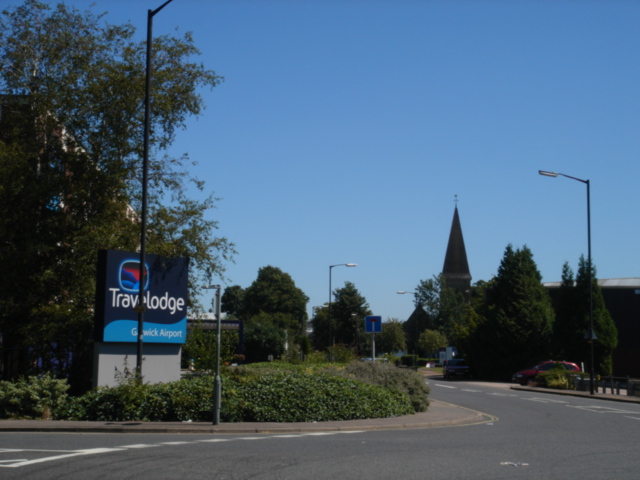
Travelodge Gatwick Airport, Church Road, Lowfield Heath (May 2012).jpg - Hassocks5489

Westward view along Church Road, Lowfield Heath (August 2007).jpg - Hassocks5489

Windmill Garage, Charlwood Road, Lowfield Heath (May 2012).jpg - Hassocks5489