Wikimedi'Òc
Modes d'emploi

Cet album fait partie des albums
Cet album photos contient les sous-albums suivants :


Bonsall, Derbyshire.jpg - File Upload Bot (Magnus Manske)

Fern Dale - geograph.org.uk - 45160.jpg - GeographBot

Low Moor Wood - geograph.org.uk - 45165.jpg - GeographBot

Youlgreave - geograph.org.uk - 33638.jpg - GeographBot

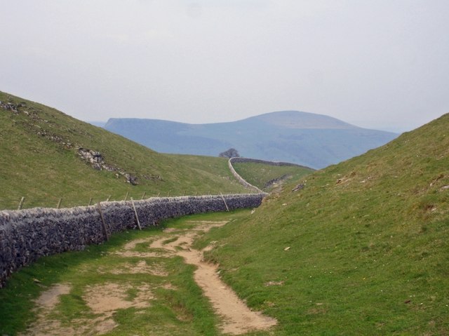
Barn on the Limestone Way above Bradford Dale - geograph.org.uk - 87077.jpg - GeographBot

Holly Bush Inn, Grangemill - geograph.org.uk - 83766.jpg - GeographBot

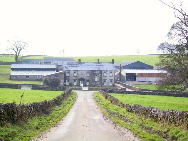
Limestone Way Farm - geograph.org.uk - 88407.jpg - GeographBot

Pennine Bridleway - geograph.org.uk - 88423.jpg - GeographBot

Pot Luck - geograph.org.uk - 88425.jpg - GeographBot

Misty morning, southern end of Peter Dale - geograph.org.uk - 90998.jpg - GeographBot
Wheston Hall Farm - geograph.org.uk - 88433.jpg - GeographBot

View from the Limestone Way - geograph.org.uk - 198590.jpg - GeographBot

Cop Well - geograph.org.uk - 215025.jpg - GeographBot

Approaching Lordspiece on the Limestone Way - geograph.org.uk - 231474.jpg - GeographBot

Limestone Way, The Cop - geograph.org.uk - 215029.jpg - GeographBot

Dydon - geograph.org.uk - 231462.jpg - GeographBot

Lees Farm - geograph.org.uk - 231488.jpg - GeographBot

Limestone Way near Rocester - geograph.org.uk - 231420.jpg - GeographBot

Marten Hill - geograph.org.uk - 231485.jpg - GeographBot

Parkland cattle - geograph.org.uk - 231444.jpg - GeographBot

Pastoral with ruin - geograph.org.uk - 231450.jpg - GeographBot

Squeeze stile - geograph.org.uk - 231468.jpg - GeographBot

Swinholm Farm - geograph.org.uk - 231423.jpg - GeographBot
The Limestone Way near Swinscoe - geograph.org.uk - 231479.jpg - GeographBot

The guardian of the Limestone Way - geograph.org.uk - 231460.jpg - GeographBot

Woodhouses - geograph.org.uk - 231489.jpg - GeographBot

Limestone Way above Bonsall - geograph.org.uk - 272393.jpg - GeographBot

Pig pens, One Ash Grange Farm - geograph.org.uk - 273248.jpg - GeographBot

View towards Mam Tor - geograph.org.uk - 409137.jpg - GeographBot

Limestone Way - geograph.org.uk - 413641.jpg - GeographBot

Limestone Way - geograph.org.uk - 413650.jpg - GeographBot

Limestone Way approaching Mount Pleasant Farm - geograph.org.uk - 413644.jpg - GeographBot
Limestone Way at the top of Cave Dale - geograph.org.uk - 416014.jpg - GeographBot

On the Limestone Way - geograph.org.uk - 416008.jpg - GeographBot

Crossing the Limestone Way - geograph.org.uk - 434812.jpg - GeographBot

Bee Low Wood - geograph.org.uk - 558615.jpg - GeographBot

Boundary of Low Moor Wood - geograph.org.uk - 558611.jpg - GeographBot

Footpath Junction - geograph.org.uk - 559126.jpg - GeographBot

Looking back towards Calling Low - geograph.org.uk - 558634.jpg - GeographBot

Low Moor Wood Entrance - geograph.org.uk - 558621.jpg - GeographBot

Bee Low Wood viewed from Back Lane - geograph.org.uk - 561424.jpg - GeographBot

Ancient Landscape - geograph.org.uk - 586682.jpg - GeographBot

Millers Dale - Gate Posts on Limestone Way - geograph.org.uk - 595418.jpg - GeographBot

Lane junction near Priestcliffe - geograph.org.uk - 619339.jpg - GeographBot

Matlock - Fingerpost on Limestone Way - geograph.org.uk - 619174.jpg - GeographBot

Matlock - Town from start of Limestone Way - geograph.org.uk - 619169.jpg - GeographBot

Millers Dale viewed from Long Lane - geograph.org.uk - 618557.jpg - GeographBot

Footbridge over Bletch Brook - geograph.org.uk - 772683.jpg - GeographBot

Footbridge over Ditch - geograph.org.uk - 772697.jpg - GeographBot

Parwich from The Limestone Way - geograph.org.uk - 772705.jpg - GeographBot

View over Bletch Brook - geograph.org.uk - 772674.jpg - GeographBot

The Limestone Way intersects the Midshires Way - geograph.org.uk - 814668.jpg - GeographBot

Woodhouses Farm - geograph.org.uk - 941186.jpg - GeographBot

Winster - Limestone Way - geograph.org.uk - 966706.jpg - GeographBot

Winster - Stile onto the Limestone Way - geograph.org.uk - 966718.jpg - GeographBot

Winster - View from Limestone Way towards B5056 - geograph.org.uk - 966715.jpg - GeographBot

Winster - View from Limestone Way towards B5056 Road Junction - geograph.org.uk - 966712.jpg - GeographBot

The Limestone Way between Flagg and Monyash - geograph.org.uk - 1002077.jpg - GeographBot

Intersection of Monk's Dale and Peter Dale - geograph.org.uk - 1026290.jpg - GeographBot

Looking towards Cheedale from the Limestone Way near Priestcliffe - geograph.org.uk - 1022197.jpg - GeographBot

Miller's Dale from the Limestone Way - geograph.org.uk - 1022201.jpg - GeographBot

Limestone Way above Cave Dale - geograph.org.uk - 1161496.jpg - GeographBot

Pasture land above Ballidon - geograph.org.uk - 1196192.jpg - GeographBot

Blakelow Farm and spoil heaps - geograph.org.uk - 1231956.jpg - GeographBot

Grey Tor, from track, Limestone Way - geograph.org.uk - 1230516.jpg - GeographBot

Squeeze stile on Limestone Way - geograph.org.uk - 1231951.jpg - GeographBot

View of Winster from Limestone Way - geograph.org.uk - 1230549.jpg - GeographBot

View from the Limestone Way - geograph.org.uk - 1241531.jpg - GeographBot

Footpath to Moor Lane - geograph.org.uk - 1310326.jpg - GeographBot

From the Limestone Way near Low Moor Wood - geograph.org.uk - 1310327.jpg - GeographBot

Limestone Way in Monk's Dale - geograph.org.uk - 1391474.jpg - GeographBot
Limestone Way crosses Blakelow Lane - geograph.org.uk - 1456267.jpg - GeographBot

The Limestone Way towards Grangemill - geograph.org.uk - 1529659.jpg - GeographBot

Cratcliff Cottage, from Limestone Way path - geograph.org.uk - 1559913.jpg - GeographBot

Limestone Way - geograph.org.uk - 1552513.jpg - GeographBot

Limestone Way footpath near The Cop - geograph.org.uk - 1558413.jpg - GeographBot

Looking south on the Limestone Way - geograph.org.uk - 1559924.jpg - GeographBot

On Limestone Way - geograph.org.uk - 1559546.jpg - GeographBot

View north from Limestone Way - geograph.org.uk - 1616495.jpg - GeographBot

Curzon Lodge from Limestone Way - geograph.org.uk - 1625258.jpg - GeographBot

Limestone Way crosses Pennine Bridleway - geograph.org.uk - 1625251.jpg - GeographBot

Stile on Limestone Way - geograph.org.uk - 1625265.jpg - GeographBot

Towards Winster - geograph.org.uk - 1623365.jpg - GeographBot

Tumulus, and rock outcrops, Limestone Way - geograph.org.uk - 1625261.jpg - GeographBot

Cattle grid on Limestone Way - geograph.org.uk - 1634612.jpg - GeographBot

Fields around Matlock - geograph.org.uk - 1639155.jpg - GeographBot

Fingerpost on Limestone Way, nearly gone - geograph.org.uk - 1639161.jpg - GeographBot

Footpath ascending from Matlock - geograph.org.uk - 1639147.jpg - GeographBot

Tissington Trail, from a bridge - geograph.org.uk - 1634623.jpg - GeographBot

Sough Lane, the route of the Limestone Way - geograph.org.uk - 1691369.jpg - GeographBot

Junction of four lanes, near Monyash - geograph.org.uk - 1759261.jpg - GeographBot

Stile on The Limestone Way, near to Thorpe - geograph.org.uk - 644956.jpg - GeographBot

Stile on The Limestone Way, on Hollington End Farm - geograph.org.uk - 644966.jpg - GeographBot

Footpath beside dry stone wall - geograph.org.uk - 1805935.jpg - GeographBot
Footpaths meet in Cales Dale - geograph.org.uk - 1805990.jpg - GeographBot

Walkers heading to Cales Dale - geograph.org.uk - 1805998.jpg - GeographBot

Walls, stile and posts at top of Fern Dale - geograph.org.uk - 1805920.jpg - GeographBot

Way (1).jpg - File Upload Bot (Magnus Manske)

Limestone Way heads downhill.jpg - Geograph Update Bot

Limestone Way Signpost, Castleton.JPG - Nessy-Pic
Holly Bush Inn, Grangemill - geograph.org.uk - 83766 (cropped).jpg - Saga City

Hay Dale on Limestone Way.jpg - Douglal

Peter Dale on the Limestone Way.jpg - Douglal
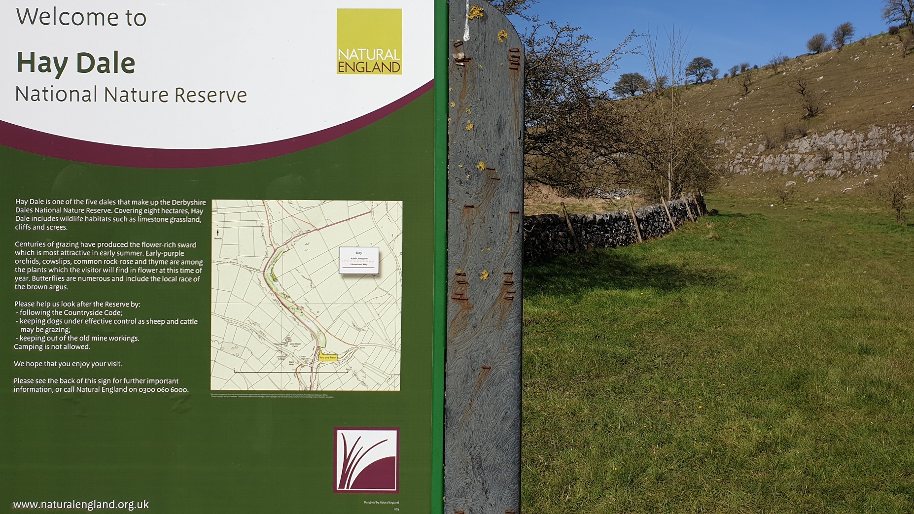
Hay Dale Nature Reserve Sign.jpg - Douglal

Hermit's Cave at Cratcliff Rocks.jpg - Douglal

Cratcliff Rocks and Robin Hood's Stride.jpg - Douglal

Civil War redoubt near Tissington Hall.jpg - Douglal
Romano-British settlement and field system at Rainster Rocks.jpg - Douglal

Ellastone Bridge over the River Dove.jpg - Douglal

Site of medieval settlement and field system at Ballidon.jpg - Douglal
Limestone Way Roundel.jpg - Douglal

Limestone Way - geograph.org.uk - 2368069.jpg - GeographBot

Limestone Walls - geograph.org.uk - 2368193.jpg - GeographBot

Stone stile and gate on The Limestone way - geograph.org.uk - 2567356.jpg - GeographBot

View from the Limestone Way near Winster - geograph.org.uk - 2678457.jpg - GeographBot

View from Long Lane, Limestone Way, approaching Miller's Dale.jpg - AndyScott

Limestone Way sign near Priestcliffe - geograph.org.uk - 2829599.jpg - GeographBot

Limestone Way, Long Lane in the parish of Taddington - geograph.org.uk - 2829602.jpg - GeographBot

Limestone Way north of the A623 - geograph.org.uk - 2859897.jpg - GeographBot

Limestone Way above The Cop farm - geograph.org.uk - 2859923.jpg - GeographBot

Limestone Way to Old Moor - geograph.org.uk - 2859932.jpg - GeographBot

Limestone Way above Cave Dale, looking towards a distant Mam Tor - geograph.org.uk - 2861253.jpg - GeographBot

Limestone Way above Miller's Dale - geograph.org.uk - 3087789.jpg - GeographBot

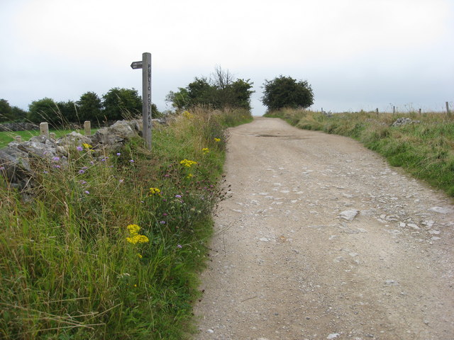
Stile and signpost on the Limestone Way - geograph.org.uk - 3266963.jpg - GeographBot

Limestone Way at the top of Cave Dale - geograph.org.uk - 3283085.jpg - GeographBot

Limestone Way - geograph.org.uk - 3625592.jpg - GeographBot

Limestone Way near Castleton - geograph.org.uk - 3854150.jpg - GeographBot

Limestone Way - geograph.org.uk - 4065353.jpg - GeographBot

Walking the Limestone Way - geograph.org.uk - 4076714.jpg - GeographBot

Limestone Way climbing to Cave Dale - geograph.org.uk - 4368919.jpg - GeographBot

Limestone Way near Hurd Low - geograph.org.uk - 4369352.jpg - GeographBot

Limestone Way near Hurd Low - geograph.org.uk - 4369373.jpg - GeographBot

Limestone Way near Hurd Low - geograph.org.uk - 4369379.jpg - GeographBot

Limestone Way south of Hurd Low - geograph.org.uk - 4369720.jpg - GeographBot

Monyash, One-Ash Grange Farm, nativity.jpg - AndyScott

Monyash, One-Ash Grange Farm on the Limestone Way.jpg - AndyScott

Monyash, Cales Dale, Limestone Way near One-Ash Grange Farm.jpg - AndyScott

Lathkill Dale from the Limestone Way.jpg - AndyScott

The Limestone Way on a wet day - geograph.org.uk - 4980970.jpg - GeographBot

Stone stile on the Limestone Way - geograph.org.uk - 4980996.jpg - GeographBot

The Limestone Way - geograph.org.uk - 5425935.jpg - GeographBot

The Limestone Way - geograph.org.uk - 5425937.jpg - GeographBot
The Limestone Way - geograph.org.uk - 5425940.jpg - GeographBot

The Limestone Way - geograph.org.uk - 5425941.jpg - GeographBot

View from The Limestone Way - geograph.org.uk - 5425965.jpg - GeographBot

The Limestone Way - geograph.org.uk - 5425970.jpg - GeographBot

View from The Limestone Way - geograph.org.uk - 5425973.jpg - GeographBot

The Limestone Way - geograph.org.uk - 5425976.jpg - GeographBot

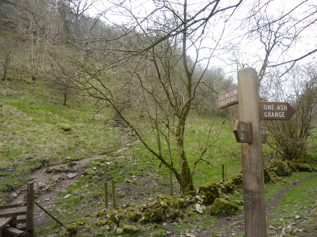
The Limestone Way approaching One Ash Grange Farm - geograph.org.uk - 5427303.jpg - GeographBot

The Limestone Way approaching One Ash Grange Farm - geograph.org.uk - 5427305.jpg - GeographBot

The Limestone Way - geograph.org.uk - 5427310.jpg - GeographBot

The Limestone Way approaching Cales Dale - geograph.org.uk - 5427330.jpg - GeographBot

The Limestone Way approaching Cales Dale - geograph.org.uk - 5427334.jpg - GeographBot

The Limestone Way Cales Dale - geograph.org.uk - 5427350.jpg - GeographBot

The Limestone Way Cales Dale - geograph.org.uk - 5427354.jpg - GeographBot

The Limestone Way Cales Dale - geograph.org.uk - 5427361.jpg - GeographBot

Monyash, One-Ash Grange Farm, weather vane.jpg - AndyScott