Wikimedi'Òc
Modes d'emploi

Cet album fait partie des albums


Pleistocene north ice map.jpg - Samulili
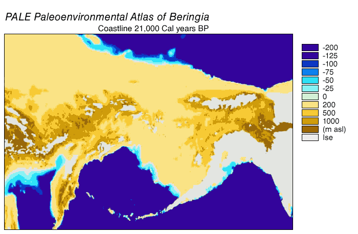
Beringia land bridge-noaagov.gif - Leonid 2

Aegiis 2007 01.jpg - Odysses~commonswiki

SE-USshoreline.svg - Kbh3rd
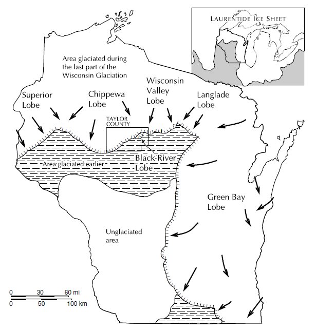
Taylor County glaciation.jpg - Jeff the quiet

Iceage02.png - Mikenorton

ISS-32 Walker Lake, Nevada.jpg - Ras67

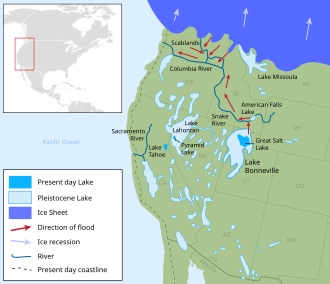
Lake bonneville map.svg - Liandrei

Lake Bonneville map de.svg - Thgoiter

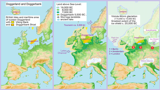
Doggerland3er.png - Juschki

Merida Glaciation in Venezuelan Andes.png - Gabrielsanz

Doggerland3er en.png - Alphathon

Glacer maximum extent, pluvial lakes, Missoula Flood deposits, and glacial-maximum shoreline (estimated) in Oregon.png - Answer.to.the.rock

Lake Bonneville map de cropped.svg - NordNordWest

Global sea levels during the last Ice Age.jpg - पाटलिपुत्र

Mollweide Paleographic Map of Earth, 21 Ka (Late Pleistocene Age).png - Alex26337