×

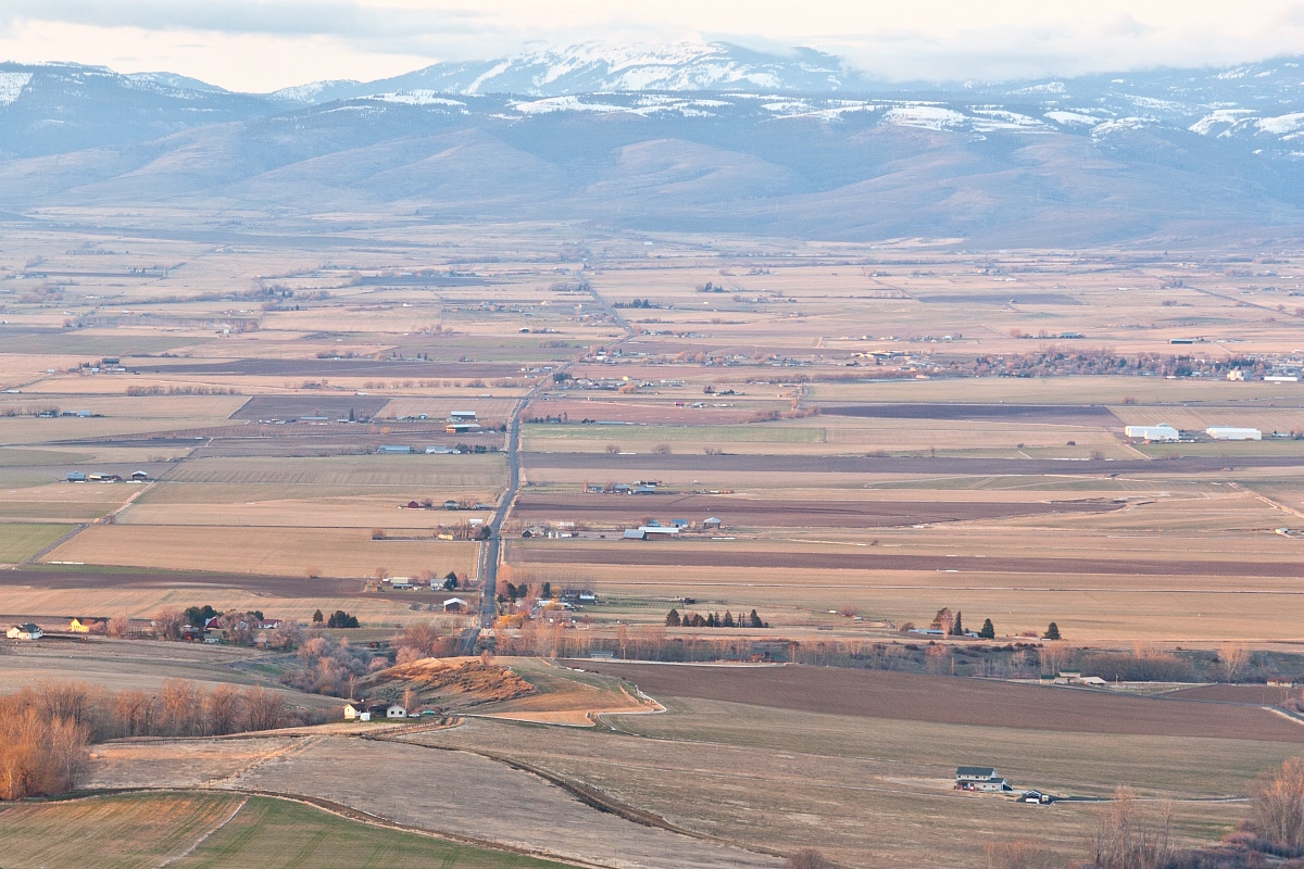
Sunset over kittitas valley.jpg - Nanomu

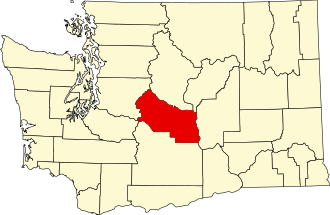
Map of Washington highlighting Kittitas County.svg - Nux

USA Kittitas County, Washington age pyramid.svg - DieBucheBot

May 2008 Yakima River Canyon from the North IMG 1404.JPG - Williamborg

Manastash.JPG - File Upload Bot (Magnus Manske)

Kittitas, WA.jpg - Amicon

Irrigated Hillside near Ellensburg WA.jpg - A. Balet

Lake Easton.jpg - Kgrr

Easy Gold chair at the Summit East ski area.jpg - File Upload Bot (Magnus Manske)

Morgan Schmitt 2010.jpg - Dirtymoose

ThorpWA-7Lucy.jpg - Morellit

ThorpWA-6Antoine.jpg - Morellit

Climbing up Brewton Road.jpg - File Upload Bot (Magnus Manske)

Teanaway River Valley.jpg - Thefclef777

Aerial - Columbia River north from Vantage, WA area 01 - white balanced (9796036133).jpg - File Upload Bot (Magnus Manske)

Aerial - Columbia River north from Vantage, WA area 01 (9792293656).jpg - File Upload Bot (Magnus Manske)

Mystery tubes (7235146512).jpg - McZusatz

Dad on trail (6067593653).jpg - McZusatz

Kittitas Washington Skyline.jpg - Kelly

20150613MargaretLake1.JPG - Danust

Dairying, poultry and stock raising in Washington (1912) (20803615616).jpg - SteinsplitterBot

Thorp Mountain Lookout - panoramio.jpg - Panoramio upload bot

View west from Thorp Mountain - panoramio.jpg - Panoramio upload bot

View south from Thorp Moutain - panoramio.jpg - Panoramio upload bot

Rainier from Thorp Mountain - panoramio.jpg - Panoramio upload bot

Above Cooper Pass - panoramio.jpg - Panoramio upload bot

Honolulu Basin - panoramio.jpg - Panoramio upload bot

Iron Horse Trail - Flickr - brewbooks.jpg - Josve05a

Start of our hike - Flickr - brewbooks.jpg - Josve05a

Teanaway Field Trip - Flickr - brewbooks.jpg - Josve05a

Coming down Iron Peak - Flickr - brewbooks.jpg - Josve05a

Mount Stuart from Iron Peak - Flickr - brewbooks.jpg - Josve05a

Mount Daniel from Iron Peak - Flickr - brewbooks.jpg - Josve05a

Mount Stuart from Iron Peak - Flickr - brewbooks (1).jpg - Josve05a

Richard photographing an Ivesia - Flickr - brewbooks.jpg - Josve05a

Jeff hiking up to Iron Peak - Flickr - brewbooks.jpg - Josve05a

Penstemon rock - Flickr - brewbooks.jpg - Josve05a

Stuart Range from Tronsen Ridge - Flickr - brewbooks.jpg - Josve05a

Mountain View driving to Tronsen Ridge - Flickr - brewbooks.jpg - Josve05a

Cool Toy - Flickr - brewbooks.jpg - Josve05a

Cool Toy - Flickr - brewbooks (1).jpg - Josve05a

Central Washington Sun - panoramio.jpg - Panoramio upload bot

Red Barn and Cattails - panoramio.jpg - Panoramio upload bot

Creek Crossing - Flickr - brewbooks.jpg - Josve05a

India john hill - panoramio.jpg - Panoramio upload bot

India john hill - panoramio (2).jpg - Panoramio upload bot

India john hill - panoramio (3).jpg - Panoramio upload bot

I-90 bridge, vantage - panoramio.jpg - Panoramio upload bot

Ellensburg, WA, USA - panoramio.jpg - Panoramio upload bot

Ellensburg, WA, USA - panoramio (1).jpg - Panoramio upload bot

Ellensburg, WA, USA - panoramio (2).jpg - Panoramio upload bot

Ellensburg, WA, USA - panoramio (3).jpg - Panoramio upload bot

Ellensburg, WA, USA - panoramio (4).jpg - Panoramio upload bot

Lila Lake - panoramio.jpg - Panoramio upload bot

Driving south from Ellensburg, Washington down the Canyon Raod, beams of sunlight streak the landscape and directly center this photo, above the treeline, glare off a ridgetop, ice field - panoramio.jpg - Panoramio upload bot

Night Photo at Vantage (Unsplash).jpg - Fæ

Near Ellensburg, WA. (10900522693).jpg - Artix Kreiger 2

Lake Keechelus from Iron Horse Trail, 2002 (10900358604).jpg - Artix Kreiger 2

Keechelus Lake east of Snoqualmie Pass (10776236966).jpg - Artix Kreiger 2

Irrigation flume west of Ellensburg (1770328806).jpg - Artix Kreiger 2

Kittitas Valley Wind Farm (22681110337).jpg - Jon Kolbert

Star Trails in Vantage, WA (5608145363).jpg - Jon Kolbert

Chevy Express (5608125373).jpg - Jon Kolbert

Eastern Washington Clouds (5608123925).jpg - Jon Kolbert

Volvo Truck (5608687664).jpg - Jon Kolbert

Different Types of Towers (7779184390).jpg - Jon Kolbert

Ryegrass Star Trails (7779186380).jpg - Jon Kolbert

Star Trails - Vantage, WA (6161238917).jpg - Jon Kolbert

Camping at Wanapum (6161748892).jpg - Jon Kolbert

Horse-drawn carriages and a dog on a road between Liberty and Cle Elum, April 8, 1913 (WASTATE 2367).jpeg - BMacZeroBot

University of Washington College of Mines student mining trip, Kittitas County, Washington, 1913 (INDOCC 193).jpg - BMacZeroBot

Wrecked truck on Interstate 90 east of Snoqualmie Pass 01.jpg - Jmabel

Wrecked truck on Interstate 90 east of Snoqualmie Pass 02.jpg - Jmabel

Morrison family at Stampede Pass Hospital, ca 1888 (MOHAI 6380).jpg - BMacZeroBot

Mosquito Creek Falls, site of Stampede Tunnel, ca 1886 (MOHAI 6382).jpg - BMacZeroBot

Lewis Witt in tunnel inside Esther Mine, near Gold Creek, Kittitas County, 1898 (LL 1048).jpg - BMacZeroBot

Lindsley's grandfather David Denny and Victor WS Denny in mining tunnel near Gold Creek, Kittitas County, October 1899 (LL 1081).jpg - BMacZeroBot

Mountain view possibly showing glacier in Kittitas County, 1901 (LL 1210).jpg - BMacZeroBot

Victor Denny standing in front of glacier, Kittitas County, approximately 1900 (LL 1211).jpg - BMacZeroBot

Victor Denny, carrying a rifle, ascending a snow field possibly on Chikamin Peak, Kittitas County, approximately 1900 (LL 1212).jpg - BMacZeroBot

Victor Denny holding candle inside tunnel at Esther Mine, Kittitas County, 1901 (LL 1286).jpg - BMacZeroBot

Victor Denny with rifle and and dead mountain goat, Kittitas County, 1901 (LL 976).jpg - BMacZeroBot

Tinkham Peak view.jpg - Ron Clausen

Flag of Kittitas County, Washington.svg - IndysNotHere

Kittitas at Taneum.png - Generalissima
❮
❯


